Fury and Hecla: Parry’s Formidable Arctic Exploration Sisters

On March 31st, 1827, Captain William Edward Parry took leave of his friends, relations, and his young wife Isabella. He boarded his beloved exploration vessel, HMS Hecla. After five expeditions searching for a Northwest Passage in the Canadian Arctic – four of which he was in overall command of – he was setting out for a different destination: The North Pole. Onboard Hecla were the latest contingent of a long line of British officers who would write their names on geographic features across both Arctic and Antarctic regions.1 His crew well-understood the hazards of polar exploration. On Parry’s last expedition Hecla’s sistership and exploration consort, HMS Fury, had been destroyed. Parry – an evangelical Christian – must have wondered, as he moved north along the English coast, if Providence and his continuing good fortune would keep them all safe on this new foray towards the top of the World.
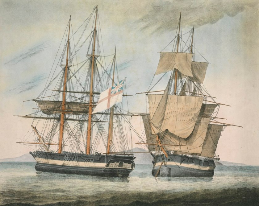
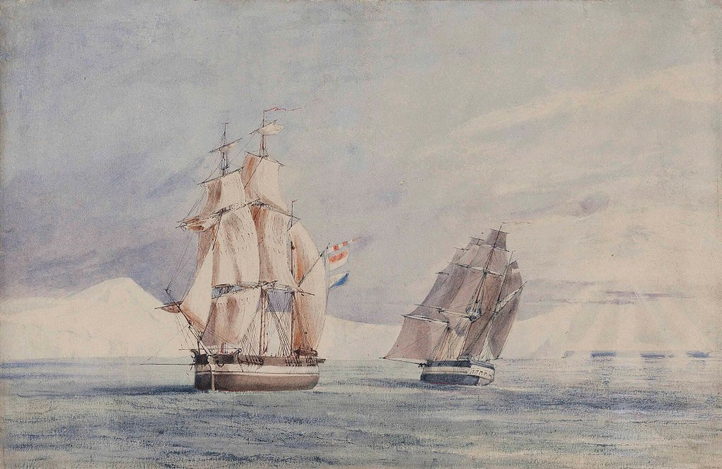
His Majesty’s Discovery ships, Fury and Hecla by Arthur Parsey (Artist & Engraver) Charles Joseph Hullmandel (Printer) in 1823. Both show “Parry scheme” modifications for Arctic service, with broadside armament and mortars removed, reinforced channels, and bow iceguards. credit: National Maritime Museum PAH9224.

Forty-five years elapsed from the Constantine Phipps North Pole Expedition until William Edward Parry’s 1819 Northwest Passage search again brought polar-modified bomb vessels back to the Arctic. The 1741 modifications to HMS Furnace had set a basic pattern for reinforcing bomb vessels to participate in polar exploration missions. The Phipps’ North Pole attempt had introduced yet more innovations.2 However, the “Parry scheme” – the identical strengthening of two sisterships – HM Ships Hecla and Fury – is the most relevant precedent for the modifications of the final, and ill-fated bombs, HM Ships Terror and then Erebus.

Both Hecla and Fury were laid down in 1813, and completed at the very twilight of the Napoleonic Wars. The Hecla class was a slight enlargement of the Vesuvius class bomb vessels.3 They were 105′ / 32m long on the gundeck, 28.5′ /8.7m in maximum beam, and displaced about 375 tons.4 Like the previous exploration bombs Furnace, Racehorse, and Carcass, these two sisterships had participated in a military campaign in their intended role: Firing bombs or carcasses (incendiary shells) from their main armament of a 10” and 13″ mortars. Both had been members of Admiral Edward Pellew’s fleet during the Bombardment of Algiers, 27 August 1816. They, along with the other bomb vessels Beelzebub and Infernal, fired hundreds of shells into the defences, harbour, and city, and were present the next day when the Dey of Algiers capitulated.
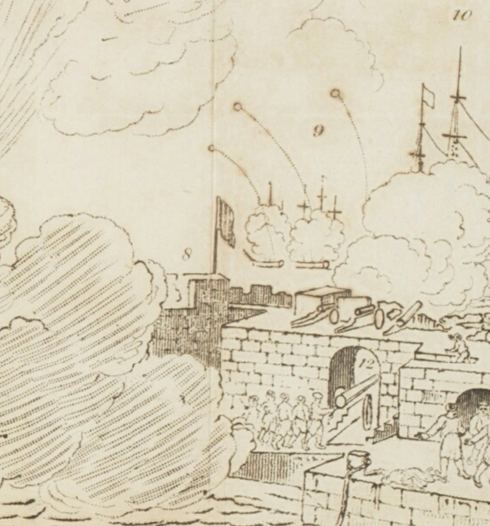
A detail of a panoramic illustration of the Bombardment of Algiers, showing Hecla, Fury and Belzebub firing bombs on a high trajectory. A section of the fortified harbour wall and a great gun are in the foreground. Panoramic views of various places : collection of pamphlets describing panoramas on exhibition in London, 1818 -1832 [detail of panoramic illustration] Credit: State Library of New South Wales DSM/791/PA1

Hecla’s first exposure to Arctic service involved conversion for a Northwest Passage expedition. This mission followed up on John Ross’s recent voyage, which had used two converted whaling ships, Isabella and Alexander, to revive the whole program of Admiralty polar exploration.5 Lieutenant William Edward Parry (who had commanded Alexander) would now make his own effort to solve the great cartographic mystery at the top of North America: was there a navigable passage from Baffin Bay through to the Western Arctic?6 Parry was also directed to try to resolve the cartographic confusion that John Ross’s mission had raised.7 His methodical approach to preparing for polar exploration involved thoughtful consideration of the unique environment his crews would operate in, an almost fanatical attention to technical details of the ships, equipment, and supplies, and careful planning for unanticipated situations.

Capt. William Edward Parry, Commander of the Polar Expeditions (on the print this is updated from 1819-1827). Credit: Credit: Library and Archives Canada, Acc. No. 1939-159-1.

Hecla was accompanied by HMS Griper (Matthew Liddon commanding). Griper was a gunbrig: a much smaller type that was about 85’/26m long on the gundeck and displaced only 180 tons. The pairing of a lead ship with a smaller consort had been a feature of prior expeditions. The reinforcement of the ships combined the best features of previous refits. Parry’s expedition made remarkable progress westwards into the uncharted Arctic Archipelago at the top of the North American landmass. The crews overwintered, in their carefully prepared and housed-over ships, in the midst of their discovery mission.8 This frozen pause, far north of the Arctic Circle, was a first for the Admiralty exploration program.

This image of Hecla on her first mission, housed over for overwintering at Melville Island with Griper nearby, is take from The frozen zone and its explorers; a comprehensive record of voyages, travels, discoveries, adventures and whale-fishing in the Arctic regions for one thousand years, an 1874 publication. Internet Archive Book Images, No restrictions, via Wikimedia Commons

Parry penetrated the Arctic as far west as Cape Providence at the southwestern tip of Melville Island (beyond 113° degrees longitude west of Greenwich). With the (brief) navigation season rapidly closing, he chose to winter at a suitable bay back along the southern coast. As the ice was setting in, they had to cut their way in to “Winter Harbour” using ice saws. Parry kept his ships safe and his crews relatively healthy during this 10-month period. He even continued the exploration mission overland by leading treks to survey the northern coast of Melville, where he discovered Hecla and Griper Bay. Early the next exploration season, he was turned back from further progress westwards by pack ice. The two ships arrived home to wild enthusiasm in October 1820.
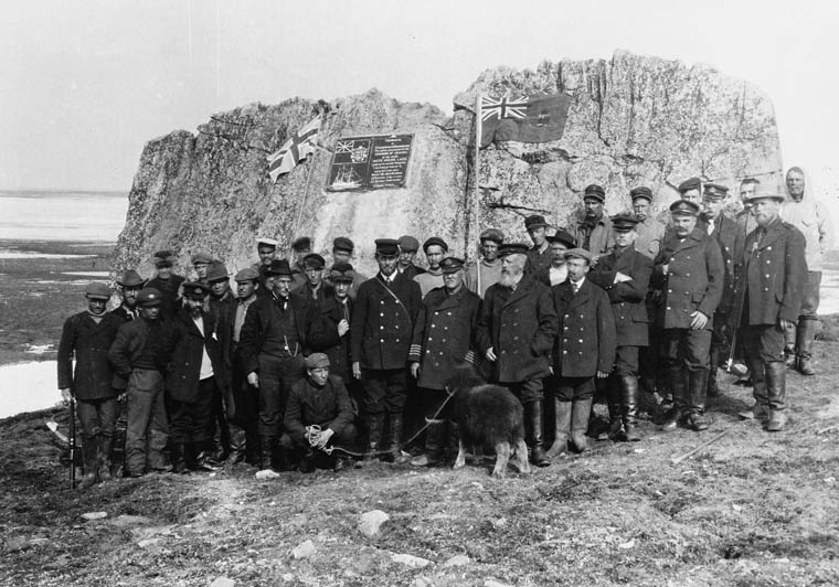
Captain Joseph-Elzéar Bernier and the crew of the CGS Arctic visit Parry’s rock at Winter Harbour, on 1 July 1909. They erected a commemorative plaque, alongside carvings made by Parry’s crew in 1819-1820, which would become important to Canadian sovereignty claims over the Arctic. This is now a National Historic Site of Canada. Credit: Library and Archives Canada C-001198

In preparation for Parry’s next mission to the Arctic, HMS Fury was reinforced to the same standard as Hecla, to become Parry’s lead ship in a new effort to locate a passage west. Hecla was commanded by George Francis Lyon. This dual refit, starting in late 1820 at Deptford Dockyard, represents the beginning of the classical age of the Admiralty’s program of strengthening ships for polar service: Here two sisterships were identically outfitted, to operate in tandem. In the event of the loss of one ship, both crews could be fully accommodated on the remaining ship.9 Parry described this important refit in detail in the published journal of his second expedition.10 In the wake of his first expedition, and frustrating experiences sailing in company with the slower Griper, he now rejected the convention that a lighter vessel, acting as a consort, could explore inshore waters more effectively than two evenly-matched ships. He emphasized that all inshore surveying could be completed by detached boat crews (who have the light vessels with minimal draft to best exploit inshore charting opportunities). He argued that ships of the same design could better survey a larger area (with independent charting of whole stretches of coastline a possibility). In order to ensure that sailing performance was as even as possible, he adopted what he called an “equalized rig” between ships. This went beyond merely ensuring that the three-masted barque rig of both ships was identical, because the fore and main masts were fitted with the exact same lengths of spar for a given sail type between both masts. This meant that four masts between two ships had the exact same spar dimensions for courses, topsails, and topgallant and studding sails – something that would greatly simplify repairs in case of damage to the top hamper.

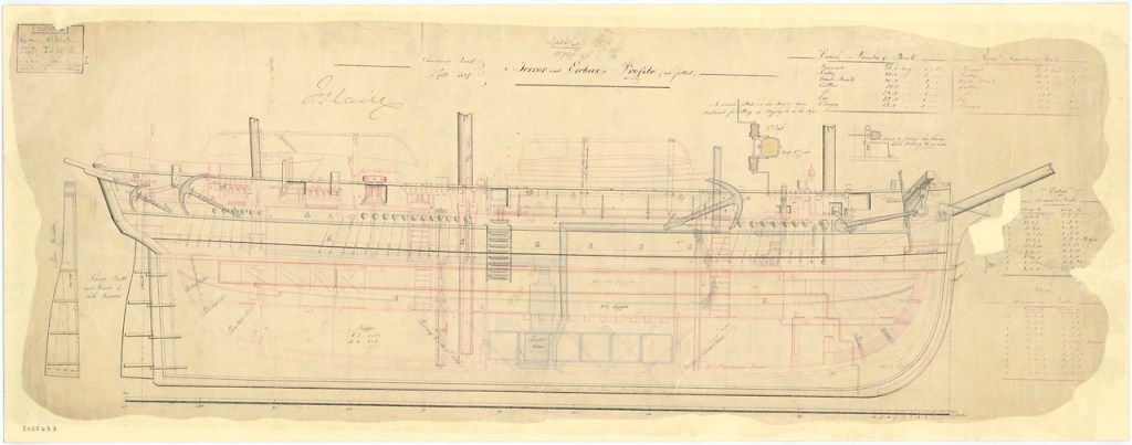
The draught plans of the original Hecla class design of 1813 (upper ZAZ5687), and an internal arrangement plan of the modifications to Fury for the 1821 NW passage mission (lower ZAZ5696) © Crown copyright. National Maritime Museum, Greenwich, London

The original Admiralty plans, now preserved at the National Maritime Museum at Greenwich, show a more thorough conversion for Arctic service than any prior British vessel had undergone. In contrast to Racehorse and Carcass, Parry’s ships received a full weatherdeck, which united the quarterdeck, foc’sl, and the intervening space amidships. This decking enclosed a much larger internal space which could protect crews from foul weather and, more importantly, Arctic conditions. Fury and Hecla were the first bombs to be so heavily modified that no internal traces remained of their original mortar beds. They also were the first to have all gun-ports fully omitted (planked over). The fragile channels (where the shrouds connect down to the hull outboard of the rails) were filled in by ice chocks, as they had been on HMS Furnace in 1741. Massive timbers – Heavy bolsters and hooks – strengthened the bows. Parry’s ships had doubled planking on the exterior (which was thicker than what had been fitted to Hecla and Griper for the earlier mission). This ran all the way up to deck-level. The outer layer noticeably thickened at the waterline. Heavy iron strengthening bolted through the knees and keelson, spirketting (reinforced timbers) ran lengthwise, bolted into the frames at different levels. A full double layer of “footwailing” sheathed the area inside the frames of the lower hull (interior paneling in the hold which was laid diagonal for further strength). A sectional plan helps us further interpret the details of these massively strengthened vessels:

HMS Fury sectional plan, 1821 (ZAZ5700) © Crown copyright. National Maritime Museum, Greenwich, London

One of the most notable updates is the first use of diagonal deck planking on a discovery mission. This update can be seen in the uppermost layer of 3” thick decking, represented in the above plan as wider than the underlying fore-and-aft planking. The two layers made for a much stronger protective sheathing: 6” of wood, with a layer of waterproofing tar paper sandwiched in between. This strengthened decking was conventionally fastened to the underlying deck beams. The concept of diagonal decking appears to have been a recent novelty, and can be credited to a naval architect who was coming up with a whole system of new design elements to strengthen British warships: Sir Robert Seppings. Seppings had first installed diagonal decking to HMS Albion’s two gundecks in 1815. He had then arranged a comparative trial, where he had fitted it only to the port side decking of HMS Northumberland. This ship and its experimental deck were put to use from August to October 1815 to transport the deposed French Emperor, Napoleon Buonaparte, to his final exile on the island St. Helena.11 On Parry’s exploration ships, the diagonal sections flanked a central area of the deck, which had massively thickened decking – a full 6″ thick – running lengthwise. This reinforced and buttressed decking – visible today at the wreck sites of Erebus and Terror, created a structure of incredible solidity.12

A Sylvester warming oven (furnace) of an ingenious design circulated warm air to the newly-enclosed interior spaces by flues (it can be seen shaded blue in the second plan above). Relevant to air circulation and lighting below decks, Parry also noted in passing that his ships were fitted with “illuminators,” which, in this context, would appear to be a very early instance of the installation of Preston’s Patent illuminator (which also could be called a portable deck glass and ventilator).13
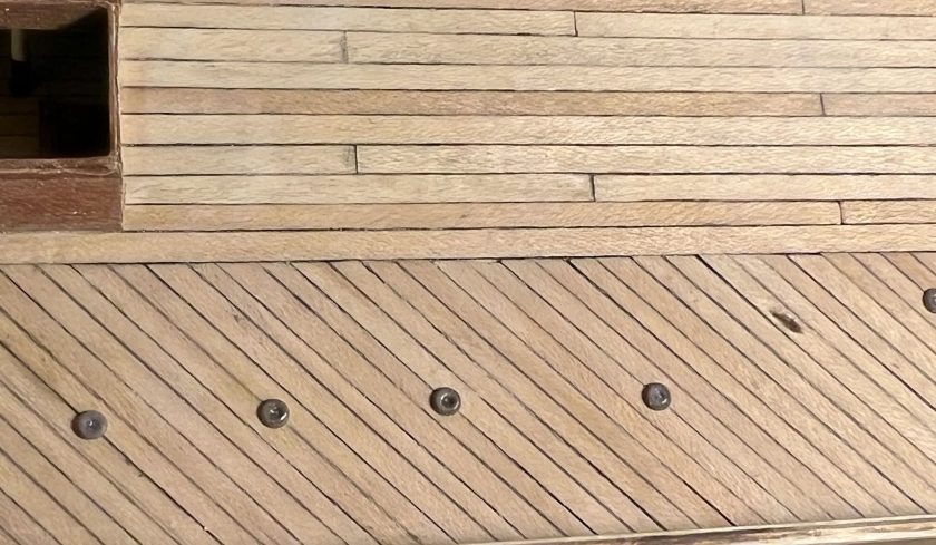
The reinforced diagonal decking and thicker central planks of a polar-modified bomb vessel looking from the main hatch forwards along the starboard side. Illuminators, which my research has established may have been fitted to Parry’s ships on his second polar expedition, and deck prisms also appear. (author’s photo of an incomplete model)

Parry’s second expedition in command (1821-1823) saw the ships overwinter first at Winter Island and then further north at Igloolik. This expedition had set yet another important polar precedent when the merchant vessel Nautilus was hired to transport some of the burden of coal and provisions across the Atlantic to Resolution Island (at the entrance to the Hudson Strait). Crew then discharged its cargo into the exploration vessels, to top up their supplies.14 No ice-free passage towards the west was located, but, in Foxe Basin, Parry did transit the Frozen Straits at the top of Southampton Island into Hudson’s Bay, finally proving the accuracy of Christopher Middleton’s 1742 surveying in HMS Furnace. Near Igloolik, he also discovered a frozen waterway stretching westwards out of the Basin, which he named Fury and Hecla Strait. Both his official publication and Lyon’s private journal (private yet officially approved to be published) include invaluable observations about local Inuit communities’ culture, social practices and daily life.15 All these decades later, Inuit communities on Igloolik Island and around the Melville Peninsula continue to preserve a rich oral tradition around the visit of Parry’s crews. In early 1823, Parry’s crews were beginning to show signs of the onset of that dreaded mariner’s disease: Scurvy. Hecla and Fury departed the Arctic in good condition for a safe return home. Despite Lyon’s remarkable ethnographic observations of Inuit community life, the actual cartographic results of the expedition could not compare to the incredible progress westwards of Parry’s first foray. Still, the public at home in Great Britain continued to be inspired by his exploration.
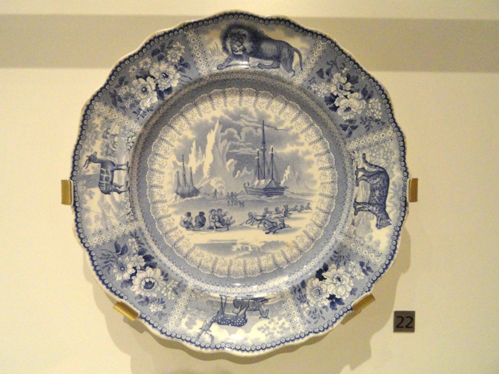
Parry’s Arctic expeditions led to widespread popular enthusiasm in Europe for depictions of Arctic adventures. A Staffordshire dish ca. 1835, shows an Arctic scene of Parry’s ships in the background, and Inuit community members with a sledge and dogs. This appears to be a inspired by a scene of Hecla and Griper at Winter Harbour, updated with events from later expeditions. Credit: Daderot, CC0, via Wikimedia Commons.

Parry immediately threw himself into the planning of yet another expedition. The discovery duo of Hecla and Fury would now look for a passage 500 km to the Northwest of Igloolik, down Prince Regent Inlet (a waterway which he had entered but not fully charted during his westward passage in 1819). Parry shifted back to Hecla. Henry Parkyns Hoppner (an experienced Arctic officer with service on all recent Parry-associated missions) took command of Fury.16 Departing England in May, 1824, the expedition again made use of a transport, the William Harris, which was unloaded at the Whalefish Islands, Greenland (now known as Kitsissut and Imerissoq). The exploration ships were delayed in crossing Baffin Bay, and had to winter at Port Bowen, on the eastern side of the Inlet. Officers and crew disliked the dreary winter site, and had misgivings about the mission to explore the Inlet.17 When finally released from the ice in late July 1825, the ships began navigating the western coast of North Somerset Land (Somerset Island’s insularity would not be proved until 1852), looking for some route to the west. It was along the dramatic cliffs of this coastline that disaster finally caught up with Parry’s crews.
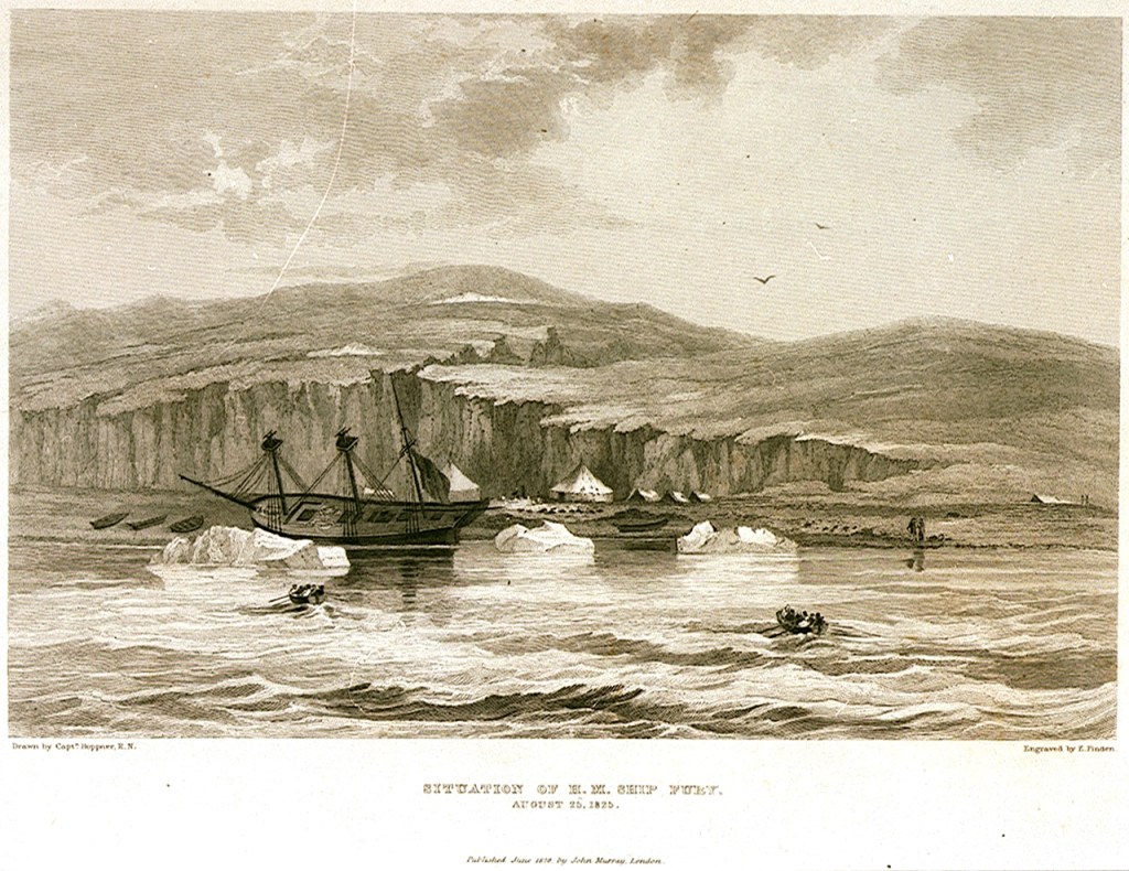
The appearance of HMS Fury on the day of her abandonment (taken from Parry’s Journal of his Third Expedition): Edward Francis Finden (engraver); Hoppner, Capt (artist); Murray, John (publisher), Public domain, via Wikimedia Commons

On the first of August, Fury and Hecla were both damaged by being nipped by ice as it crowded close in to the shores of Somerset Island. Unbeknownst to Parry, Fury was more severely wounded, and began taking on water at a prodigious rate. By the time Hoppner was able to report in, a third of the entire crew were required to work all four pumps just to keep the vessel afloat.18 A careful examination showed that, despite the phenomenal strengthening of the hull as noted above, the basic skeleton of the ship had been seriously damaged: Fury’s forefoot and sternpost were both mauled, and areas of the keel were effectively shattered.19 Parry’s published journal of the expedition relates the episodes of a worsening situation over the next week: Exhausting efforts to find a safe location to shelter the damaged vessel from further ice damage and unload her, to try and repair the hull, eventually failed when ice again crowded inshore and bodily heaved the ship up into the shallows of the beach. This further damaged the bilge areas on August 25th. Parry, returning onboard his former command, recognized the ship was doomed. He allowed Hoppner and his senior staff to carefully assess the ship. The verdict from Fury’s officers was clear: it was time to abandon their vessel and press on.20 A storage depot was created at Fury Beach, with anchors, anchor chains, spars, ships boats, and a vast supply of coal and provisions.21 Given the state of crowding and the reduction in provisions on Hecla, Parry turned aside from further exploration of the Inlet and hastened back to England. He concluded his official account of the protracted destruction of the Fury by stating “…it will be plain that an occurrence of this nature was at all times rather to be expected than otherwise, and that the only real cause for wonder has been our long exemption from such a catastrophe.”22

Remarkably, given the hazards of exploration and the amount of time he had been away from his home on these successive missions, Parry, newly-married, opted to lead one more Arctic expedition. The 1827 mission would see Hecla ordered towards a higher latitude than she had ever navigated to. Parry went from his old quest to complete a Northwest Passage to a mission aimed at the North Pole. This would revisit the site of both Constantine Phipps’ 1773 expedition, and the recent David Buchan and John Franklin 1818 journey towards the Pole: the Svalbard archipelago. The overall plan had actually been thought up by Franklin. John Barrow, Second Secretary at the Admiralty, forwarded it on to Franklin’s friend Parry.23 This time, his venerable exploration vessel would serve as a base ship for a further effort to push north, by carrying up two specially-constructed boats (named Enterprise and Endeavour). The 20′ long boats were fitted with conspicuous steel runners that reached down to the ice from the bilges, and could also be moved on wheels. They were ingeniously fortified, double-planked, and protected by inner layers of felt and Mackintosh waterproof canvas. Their design had been the result of a collaboration of expert naval architects Henry Peake and Oliver Lang.24 After Hecla reached Treurenberg Bay (Sorgfjorden), the two boat crews, commanded by Parry and James Clark Ross, John Ross’s nephew, sledged northwards from Hakluyt’s Headland on pack ice, in difficult conditions.25 Where the plan had envisioned a rapid sledge up to the Pole over smooth expanses of pack ice, the crews encountered a torturous, broken landscape. They reached a furthest north record of 82° 45′ before turning back, exhaused, for the shelter of their ship.26
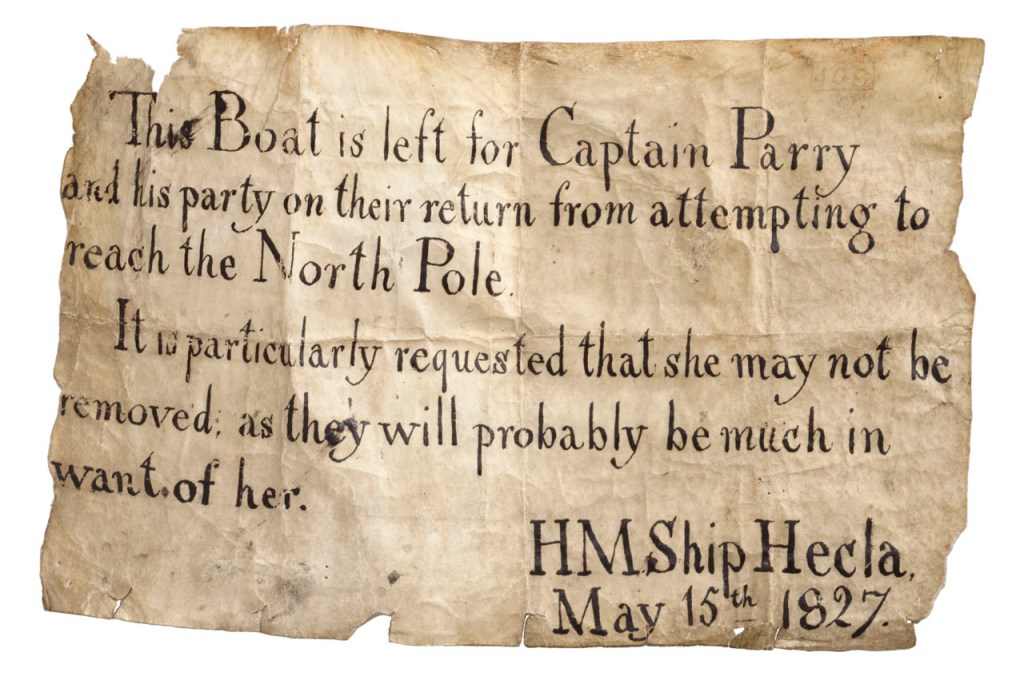
A note left by Parry’s crew, remaining with Hecla, to ensure that no one else absconded with a depot boat left to assist with the return from their polar mission. Credit: National Maritime Museum, Greenwich, London, Royal United Service Institution Collection (AAA3957)

And with her safe return to England from yet another record-setting mission – a highest north latitude that would stand for fifty years – Hecla reached the end of her Arctic exploration career. She was converted to the complimentary role of survey ship (to chart temperate waters, like several of the other surviving bomb vessels), and worked along the coasts of West Africa. Sold out of naval service in 1831, she was first used as a general cargo vessel and then converted to become a whaling ship for the 1835 season. Lloyd’s Register (LR) Foundation Archivist Max Wilson has located important documents to track the interesting history of Hecla’s commercial service. As Wilson notes: “Ironically Hecla was to hunt in the exact area she had opened up to whaling and explored in 1819.”27 She continued to endure Arctic punishment on annual whaling journeys to the familiar waters of the Davis Strait until she was wrecked there in 1840.28 Like her lost sister Fury, Hecla’s final resting spot has not yet been located.

With popular enthusiasm for exploration sustained by the published accounts of Parry’s exploits, the Admiralty turned to other modified bomb vessels to continue the exploration of polar regions. In late 1835, even as Hecla continued plying northern waters, there was a sudden need to rescue the crews of some of her fellow whaling ships: A dozen ships had become trapped in the pack ice of the Davis Strait. A slightly smaller, older bomb vessel, laid up at Portsmouth, was rushed into refit: HMS Terror.29 The scene was now set for the final conversions of the bomb vessel type to polar exploration ships.

This concludes our series of blog posts exploring the history of every bomb vessel that was converted to a polar discovery ship: HM Ships Furnace, Racehorse and Carcass, Hecla and Fury, Erebus and Terror.

Click for Endnotes
Christopher Middleton – the First Royal Navy Arctic Explorer – Crosses the Line in 1742

Traditionally, the Royal Navy’s program of Arctic exploration is represented as having commenced with the Constantine Phipps Expedition towards the North Pole in 1773.1 Phipps and his crews pushed north to above 80° latitude near Spitzbergen, before having to turn for home. Though the Phipps Expedition set many precedents for later polar exploration missions, it is Captain Christopher Middleton who deserves wider recognition for his trailblazing 1741-1742 Hudson’s Bay Expedition .2 This was the first Admiralty mission to search for a Northwest Passage.3 I will argue that Middleton also deserves credit for commanding the first Royal Navy expedition to explore an area north of the Arctic Circle.4 He had reached this far north in the first bomb vessel modified for northern exploration (which set the precedent for a century of discovery missions).5 During his time in Hudson’s Bay, he conducted a program of scientific research spanning several disciplines. After he arrived back in England, a dispute with Arthur Dobbs – his armchair-cartographer nemesis -marred his reputation and cast doubt upon his important discoveries.

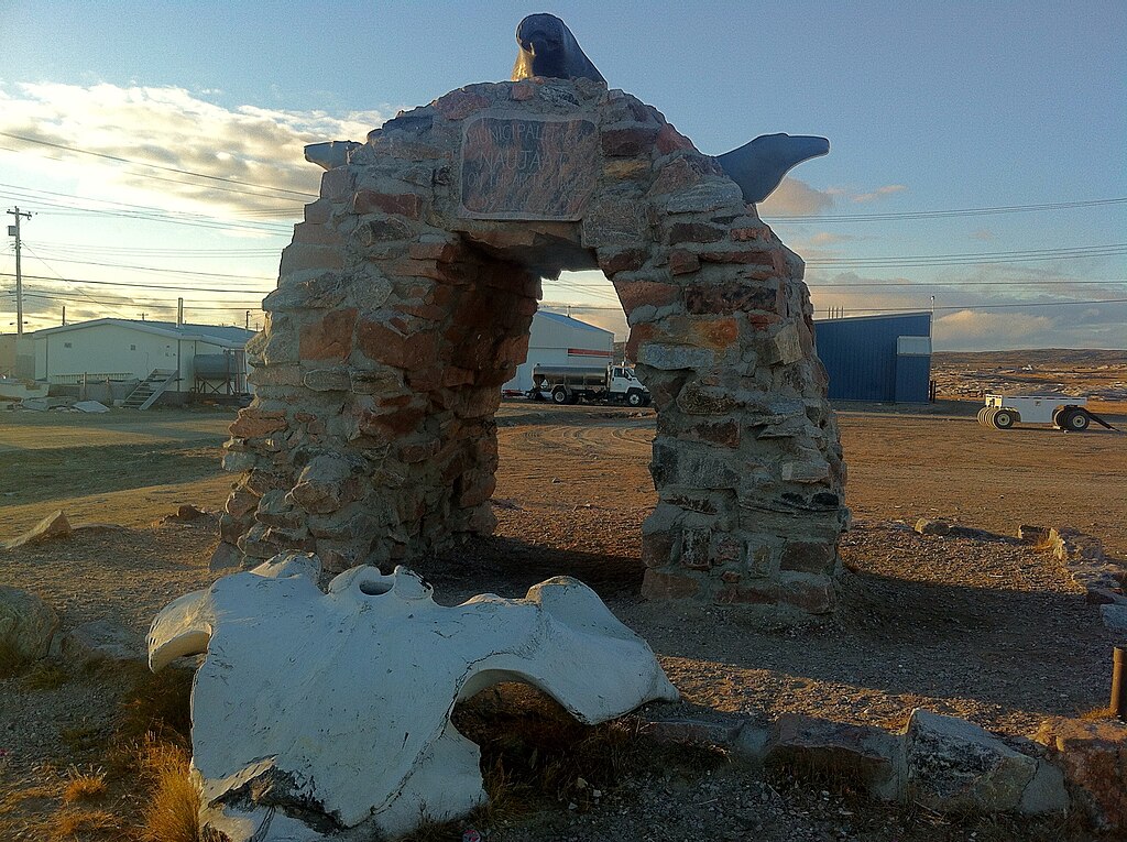
The Naujaat Arctic Circle Arch, a gateway to the Canadian Arctic. Credit: Wes Gill from Winnipeg, Canada, CC BY-SA 2.0 https://creativecommons.org/licenses/by-sa/2.0, via Wikimedia Commons

Early on the morning of August 7th, 1742, Captain Christopher Middleton nervously paced the quarterdeck of His Majesty’s Ship Furnace.6 He and his crew believed they were on the threshold of a historic discovery: A northwest passage towards the “South Sea” (the Pacific Ocean). These explorers had diligently clawed their way up Roes Welcome Sound, between the northwestern shores of Hudson’s Bay and Southampton Island. Standing into danger, they had picked their way around “islands of ice” (icebergs) and “ledges” (land floes). When they could find no favourable winds, they had even used cables anchored to the ice to haul the ships north from berg to berg.7

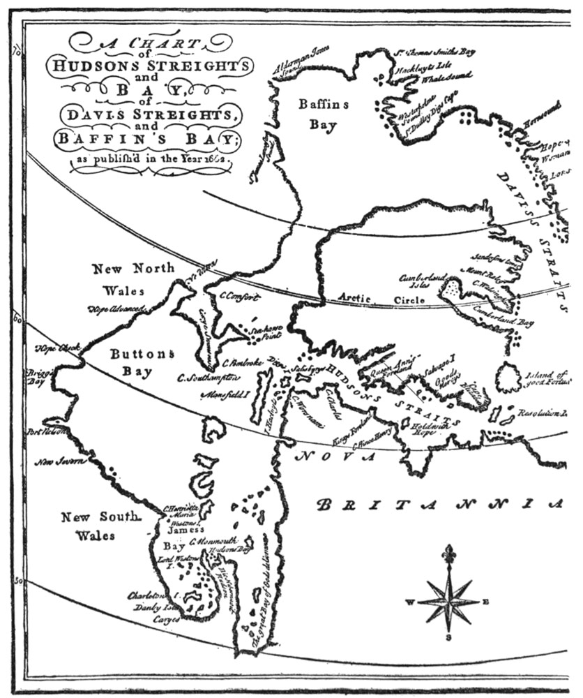
A Chart of Hudson’s Straits and Bay, of Davis Straits, and Baffin’s Bay; as published in the Year 1668. This shows the extent of knowledge about the Bay after the Henry Hudson, Thomas Button, Luke Foxe, and Thomas James expeditions of the first half of the seventeenth century. “Buttons Bay” and much of the NW and SW coasts of the Bay was conjectural.8

In the hazy morning twilight of those extended northern days, Furnace had been working around a promontory which Middleton had just named “Cape Hope.” He believed this could represent the “extreme part of America,” (or the northern most point of the North American continental landmass) a major milestone along the way of achieving his Admiralty mission to discover the fabled maritime route westwards.9

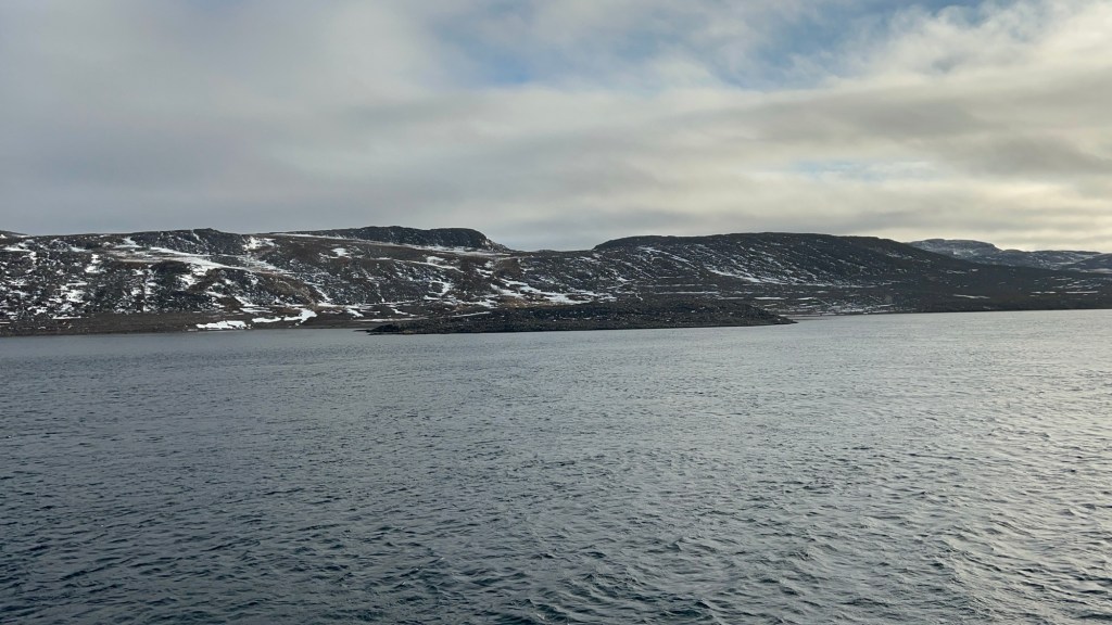
Zenith Point, Murchison Promontory, on the southern shores of the Bellot Strait, is the highest point of land of continental North America, or what Middleton would have called the “extreme part of America.” It was discovered in 1852 by William Kennedy and Joseph-René Bellot. It is an important waypoint on one of the main routes of the actual Northwest Passage through the Arctic Archipelago, and is located at 72’00’06” latitude north, 740 km NNW of Middleton’s Cape Hope. Photo by author, 5 Sep. 2025.

Middleton was a skilled navigator, who had outfitted his ships with the latest navigational devices. He employed these to survey under exceptionally challenging circumstances.10 His career had prepared him for the rigors of commanding a discovery mission in the Bay.11 After early service aboard a privateer in North American waters (during Queen Anne’s War, 1702-1713), he had worked for many seasons as a merchant captain with the Hudson’s Bay Company (HBC), sailing between England and the HBC factories of the Bay on yearly supply missions.12 His experiences commanding HBC sloops had led him to enthusiastically support a popular European belief that the undiscovered shores of the Bay concealed the beginnings of the Northwest Passage.13 In early 1741, with the support of an influential ally and confidant, Arthur Dobbs, he had left HBC service to secure the command of an official Royal Navy exploration mission.14 The crews of his two ships – Furnace and the small tender Discovery – were the first Europeans to navigate these waters (whose adjoining lands were the ancestral territory of the Aivilingmiut Inuit).15 They had endured many hardships since departing England on 8 June, 1741. A dozen of their mates had already perished.16 The dedicated assistance of both the HBC staff and local indigenous communities at and around the post at Churchill, over the winter of 1741-42, had prevented a much greater loss of life.17

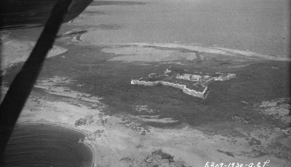
Prince of Wales Fort, aerial view from 1930. The fort sheltered the Middleton Expedition’s senior staff at Churchill, while the crew were lodged in the old, disused post upriver. Middleton, during his HBC career, had been involved in this massive fortification’s original design.18 Credit: Alf Erling Porsild / Department of Indian Affairs and Northern Development fonds / Library and Archives Canada / a101002-v8

As the sun burned off the haze, the watch on deck sighted high land continuing westwards from under the cape – So far, so good. But then a low shoreline materialized across Furnace’s stout bows. The land stretched around to the starboard beam. This day would bring no happy run far to the west – Christopher Middleton had discovered another bay.19 Disappointed at being “embayed” and turned away from his main objective, he named these waters “the Bay of Repulse” (the Inuktitut name for these enclosed waters is Aiviliup Tariunga). The next few days would see the expedition halted from further progress north by an impassable barrier of ice at the top of Southampton Island. The captain went ashore with two healthy crew members and an indigenous guide, climbed to the highest point he could find, and surveyed the distant shores. From this vantage he saw an iced-over passage extending towards the east, and named this the “Frozen Strait.”20 Given what would befall him upon his return home, Middleton may well have lived to regret ever having been up here in 1742. Today we can acknowledge that he started something in this northwest corner of Hudson’s Bay: An organized program of northern discovery that would eventually see the mapping of vast extents of what would become the Canadian Arctic.

The entry from Furnace’s ship’s log for 6 August 1742, illustrating the hopes and then disappointment of the crew. A selection of the log is reproduced in his Vindication. (Cited below) Middleton’s observed position for this day was 66°44’ north. 21
Click Here to Continue exploring Northwards

Erebus Emerges from the Shadows

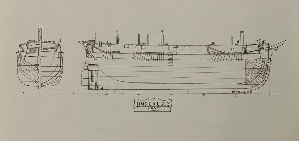
Ten years ago, the sea gifted us back a legendary ship, lost for almost seventeen decades: HMS Erebus. As visitors to our site know, there is a lot of Terror talk on this blog! HMS Terror, was the “other ship” on Sir John Franklin’s ill-fated 1845 expedition to discover a Northwest Passage. We had been neglecting Erebus, and are now trying to make amends! Interpreting a variety of archival sources, we decided to attempt a simplified set of plans of this incredible ship to mark the important anniversary of Erebus being back in our World:

Our reconstruction of HMS Erebus in her 1845 (final) configuration: stern/bow and side elevation. Credit:www.warsearcher.com adapted from National Maritime Museum plan ZAZ5673 and other technical info and used with written permission of NMM staff. Dotted lines represent features documented on Terror wreck, which could just as well have been located on Erebus, while anchor positions are from 1845 artistic representations of both vessels at sea, click the “design dossier” link at bottom for more information on this reconstruction.

On 7 September 2014, Parks Canada, a key member of the Victoria Strait Expedition – a consortium of government and private partners – definitively located one of Sir John Franklin’s lost ships. A promising sonar target had been identified in Wilmot and Crampton Bay, Nunavut, on 2 September, after archaeological finds on a nearby island had redirected the search. The Parks Canada Underwater Archaeology Team (UAT) deployed a Remotely Operated Vehicle to the well-preserved remains of a shipwreck, located in only 11 meters / 36 feet of water. By the afternoon of the 7th, it was clear to the team that the vessel was one of Franklin’s elusive ships. The UAT informed Canadian Prime Minister Stephen Harper’s Office. Further investigation by the UAT dive team allowed them to definitively identify the ship on 1 October as HMS Erebus.1 The discovery tied into a rich tradition of Inuit oral history, which had suggested, down through the 166-years of searching, that one of the lost ships had come to grief on the western coast of the Adelaide Peninsula.

The moment had finally come for Erebus, that personification of darkness, of gloom, of the unseen World, to come back into the light; it was time for Sir John Franklin’s lost flagship to be restored to the public consciousness. The discovery was an immediate sensation, and ten years on, the yearly program of archaeology – of surveying, imaging, artifact recovery and conservation – continues to be followed with great enthusiasm.

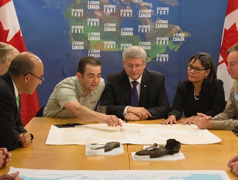
Ryan Harris (left), Parks Canada project lead, alongside Prime Minister Stephen Harper (center) and Minister of the Environment Leona Aglukkaq, announcing the discovery of HMS Erebus 9 Sep. 2014 [cropped]. Credit: Jason Ransom Library and Archives Canada R16093-50252-9-E.

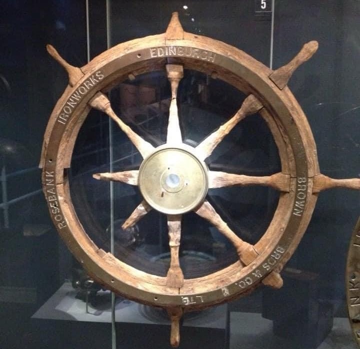
On the day the find was announced, 9 September 2014, as media reports appeared on my device, I was staring at a damaged ship’s wheel and a bell recovered from another famous shipwreck – and one of Canada’s worst maritime disasters – RMS Empress of Ireland. These were on display in the exhibit Empress of Ireland: Canada’s Titanic at the Canadian Museum of History in Gatineau. I bought a commemorative bell, walked across the Alexandra Bridge to stand under the statue of explorer Samuel de Champlain – wielding his famous astrolabe over Nepean Point (now Kìwekì Point) – which looks out over the Canadian capital – and rang the bell to celebrate the discovery! It doesn’t have to make sense, it just felt right.

RMS Empress of Ireland wheel, recovered from the wreck off from Pointe-au-Père QC. Taken 9 Sep. 2014 at the Canadian Museum of History (centenary of the sinking) exhibit.

HMS Erebus was a Hecla class bomb vessel completed in 1826, long after the conflict the “bombs” were designed for had terminated. This small warship was about 370 tons burthen, about 105′ / 32m on the gundeck (later considered the lower deck), with a beam (width) of about 28′ / 8.5m. The class was originally armed with two massive mortars – 10” and 13” varieties – housed in rotating carriages in firing beds overtop of reinforced cribbing, that also stored their massive shells. The mortars were located along the centerline of the deck between the fore and main masts. A few cannon installed along the gundeck rounded out the armament, and enabled the ships to defend themselves and perform auxiliary service as a convoy escorts – a useful secondary role during the Napoleonic Wars, when enemy warships and privateers were a constant worry to keeping merchant sea lanes open. The first Heclas were completed at the very twilight of the Wars, and took no active role. Hecla and Fury did participate in the August 1816 Bombardment of Algiers, firing hundreds of shells into the fortified city. In 1819, to lead William Edward Parry’s first exploration mission north, Hecla was converted to the radically different role of polar discovery vessel. For Parry’s next two exploration missions (1821-1825), Fury accompanied Hecla. This revived a tradition of the crews of two reinforced bombs working together on polar missions.2

His Majesty’s Discovery ships, Fury and Hecla by Arthur Parsey (Artist & Engraver) Charles Joseph Hullmandel (Printer) in 1823. Both show early “Parry scheme” modifications for Arctic service, with broadside armament and mortars removed, reinforced channels, and bow iceguards. credit: National Maritime Museum PAH9224.

Erebus, completed the next year at the Royal Navy’s Pembroke, Wales, dockyard, remained in ordinary (out of commission), awaiting a day when the Royal Navy would have need of this compact, incredibly specialized warship. Her first missions saw her employed in the Mediterranean making ports-of-call visits and showing the flag, the typical peacetime routines of the “wooden walls” – the ships of Britain’s massive naval fleet.3 In 1839, Erebus’s moment came to be modified, but it was for an entirely new theatre of polar operations: The exploration of Antarctica. Erebus was selected to be the lead ship in James Clark Ross’s expedition south. The older and smaller Terror (commanded by Francis Crozier) accompanied her. The waist was decked over in a continuous weather deck, as the mortars were unshipped and the massive beds were removed. The ship’s basic skeleton – keel, frames and knees – was reinforced, hull planking was doubled, and this new weather deck was overlayed with diagonal planking. An enormous ice channel or chock now extended from bows to the stern, girdling the hull more completely than earlier exploration ships. The elaborate seven-light (windowed) stern with overhanging quarter galleries was reduced to five lights across the transom, in a simplified design. The entire underbody of the ship was clad in a shining layer of copper plating, but certain areas, such as the bows and waterline, were reinforced with special thickened copper. The vessel that emerged from refit looked less like a pint-sized frigate from the Wars, and more like a bulked-up whaling ship.4

HMS Erebus as fitted for the 1839 Ross Antarctic expedition. (ZAZ5673) © Crown copyright. National Maritime Museum, Greenwich, London

The crews of both vessels succeeded brilliantly on their four-year surveying odyssey, charting vast coastal expanses and ice shelves of the most southern continent, and making important scientific discoveries in biology, zoology, and magnetism. Operating in totally uncharted waters was perilous work, with Erebus and Terror both being damaged in an almost fantastical collision while dodging icebergs. Despite the hazardous environment, casualties on the voyage were incredibly light.

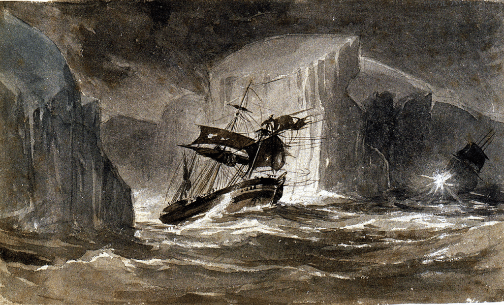
“The Erebus passing through the chain of bergs, 13 Mar. 1842” by John Edward Davis (who was Second Master in HMS Terror) depicts the moments after the collision of the two ships when the damaged Erebus sought refuge in the lee of an Iceberg to make emergency repairs. As Terror maneuvers in the distance, Erebus has lost some of her rig, her bowsprit, and her starboard cathead. Crew are frantically trying to save the bower anchor. PAF0593 Credit: National Maritime Museum, Greenwich, London

After repairs and a brief lay-up, the “Discovery Duo” was selected for the next major polar effort: Sir John Franklin’s 1845 bid to chart the last section of the Northwest Passage along the top of the North American landmass. Another major rebuild followed. A reinforced iceguard of massive iron plates was fitted to the stem and forefoot under the bows. A radical alteration to the stern timbers allowed each ship to operate a screw propeller, powered by a converted railway steam locomotive (please see our subsequent post about HMS Terror’s screw propeller to explore this interesting technological update). When not in use, the screw could be uncoupled from the drive shaft, and raised into a protective cavity that hung inside the stern. These small engines, with a very limited supply of coal for fuel, were intended to help the ships navigate in the challenging Arctic environment without being fully dependent on the wind’s vagaries.

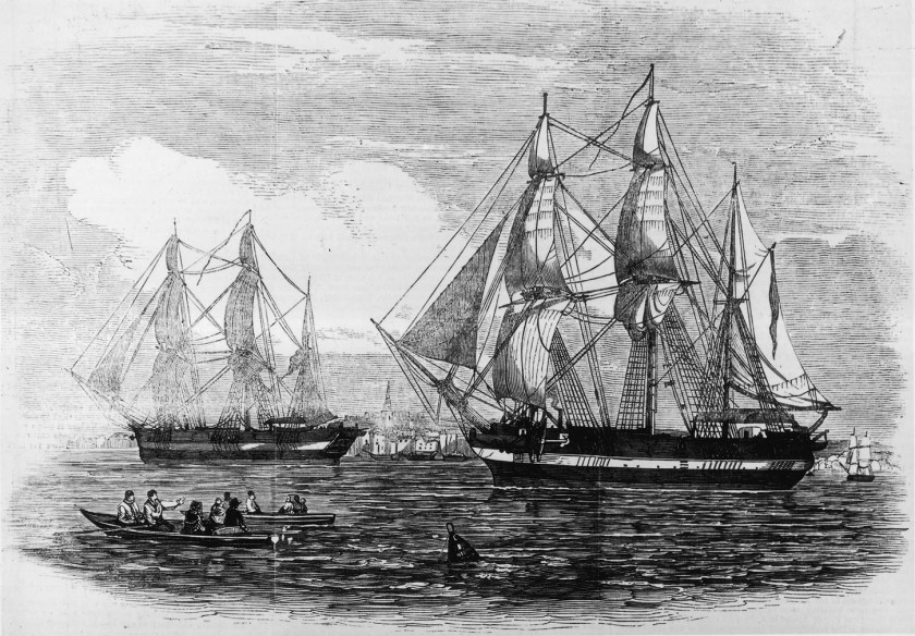
The Franklin expedition ships, HMS Erebus and Terror, setting out with fanfare in late May 1845 from Greenhithe. This was originally published for the 24 May 1845 edition of the Illustrated London News. (Via wikimedia commons) The location of the prominent scuppers along the ice chock of Erebus (in white) seems to indicate Erebus is at right.

Franklin, installed on Erebus, would lead the expedition. James Fitzjames commanded the flagship, while Crozier, Second-in-Command of the effort, remained in his familiar Terror. As most visitors to this site likely are aware, this was to be a one-way trip for ships and crew, that ended in disaster, shipwrecks, boatwrecks, and a trail of abandoned items, burials and bones. Of the lost 129 expedition members, 67 had served on Erebus. The hulk somehow wound up wrecked in Wilmot and Crampton Bay, south of King William Island. Just like the wrecking of HMS Terror nearby, the exact details of the Erebus sinking have yet to be established.

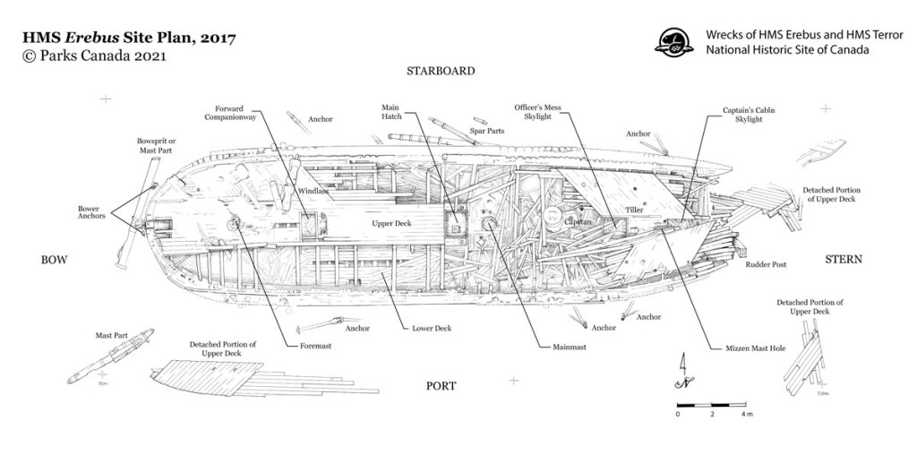
Archaeological reconstruction of the wreck, discovered ten years ago. The site plan was completed in 2017 and shared online in 2021. Credit: Parks Canada, under Crown Copyright

What were the main differences between Terror (Vesuvius class) and Erebus (Hecla class)? These were not sisterships, though they appeared so similar most observers may have thought they were. Both ships were stout, and very similar to merchant designs, with their bluff bows and broad hulls. The differences were summarized by Dr. Matthew Betts, an expert in HMS Terror’s design and history, in his blog post “What’s the Difference – Franklin’s ships compared“. Henry Peake’s original 1813 design for the Hecla class emerged iteratively out of his earlier design for the Vesuvius class. The enlargement of 50 tons displacement and deepening of the hull are less visible than the overall impression the original plans provide: Terror’s lines harkened back to a time of more elaborate decoration and sweeping sheer (sheer being the lengthwise curvature up by the bows and stern, down at the waist); Erebus was more upright, with stem and stern posts that dropped from the ship’s built-up rails almost straight down, and a flatter sheer. The very bottom of the ship, out from the massive keel, was broader in Erebus, while Terror had a noticeably more “V” shaped lower hull.5

HMS Erebus and Terror in the Ross Sea. Erebus is at left. John Edward Davis, R.N. (1815-1877), Public domain, via Wikimedia Commons

During the 1845 refit, Terror’s bowsprit was seated much further aft, so that this heavy mast angled out forwards at the level of the rails. Erebus’s bowsprit remained in its traditional location, piercing the bow lower down, between the anchor hawse holes, and just above the visible ledge of the ice channel. As detailed in the “Design Dossier” link below, what is revealed from a close interpretation of plans and depictions of these vessels through their lengthy service is that Erebus, and the Heclas, had upper counters beneath their stern windows, whereas Terror and her two Vesuvius class sisters did not. Erebus also had six large scuppers a side that discharged via pipes halfway down the ice channel. These drained the weatherdeck. Terror had four large scuppers that discharged higher up, level with the deck and above the channel. Thus, by the time of their departure from Greenhithe on 19 May 1845, the ships featured distinctive elements to sort one out from the other at the bows, amidships, and aft.

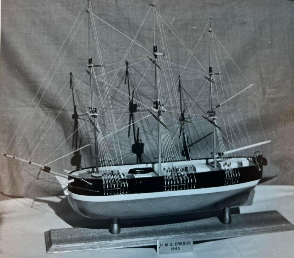
May Fluhmann (1906-1985), a notable Franklin researcher, commissioned this model of Erebus during the mid-1950s. We know based on her archival records at Library and Archives Canada that she worked diligently to secure the ship’s plans. We now also know it to not be a strong likeness, of the indicated 1845 appearance. Credit: Library and Archives Canada May Fluhmann fonds.

To conclude, when it comes to the design of these two incredibly unique vessels, we are still very much on a voyage of discovery! It has been a decade since the heady days of the Victoria Straits Expedition’s location of Franklin’s lost flagship, HMS Erebus. Much has been discovered, and much remains to be found at both Erebus and Terror sites. Along with artifacts that allow us to explore the human tragedy – the loss of two shiploads of exceptional individuals – our knowledge about the exact design and advanced technology of both ships will continue to expand over the next decades. Parks Canada’s Underwater Archaeology Team is at the Franklin ships at this exact moment! What will they find this year?

“Westward from the Davis Strait, tis’ there twas’ said to lie; the sea route to the Orient, for which so many died. Seeking gold and glory, leaving weathered broken bones, and a long-forgotten lonely cairn of stones” (S. Rogers Northwest Passage – 1981)

CLICK HERE to read the “Design Dossier” for HMS Erebus, and Acknowledgments

The Design Dossier: To create my reconstruction and simplified plans, I had to interpret a variety of sometimes contradictory sources. This project followed on from the reconstruction of HMS North Star, Franklin search ship, and HMS Ontario historic shipwreck. This may only interest a few readers, so I will summarize this research. It adds up to a unique perspective on HMS Erebus. My starting point was the excellent archival collection of plans held at the National Maritime Museum (NMM), Greenwich. My simplified reconstruction omits some frame lines along the midships section for clarity, and because I drew the plans at a small but consistent scale of 1:125. A particularly fine set of technical drawings that show the body plans or hull lines exist at the NMM for Erebus sisters Meteor (1823) and Fury. These made it possible for me to reconstruct both the overall hull lines, and also the bow and stern elevations and body plans for Erebus. Without close adherence to these plans it would be virtually impossible to reconstruct these ships, absent more information from the wreck archaeology. Another guide in this reconstruction was the artistic works that Lt. Graham Gore [Scott Polar Research Institute item 35195957] and Capt. Owen Stanley [National Library of Australia collection item 2484731] created in 1845, as the squadron moved north. I am privileging their first-hand observations over certain other technical evidence. Gore, as First Lieutenant, would have had direct involvement with readying the vessels for sea in 1845, whereas Stanley had sailed in Terror during the 1836 Frozen Strait Expedition, and temporarily accompanied the squadron northwards while commanding HMS Blazer, a steamship towing Erebus. Gore sent his artistic depictions back for Lady Jane Franklin while the expedition members posted their final letters from Disko Bay, Greenland (Qeqertarsuup tunua).

  1. Erebus had a large convex iron iceguard fitted to the bows. Parks Canada’s archaeology has documented iron plating extending from the stem all the way back to be level with the foremast. Their commissioned wrecksite diorama (built by professional model builder Fred Werthman) also demonstrates this expanse of plating. Correspondence with Parks Canada’s Underwater Archaeology Team and Dr. Matthew Betts have substantiated this feature. This appears to be larger than any polar-modified ship from before the Expedition and any of the search vessels that followed in the wake of the lost ships (with the possible exception of the armoured “beaks” of HM Steam Vessels Pioneer and Intrepid).
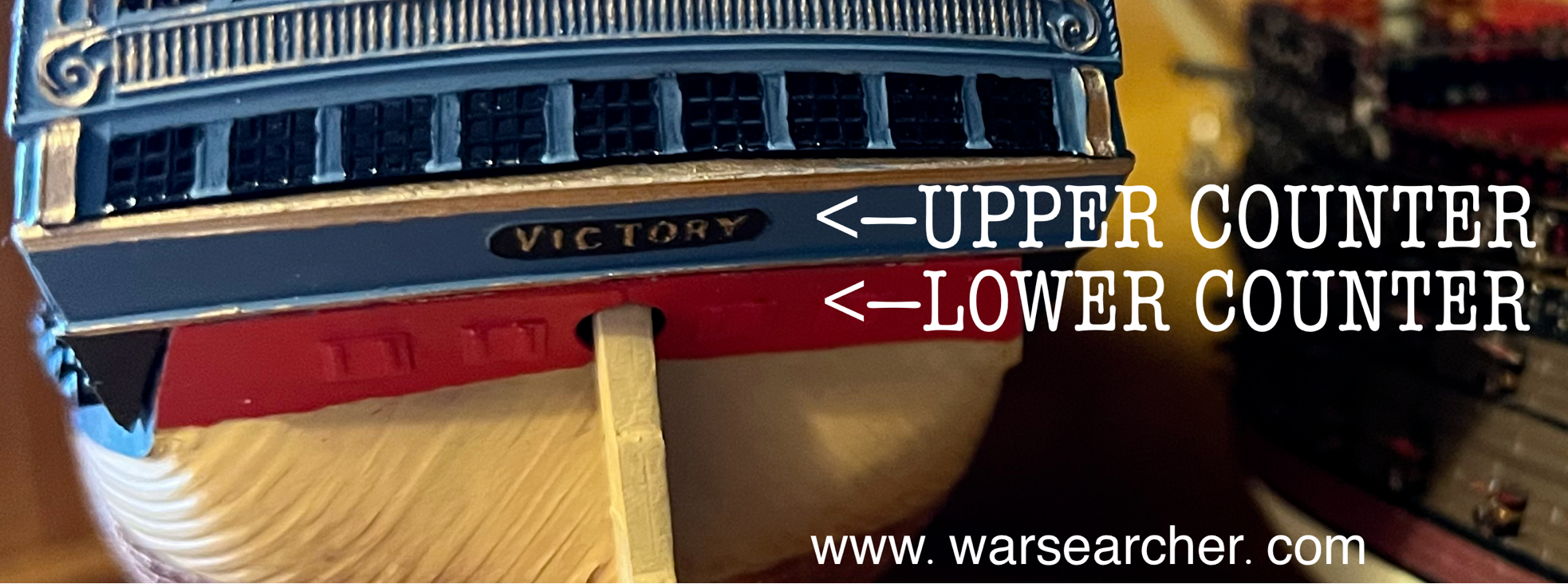
  2. A distinctive difference in the sterns of the ships is that Erebus always had an upper counter, whereas Terror never had one. An upper counter (see below HMS Victory model) is a space traditionally found under the lowest level of lights (windows) on the stern of a vessel, which also often has the nameplate or lettering identifying the ship. Developing to its classical appearance in the early 18th century, the design of the upper counter was mostly aesthetic, and made a visual transition to the more concave space of the lower counter (where the ship’s rudder usually enters the stern, and stern chase ports, if they exist, are located):This small feature can be readily seen under the stern windows of Parry’s ships in the illustration of Hecla and Fury at top. Terror and her two Vesuvius class sisters (RMG ZAZ5615), by contrast, were more constricted aft and had less deck height in the great cabin, so no upper counter existed under the lights, even when the ship had full, frigate-like stern and quarter galleries. Terror lacked the upper counter in 1813, in 1836, and again in 1845, according to the NMM collections of plans, and a variety of depictions. The upper counter is documented for Erebus on Meteor and Fury‘s 1823 plans and her own 1839 plans as rebuilt for the James Clark Ross Antarctica mission.
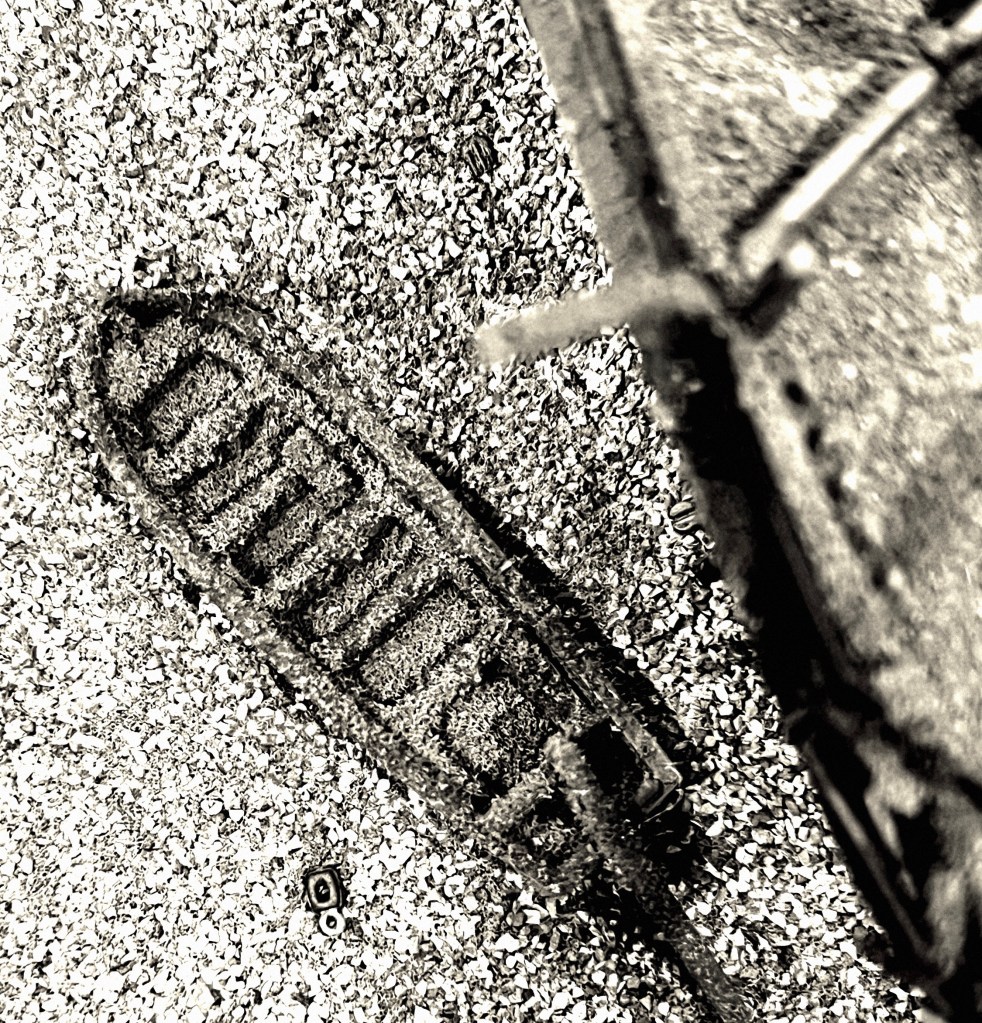
  3. This era saw a lot of experimentation in naval architecture around the stern, to establish the most optimal means of fitting a screw propeller into an existing wooden warship. Oliver Lang (the shipwright for the 1845 modifications to both ships) was at the very heart of this innovative furor, and was involved in the design of the stern of revolutionary new types of steam sloops, frigates, and line-of-battle ships, all modified or designed from the ground up to fit the new models of screw propellers (please see my subsequent post exploring Lang’s contributions to steam-propelled warship design). I believe, when he came to modify these two veteran exploration ships with new propulsion, he omitted the traditional lower counter design from under the transom/stern galleries of both ships, rounding the tuck up, or carrying and uniting the hull planking upwards to meet the transom timbers. His 1845 technical drawing for the stern of both ships (RMG ZAZ5683) is an approximation, even when overlaid to produce the June 1845 “green ink” updates on the 1836 Terror plan (RMG ZAZ5672). The plan had to work for both ships, which had some significant differences in dimensions and stern post orientation. This plan’s inaccuracy can easily be observed when it was traced over to the 1836 Terror plan: The 1845 updates create lines at the level of the ship’s upper rail that have no sheer and terminate hanging in space! Those lines are a simple tracing of the left side sectional stern plan from the 1845 technical drawing, not the right side exterior elevation. This means they are a sectional view imposed inaccurately over Terror’s 1836 lines, with nothing added about what this all looked like from the outside! My interpretation is one of three possible options for the 1845 stern: Round the tuck up to the level of the upper counter in Erebus and the transom/stern galleries in Terror; round the tuck up to the level of the galleries and also remove Erebus’s upper counter; deviate from Lang’s 1845 technical drawing and retain the lower counter in both ships, with Erebus likely also retaining her existing upper counter. As I hope I have indicated with linked examples above, the green tracing on the 1836/45 Terror plans are not accurate – but especially not for the larger Erebus! Only the wreck archaeology will determine the true dimensions and precise geometry of either ship’s 1845 stern configuration. I believe that Lang, familiar with what had happened to Terror’s old-style traditional stern during her 1836 Frozen Straits Expedition ordeal – the near fatal damage to the stern timbers – would have followed his general program of propeller installations, and planked the strongest stern he could have into the two ships- to give the vessels the best chance of not being destroyed by Arctic ice. In my plan, I drew in a “quarter fashion piece” element which tails downwards and which would have flanked the original lower counter in Erebus. This is a stylistic decision and also allows me to easily pencil in a lower counter dividing line towards the stern post if I end up being wrong!

ACKNOWLEDGMENTS: We would like to acknowledge the assistance of staff at the National Maritime Museum / Royal Museums Greenwich, as well as HMS Terror expert Dr. Matthew Betts, and Jonathan Moore at the Parks Canada Underwater Archaeology Team, both of whom generously corresponded with me about elements of Erebus’s design over the course of my often-ambling 2022-24 correspondence. Their assistance does not imply that they endorse the above interpretations.

Notes:

  1. This summary of events is drawn from several chapters of John Geiger and Alanna Mitchell Franklin’s Lost Ship: The Historic Discovery of HMS Erebus (Toronto: HarperCollins Pub. 2015). Ryan Harris, Parks Canada’s project lead on Erebus, provided an incredible guided tour of the wreck in October 2014: https://youtu.be/ZxH18XKqt-k?si=OCrC1XHYZa6AfpvC ↩︎
  2. Earlier expeditions of the 19th Century had used converted whaling ships, but Captain Christopher Middleton’s 1741-42 Northwest Passage Expedition featured the converted bomb vessel HMS Furnace, while Constantine Phipps 1773 Expedition “towards the North Pole” (which a young Horatio Nelson journeyed on) used a pair of bombs, HMS Racehorse and Carcass. Fury did not survive her Arctic ordeal, and, it is hoped, one day this near-sister of Erebus, with earlier Arctic modifications, will be discovered near Fury Beach, Somerset Island, Nunavut. ↩︎
  3. Michael Palin’s book, Erebus: The Story of a Ship (Random House: 2019), is an essential source for information about all periods of the vessel’s service. The equivalent work for Terror is Dr. Matthew Betts’ HMS TERROR: The Design, Fitting and Voyages of a Polar Discovery Ship (Seaforth pub.: 2023) ↩︎
  4. Hecla was in fact sold for conversion to a whaling vessel in 1831, and a very good whaler was she! ↩︎
  5. In technical parlance, Terror had slightly more steep-rising floors. A useful description of the changes to sterns, bows, and sheer in the first half of the nineteenth century can be found in Dr. Frank Howard’s Sailing Ships of War 1400-1860 (Greenwich: Conway Maritime Press, 1971) P271. Howard also mentions an interesting and cautionary issue about interpreting contemporary 19th C. naval plans: The ability to draft accurate technical depictions to represent new design elements on paper lagged behind the innovations themselves. ↩︎

Raise the Terror Boat!

Raise the Terror? Raise the Terror’s Boat! Why? Read on!

Since the incredible discovery of HMS Terror in September, 2016, there has been keen interest in the archaeology taking place at the wreck. Terror was Sir John Franklin’s second ship from the ill-fated 1845 search for the Northwest Passage, and was discovered almost exactly two years after the lead ship, HMS Erebus. The 2023 archaeological season has concluded, but announcements of new discoveries by Parks Canada archaeologists remain weeks or months away. We are years from a full archaeological assessment of Terror, though a tantalizing vision has formed of an astonishingly well-preserved site, 80-feet under the waters of Terror Bay, King William Island, Nunavut. An international community of “Franklinites” – those interested in all things Franklin Expedition- continues to speculate: What was discovered this year; what new information helps explore the last days of the Expedition; are there connections to known or as yet undiscovered terrestrial archaeological sites? Is either ship an actual tomb to some of its crew?

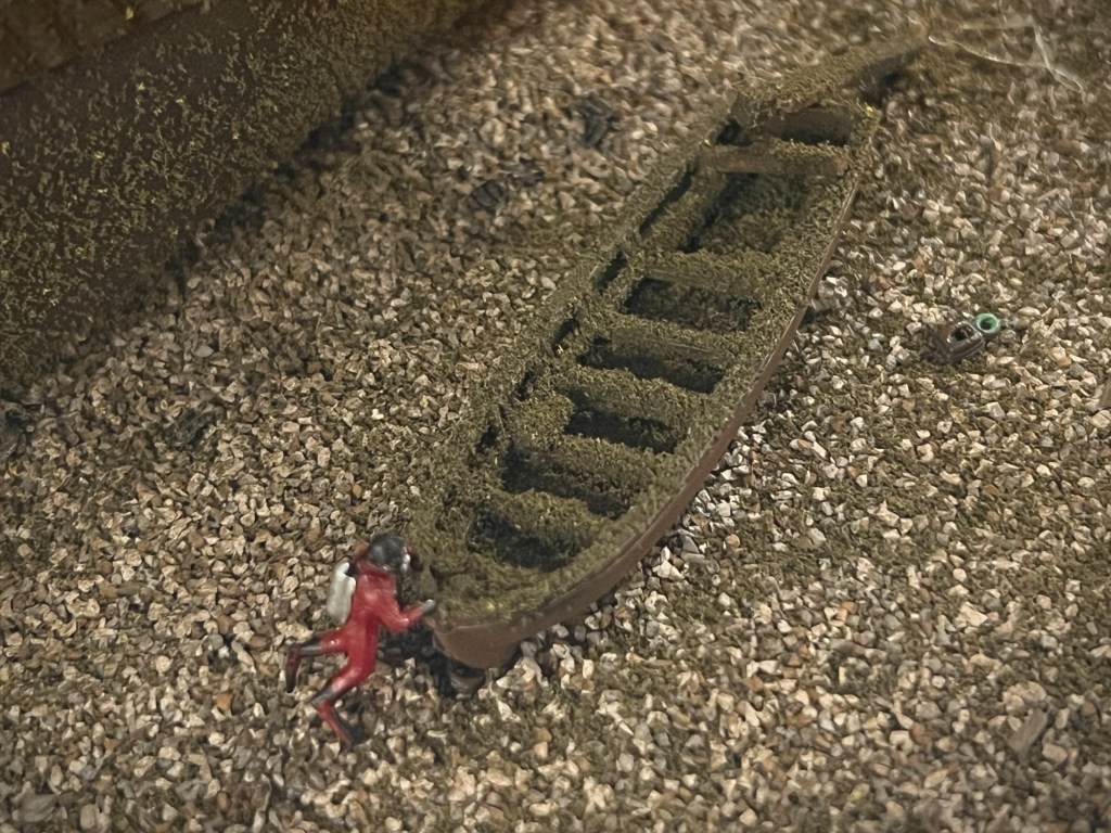
The ship’s boat immediately to port at the stern of the Terror wreck, as represented in our 1/125 scale wreck diorama. Credit: http://www.warsearcher.com

Over the years, there have been posts on the very active “Remembering the Franklin Expedition” Facebook group, proposing to “RAISE THE TERROR” from her current location. Other members, just as passionately, dismiss the idea as premature, ruinously expensive, and potentially destructive to an artifact group members care very much about. In this post we’d like to focus on what we think would be a less contentious project. We remind readers that we are not archaeologists or marine salvage experts.

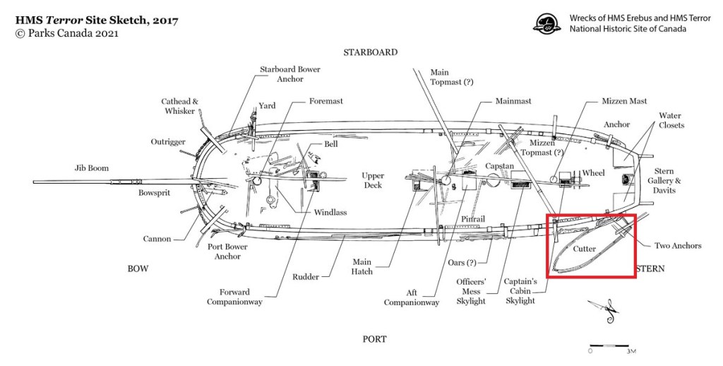
What we are proposing is to recover one artifact: RAISE TERROR’S BOAT! It is located on the seabed off the port quarter of the wreck, under a pair of davits. It can be readily seen on the site plan that was prepared by Parks’ archaeology staff in 2017 and released on their website two years later. Like the ship, this boat-wreck appears to be in very good condition after almost 175 years of frigid immersion.

HMS Terror site plan, ca. 2017, modified to emphasize the location of the ship’s boat. Credit: Parks Canada source.

The boat appears to be a standard 23-foot ship’s cutter, about 7-feet at its broadest part. It is clinker-built (overlapping boards) and has recessed slots for rowing with eight or so oars. It has several thwarts for crew and passengers, and could also be fitted with two small masts to sail it. Some upper sections of the gunwales appear to be damaged or rotted through, and it is unclear to us if it still has some type of fabric cover or is instead almost completely filled with sediment. A fallen section of davit or post rests at the squared-off stern, overhanging the transom. The rudder is not installed.1

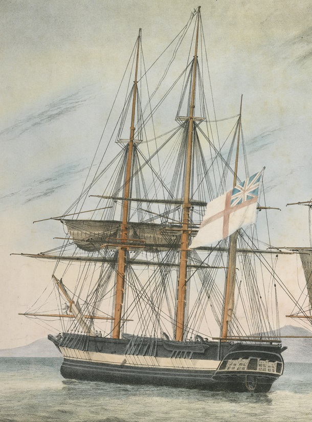
HMS Fury, carrying a similar cutter in the same position, as depicted before the second William E. Parry Expedition searching for a NW passage. Fury was very similar to both Franklin ships, and had been wrecked in the Arctic at Somerset Island, two decades before. Detail of His Majesty’s Discovery ships, Fury and Hecla by Arthur Parsey (Artist & Engraver) Charles Joseph Hullmandel (Printer) in 1823 PAH9224.

Raising this small vessel should not compromise other areas of the wreck. The operation would not upset precious artifacts or records inside Terror, as they await systematic archaeological study. Based on the Parks Canada tour of HMS Terror film, the boat is not deeply embedded in the hard, gravel-like seabed. Compared to the complex overall sites of either Terror or Erebus, a thorough survey of the boat and its immediate surroundings should not be a multi-year operation. The full survey would ensure that no artifact, no matter how small, was overlooked.

An underwater archaeologist examines the boat near the HMS Terror wreck diorama. Credit: http://www.warsearcher.com

Once recovered and conserved, the artifact could serve a variety of purposes, helping to interpret the history of the Expedition, and its grim denouement. This cutter is a tangible link to its companion boats–the sledge-bound boats that crew members dragged along the coasts until they could go no further. It could also help explore less tragic polar exploration voyages and other searches for a Northwest Passage.2

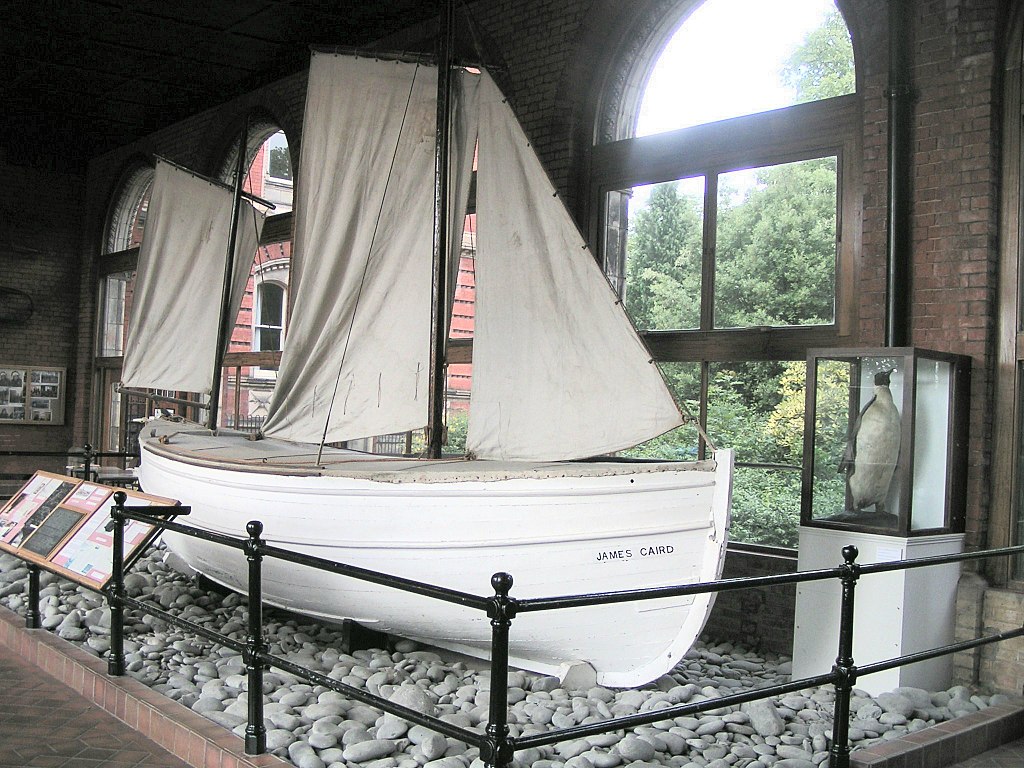
A comparative example is the display of the famous James Caird, a 22.5-foot reinforced ship’s boat from Sir Ernest Shackleton’s expedition ship, Endurance. After the Endurance was crushed by ice in the Weddell Sea, in November 1915, the boats allowed the crew to escape to Elephant Island. Shackleton and two companions pushed on in the James Caird to South Georgia, where they were able to organize a rescue party to return to for the whole crew. The boat is now on display at Dulwich College, South London. Credit: Rumping, Public domain, via Wikimedia Commons

Raising the Terror’s boat is only half of the ambitious plan, though! The cutter is a character-defining element of the overall Terror site. If it is raised to the surface for conservation and display, it would create an absence at the wreck site. Why not replace it with a replica that also memorializes the lost crews? A traditional boatworks in Great Britain, the Canadian Maritimes, or New England could be contracted to create a faithful copy of the craft, to be deposited (or sunk) in situ in the same exact position. It would gradually silt up and decay alongside the wreck, becoming more integrated into the environment and benthic marine ecosystem as the years pass. This new boat could also serve as a kind of benchmark or “canary in the coal mine” for identifying more rapid changes to the site, which may be less evident on the original structures. In the (hopefully distant) future, when the Terror decays, the boat could remain as one of the last wooden elements at the Terror wrecksite. Beechey Island has memorials and the replica wooden gravestones currently marking the earthly remains of three Franklin expedition crewmembers. It seems fitting that HMS Terror could have a replica boat to mark her resting spot. There are also precedents for this. Replica objects deposited at famous wrecks mark removals, and can restore an aesthetic appearance to the site.3 A suitable plaque affixed to the replica boat could help memorialize the lost crews–an underwater cenotaph to the lost men of the Franklin Expedition in an incredibly powerful location. RAISE THE TERROR’S BOAT INDEED!

So, have we persuaded you? Let us know by leaving a comment or sharing!

  1. This description is drawn from the Parks Canada Terror dive tour video linked to above, Matthew Betts’ work HMS Terror: the Design, Fitting, and Voyages of the Polar Discovery Ship, archaeological field reports about Terror prepared by Parks Canada’s Underwater Archaeology Team, and comparative examples of other Royal Navy cutters. ↩︎
  2. A 23-foot boat could also help interpret more positive events, such as when HMS Fury‘s abandoned boats were instrumental in saving Sir John Ross’s entire expedition crew, after the abandonment of their own ship Victory. Elsewhere, it is also the same basic size as the HMAV Bounty’s launch. ↩︎
  3. One example is a proposal to sink a sculpture of a 55-foot long Sea King Maritime Patrol Helicopter on the deck of the artificial reef, the former Canadian HMCS Annapolis, to reincorporate a representation of the destroyer’s helicopter detachment to the site. ↩︎