Fury and Hecla: Parry’s Formidable Arctic Exploration Sisters

On March 31st, 1827, Captain William Edward Parry took leave of his friends, relations, and his young wife Isabella. He boarded his beloved exploration vessel, HMS Hecla. After five expeditions searching for a Northwest Passage in the Canadian Arctic – four of which he was in overall command of – he was setting out for a different destination: The North Pole. Onboard Hecla were the latest contingent of a long line of British officers who would write their names on geographic features across both Arctic and Antarctic regions.1 His crew well-understood the hazards of polar exploration. On Parry’s last expedition Hecla’s sistership and exploration consort, HMS Fury, had been destroyed. Parry – an evangelical Christian – must have wondered, as he moved north along the English coast, if Providence and his continuing good fortune would keep them all safe on this new foray towards the top of the World.
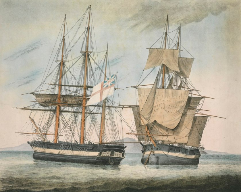
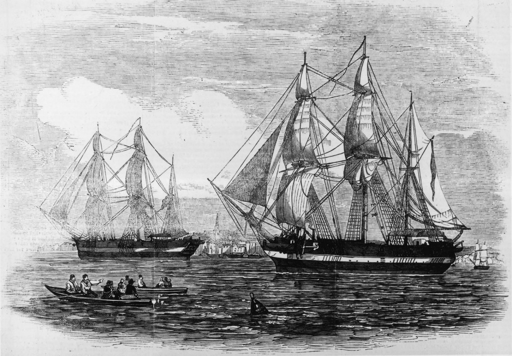
His Majesty’s Discovery ships, Fury and Hecla by Arthur Parsey (Artist & Engraver) Charles Joseph Hullmandel (Printer) in 1823. Both show “Parry scheme” modifications for Arctic service, with broadside armament and mortars removed, reinforced channels, and bow iceguards. credit: National Maritime Museum PAH9224.

Forty-five years elapsed from the Constantine Phipps North Pole Expedition until William Edward Parry’s 1819 Northwest Passage search again brought polar-modified bomb vessels back to the Arctic. The 1741 modifications to HMS Furnace had set a basic pattern for reinforcing bomb vessels to participate in polar exploration missions. The Phipps’ North Pole attempt had introduced yet more innovations.2 However, the “Parry scheme” – the identical strengthening of two sisterships – HM Ships Hecla and Fury – is the most relevant precedent for the modifications of the final, and ill-fated bombs, HM Ships Terror and then Erebus.

Both Hecla and Fury were laid down in 1813, and completed at the very twilight of the Napoleonic Wars. The Hecla class was a slight enlargement of the Vesuvius class bomb vessels.3 They were 105′ / 32m long on the gundeck, 28.5′ /8.7m in maximum beam, and displaced about 375 tons.4 Like the previous exploration bombs Furnace, Racehorse, and Carcass, these two sisterships had participated in a military campaign in their intended role: Firing bombs or carcasses (incendiary shells) from their main armament of a 10” and 13″ mortars. Both had been members of Admiral Edward Pellew’s fleet during the Bombardment of Algiers, 27 August 1816. They, along with the other bomb vessels Beelzebub and Infernal, fired hundreds of shells into the defences, harbour, and city, and were present the next day when the Dey of Algiers capitulated.
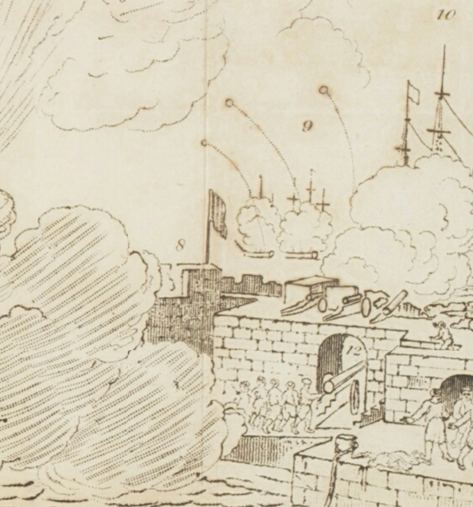
A detail of a panoramic illustration of the Bombardment of Algiers, showing Hecla, Fury and Belzebub firing bombs on a high trajectory. A section of the fortified harbour wall and a great gun are in the foreground. Panoramic views of various places : collection of pamphlets describing panoramas on exhibition in London, 1818 -1832 [detail of panoramic illustration] Credit: State Library of New South Wales DSM/791/PA1

Hecla’s first exposure to Arctic service involved conversion for a Northwest Passage expedition. This mission followed up on John Ross’s recent voyage, which had used two converted whaling ships, Isabella and Alexander, to revive the whole program of Admiralty polar exploration.5 Lieutenant William Edward Parry (who had commanded Alexander) would now make his own effort to solve the great cartographic mystery at the top of North America: was there a navigable passage from Baffin Bay through to the Western Arctic?6 Parry was also directed to try to resolve the cartographic confusion that John Ross’s mission had raised.7 His methodical approach to preparing for polar exploration involved thoughtful consideration of the unique environment his crews would operate in, an almost fanatical attention to technical details of the ships, equipment, and supplies, and careful planning for unanticipated situations.

Capt. William Edward Parry, Commander of the Polar Expeditions (on the print this is updated from 1819-1827). Credit: Credit: Library and Archives Canada, Acc. No. 1939-159-1.

Hecla was accompanied by HMS Griper (Matthew Liddon commanding). Griper was a gunbrig: a much smaller type that was about 85’/26m long on the gundeck and displaced only 180 tons. The pairing of a lead ship with a smaller consort had been a feature of prior expeditions. The reinforcement of the ships combined the best features of previous refits. Parry’s expedition made remarkable progress westwards into the uncharted Arctic Archipelago at the top of the North American landmass. The crews overwintered, in their carefully prepared and housed-over ships, in the midst of their discovery mission.8 This frozen pause, far north of the Arctic Circle, was a first for the Admiralty exploration program.

This image of Hecla on her first mission, housed over for overwintering at Melville Island with Griper nearby, is take from The frozen zone and its explorers; a comprehensive record of voyages, travels, discoveries, adventures and whale-fishing in the Arctic regions for one thousand years, an 1874 publication. Internet Archive Book Images, No restrictions, via Wikimedia Commons

Parry penetrated the Arctic as far west as Cape Providence at the southwestern tip of Melville Island (beyond 113° degrees longitude west of Greenwich). With the (brief) navigation season rapidly closing, he chose to winter at a suitable bay back along the southern coast. As the ice was setting in, they had to cut their way in to “Winter Harbour” using ice saws. Parry kept his ships safe and his crews relatively healthy during this 10-month period. He even continued the exploration mission overland by leading treks to survey the northern coast of Melville, where he discovered Hecla and Griper Bay. Early the next exploration season, he was turned back from further progress westwards by pack ice. The two ships arrived home to wild enthusiasm in October 1820.
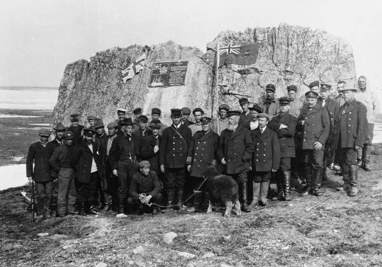
Captain Joseph-Elzéar Bernier and the crew of the CGS Arctic visit Parry’s rock at Winter Harbour, on 1 July 1909. They erected a commemorative plaque, alongside carvings made by Parry’s crew in 1819-1820, which would become important to Canadian sovereignty claims over the Arctic. This is now a National Historic Site of Canada. Credit: Library and Archives Canada C-001198

In preparation for Parry’s next mission to the Arctic, HMS Fury was reinforced to the same standard as Hecla, to become Parry’s lead ship in a new effort to locate a passage west. Hecla was commanded by George Francis Lyon. This dual refit, starting in late 1820 at Deptford Dockyard, represents the beginning of the classical age of the Admiralty’s program of strengthening ships for polar service: Here two sisterships were identically outfitted, to operate in tandem. In the event of the loss of one ship, both crews could be fully accommodated on the remaining ship.9 Parry described this important refit in detail in the published journal of his second expedition.10 In the wake of his first expedition, and frustrating experiences sailing in company with the slower Griper, he now rejected the convention that a lighter vessel, acting as a consort, could explore inshore waters more effectively than two evenly-matched ships. He emphasized that all inshore surveying could be completed by detached boat crews (who have the light vessels with minimal draft to best exploit inshore charting opportunities). He argued that ships of the same design could better survey a larger area (with independent charting of whole stretches of coastline a possibility). In order to ensure that sailing performance was as even as possible, he adopted what he called an “equalized rig” between ships. This went beyond merely ensuring that the three-masted barque rig of both ships was identical, because the fore and main masts were fitted with the exact same lengths of spar for a given sail type between both masts. This meant that four masts between two ships had the exact same spar dimensions for courses, topsails, and topgallant and studding sails – something that would greatly simplify repairs in case of damage to the top hamper.

The draught plans of the original Hecla class design of 1813 (upper ZAZ5687), and an internal arrangement plan of the modifications to Fury for the 1821 NW passage mission (lower ZAZ5696) © Crown copyright. National Maritime Museum, Greenwich, London

The original Admiralty plans, now preserved at the National Maritime Museum at Greenwich, show a more thorough conversion for Arctic service than any prior British vessel had undergone. In contrast to Racehorse and Carcass, Parry’s ships received a full weatherdeck, which united the quarterdeck, foc’sl, and the intervening space amidships. This decking enclosed a much larger internal space which could protect crews from foul weather and, more importantly, Arctic conditions. Fury and Hecla were the first bombs to be so heavily modified that no internal traces remained of their original mortar beds. They also were the first to have all gun-ports fully omitted (planked over). The fragile channels (where the shrouds connect down to the hull outboard of the rails) were filled in by ice chocks, as they had been on HMS Furnace in 1741. Massive timbers – Heavy bolsters and hooks – strengthened the bows. Parry’s ships had doubled planking on the exterior (which was thicker than what had been fitted to Hecla and Griper for the earlier mission). This ran all the way up to deck-level. The outer layer noticeably thickened at the waterline. Heavy iron strengthening bolted through the knees and keelson, spirketting (reinforced timbers) ran lengthwise, bolted into the frames at different levels. A full double layer of “footwailing” sheathed the area inside the frames of the lower hull (interior paneling in the hold which was laid diagonal for further strength). A sectional plan helps us further interpret the details of these massively strengthened vessels:

HMS Fury sectional plan, 1821 (ZAZ5700) © Crown copyright. National Maritime Museum, Greenwich, London

One of the most notable updates is the first use of diagonal deck planking on a discovery mission. This update can be seen in the uppermost layer of 3” thick decking, represented in the above plan as wider than the underlying fore-and-aft planking. The two layers made for a much stronger protective sheathing: 6” of wood, with a layer of waterproofing tar paper sandwiched in between. This strengthened decking was conventionally fastened to the underlying deck beams. The concept of diagonal decking appears to have been a recent novelty, and can be credited to a naval architect who was coming up with a whole system of new design elements to strengthen British warships: Sir Robert Seppings. Seppings had first installed diagonal decking to HMS Albion’s two gundecks in 1815. He had then arranged a comparative trial, where he had fitted it only to the port side decking of HMS Northumberland. This ship and its experimental deck were put to use from August to October 1815 to transport the deposed French Emperor, Napoleon Buonaparte, to his final exile on the island St. Helena.11 On Parry’s exploration ships, the diagonal sections flanked a central area of the deck, which had massively thickened decking – a full 6″ thick – running lengthwise. This reinforced and buttressed decking – visible today at the wreck sites of Erebus and Terror, created a structure of incredible solidity.12

A Sylvester warming oven (furnace) of an ingenious design circulated warm air to the newly-enclosed interior spaces by flues (it can be seen shaded blue in the second plan above). Relevant to air circulation and lighting below decks, Parry also noted in passing that his ships were fitted with “illuminators,” which, in this context, would appear to be a very early instance of the installation of Preston’s Patent illuminator (which also could be called a portable deck glass and ventilator).13
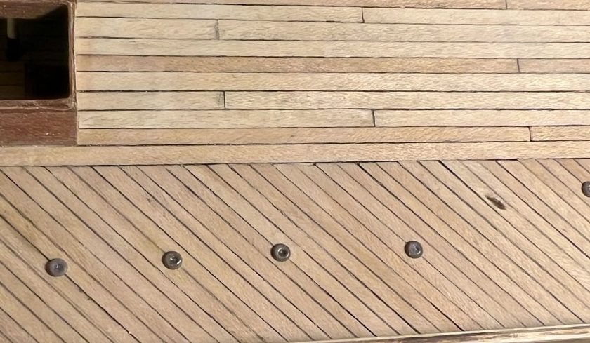
The reinforced diagonal decking and thicker central planks of a polar-modified bomb vessel looking from the main hatch forwards along the starboard side. Illuminators, which my research has established may have been fitted to Parry’s ships on his second polar expedition, and deck prisms also appear. (author’s photo of an incomplete model)

Parry’s second expedition in command (1821-1823) saw the ships overwinter first at Winter Island and then further north at Igloolik. This expedition had set yet another important polar precedent when the merchant vessel Nautilus was hired to transport some of the burden of coal and provisions across the Atlantic to Resolution Island (at the entrance to the Hudson Strait). Crew then discharged its cargo into the exploration vessels, to top up their supplies.14 No ice-free passage towards the west was located, but, in Foxe Basin, Parry did transit the Frozen Straits at the top of Southampton Island into Hudson’s Bay, finally proving the accuracy of Christopher Middleton’s 1742 surveying in HMS Furnace. Near Igloolik, he also discovered a frozen waterway stretching westwards out of the Basin, which he named Fury and Hecla Strait. Both his official publication and Lyon’s private journal (private yet officially approved to be published) include invaluable observations about local Inuit communities’ culture, social practices and daily life.15 All these decades later, Inuit communities on Igloolik Island and around the Melville Peninsula continue to preserve a rich oral tradition around the visit of Parry’s crews. In early 1823, Parry’s crews were beginning to show signs of the onset of that dreaded mariner’s disease: Scurvy. Hecla and Fury departed the Arctic in good condition for a safe return home. Despite Lyon’s remarkable ethnographic observations of Inuit community life, the actual cartographic results of the expedition could not compare to the incredible progress westwards of Parry’s first foray. Still, the public at home in Great Britain continued to be inspired by his exploration.
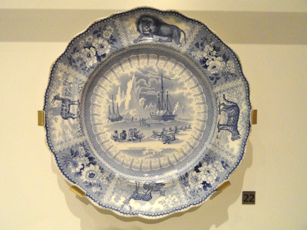
Parry’s Arctic expeditions led to widespread popular enthusiasm in Europe for depictions of Arctic adventures. A Staffordshire dish ca. 1835, shows an Arctic scene of Parry’s ships in the background, and Inuit community members with a sledge and dogs. This appears to be a inspired by a scene of Hecla and Griper at Winter Harbour, updated with events from later expeditions. Credit: Daderot, CC0, via Wikimedia Commons.

Parry immediately threw himself into the planning of yet another expedition. The discovery duo of Hecla and Fury would now look for a passage 500 km to the Northwest of Igloolik, down Prince Regent Inlet (a waterway which he had entered but not fully charted during his westward passage in 1819). Parry shifted back to Hecla. Henry Parkyns Hoppner (an experienced Arctic officer with service on all recent Parry-associated missions) took command of Fury.16 Departing England in May, 1824, the expedition again made use of a transport, the William Harris, which was unloaded at the Whalefish Islands, Greenland (now known as Kitsissut and Imerissoq). The exploration ships were delayed in crossing Baffin Bay, and had to winter at Port Bowen, on the eastern side of the Inlet. Officers and crew disliked the dreary winter site, and had misgivings about the mission to explore the Inlet.17 When finally released from the ice in late July 1825, the ships began navigating the western coast of North Somerset Land (Somerset Island’s insularity would not be proved until 1852), looking for some route to the west. It was along the dramatic cliffs of this coastline that disaster finally caught up with Parry’s crews.
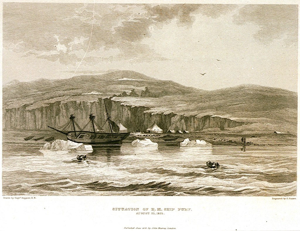
The appearance of HMS Fury on the day of her abandonment (taken from Parry’s Journal of his Third Expedition): Edward Francis Finden (engraver); Hoppner, Capt (artist); Murray, John (publisher), Public domain, via Wikimedia Commons

On the first of August, Fury and Hecla were both damaged by being nipped by ice as it crowded close in to the shores of Somerset Island. Unbeknownst to Parry, Fury was more severely wounded, and began taking on water at a prodigious rate. By the time Hoppner was able to report in, a third of the entire crew were required to work all four pumps just to keep the vessel afloat.18 A careful examination showed that, despite the phenomenal strengthening of the hull as noted above, the basic skeleton of the ship had been seriously damaged: Fury’s forefoot and sternpost were both mauled, and areas of the keel were effectively shattered.19 Parry’s published journal of the expedition relates the episodes of a worsening situation over the next week: Exhausting efforts to find a safe location to shelter the damaged vessel from further ice damage and unload her, to try and repair the hull, eventually failed when ice again crowded inshore and bodily heaved the ship up into the shallows of the beach. This further damaged the bilge areas on August 25th. Parry, returning onboard his former command, recognized the ship was doomed. He allowed Hoppner and his senior staff to carefully assess the ship. The verdict from Fury’s officers was clear: it was time to abandon their vessel and press on.20 A storage depot was created at Fury Beach, with anchors, anchor chains, spars, ships boats, and a vast supply of coal and provisions.21 Given the state of crowding and the reduction in provisions on Hecla, Parry turned aside from further exploration of the Inlet and hastened back to England. He concluded his official account of the protracted destruction of the Fury by stating “…it will be plain that an occurrence of this nature was at all times rather to be expected than otherwise, and that the only real cause for wonder has been our long exemption from such a catastrophe.”22

Remarkably, given the hazards of exploration and the amount of time he had been away from his home on these successive missions, Parry, newly-married, opted to lead one more Arctic expedition. The 1827 mission would see Hecla ordered towards a higher latitude than she had ever navigated to. Parry went from his old quest to complete a Northwest Passage to a mission aimed at the North Pole. This would revisit the site of both Constantine Phipps’ 1773 expedition, and the recent David Buchan and John Franklin 1818 journey towards the Pole: the Svalbard archipelago. The overall plan had actually been thought up by Franklin. John Barrow, Second Secretary at the Admiralty, forwarded it on to Franklin’s friend Parry.23 This time, his venerable exploration vessel would serve as a base ship for a further effort to push north, by carrying up two specially-constructed boats (named Enterprise and Endeavour). The 20′ long boats were fitted with conspicuous steel runners that reached down to the ice from the bilges, and could also be moved on wheels. They were ingeniously fortified, double-planked, and protected by inner layers of felt and Mackintosh waterproof canvas. Their design had been the result of a collaboration of expert naval architects Henry Peake and Oliver Lang.24 After Hecla reached Treurenberg Bay (Sorgfjorden), the two boat crews, commanded by Parry and James Clark Ross, John Ross’s nephew, sledged northwards from Hakluyt’s Headland on pack ice, in difficult conditions.25 Where the plan had envisioned a rapid sledge up to the Pole over smooth expanses of pack ice, the crews encountered a torturous, broken landscape. They reached a furthest north record of 82° 45′ before turning back, exhaused, for the shelter of their ship.26
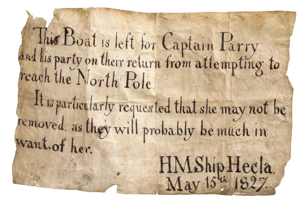
A note left by Parry’s crew, remaining with Hecla, to ensure that no one else absconded with a depot boat left to assist with the return from their polar mission. Credit: National Maritime Museum, Greenwich, London, Royal United Service Institution Collection (AAA3957)

And with her safe return to England from yet another record-setting mission – a highest north latitude that would stand for fifty years – Hecla reached the end of her Arctic exploration career. She was converted to the complimentary role of survey ship (to chart temperate waters, like several of the other surviving bomb vessels), and worked along the coasts of West Africa. Sold out of naval service in 1831, she was first used as a general cargo vessel and then converted to become a whaling ship for the 1835 season. Lloyd’s Register (LR) Foundation Archivist Max Wilson has located important documents to track the interesting history of Hecla’s commercial service. As Wilson notes: “Ironically Hecla was to hunt in the exact area she had opened up to whaling and explored in 1819.”27 She continued to endure Arctic punishment on annual whaling journeys to the familiar waters of the Davis Strait until she was wrecked there in 1840.28 Like her lost sister Fury, Hecla’s final resting spot has not yet been located.

With popular enthusiasm for exploration sustained by the published accounts of Parry’s exploits, the Admiralty turned to other modified bomb vessels to continue the exploration of polar regions. In late 1835, even as Hecla continued plying northern waters, there was a sudden need to rescue the crews of some of her fellow whaling ships: A dozen ships had become trapped in the pack ice of the Davis Strait. A slightly smaller, older bomb vessel, laid up at Portsmouth, was rushed into refit: HMS Terror.29 The scene was now set for the final conversions of the bomb vessel type to polar exploration ships.

This concludes our series of blog posts exploring the history of every bomb vessel that was converted to a polar discovery ship: HM Ships Furnace, Racehorse and Carcass, Hecla and Fury, Erebus and Terror.

Click for Endnotes
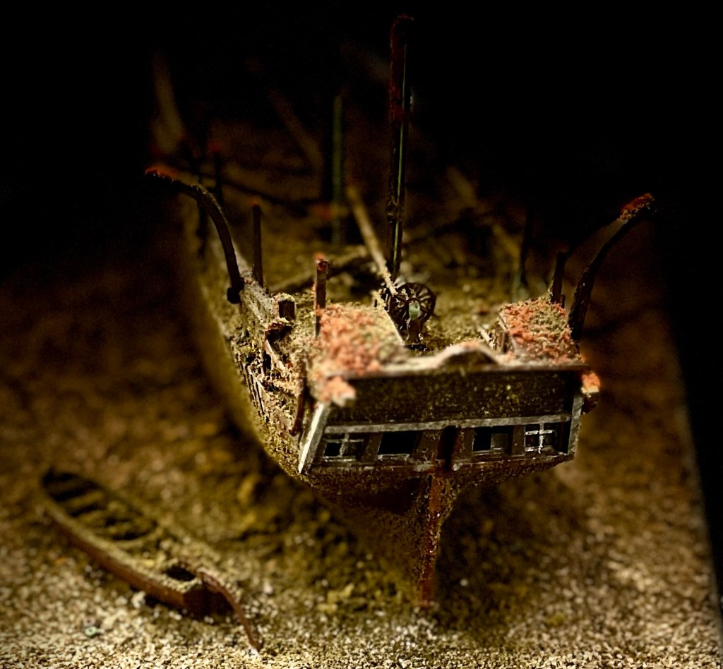
The Great Terror Wreck Repair[2025]

A basic principle of model shipwreck archaeology is that – in contrast to their full-size brethren – model shipwrecks do not necessarily deteriorate. In this post we explore updates to our miniature interpretation of HMS Terror’s wreck. The Terror mini-site has witnessed substantial improvement since 2022!

Terror’s rebuilt stern, with new rudderpost, gudgeons to hang the absent rudder, a broader stern tuck up to the sternlights (windows) and lower water-closet deckhouses aft of the double wheel.

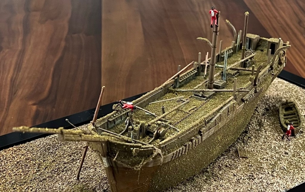
An earlier post “Wrecking the Terror: Recreating an Epic Tale of Old Loss and New Discovery” summarized what we know about the actual wreck of HMS Terror located in Terror Bay, Nunavut, and my 2022 project to build a small diorama of the wreck site. Terror, an astonishingly well-preserved time capsule of the last Franklin Expedition, continues to captivate Franklin scholars and enthusiasts, archaeologists, naval historians, ship lovers, and the expanding fandom community who continue to enjoy the fictionalized drama of AMC’s “The Terror”(season 1).

HMS Terror site sketch, 2017 copyright Parks Canada 2021 [modified by rotating]. Source.

Turning now to the reduced-scale World, Terror was my first wreck diorama, and was followed by Breadalbane High Arctic shipwreck and HMS Ontario.

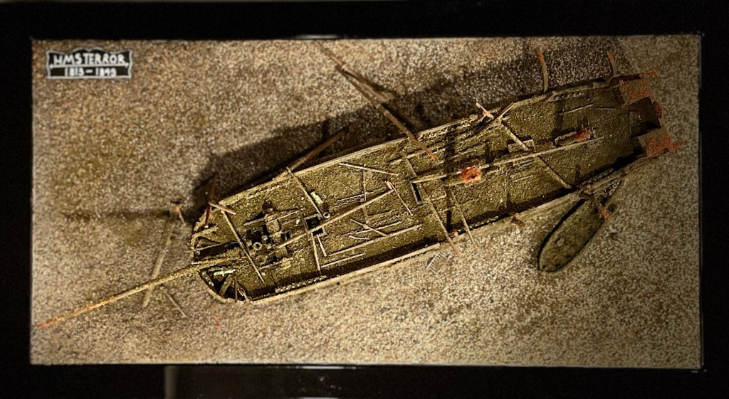
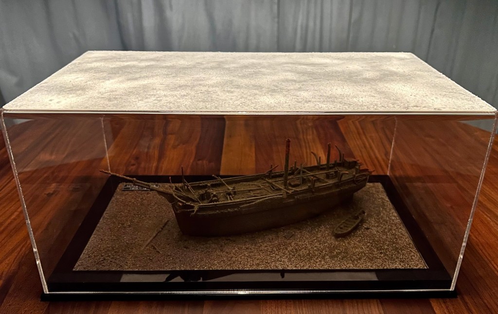
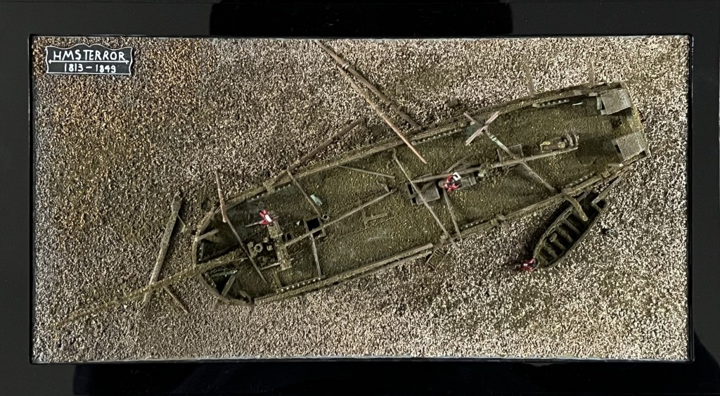
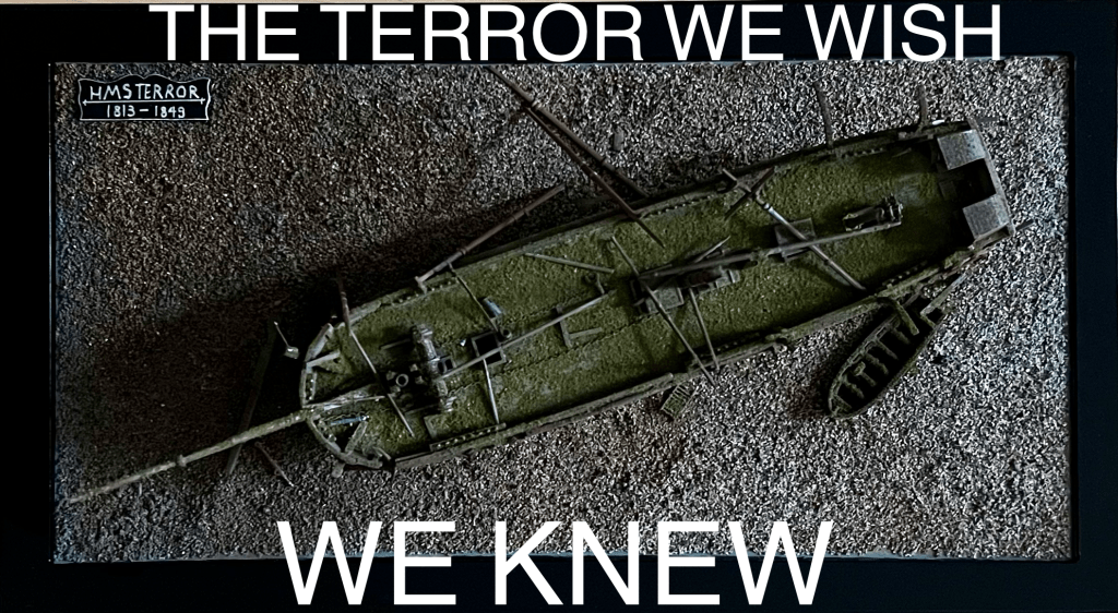
A “glass-bottomed boat” view of the updated wreck site, 80 scale feet under the acrylic case top. The shadow of the bowsprit points due north.

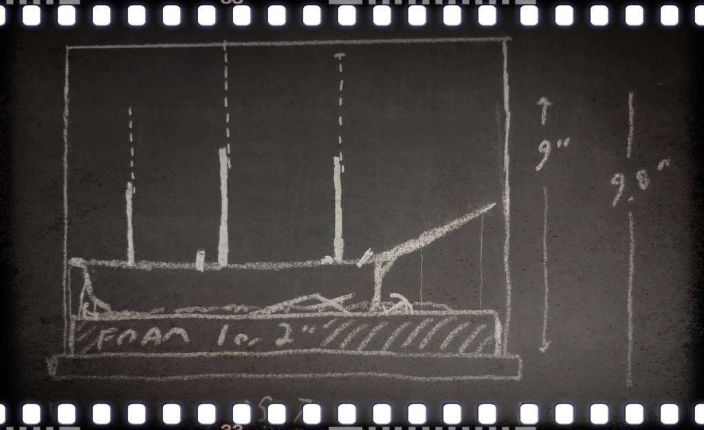
Two years after I thought the diorama was complete, I decided it was time to open the case up and revise some features. A sketch I had worked up independent of this project also helped motivate me to rebuild the Terror.

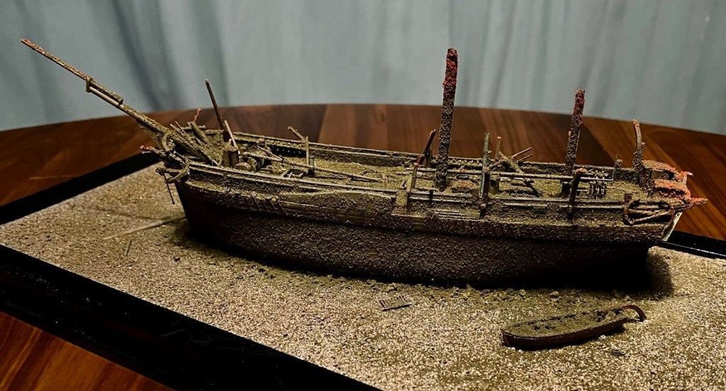
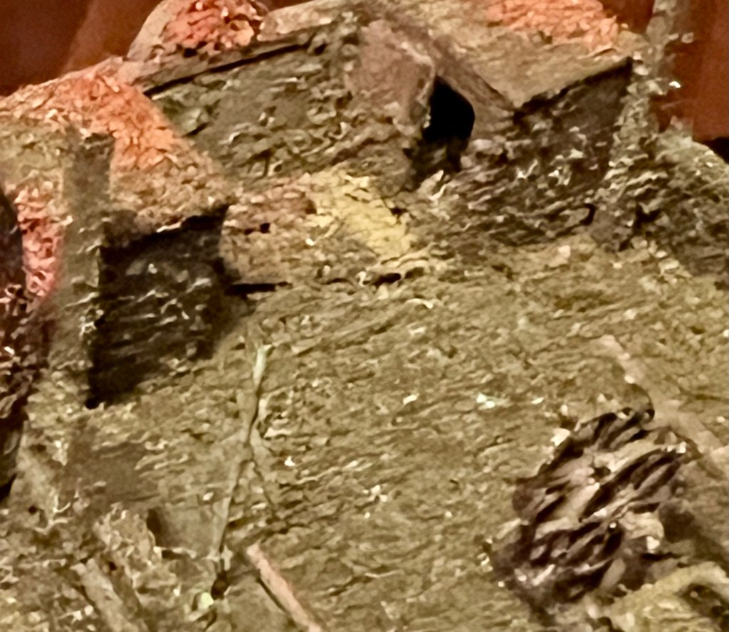
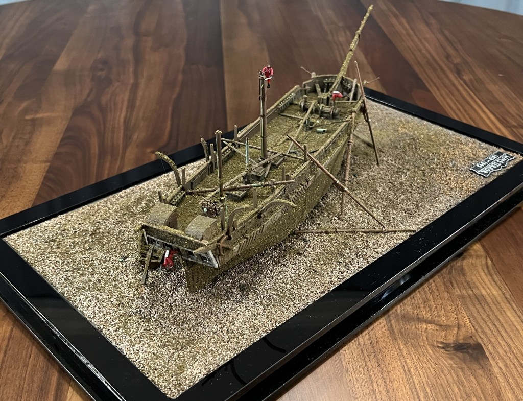
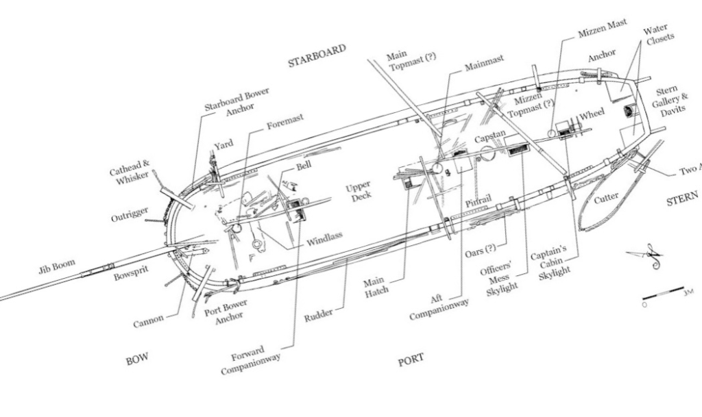
So what changes has the miniature site undergone? The entire lower hull was reshaped to better highlight the turn of Terror’s bilge, the overall body lines, and the broader aft quarters. The wreck was also placed at a more pronounced list to starboard. I added more detail to the debris of fallen masts and yards now located on the upper deck, which better interprets the complexity of the three-masted barque-rig and the chaotic event of the sinking. This “top-hamper” – and what appears to be the ridge poles of winter awnings – would have showered the deck and areas immediately adjacent to the hull with the types of debris we see in the site plan released by Parks Canada, and imagery released by their Underwater Archaeology Team.

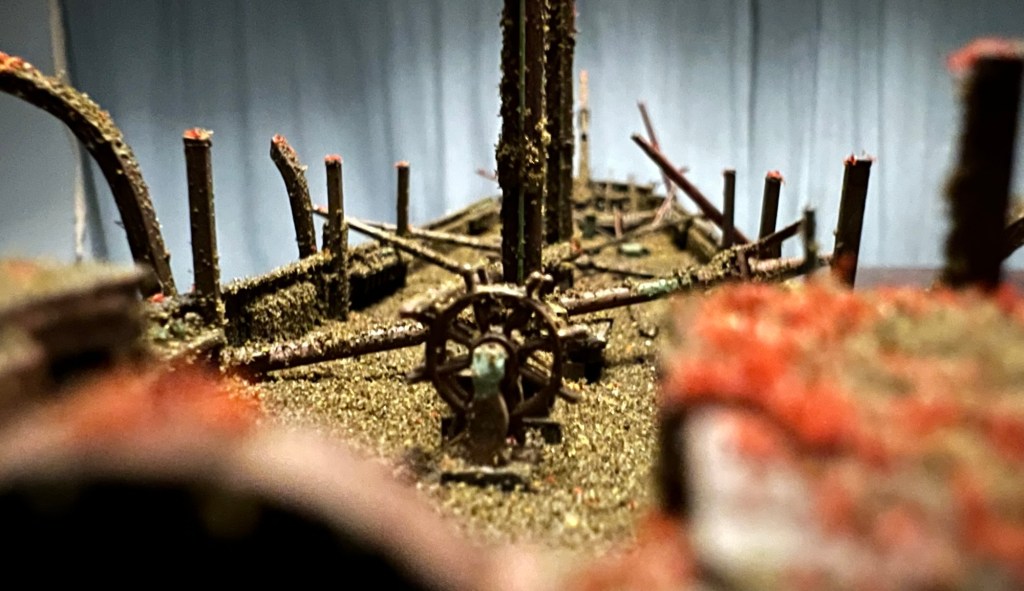
The weather deck looking forwards from the taffrail.

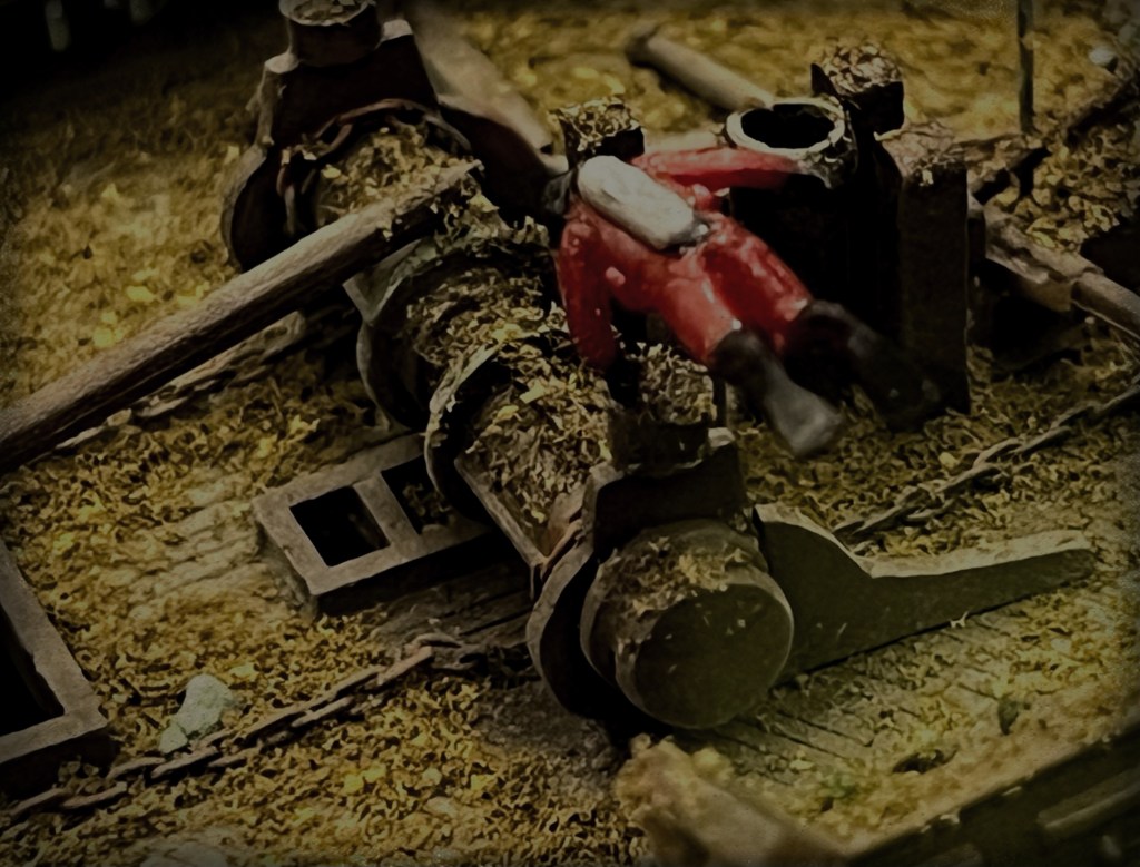
Under all the accumulated silt and growth, there is likely to be a bewildering variety of artifacts, which my interpretation can only begin to hint at. The ship’s boat off the port quarter of the wreck was given a modest update: A more accurate fallen davit resting across the stern.

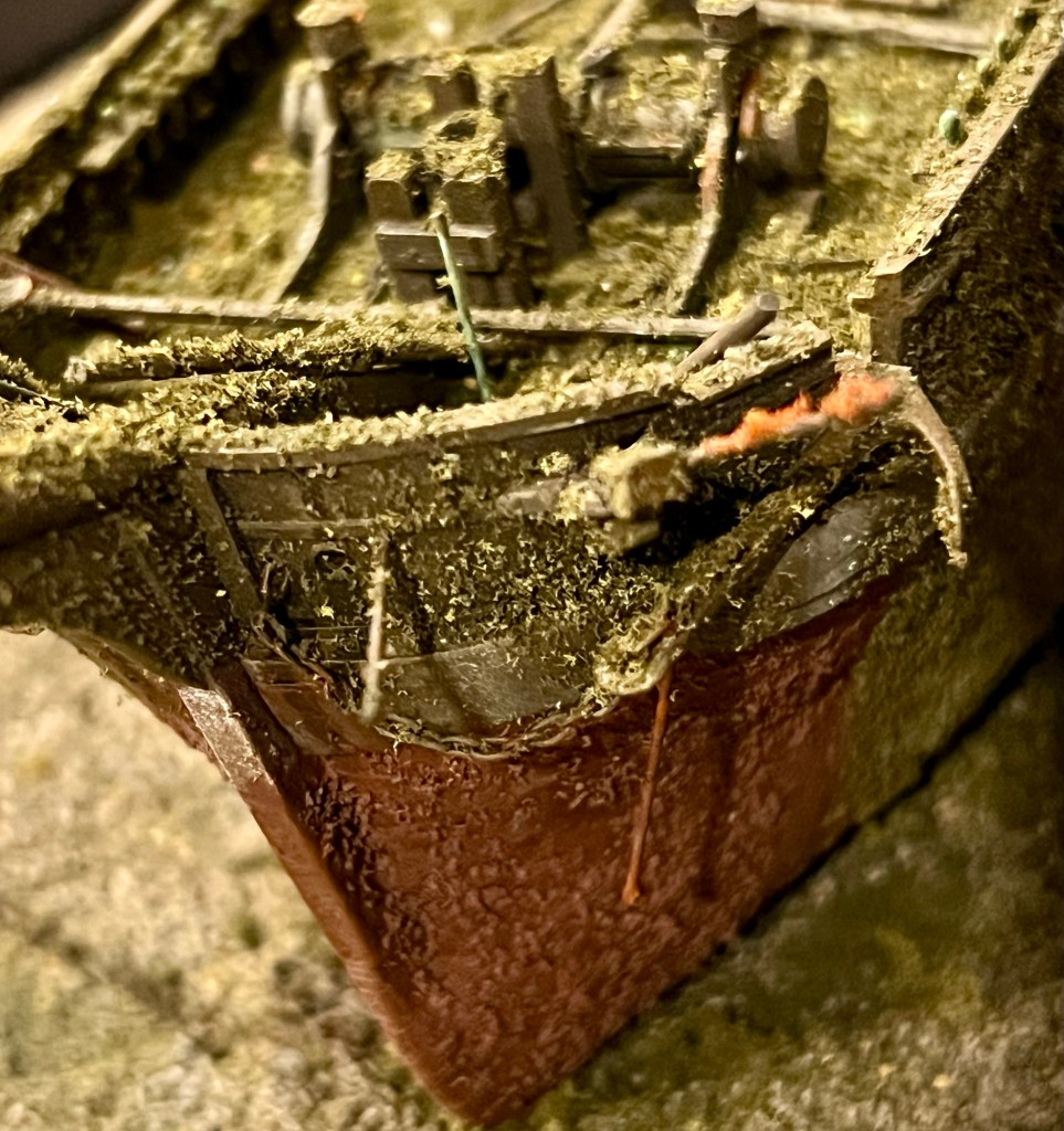
The bows including the port bower anchor, the hawse holes, the catshead with whisker boom, and other oddities of the polar-modified bomb vessels. under the reinforced channels, the massive ice shield of iron plates shows corrosion and marine life.

The water-closet structures at the stern were completely rebuilt with lower roofs and sliding doors opening to the sides. They still have detailed “privy” interiors. A small cavity at the aft end of the starboard closet shows where the flag locker was located.

The new stern water closets, the double wheel and the captain’s skylight just forward of that. In the foreground, a pipe leads down to the captain’s small stove.

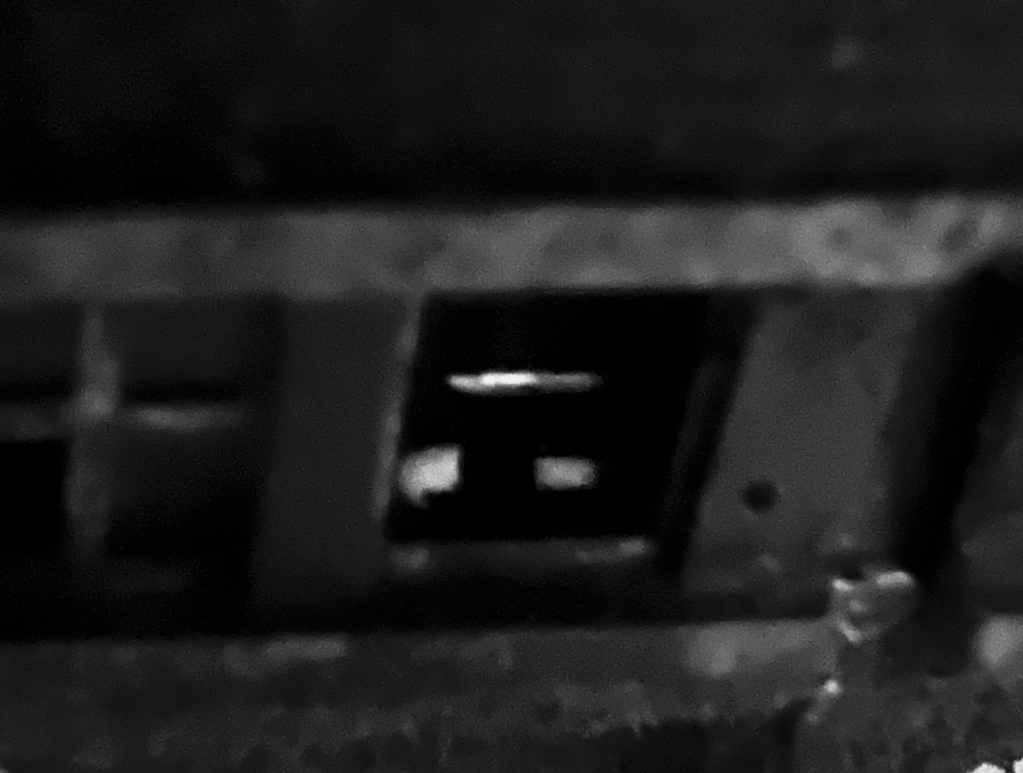
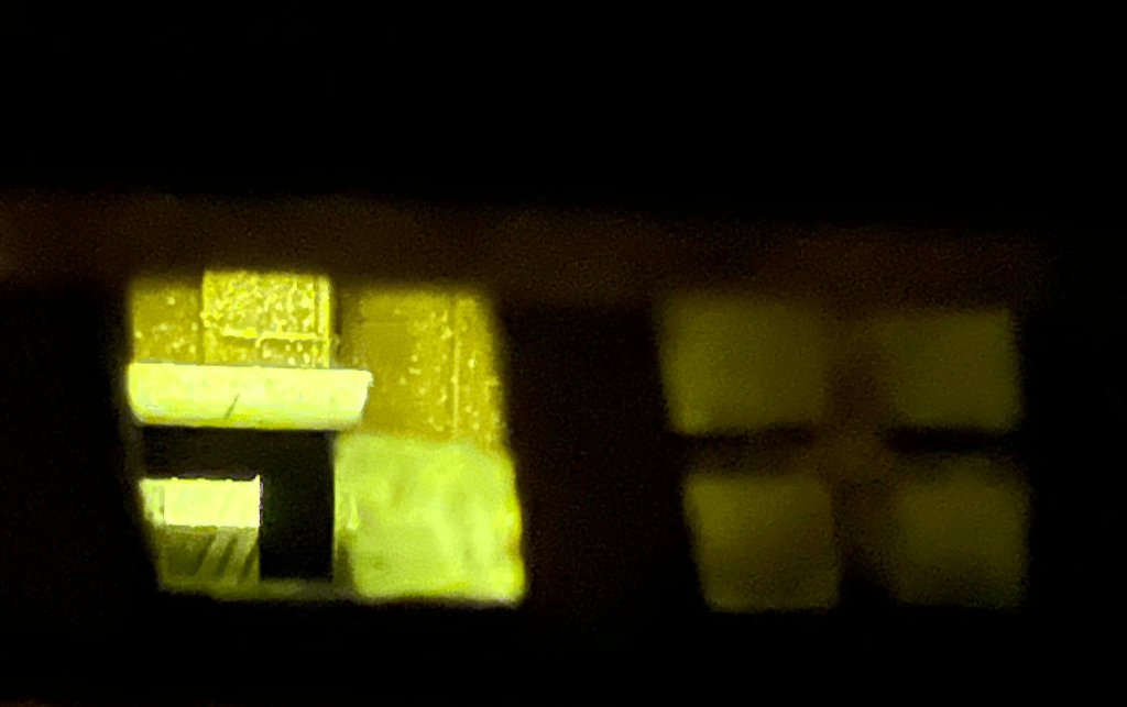
The interior of the wreck diorama remains practically inaccessible, and no substantial work was done belowdecks during our “great repair.” I do hope that, in a future season of modelling work, a more fulsome recording of the detailed interior spaces of the model could be attempted. For now, we had a quick examination of Capt. Crozier’s miniature great cabin through the stern windows; his captain’s desk remains in place, but the drawers are still modelled tightly shut. No miniature records have yet been recovered.

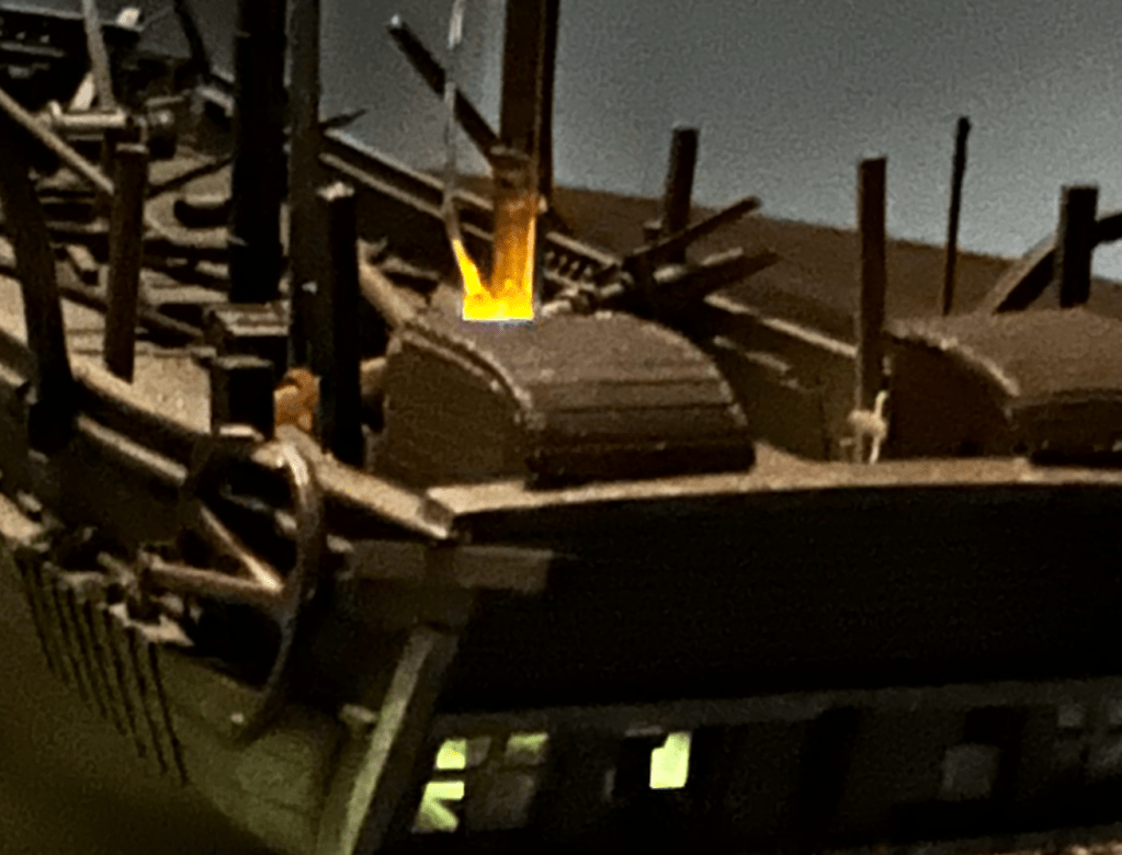
Light shines down through the captain’s skylight onto the surface of Crozier’s desk.

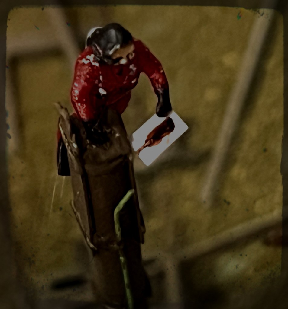
Those with keen eyes will note that the team of scuba-diving archaeologists have not been reinstalled in their customary positions. The site is currently under ice and snow, and they will not return to their program of scale archaeology until the next dive season commences in August, 2025. Could I contemplate a scenario where new information would compel me to get back to work revising the Terror diorama? You bet your sextant I could!

The diorama with its winter cover of ice and snow.

Wrecking the Terror: Recreating an Epic Tale of Old Loss and New Discovery

With a shipwreck…you are dealing with a single instant in which everything was pitched onto the seabed; and, because water can be a wonderful preservative, in the right circumstances, the wreck and almost everything within will still be there. A wreck can be a perfect time capsule.” (Mensun Bound The Ship Beneath the Ice p.280).

The Franklin expedition ships, HMS Erebus and Terror, setting out with fanfare in late May 1845 from Greenhithe. This was originally published for the 24 May 1845 edition of the Illustrated London News. (Via wikimedia commons)

In 1845, Her Majesty’s Ships Erebus and Terror sailed into the unknown. Sir John Franklin, commander of the expedition, was instructed to chart the last sections of the Northwest Passage and return via the Pacific. The British Admiralty expected that this modern, lavishly-equipped official effort would survey the remaining portions of a sea route along the top of the North American landmass. Hopes ran high that this expedition would be a crowning achievement to decades of British exploration of the Arctic.

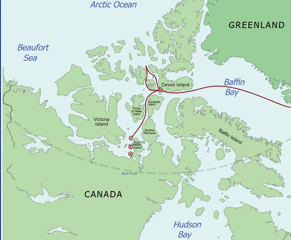
Reconstruction of Franklin’s route from 1845-1848 Locations are: 1. (off map, right) Disko Bay, Greenland, site of departure from towing and supply ships 2. Beechey Island, site of the 1845-46 wintering and artifacts; 3. NW of King William Island 1847 position of the Victory Point “All is Well” message and the 1848 addendum of “we are deserting the ships”; 4. Erebus found 2014;5. Terror found 2016. Base map: Kennonv, after CIA’s World Fact BookFranklin’s route: Own work, CC BY-SA 3.0 https://creativecommons.org/licenses/by-sa/3.0, via Wikimedia Commons

Instead, the 129 men disappeared. It would take a decade and a half for the outcome of the expedition to be reported, and decades more for the majority of the grim tale to be uncovered: No survivors, no repository of useful information collected, both ships utterly vanished, and presumed to have sunk. The witnesses, local Inuit who were recalling events from years before, provided oral testimony to parts of the tragedy. So many questions remained unanswered about how this great expedition met its end.

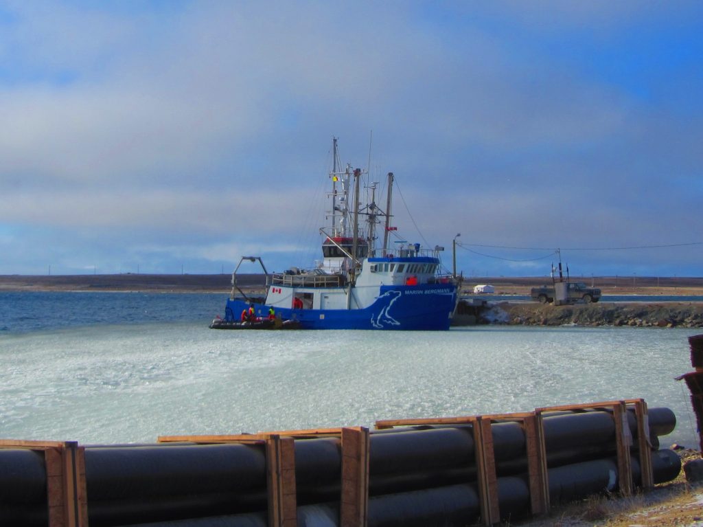
The wreck of HMS Terror, Captain Francis Crozier’s lost ship, was discovered seventeen decades later, in early September 2016, by the crew of the Arctic Research Foundation’s vessel, RV Martin Bergmann. The ARF had already participated in several Government of Canada searches, and had been involved in the discovery of HMS Erebus, Franklin’s flagship, two years earlier.

RV Martin Bergmann at Cambridge Bay, her longtime homeport. Image Courtesy of Gloria Song, who retains copyright.

While at Gjoa Haven, ARF members received a tip from local resident and Canadian Ranger Sammy Kogvik, and decided to divert from the searching area off the western coast of King William Island to enter Terror Bay. After an initial sonar search did not return any likely sonar targets, the Martin Bergmann turned to resume its journey. The course to exit the Bay took the research ship right over a well-defined sonar image of a wreck on the seabed, in about 80 feet (24m) of water.

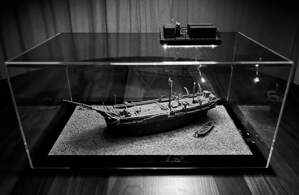
Our representation of the Terror wrecksite with the Parks Canada dive barge over top, at 80′ scale depth. Credit:www.warsearcher.com for our updated wreck interpretation from 2024, please see: The Great Terror Wreck Repair[2024]

Parks Canada’s Underwater Archaeology Team confirmed the identity of the wreck a few weeks later. It was an astonishing find: A barely-wrecked ship, almost frozen in time! The hull stands proud of the seafloor, and the weather deck is in exceptional condition. Sections of the masts and the bowsprit are still standing! Unlike Erebus, Terror’s site appears to have little scattered debris. Everything related to the wreck seems to be adjacent to the hull, or has fallen off it in close proximity.

HMS Terror site sketch, 2017 copyright Parks Canada 2021 [modified by rotating]. Source.
North is to the left, and the three-dimensional nature of the diorama introduces some positional discrepancies with the above schematic two-dimensional site plan. Credit:www.warsearcher.com

HMS Terror lies in a quiet resting spot, with few obvious signs of damage, and no immediately observable evidence of what brought her to this watery grave, in a bay later named -in a stunning coincidence-after her. She appears to have been abandoned in winter quarters, closed up with topgallant masts removed. The enormous rudder is unshipped from the stern and mounted on the port ice channels amidships. The ship is gently listing to starboard.1 The state of preservation appears outstanding – Almost everything required to operate a mid-19th Century sailing ship with auxiliary steam propulsion is still there. It is as if departing crew members left Terror in good working order as they abandoned ship.

The diorama depicts underwater archaeologists examining sections of the wreck. Credit: http://www.warsearcher.com

With the historic discovery of both Franklin vessels, a methodical exploration of the wrecks by Parks Canada underwater archaeologists, over many seasons, may yet answer important questions about the tragedy: why are the wrecks located further south than many expected; were they reoccupied; did the plan of the retreat, as described in the Victory Point note, evolve; what halted the ships further progress, and caused their final abandonment; when did this happen; how much longer did they remain afloat; is there anything onboard to help point to terrestrial archaeological sites; do the remaining supplies or preserved records help explain what maladies the crews were suffering from, and how these were impacting command decisions; were local Inuit community members able to salvage much from either of the wrecks; are there remains of either of Franklin’s crews still entombed in their ships?2 For now, Terror is keeping her secrets close below decks.

We built a model in 2022 to help us interpret the history of the wreck. We used every scrap of information, including the wreck plan on Parks Canada’s website, the Arctic Research Foundation 2016 video, the Parks Canada 2017 exploration of the wreck video. Matthew Betts’ blog site, Building the Terror where he built a large, extensively researched model of the ship, was also an important resource. He followed this with the publication HMS Terror: The Design, Fitting and Voyages of a Polar Discovery Ship, which came out just as we finished the model. Until more information is released by Parks, this is an essential source for interpreting Terror. Parks Canada Underwater Archaeology staff generously shared information about the archaeological program and assisted us in gathering further information about the ship. Their expertise, professionalism, and concern for the wrecks they conduct archaeological investigations of is remarkable.

This interpretation of the site won’t be the last or the most accurate wreck diorama. So far as we know, it is the first. Credit: http://www.warsearcher.com
  1. The 2017 Parks tour of the wreck video shows, when the ROV reaches the aft cabin, the degree of list to starboard. ↩︎
  2. We don’t yet know if or when crew reoccupied Terror. If she was reoccupied and brought to her present location, we also don’t know if she sank unexpectedly or was abandoned in orderly fashion as the crew marched westwards along the King William Island coast, to cross to the mainland. ↩︎

The Terror we Wish we Knew

HMS Terror, Sir John Franklin’s second exploration vessel, was discovered in Sept. 2016. Captain Francis Crozier’s sturdy little ship had vanished seventeen decades earlier. HMS Erebus, the flagship of the lost 1845 expedition, was located in 2014, about 70km south. Franklin’s mission was to have taken them into uncharted waters, to finish surveying a Northwest Passage across the top of North America. Where they went, none could follow.

So many questions about Terror and her lost crew remain unanswered. Archaeology on the incredibly well-preserved wreck is still in the early stages. The yearly dive season is all too short – late August to mid-September on a good year. Underwater Archaeologists are up there right now (2023/09).1 See our earlier post for possible Terror-related archaeological priorities. Here are some questions we have about this fascinating shipwreck:

A. When, why, and how did Terror actually sink? How did Terror get from the point of original Apr. 1848 abandonment by Crozier and the crew, Northwest of King William Island, to a resting spot under the waters of Terror Bay?

B. What documents or artifacts are in the great cabin desk? What other objects are along the shelves there? What is in Capt. Crozier’s bedchambers (behind the only blocked door on the lower deck)?

C. Is Terror’s screw propeller deployed in its trunk, or raised up? Since we know the massive rudder is unfitted and mounted on the ship’s port side channels, this info could help understand Terror’s last movements near Terror Bay, King William Island.

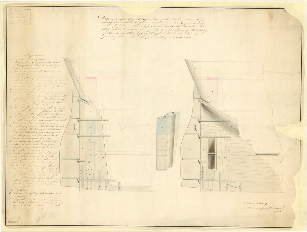
March 1845-dated plan of the modifications to the stern of both HMS Erebus and Terror, showing the massive rudder and stout construction. At left the screw propeller is raised and the full chock in place. © Crown copyright. National Maritime Museum, Greenwich, London ZAZ5683, CC BY-NC-ND

D. What did the stern gallery (windows at stern of ship) really look like and was there any transom decoration?

E. What else is on the seabed, besides the 23-foot ship’s cutter (boat) off the port quarter. The original Arctic Research Foundation 2016 wreck discovery film showed a variety of weird and interesting objects on the seabed.

F. How high do the remains of the masts project above the weather deck? We know the foremast is entirely missing (most likely on the seabed under the bowsprit – see link to last post’s multibeam sonar video clip)

G. Since the wreck and debris are highly localized, are there any significant timbers or structures missing, that suggest damage or removal by the crew?

H. What condition are the lowest decks in? How much provisions and fuel remain aboard?

I. Are there any human remains on the ship? (either the wreck is a tomb to members of its crew, or it is a powerful site of remembrance of those departed explorers)

It’s seventeen long decades since these ships of fame
Brought my Lord Franklin across the main,
To Baffin Bay where the whale fish blow
The fate of Franklin no man may know.
(Adapted Lady Franklin’s lament trad.)

  1. Early indications suggest the balance of September 2023 archaeology has again prioritized Erebus. ↩︎