Christopher Middleton – the First Royal Navy Arctic Explorer – Crosses the Line in 1742

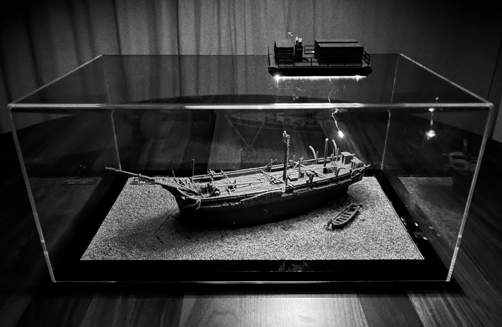
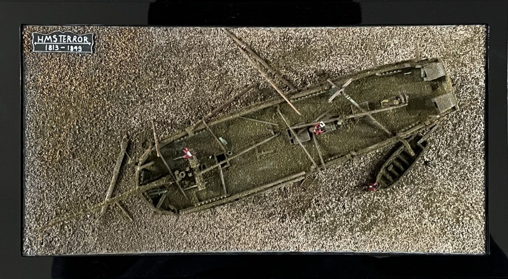
Traditionally, the Royal Navy’s program of Arctic exploration is represented as having commenced with the Constantine Phipps Expedition towards the North Pole in 1773.1 Phipps and his crews pushed north to above 80° latitude near Spitzbergen, before having to turn for home. Though the Phipps Expedition set many precedents for later polar exploration missions, it is Captain Christopher Middleton who deserves wider recognition for his trailblazing 1741-1742 Hudson’s Bay Expedition .2 This was the first Admiralty mission to search for a Northwest Passage.3 I will argue that Middleton also deserves credit for commanding the first Royal Navy expedition to explore an area north of the Arctic Circle.4 He had reached this far north in the first bomb vessel modified for northern exploration (which set the precedent for a century of discovery missions).5 During his time in Hudson’s Bay, he conducted a program of scientific research spanning several disciplines. After he arrived back in England, a dispute with Arthur Dobbs – his armchair-cartographer nemesis -marred his reputation and cast doubt upon his important discoveries.

The Naujaat Arctic Circle Arch, a gateway to the Canadian Arctic. Credit: Wes Gill from Winnipeg, Canada, CC BY-SA 2.0 https://creativecommons.org/licenses/by-sa/2.0, via Wikimedia Commons

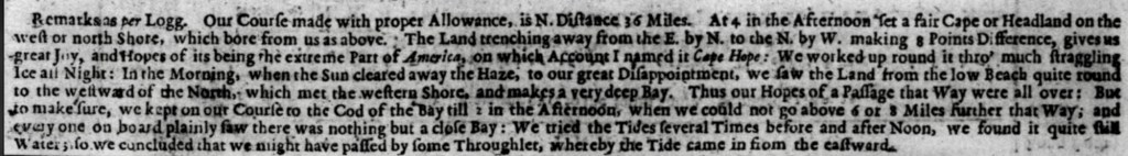
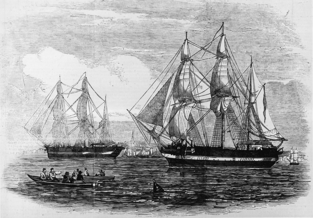
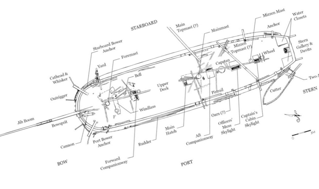
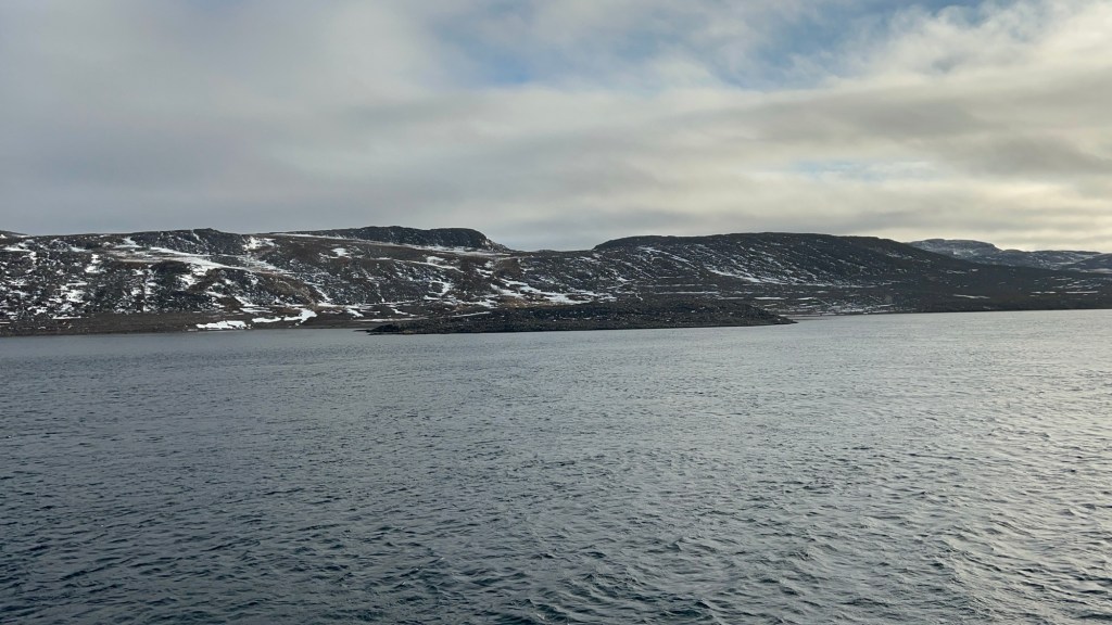
Early on the morning of August 7th, 1742, Captain Christopher Middleton nervously paced the quarterdeck of His Majesty’s Ship Furnace.6 He and his crew believed they were on the threshold of a historic discovery: A northwest passage towards the “South Sea” (the Pacific Ocean). These explorers had diligently clawed their way up Roes Welcome Sound, between the northwestern shores of Hudson’s Bay and Southampton Island. Standing into danger, they had picked their way around “islands of ice” (icebergs) and “ledges” (land floes). When they could find no favourable winds, they had even used cables anchored to the ice to haul the ships north from berg to berg.7

A Chart of Hudson’s Straits and Bay, of Davis Straits, and Baffin’s Bay; as published in the Year 1668. This shows the extent of knowledge about the Bay after the Henry Hudson, Thomas Button, Luke Foxe, and Thomas James expeditions of the first half of the seventeenth century. “Buttons Bay” and much of the NW and SW coasts of the Bay was conjectural.8

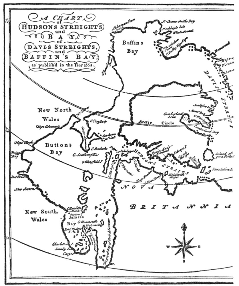
In the hazy morning twilight of those extended northern days, Furnace had been working around a promontory which Middleton had just named “Cape Hope.” He believed this could represent the “extreme part of America,” (or the northern most point of the North American continental landmass) a major milestone along the way of achieving his Admiralty mission to discover the fabled maritime route westwards.9

Zenith Point, Murchison Promontory, on the southern shores of the Bellot Strait, is the highest point of land of continental North America, or what Middleton would have called the “extreme part of America.” It was discovered in 1852 by William Kennedy and Joseph-René Bellot. It is an important waypoint on one of the main routes of the actual Northwest Passage through the Arctic Archipelago, and is located at 72’00’06” latitude north, 740 km NNW of Middleton’s Cape Hope. Photo by author, 5 Sep. 2025.

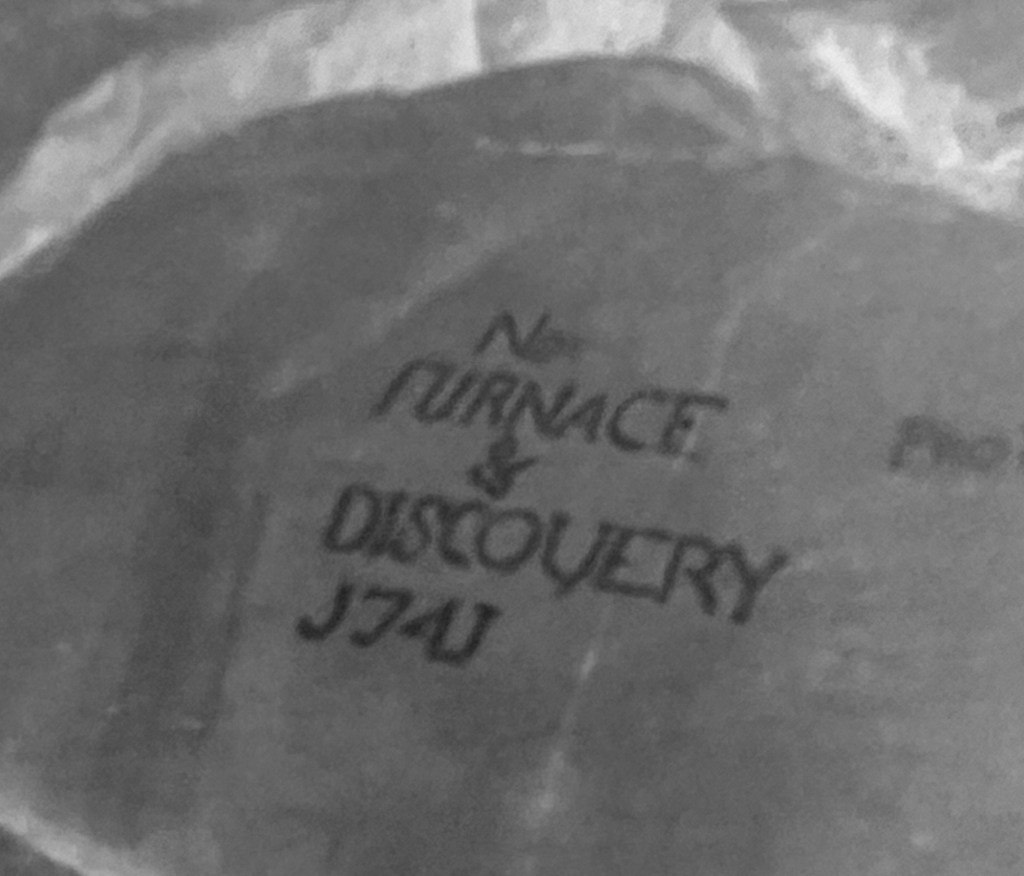
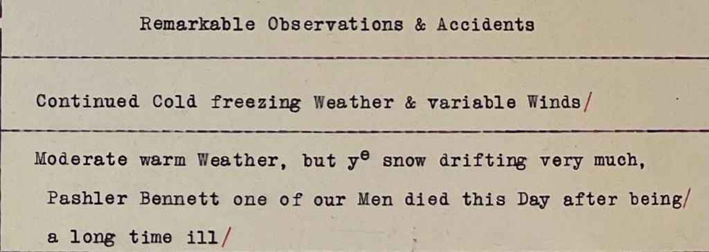
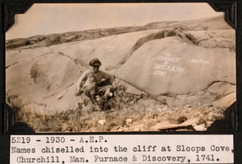
Middleton was a skilled navigator, who had outfitted his ships with the latest navigational devices. He employed these to survey under exceptionally challenging circumstances.10 His career had prepared him for the rigors of commanding a discovery mission in the Bay.11 After early service aboard a privateer in North American waters (during Queen Anne’s War, 1702-1713), he had worked for many seasons as a merchant captain with the Hudson’s Bay Company (HBC), sailing between England and the HBC factories of the Bay on yearly supply missions.12 His experiences commanding HBC sloops had led him to enthusiastically support a popular European belief that the undiscovered shores of the Bay concealed the beginnings of the Northwest Passage.13 In early 1741, with the support of an influential ally and confidant, Arthur Dobbs, he had left HBC service to secure the command of an official Royal Navy exploration mission.14 The crews of his two ships – Furnace and the small tender Discovery – were the first Europeans to navigate these waters (whose adjoining lands were the ancestral territory of the Aivilingmiut Inuit).15 They had endured many hardships since departing England on 8 June, 1741. A dozen of their mates had already perished.16 The dedicated assistance of both the HBC staff and local indigenous communities at and around the post at Churchill, over the winter of 1741-42, had prevented a much greater loss of life.17

Prince of Wales Fort, aerial view from 1930. The fort sheltered the Middleton Expedition’s senior staff at Churchill, while the crew were lodged in the old, disused post upriver. Middleton, during his HBC career, had been involved in this massive fortification’s original design.18 Credit: Alf Erling Porsild / Department of Indian Affairs and Northern Development fonds / Library and Archives Canada / a101002-v8

As the sun burned off the haze, the watch on deck sighted high land continuing westwards from under the cape – So far, so good. But then a low shoreline materialized across Furnace’s stout bows. The land stretched around to the starboard beam. This day would bring no happy run far to the west – Christopher Middleton had discovered another bay.19 Disappointed at being “embayed” and turned away from his main objective, he named these waters “the Bay of Repulse” (the Inuktitut name for these enclosed waters is Aiviliup Tariunga). The next few days would see the expedition halted from further progress north by an impassable barrier of ice at the top of Southampton Island. The captain went ashore with two healthy crew members and an indigenous guide, climbed to the highest point he could find, and surveyed the distant shores. From this vantage he saw an iced-over passage extending towards the east, and named this the “Frozen Strait.”20 Given what would befall him upon his return home, Middleton may well have lived to regret ever having been up here in 1742. Today we can acknowledge that he started something in this northwest corner of Hudson’s Bay: An organized program of northern discovery that would eventually see the mapping of vast extents of what would become the Canadian Arctic.

The entry from Furnace’s ship’s log for 6 August 1742, illustrating the hopes and then disappointment of the crew. A selection of the log is reproduced in his Vindication. (Cited below) Middleton’s observed position for this day was 66°44’ north. 21
Click Here to Continue exploring Northwards

Where we poor sailors do sometimes dwell – The Middleton Northwest Passage Expedition Roll of Honour

This post commemorates the sailors who perished during Christopher Middleton’s Royal Navy exploration mission to Hudson’s Bay (1741-42).1 It can serve as a Roll of Honour for these early explorers. For the context to this effort to locate the fabled passage to the Pacific in the waters of Hudson’s Bay, please see our post on HMS Furnace‘s unique exploration design. Our next post will argue that Middleton’s ship crews should be considered the first Royal Navy polar explorers (forthcoming).

Throughout the many wars and infrequent peace of the eighteenth century, the Royal Navy expanded into a massive fleet sailing from establishments strategically located along the seaborne trade routes. This growth came at a tragic cost: the human toll of crewing this British “wooden world” was staggering.2 Amidst all this death, it may seem odd to commemorate a dozen seafaring explorers who died in an incredibly remote outpost of British Empire. These were some of the very first deaths in a program of British naval exploration of what is now Canada.3 They would not be the last.

Christopher Middleton’s Northwest Passage Expedition departed the Nore, 8 June 1741. He had experienced significant problems filling out the complements of both his small ships, at their anchorage of Gallions Reach, near Woolwich.4 The seamen who wound up crossing the Atlantic to go looking for a northwest passage in Hudson’s Bay included conscripted men.5 According to their commanding officer, these ninety men were a “crew of rogues.”6 After transiting the Hudson’s Straits into the Bay, a council of officers decided to head for the Churchill River (present-day Manitoba), to overwinter. They would commence their search mission early the next navigation season. At their arrival near the Hudson’s Bay Company (HBC) establishment, Fort Prince of Wales, crews laboriously cut both ships into secure docks to overwinter in Sloop Cove.

John Wigate’s map, “Chart of the seas thro which H. M. S. Furnace passed for discovering a passage from Hudson’s Bay to the South Sea.” Despite falsified sections of the NW coast of Hudson’s Bay (to support Arthur Dobbs’ spurious claims), this 1746 map includes this remarkably accurate inset plan of the mouth of Churchill River. On the northern shore, the “Old Factory,” Sloop Cove (“Winter Cove”), and the impressive Vauban-style “New Fort” are clearly indicated. If any of the crew were buried ashore, they should be located closer to the old factory. Credit:
Bibliothèque nationale de France, département Cartes et plans, GE SH 18 PF 123 DIV 3 P 6 via Wikimedia commons.

These northern explorers weren’t equipped with the types of cold weather gear that later expeditions would benefit from. While the officers were lodged at the new fort, crew spent a difficult winter billeted in the “Old Factory,” the former HBC trading post. Several members suffered from frost bite, and the naval surgeons were routinely called over to the old HBC factory to amputate damaged toes before gangrene spread. Worse still, scurvy made an early appearance in the Fall. This dreaded mariner’s disease continued to be a feature of the Expedition all the way back to the Thames, and would eventually claim ten lives. But for Middleton’s desperate attempts to secure fresh meat and vegetables, and the intervention of local indigenous hunters (from the Dene and Cree communities who traded near the HBC Fort and who supplied the expedition with huge quantities of foul), there would have been many more deaths.

The transcribed page of the journal for 29 December 1741, recording P. Bennett’s death – the first Middleton Expedition death at Churchill. Credit: Library and Archives Canada, Arthur Dobbs fonds, LAC MG18-D-4 volume 4.

I feel it important to compile the names of these early explorers, their dates of death, and the causes, based on the original expedition journal entries and associated contextual documents found in William Barr and Glyndwr Williams’ edited Hakluyt Society publication:


William Clark, sailmaker Furnace 28 July 1741 drowned after a fall from fore shrouds in Hudson’s Straits7;

Pashler Bennett (or possibly “Paskler Bennet” 29 Dec. 1741 (scurvy at Churchill)8;

Christopher Row 13 February 1742 (scurvy at Churchill);

Edward Matthews 21 February 1742 (scurvy at Churchill);

Abraham Page 13 March 1742 (scurvy at Churchill);

John Blair 21 March 1742 (scurvy at Churchill);

Henry Spencer 26 March 1742 (scurvy at Churchill);

James Thrumshaw 28 March 1742 (scurvy at Churchill);

Ralph Pearce Carpenter’s Mate Discovery 9 April 1742 (scurvy at Churchill);

John Furnix 24 May 1742 (scurvy at Churchill)9;

Robert Rattery 31 May 1742 (scurvy at Churchill);

John Matthews Master’s Servant Furnace 20 June 1742 (drowned at Sloop Cove near Churchill)

Sloop Cove rock inscriptions from 1741 overwintering of HMS Furnace and Discovery, as photographed in 1930. A series of inscriptions, including one by explorer Samuel Hearne, are preserved at the Sloop Cove National Historic Site. This may be the closest thing to a memorial the lost crew of the Middleton Expedition have. Credit: Northwest Territories (Album 31). Credit: A.E. Porild, Canada. Dept. Indian and Northern Affairs / Library and Archives Canada / e010983471

In some sources Middleton referred to two or three additional deaths. If anyone locates a reference to these other fatalities, or has any information about any known shore burials of the men who died near Churchill, please leave us a comment below.

Click for endnotes:

Wrecking the Terror: Recreating an Epic Tale of Old Loss and New Discovery

With a shipwreck…you are dealing with a single instant in which everything was pitched onto the seabed; and, because water can be a wonderful preservative, in the right circumstances, the wreck and almost everything within will still be there. A wreck can be a perfect time capsule.” (Mensun Bound The Ship Beneath the Ice p.280).

The Franklin expedition ships, HMS Erebus and Terror, setting out with fanfare in late May 1845 from Greenhithe. This was originally published for the 24 May 1845 edition of the Illustrated London News. (Via wikimedia commons)

In 1845, Her Majesty’s Ships Erebus and Terror sailed into the unknown. Sir John Franklin, commander of the expedition, was instructed to chart the last remaining sections of the Northwest Passage and return via the Pacific. The British Admiralty expected that this modern, lavishly-equipped official effort would survey the remaining portions of a sea route along the top of the North American landmass. Hopes ran high that this expedition would be a crowning achievement to decades of British exploration of the Arctic.

Reconstruction of Franklin’s route from 1845-1848 Locations are: 1. (off map, right) Disko Bay, Greenland, site of departure from towing and supply ships 2. Beechey Island, site of the 1845-46 wintering and artifacts; 3. NW of King William Island 1847 position of the Victory Point “All is Well” message and the 1848 addendum of “we are deserting the ships”; 4. Erebus found 2014;5. Terror found 2016. Base map: Kennonv, after CIA’s World Fact BookFranklin’s route: Own work, CC BY-SA 3.0 https://creativecommons.org/licenses/by-sa/3.0, via Wikimedia Commons

Instead, the 129 men disappeared. It would take a decade and a half for the outcome of the expedition to be reported, and decades more for the majority of the grim tale to be uncovered: No survivors, no repository of useful information collected, both ships utterly vanished, and presumed to have sunk. The witnesses, local Inuit who were recalling events from years before, provided oral testimony to parts of the tragedy. So many questions remained unanswered about how this great expedition met its end.

The wreck of HMS Terror, Captain Francis Crozier’s lost ship, was discovered seventeen decades later, in early September 2016, by the crew of the Arctic Research Foundation’s vessel, RV Martin Bergmann. The ARF had already participated in several Government of Canada searches, and had been involved in the discovery of HMS Erebus, Franklin’s flagship, two years earlier.

RV Martin Bergmann at Cambridge Bay, her longtime homeport. Image Courtesy of Gloria Song, who retains copyright.

While at Gjoa Haven, ARF members received a tip from local resident and Canadian Ranger Sammy Kogvik, and decided to divert from the searching area off the western coast of King William Island to enter Terror Bay. After an initial sonar search did not return any likely sonar targets, the Martin Bergmann turned to resume its journey. The course to exit the Bay took the research ship right over a well-defined sonar image of a wreck on the seabed, in about 80 feet (24m) of water.

Our representation of the Terror wrecksite with the Parks Canada dive barge over top, at 80′ scale depth. Credit:www.warsearcher.com for our updated wreck interpretation from 2024, please see: The Great Terror Wreck Repair[2024]

Parks Canada’s Underwater Archaeology Team confirmed the identity of the wreck a few weeks later. It was an astonishing find: A barely-wrecked ship, almost frozen in time! The hull stands proud of the seafloor, and the weather deck is in exceptional condition. Sections of the masts and the bowsprit are still standing! Unlike Erebus, Terror’s site appears to have little scattered debris. Everything related to the wreck seems to be adjacent to the hull, or has fallen off it in close proximity.

HMS Terror site sketch, 2017 copyright Parks Canada 2021 [modified by rotating]. Source.
North is to the left, and the three-dimensional nature of the diorama introduces some positional discrepancies with the above schematic two-dimensional site plan. Credit:www.warsearcher.com

HMS Terror lies in a quiet resting spot, with few obvious signs of damage, and no immediately observable evidence of what brought her to this watery grave, in a bay later named -in a stunning coincidence-after her. She appears to have been abandoned in winter quarters, closed up with topgallant masts removed. The enormous rudder is unshipped from the stern and mounted on the port ice channels amidships. The ship is gently listing to starboard.1 The state of preservation appears outstanding – Almost everything required to operate a mid-19th Century sailing ship with auxiliary steam propulsion is still there. It is as if departing crew members left Terror in good working order as they abandoned ship.

The diorama depicts underwater archaeologists examining sections of the wreck. Credit: http://www.warsearcher.com

With the historic discovery of both Franklin vessels, a methodical exploration of the wrecks by Parks Canada underwater archaeologists, over many seasons, may yet answer important questions about the tragedy: why are the wrecks located further south than many expected; were they reoccupied; did the plan of the retreat, as described in the Victory Point note, evolve; what halted the ships further progress, and caused their final abandonment; when did this happen; how much longer did they remain afloat; is there anything onboard to help point to terrestrial archaeological sites; do the remaining supplies or preserved records help explain what maladies the crews were suffering from, and how these were impacting command decisions; were local Inuit community members able to salvage much from either of the wrecks; are there remains of either of Franklin’s crews still entombed in their ships?2 For now, Terror is keeping her secrets close below decks.

We built a model in 2022 to help us interpret the history of the wreck. We used every scrap of information, including the wreck plan on Parks Canada’s website, the Arctic Research Foundation 2016 video, the Parks Canada 2017 exploration of the wreck video. Matthew Betts’ blog site, Building the Terror where he built a large, extensively researched model of the ship, was also an important resource. He followed this with the publication HMS Terror: The Design, Fitting and Voyages of a Polar Discovery Ship, which came out just as we finished the model. Until more information is released by Parks, this is an essential source for interpreting Terror. Parks Canada Underwater Archaeology staff generously shared information about the archaeological program and assisted us in gathering further information about the ship. Their expertise, professionalism, and concern for the wrecks they conduct archaeological investigations of is remarkable.

This interpretation of the site won’t be the last or the most accurate wreck diorama. So far as we know, it is the first. Credit: http://www.warsearcher.com
  1. The 2017 Parks tour of the wreck video shows, when the ROV reaches the aft cabin, the degree of list to starboard. ↩︎
  2. We don’t yet know if or when crew reoccupied Terror. If she was reoccupied and brought to her present location, we also don’t know if she sank unexpectedly or was abandoned in orderly fashion as the crew marched westwards along the King William Island coast, to cross to the mainland. ↩︎