What if we could rebuild the “Boat Place” Franklin Expedition boat from its wrecked and scattered remains? In this post I will show my efforts to reconstruct the important boat I explored last week, at the same small scale as the HMS Terror wreck diorama.
In early 2025 I set about transforming a tiny plastic model to represent the boat and sledge that searchers looking for the lost Sir John Franklin 1845 Expedition came across in 1859 on the western coast of King William Island.1 My research is summarized in the “design dossier” section of my recent post on this discovery. Stages of my build resembled some of the real modifications ship carpenters would have worked at early in 1848, as they prepared to desert HM Ships Erebus and Terror – I sawed off the old square transom (visible in the below photo) and reshaped a sharp or rounded stern using Milliput putty around a balsa wood carved-out form (later removed), and built a new curved sternpost. I added two gudgeons, on the chance that the boat could have been fitted with a rudder. As of this writing, I believe the converted boat was based on the hull of the lighter 25’ Cutter instead of the Pinnace (see below boat dimensions section for detailed information).
The model boats. The sharper and narrower whale boats are 30 scale feet long. The original square transom of the model appears beside the two-dollar Canadian coin. Credit: http://www.warsearcher.com
I modelled the stanchions (the two posts rising out of the hull painted two-tone black and white) to be high, with gaff jaws at their tops (as described by Lt. Hobson). Some practical tests with the model revealed that the pronounced list observed in 1859 meant that, in order for Hobson’s team to have spotted anything emerging from the high drifts of snow, that stanchion would have to be significantly taller than represented in most reconstructions. With its gaping jaws open to the sky, it must have appeared a grim marker, indeed!
The model and sledge with a list down to starboard, buried in a drift of snow in my backyard. Credit: http://www.warsearcher.com
I decked over the bow and stern areas based on the Durand-Brager illustration (seen in the last post). The internal layout is similar to the whale boats that the ships carried. I like to think that the crews had a space in each boat to shelter an exhausted or ill member. A foredeck and covered stern sheets may also help explain the decade-long survival in decent condition of some of the artifacts that Hobson and McClintock discovered in the boat.
The gunwales were drilled for the thowells – tiny metal rods. I believe there was no washstrake boards, so I spaced the twenty-four thowells to support a washcloth that wrapped around the hull between the posts. Hobson noted these thowells (National Maritime Museum artifact AAA2143) were doubled up to assist the paddling. I paired them to create four rowing positions a side, and ran a rope along the top of the thowells, which the washcloth would have been rove into along its top edge.
The awning, and “cutaway” view. It is also possible that the awning connected directly to the gunwales, and not to the tops of the stanchions, which may not have been fitted while sledging on land. Credit: http://www.warsearcher.com
Artifacts currently placed in the model hull include six modified oars (cut down with add-on blade extensions), the sheet block (AAA2198), the folded-up lead sheets (AAA2280), and some sailcloth that could be the awning or the washcloths (AAA2144). Basic pieces of boat equipment, such as two masts, and a rudder, have never been found. I have added a mast step amidships, in case information or evidence of these details turn up. When under sail, the boat would likely have carried lugsails on its two masts.2 I hope someday to model the ice grapple/anchor encountered by the searchers. The bewildering assortment of personal items, cutlery, packets of chocolate, and human remains have not been represented.
The model takes to the water. Credit:www.warsearcher.com
This boat and sledge combination may look unwieldy, especially when compared to the supremely well-adapted Inuit equivalents: animal hide boats (Umiaks) on sledges built of lightweight organic materials. But in 1859, Francis Leopold McClintock – a masterful long-distance sledge traveler – seems to have been impressed by the lost crews’ efforts at lightening it.
As with so many of the specifics about the 1845 Franklin Expedition, we continue along our own voyages of discovery. This is not the first interpretation of the Erebus Bay boat, nor will it be the last. I have created a sad miniature of that “melancholy relic.” [Read more in the Appendix below for technical info about the boats and sources]
In this post I will describe the “boat place” boat at Erebus Bay that searchers looking for the lost Sir John Franklin 1845 Expedition came across in 1859. A later post will show my effort to construct a small model of this unique and sadly-fated boat, and propose some likely dimensions of the full complement of Franklin boats.
William Thomas Smith’s powerful 1895 work “They forged the last link with their lives: HMS Erebus and Terror, 1849-50.” The boat has several well-researched components, such as the washcloth around the gunwale and the ice grapnel. It also appears rigged for sailing with full masts stepped. (CC-BY-NC-ND) copyright: National Maritime Museum, Greenwich London
On May 23rd, 1859, at a wide bay on the frozen western shores of King William Island, a group looking for the lost Franklin Expedition found something incredible: A large boat on a sledge. Fourteen years after Franklin’s two ships had left Greenhithe, England, searchers had finally arrived at “ground zero” of the Franklin Expedition escape saga. They were a decade too late. Quartermaster Henry Toms and Carpenter’s Mate George Edwards – both members of Lt. William Hobson’s detached sledge party searching the coast as part of Francis Leopold McClintock’s Franklin search expedition – first spotted something odd projecting out of the snow as they scouted ahead of their mates.1 Closer examination revealed it to be a wooden stanchion, hanging like a beacon over the curved outlines of a gunwale in the high drifts of snow – beneath their feet was the ghostly outline of a large boat.
Chart showing the vicinity of King William Island with the various positions in which relics of the Arctic expedition under Sir John Franklin have been found / compiled by Lieut.-Cmdr. R.T. Gould, R.N [detail of]. “Boat Place” is indicated in red text at the base of Erebus Bay. Credit: Library and Archives Canada 3674742
The next morning Hobson’s group began in earnest a two-day process of clearing out the site and inventorying an unusual assortment of artifacts. That stanchion also marked a gravesite – the resting place of at least two unidentified Royal Navy crewmembers who were entombed within the hull. McClintock’s sledge team arrived a few days after Hobson had departed. His published description of what he called this “melancholy relic” is the standard account of the site.2 But Hobson had also drafted a report on his sledge team’s discoveries, which included a detailed description of the boat. We are indebted to archaeologist Dr. Douglas Stenton’s work resuscitating Hobson’s report about his journey from obscurity. Stenton’s publication of the report provides important additional details to help explore the boat place.3 Since Hobson’s team had excavated the snow from the boat and examined the objects found therein, the site had already been altered before McClintock’s party reached it. For a detailed list of the interesting and unusual contents of the boat, please see Russell Potter’s Visions of the North blog “The Boat” on the topic. My interest here remains focused on the boat itself.
This early 1860s illustration represents some of the major relics accurately, and shows the double-ended appearance and large proportions of the vessel. Credit: Durand-Brager, from Arthur Mangin, Voyages et Découvertes outre-mer au XIXe siècle, illustrations par Durand-Brager, 1863 ː Découverte des restes de l’expédition Franklin. Public domain, via Wikimedia Commons
The Erebus Bay find remains the only Franklin Expedition boat and sledge, originally encountered reasonably intact, whose appearance and contents were described in detail. Its importance is tied to the slightly earlier discovery by Hobson’s party of the Victory Point record, in a sealed cylinder in a cairn about 60 km northeast. An update to a routine Admiralty form mentioned the abandonment of the long-beset ships, and recorded captains Crozier and Fitzjames’s intention to mount a desperate trek with their ailing crews towards Back’s Great Fish River. The note had no specific information about how they planned to cross the vast distances involved. The Boat Place discovery seemed to illustrate the mechanism of the evacuation plan: Crew members would use drag ropes to man-haul boat/sledge combinations down and around the coastline of King William Island. They would then unship the sledges and navigate the boats to the mainland and down a treacherous river towards a still-distant fur trading post. We don’t know how this plan changed as they struggled along, losing more men, and abandoning more boats. Some of the last of a group of weary men laid down to die, under another boat, on the mainland at Starvation Cove.
Back at Erebus Bay, the 28’/8.5 m boat was found just above the frozen shoreline. It listed dramatically down to starboard. A hole may have allowed wildlife – bears or scavenging foxes – access on the low side. Both boat and heavy sledge were oriented back towards the northeast, though if that was by intent (to return towards the ships), or by happenstance, no one can say. McClintock commented on both the boat’s lightness, and the sledge’s weight. He estimated the weight of the boat to be about 700-800 lbs while the sledge could have been as much as 650 lbs (the average weight of a 28-foot whaling boat, by contrast, was about 1,000 lbs).4 His observations were informed by his great expertise in sledging, acquired during his participation on this and earlier expeditions.
A remarkable 3D interpretation of “Boat Place.” This well-researched depiction of the boat and sledge is a recent and valuable addition to the artistic reconstructions of Erebus Bay. It was inspired by Matthew Betts’ reconstruction (see notes). The outlines of one of the ships in the distance heightens the pathos of this bleak scene. Certainly, the ships did transit by the Bay at some point after April 1848. Used with written permission of Case Western, who maintains a site with 3D printing models.
The boat had been modified by the ships’ carpenters – the square transom at the stern had been removed and the boat was now pointed or “sharp” at both ends, with a curving stem and sternpost, like a broader, deeper version of the two ships’ whale boats. The “carvel” planking (flush-edge-to-edge) of the top strakes of the hull had been replaced and lighter fir “clinker” planks (overlapping) re-laid in their place. An ingenious washcloth design of canvas was fitted in the place of the heavier washstrake boards. The set of six paddles – cut-down oars converted with larger “add-on” blades – indicate that the boat had been converted for inland/river navigation.
The stem, as drawn by McClintock in his 1859 edition of The voyage of the ‘Fox’ in the Arctic seas: A narrative of the discovery of the fate of Sir John Franklin and his companions (P 292) see notes section for link.
The distinctive stem of the boat was sketched by McClintock. This was recovered two decades later by American Franklin searcher Frederick Schwatka, who, while looking for records, was leading the first expedition on King William Island that encountered the sites in the summer, not under cover of snow and ice.
According to Inuit oral testimony, there was at least one other abandoned boat with many more skeletal remains that was located nearby.5 Both boats were dismantled in the early 1860s for their useful materials and fittings. Following the initial recovery of some artifacts, the dismantling, and Schwatka’s later removals, only archaeological traces and a memorial with bone fragments remain at the site – the last vestiges of a melancholy relic.
Another famous boat/sledge with a less tragic outcome, the James Caird, originally one of Sir Ernest Shackleton’s 22.5’/6.9m boats from his exploration ship Endurance, being dragged across the sea ice in Antarctica, Dec. 1915. Credit: Frank Hurley : via wikimedia commons.The Design Dossier and References (click here):
A basic principle of model shipwreck archaeology is that – in contrast to their full-size brethren – model shipwrecks do not necessarily deteriorate. In this post we explore updates to our miniature interpretation of HMS Terror’s wreck. The Terror mini-site has witnessed substantial improvement since 2022!
Terror’s rebuilt stern, with new rudderpost, gudgeons to hang the absent rudder, a broader stern tuck up to the sternlights (windows) and lower water-closet deckhouses aft of the double wheel.
An earlier post “Wrecking the Terror: Recreating an Epic Tale of Old Loss and New Discovery” summarized what we know about the actual wreck of HMS Terror located in Terror Bay, Nunavut, and my 2022 project to build a small diorama of the wreck site. Terror, an astonishingly well-preserved time capsule of the last Franklin Expedition, continues to captivate Franklin scholars and enthusiasts, archaeologists, naval historians, ship lovers, and the expanding fandom community who continue to enjoy the fictionalized drama of AMC’s “The Terror”(season 1).
HMS Terror site sketch, 2017 copyright Parks Canada 2021 [modified by rotating]. Source.
Turning now to the reduced-scale World, Terror was my first wreck diorama, and was followed by Breadalbane High Arctic shipwreck and HMS Ontario.
A “glass-bottomed boat” view of the updated wreck site, 80 scale feet under the acrylic case top. The shadow of the bowsprit points due north.
Two years after I thought the diorama was complete, I decided it was time to open the case up and revise some features. A sketch I had worked up independent of this project also helped motivate me to rebuild the Terror.
So what changes has the miniature site undergone? The entire lower hull was reshaped to better highlight the turn of Terror’s bilge, the overall body lines, and the broader aft quarters. The wreck was also placed at a more pronounced list to starboard. I added more detail to the debris of fallen masts and yards now located on the upper deck, which better interprets the complexity of the three-masted barque-rig and the chaotic event of the sinking. This “top-hamper” – and what appears to be the ridge poles of winter awnings – would have showered the deck and areas immediately adjacent to the hull with the types of debris we see in the site plan released by Parks Canada, and imagery released by their Underwater Archaeology Team.
The weather deck looking forwards from the taffrail.
Under all the accumulated silt and growth, there is likely to be a bewildering variety of artifacts, which my interpretation can only begin to hint at. The ship’s boat off the port quarter of the wreck was given a modest update: A more accurate fallen davit resting across the stern.
The bows including the port bower anchor, the hawse holes, the catshead with whisker boom, and other oddities of the polar-modified bomb vessels. under the reinforced channels, the massive ice shield of iron plates shows corrosion and marine life.
The water-closet structures at the stern were completely rebuilt with lower roofs and sliding doors opening to the sides. They still have detailed “privy” interiors. A small cavity at the aft end of the starboard closet shows where the flag locker was located.
The new stern water closets, the double wheel and the captain’s skylight just forward of that. In the foreground, a pipe leads down to the captain’s small stove.
The interior of the wreck diorama remains practically inaccessible, and no substantial work was done belowdecks during our “great repair.” I do hope that, in a future season of modelling work, a more fulsome recording of the detailed interior spaces of the model could be attempted. For now, we had a quick examination of Capt. Crozier’s miniature great cabin through the stern windows; his captain’s desk remains in place, but the drawers are still modelled tightly shut. No miniature records have yet been recovered.
Light shines down through the captain’s skylight onto the surface of Crozier’s desk.
Those with keen eyes will note that the team of scuba-diving archaeologists have not been reinstalled in their customary positions. The site is currently under ice and snow, and they will not return to their program of scale archaeology until the next dive season commences in August, 2025. Could I contemplate a scenario where new information would compel me to get back to work revising the Terror diorama? You bet your sextant I could!
The diorama with its winter cover of ice and snow.
Ten years ago, the sea gifted us back a legendary ship, lost for almost seventeen decades: HMS Erebus. As visitors to our site know, there is a lot of Terror talk on this blog! HMS Terror, was the “other ship” on Sir John Franklin’s ill-fated 1845 expedition to discover a Northwest Passage. We had been neglecting Erebus, and are now trying to make amends! Interpreting a variety of archival sources, we decided to attempt a simplified set of plans of this incredible ship to mark the important anniversary of Erebus being back in our World:
Our reconstruction of HMS Erebus in her 1845 (final) configuration: stern/bow and side elevation. Credit:www.warsearcher.com adapted from National Maritime Museum plan ZAZ5673 and other technical info and used with written permission of NMM staff. Dotted lines represent features documented on Terror wreck, which could just as well have been located on Erebus, while anchor positions are from 1845 artistic representations of both vessels at sea, click the “design dossier” link at bottom for more information on this reconstruction.
On 7 September 2014, Parks Canada, a key member of the Victoria Strait Expedition – a consortium of government and private partners – definitively located one of Sir John Franklin’s lost ships. A promising sonar target had been identified in Wilmot and Crampton Bay, Nunavut, on 2 September, after archaeological finds on a nearby island had redirected the search. The Parks Canada Underwater Archaeology Team (UAT) deployed a Remotely Operated Vehicle to the well-preserved remains of a shipwreck, located in only 11 meters / 36 feet of water. By the afternoon of the 7th, it was clear to the team that the vessel was one of Franklin’s elusive ships. The UAT informed Canadian Prime Minister Stephen Harper’s Office. Further investigation by the UAT dive team allowed them to definitively identify the ship on 1 October as HMS Erebus.1 The discovery tied into a rich tradition of Inuit oral history, which had suggested, down through the 166-years of searching, that one of the lost ships had come to grief on the western coast of the Adelaide Peninsula.
The moment had finally come for Erebus, that personification of darkness, of gloom, of the unseen World, to come back into the light; it was time for Sir John Franklin’s lost flagship to be restored to the public consciousness. The discovery was an immediate sensation, and ten years on, the yearly program of archaeology – of surveying, imaging, artifact recovery and conservation – continues to be followed with great enthusiasm.
Ryan Harris (left), Parks Canada project lead, alongside Prime Minister Stephen Harper (center) and Minister of the Environment Leona Aglukkaq, announcing the discovery of HMS Erebus 9 Sep. 2014 [cropped]. Credit: Jason Ransom Library and Archives Canada R16093-50252-9-E.
On the day the find was announced, 9 September 2014, as media reports appeared on my device, I was staring at a damaged ship’s wheel and a bell recovered from another famous shipwreck – and one of Canada’s worst maritime disasters – RMS Empress of Ireland. These were on display in the exhibit Empress of Ireland: Canada’s Titanic at the Canadian Museum of History in Gatineau. I bought a commemorative bell, walked across the Alexandra Bridge to stand under the statue of explorer Samuel de Champlain – wielding his famous astrolabe over Nepean Point (now Kìwekì Point) – which looks out over the Canadian capital – and rang the bell to celebrate the discovery! It doesn’t have to make sense, it just felt right.
RMS Empress of Ireland wheel, recovered from the wreck off from Pointe-au-Père QC. Taken 9 Sep. 2014 at the Canadian Museum of History (centenary of the sinking) exhibit.
HMS Erebus was a Hecla class bomb vessel completed in 1826, long after the conflict the “bombs” were designed for had terminated. This small warship was about 370 tons burthen, about 105′ / 32m on the gundeck (later considered the lower deck), with a beam (width) of about 28′ / 8.5m. The class was originally armed with two massive mortars – 10” and 13” varieties – housed in rotating carriages in firing beds overtop of reinforced cribbing, that also stored their massive shells. The mortars were located along the centerline of the deck between the fore and main masts. A few cannon installed along the gundeck rounded out the armament, and enabled the ships to defend themselves and perform auxiliary service as a convoy escorts – a useful secondary role during the Napoleonic Wars, when enemy warships and privateers were a constant worry to keeping merchant sea lanes open. The first Heclas were completed at the very twilight of the Wars, and took no active role. Hecla and Fury did participate in the August 1816 Bombardment of Algiers, firing hundreds of shells into the fortified city. In 1819, to lead William Edward Parry’s first exploration mission north, Hecla was converted to the radically different role of polar discovery vessel. For Parry’s next two exploration missions (1821-1825), Fury accompanied Hecla. This revived a tradition of the crews of two reinforced bombs working together on polar missions.2
His Majesty’s Discovery ships, Fury and Hecla by Arthur Parsey (Artist & Engraver) Charles Joseph Hullmandel (Printer) in 1823. Both show early “Parry scheme” modifications for Arctic service, with broadside armament and mortars removed, reinforced channels, and bow iceguards. credit: National Maritime Museum PAH9224.
Erebus, completed the next year at the Royal Navy’s Pembroke, Wales, dockyard, remained in ordinary (out of commission), awaiting a day when the Royal Navy would have need of this compact, incredibly specialized warship. Her first missions saw her employed in the Mediterranean making ports-of-call visits and showing the flag, the typical peacetime routines of the “wooden walls” – the ships of Britain’s massive naval fleet.3 In 1839, Erebus’s moment came to be modified, but it was for an entirely new theatre of polar operations: The exploration of Antarctica. Erebus was selected to be the lead ship in James Clark Ross’s expedition south. The older and smaller Terror(commanded by Francis Crozier) accompanied her. The waist was decked over in a continuous weather deck, as the mortars were unshipped and the massive beds were removed. The ship’s basic skeleton – keel, frames and knees – was reinforced, hull planking was doubled, and this new weather deck was overlayed with diagonal planking. An enormous ice channel or chock now extended from bows to the stern, girdling the hull more completely than earlier exploration ships. The elaborate seven-light (windowed) stern with overhanging quarter galleries was reduced to five lights across the transom, in a simplified design. The entire underbody of the ship was clad in a shining layer of copper plating, but certain areas, such as the bows and waterline, were reinforced with special thickened copper. The vessel that emerged from refit looked less like a pint-sized frigate from the Wars, and more like a bulked-up whaling ship.4
The crews of both vessels succeeded brilliantly on their four-year surveying odyssey, charting vast coastal expanses and ice shelves of the most southern continent, and making important scientific discoveries in biology, zoology, and magnetism. Operating in totally uncharted waters was perilous work, with Erebus and Terror both being damaged in an almost fantastical collision while dodging icebergs. Despite the hazardous environment, casualties on the voyage were incredibly light.
“The Erebus passing through the chain of bergs, 13 Mar. 1842” by John Edward Davis (who was Second Master in HMS Terror) depicts the moments after the collision of the two ships when the damaged Erebus sought refuge in the lee of an Iceberg to make emergency repairs. As Terror maneuvers in the distance, Erebus has lost some of her rig, her bowsprit, and her starboard cathead. Crew are frantically trying to save the bower anchor. PAF0593 Credit: National Maritime Museum, Greenwich, London
After repairs and a brief lay-up, the “Discovery Duo” was selected for the next major polar effort: Sir John Franklin’s 1845 bid to chart the last section of the Northwest Passage along the top of the North American landmass. Another major rebuild followed. A reinforced iceguard of massive iron plates was fitted to the stem and forefoot under the bows. A radical alteration to the stern timbers allowed each ship to operate a screw propeller, powered by a converted railway steam locomotive (please see our subsequent post about HMS Terror’s screw propeller to explore this interesting technological update). When not in use, the screw could be uncoupled from the drive shaft, and raised into a protective cavity that hung inside the stern. These small engines, with a very limited supply of coal for fuel, were intended to help the ships navigate in the challenging Arctic environment without being fully dependent on the wind’s vagaries.
The Franklin expedition ships, HMS Erebus and Terror, setting out with fanfare in late May 1845 from Greenhithe. This was originally published for the 24 May 1845 edition of the Illustrated London News. (Via wikimedia commons) The location of the prominent scuppers along the ice chock of Erebus (in white) seems to indicate Erebus is at right.
Franklin, installed on Erebus, would lead the expedition. James Fitzjames commanded the flagship, while Crozier, Second-in-Command of the effort, remained in his familiar Terror. As most visitors to this site likely are aware, this was to be a one-way trip for ships and crew, that ended in disaster, shipwrecks, boatwrecks, and a trail of abandoned items, burials and bones. Of the lost 129 expedition members, 67 had served on Erebus.The hulk somehow wound up wrecked in Wilmot and Crampton Bay, south of King William Island. Just like the wrecking of HMS Terror nearby, the exact details of the Erebus sinking have yet to be established.
Archaeological reconstruction of the wreck, discovered ten years ago. The site plan was completed in 2017 and shared online in 2021. Credit: Parks Canada, under Crown Copyright
What were the main differences between Terror (Vesuvius class) and Erebus (Hecla class)? These were not sisterships, though they appeared so similar most observers may have thought they were. Both ships were stout, and very similar to merchant designs, with their bluff bows and broad hulls. The differences were summarized by Dr. Matthew Betts, an expert in HMS Terror’s design and history, in his blog post “What’s the Difference – Franklin’s ships compared“. Henry Peake’s original 1813 design for the Hecla class emerged iteratively out of his earlier design for the Vesuvius class. The enlargement of 50 tons displacement and deepening of the hull are less visible than the overall impression the original plans provide: Terror’s lines harkened back to a time of more elaborate decoration and sweeping sheer (sheer being the lengthwise curvature up by the bows and stern, down at the waist); Erebus was more upright, with stem and stern posts that dropped from the ship’s built-up rails almost straight down, and a flatter sheer. The very bottom of the ship, out from the massive keel, was broader in Erebus, while Terror had a noticeably more “V” shaped lower hull.5
HMS Erebus and Terror in the Ross Sea. Erebus is at left. John Edward Davis, R.N. (1815-1877), Public domain, via Wikimedia Commons
During the 1845 refit, Terror’s bowsprit was seated much further aft, so that this heavy mast angled out forwards at the level of the rails. Erebus’s bowsprit remained in its traditional location, piercing the bow lower down, between the anchor hawse holes, and just above the visible ledge of the ice channel. As detailed in the “Design Dossier” link below, what is revealed from a close interpretation of plans and depictions of these vessels through their lengthy service is that Erebus, and the Heclas, had upper counters beneath their stern windows, whereas Terror and her two Vesuvius class sisters did not. Erebus also had six large scuppers a side that discharged via pipes halfway down the ice channel. These drained the weatherdeck. Terror had four large scuppers that discharged higher up, level with the deck and above the channel. Thus, by the time of their departure from Greenhithe on 19 May 1845, the ships featured distinctive elements to sort one out from the other at the bows, amidships, and aft.
May Fluhmann (1906-1985), a notable Franklin researcher, commissioned this model of Erebus during the mid-1950s. We know based on her archival records at Library and Archives Canada that she worked diligently to secure the ship’s plans. We now also know it to not be a strong likeness, of the indicated 1845 appearance. Credit: Library and Archives Canada May Fluhmann fonds.
To conclude, when it comes to the design of these two incredibly unique vessels, we are still very much on a voyage of discovery! It has been a decade since the heady days of the Victoria Straits Expedition’s location of Franklin’s lost flagship, HMS Erebus. Much has been discovered, and much remains to be found at both Erebus and Terror sites. Along with artifacts that allow us to explore the human tragedy – the loss of two shiploads of exceptional individuals – our knowledge about the exact design and advanced technology of both ships will continue to expand over the next decades. Parks Canada’s Underwater Archaeology Team is at the Franklin ships at this exact moment! What will they find this year?
“Westward from the Davis Strait, tis’ there twas’ said to lie; the sea route to the Orient, for which so many died. Seeking gold and glory, leaving weathered broken bones, and a long-forgotten lonely cairn of stones”(S. Rogers Northwest Passage – 1981)
CLICK HERE to read the “Design Dossier” for HMS Erebus, and Acknowledgments
The Design Dossier: To create my reconstruction and simplified plans, I had to interpret a variety of sometimes contradictory sources. This project followed on from the reconstruction of HMS North Star, Franklin search ship, and HMS Ontario historic shipwreck. This may only interest a few readers, so I will summarize this research. It adds up to a unique perspective on HMS Erebus. My starting point was the excellent archival collection of plans held at the National Maritime Museum (NMM), Greenwich. My simplified reconstruction omits some frame lines along the midships section for clarity, and because I drew the plans at a small but consistent scale of 1:125. A particularly fine set of technical drawings that show the body plans or hull lines exist at the NMM for Erebus sisters Meteor(1823) and Fury. These made it possible for me to reconstruct both the overall hull lines, and also the bow and stern elevations and body plans for Erebus. Without close adherence to these plans it would be virtually impossible to reconstruct these ships, absent more information from the wreck archaeology. Another guide in this reconstruction was the artistic works that Lt. Graham Gore [Scott Polar Research Institute item 35195957] and Capt. Owen Stanley [National Library of Australia collection item 2484731] created in 1845, as the squadron moved north. I am privileging their first-hand observations over certain other technical evidence. Gore, as First Lieutenant, would have had direct involvement with readying the vessels for sea in 1845, whereas Stanley had sailed in Terror during the 1836 Frozen Strait Expedition, and temporarily accompanied the squadron northwards while commanding HMS Blazer, a steamship towing Erebus. Gore sent his artistic depictions back for Lady Jane Franklin while the expedition members posted their final letters from Disko Bay, Greenland (Qeqertarsuup tunua).
Erebus had a large convex iron iceguard fitted to the bows. Parks Canada’s archaeology has documented iron plating extending from the stem all the way back to be level with the foremast. Their commissioned wrecksite diorama (built by professional model builder Fred Werthman) also demonstrates this expanse of plating. Correspondence with Parks Canada’s Underwater Archaeology Team and Dr. Matthew Betts have substantiated this feature. This appears to be larger than any polar-modified ship from before the Expedition and any of the search vessels that followed in the wake of the lost ships (with the possible exception of the armoured “beaks” of HM Steam Vessels Pioneer and Intrepid).
A distinctive difference in the sterns of the ships is that Erebus always had an upper counter, whereas Terror never had one. An upper counter (see below HMS Victory model) is a space traditionally found under the lowest level of lights (windows) on the stern of a vessel, which also often has the nameplate or lettering identifying the ship. Developing to its classical appearance in the early 18th century, the design of the upper counter was mostly aesthetic, and made a visual transition to the more concave space of the lower counter (where the ship’s rudder usually enters the stern, and stern chase ports, if they exist, are located):This small feature can be readily seen under the stern windows of Parry’s ships in the illustration of Hecla and Fury at top. Terror and her two Vesuvius class sisters (RMG ZAZ5615), by contrast, were more constricted aft and had less deck height in the great cabin, so no upper counter existed under the lights, even when the ship had full, frigate-like stern and quarter galleries. Terror lacked the upper counter in 1813, in 1836, and again in 1845, according to the NMM collections of plans, and a variety of depictions. The upper counter is documented for Erebus on Meteor and Fury‘s 1823 plans and her own 1839 plans as rebuilt for the James Clark Ross Antarctica mission.
This era saw a lot of experimentation in naval architecture around the stern, to establish the most optimal means of fitting a screw propeller into an existing wooden warship. Oliver Lang (the shipwright for the 1845 modifications to both ships) was at the very heart of this innovative furor, and was involved in the design of the stern of revolutionary new types of steam sloops, frigates, and line-of-battle ships, all modified or designed from the ground up to fit the new models of screw propellers (please see my subsequent post exploring Lang’s contributions to steam-propelled warship design). I believe, when he came to modify these two veteran exploration ships with new propulsion, he omitted the traditional lower counter design from under the transom/stern galleries of both ships, rounding the tuck up, or carrying and uniting the hull planking upwards to meet the transom timbers. His 1845 technical drawing for the stern of both ships (RMG ZAZ5683) is an approximation, even when overlaid to produce the June 1845 “green ink” updates on the 1836 Terror plan (RMG ZAZ5672). The plan had to work for both ships, which had some significant differences in dimensions and stern post orientation. This plan’s inaccuracy can easily be observed when it was traced over to the 1836 Terror plan: The 1845 updates create lines at the level of the ship’s upper rail that have no sheer and terminate hanging in space! Those lines are a simple tracing of the left side sectional stern plan from the 1845 technical drawing, not the right side exterior elevation. This means they are a sectional view imposed inaccurately over Terror’s 1836 lines, with nothing added about what this all looked like from the outside! My interpretation is one of three possible options for the 1845 stern: Round the tuck up to the level of the upper counter in Erebus and the transom/stern galleries in Terror; round the tuck up to the level of the galleries and also remove Erebus’s upper counter; deviate from Lang’s 1845 technical drawing and retain the lower counter in both ships, with Erebus likely also retaining her existing upper counter. As I hope I have indicated with linked examples above, the green tracing on the 1836/45 Terror plans are not accurate – but especially not for the larger Erebus! Only the wreck archaeology will determine the true dimensions and precise geometry of either ship’s 1845 stern configuration. I believe that Lang, familiar with what had happened to Terror’s old-style traditional stern during her 1836 Frozen Straits Expedition ordeal – the near fatal damage to the stern timbers – would have followed his general program of propeller installations, and planked the strongest stern he could have into the two ships- to give the vessels the best chance of not being destroyed by Arctic ice. In my plan, I drew in a “quarter fashion piece” element which tails downwards and which would have flanked the original lower counter in Erebus. This is a stylistic decision and also allows me to easily pencil in a lower counter dividing line towards the stern post if I end up being wrong!
ACKNOWLEDGMENTS: We would like to acknowledge the assistance of staff at the National Maritime Museum / Royal Museums Greenwich, as well as HMS Terror expert Dr. Matthew Betts, and Jonathan Moore at the Parks Canada Underwater Archaeology Team, both of whom generously corresponded with me about elements of Erebus’s design over the course of my often-ambling 2022-24 correspondence. Their assistance does not imply that they endorse the above interpretations.
Notes:
This summary of events is drawn from several chapters of John Geiger and Alanna Mitchell Franklin’s Lost Ship: The Historic Discovery of HMS Erebus (Toronto: HarperCollins Pub. 2015). Ryan Harris, Parks Canada’s project lead on Erebus, provided an incredible guided tour of the wreck in October 2014: https://youtu.be/ZxH18XKqt-k?si=OCrC1XHYZa6AfpvC↩︎
Earlier expeditions of the 19th Century had used converted whaling ships, but Captain Christopher Middleton’s 1741-42 Northwest Passage Expedition featured the converted bomb vessel HMS Furnace, while Constantine Phipps 1773 Expedition “towards the North Pole” (which a young Horatio Nelson journeyed on) used a pair of bombs, HMS Racehorse and Carcass. Fury did not survive her Arctic ordeal, and, it is hoped, one day this near-sister of Erebus, with earlier Arctic modifications, will be discovered near Fury Beach, Somerset Island, Nunavut. ↩︎
Michael Palin’s book, Erebus: The Story of a Ship (Random House: 2019), is an essential source for information about all periods of the vessel’s service. The equivalent work for Terror is Dr. Matthew Betts’ HMS TERROR: The Design, Fitting and Voyages of a Polar Discovery Ship (Seaforth pub.: 2023) ↩︎
Hecla was in fact sold for conversion to a whaling vessel in 1831, and a very good whaler was she! ↩︎
In technical parlance, Terror had slightly more steep-rising floors. A useful description of the changes to sterns, bows, and sheer in the first half of the nineteenth century can be found in Dr. Frank Howard’s Sailing Ships of War 1400-1860 (Greenwich: Conway Maritime Press, 1971) P271. Howard also mentions an interesting and cautionary issue about interpreting contemporary 19th C. naval plans: The ability to draft accurate technical depictions to represent new design elements on paper lagged behind the innovations themselves. ↩︎
A hundred-and-seventy-one-years ago, crew members of the supply ship Breadalbane gazed forwards from the bow rails, looking towards the forbidding cliffs and unknown shores of Beechey Island, in the High Arctic. Today, the spot where they once stood is preserved 310 feet/ 95m underwater, near those same cliffs. Breadalbane’s shipwreck endures as a magnificent time capsule of a remarkable era of Arctic exploration.
Breadalbane’s broken bowsprit and head rails. The bowsprit was most likely sheared off as the ship plunged through the ice. Credit: used with written permission of Parks Canada, who retain copyright
This fourth post will focus on the program of archaeological research conducted ten years ago by Parks Canada and the Canadian Armed Forces at Beechey Island, Nunavut. We will also provide a brief description of the wreck, accompanied with remarkable images. The first post summarized the loss of this supply ship in the High Arctic in August 1853, while provisioning search expeditions looking for the Franklin Expedition. The second post described the original 1980s discovery and exploration of the wreck. The third post showcased the construction of an archaeologically-based scale diorama of this National Historic Site of Canada.
Two decades after the last visits to Breadalbane, there was a revived interest in exploring the wreck. The 2012 Canadian Armed Forces (CAF) work involved a preparatory survey by a naval dive team using a remotely operated vehicle (ROV). Parks Canada archaeological participation would correspond with the 2014 iteration of Operation NUNALIVUT, a CAF exercise in the Arctic.
Combined dive team photo Operation NUNALIVUT 2014 with Beechey Island’s cliffs in the background (left to right): Jonathan Moore (Parks Canada Underwater Archaeology Team), Jesse Rodocker (SeaBotix Inc.), Petty Officer Second Class Geoff White, Petty Officer First Class Yves Bernard, Leading Seaman Luke Therrien, Lieutenant Greg Oickle and Leading Seaman Quinn Audette from Fleet Diving Unit (Atlantic). Credit: Crown Copyright Department of National Defence/Canadian Armed Forces RE2014-0013-140 (cropped)
This visit involved surveying and filming efforts employing SeaBotix ROVs, one of which used multibeam sonar to guide the exploration to sites of interest, and to construct a detailed visual survey of the site. Parks Canada Underwater Archaeologist Jonathan Moore was the permit holder for the archaeological program, working from an ice camp 330’/100m above the seafloor.
One of the Seabotix ROVs in the ice hole above Breadalbane Credit: Crown Copyright Department of National Defence/Canadian Armed Forces RE2014-0013-139 [cropped]
We are very excited to share stunning ROV images from this visit. Some photos were generously provided to us by Parks Canada, and others are from the Department of National Defence. These allow us to navigate around and inside this wrecked supply barque to note some of her outstanding features.*
The ship’s port bower anchor, resting on the seabed near the copper-clad stem. Credit: used with written permission of Parks Canada, who retain copyright
The return to Breadalbane was an exciting phase in the archaeological survey of Franklin Expedition-related sites, continuing on from the 2010-2011 Parks Canada-led location and dives on HMS Investigator at Mercy Bay, Northwest Territories, and coming a short time before the discovery of Sir John Franklin’s lost flagship, HMS Erebus, in September 2014. One objective of the underwater survey was to assess changes to the Breadalbane since the 1980s.
The broken port quarter rail and rear of the unusually large deckhouse, showing fallen roof planking, the tight fit with the ship’s side rails, and the small aft deck. This area is little changed in 30 years. Credit: Crown Copyright Department of National Defence/Canadian Armed Forces RE2014-0013-133
Though Breadalbane is often treated as a footnote in the saga of Arctic exploration, and as “also wrecked” in the high-drama surrounding the lost Franklin Expedition, it is an incredible site – many areas have not witnessed significant deterioration.
Breadalbane’s well-preserved lower hull, clad in copper sheathing, and stern post (the rudder lies under the wreck on the seabed). This shows the draft marks that climb up the post. Credit: Crown Copyright Department of National Defence/Canadian Armed Forces RE2014-0013-131
The marine life growing at the wreck site is as stunning as what Dr. Joe MacInnis and his teammates encountered in the early 1980s.
Breadalbane’s capstan between the forward wall of the deckhouse and a companionway. Credit: used with written permission of Parks Canada, who retain copyright
Breadalbane helps us understand the range of options available to the British Admiralty for reinforcing mid-19th Century vessels intended for polar service. This supply vessel was not a “paper ship”, totally unprepared for the rigors of Arctic service, but rather received hybrid modifications which were suitable to her intended role: “Continuation service” outbound for the Lancaster Sound.1
Breadalbane was going north in the high summer. The ship was not intended to be beset by ice – frozen-in over the long, dark months. The commanding officer of HMS Phoenix, Captain Edward Augustus Inglefield, was under specific instructions to unload Breadalbane’s vital cargo at Beechey, and then get her turned around and on her way back south before the season changed and all the navigable waters froze.
Breadalbane’s interior spaces. The Lower deck looking aft from near the companionway, towards closed cabins near the stern. Note the heavy timbers to reinforce the hull. Credit: used with written permission of Parks Canada, who retain copyright
An 1853 Lloyd’s special survey report notes that the outside of the bows was shielded by 4″ thick Canadian elm planks, which extended 7′ / 2.1m below the water, from the stem back to a point even with the foremast. This was a lighter-duty version of the combined sheathing and iron-plates installed at the bows of the Franklin search ships.
Lower area of the starboard bow. This view shows the coppering of the lower hull and the beginning of the elm sheathing that extended 7′ down from the waterline and forwards to the stem. Credit: used with written permission of Parks Canada, who retain copyright
Ultimately, these reinforcements did not save the ship from being crushed. The unexpected movement of the ice south of Beechey Island on 21 August, 1853 was instantly fatal to the fabric of the lower hull. The ice created a large rent that stretches for 70’/ 21m along the starboard side, revealing the ship’s mostly empty cargo hold.
The ROV explores the massive hole in the starboard side, running along the bilge. The ice punched through the copper sheathing, ship’s side, and interior framing, before continuing on to damage supporting knees, bulwarks, and decks. Credit: Crown Copyright Department of National Defence/Canadian Armed Forces RE2014-0013-130
I would like to acknowledge the significant assistance of Parks Canada’s Underwater Archaeology Team, and especially Jonathan Moore, who generously shared Parks’ substantial research and the above images.
This is how the Captain of HMS North Star, William J.S. Pullen, described Breadalbane in a letter to John Barrow, written at Beechey Island soon after the sinking. At this time North Star was frozen-in on the inland side of Beechey. As noted in the first blog, the Lloyd’s survey report of early 1853 is an important source for interpreting the modifications Breadalbane received for her “Continuation Service” (a termed used in their survey) in early 1853. ↩︎
HMS North Star was an outstanding ship with a most fitting name. Like her namesake, the Pole Star, she guided mariners back home from the edges of the charted World. Though overshadowed by the lost Sir John Franklin 1845 Expedition ships Erebus and Terror, and the famous vessels searching for them, Resolute and Investigator (to name two), North Star did exceptional work in the Arctic.1 Her transformation from fighting corvette to expedition depot ship may not seem as interesting as the refits those other ships received. Actually, the 1849 rebuild created an Arctic juggernaut – a vessel tough enough to withstand collisions, groundings, ice “nipping,” and general Arctic pummeling during two missions over the course of five busy years. When all other ships had to be abandoned, North Star brought the Sir Edward Belcher Expedition home – saving the Franklin searchers!
Our interpretation of HMS North Star’s updated appearance ca. 1849-1854, ready for the Arctic! Credit:www.warsearcher.com adapted from National Maritime Museum plan ZAZ3213 and other technical info and used with written permission of NMM staff.
HMS North Star was launched at Woolwich dockyard in 1824 and completed in 1826, to a trim design – an Atholl class corvette – that we explored in a recent post.2 Like other “Donkey Frigates,” she spent much of her career in distant waters. “Donkey Frigates” was a contemporary term for a small frigate-like corvette performing the roles normally taken on by larger, more expensive to operate warships, such as Leda class frigates. A fine record of the 1826-1848 events of North Star exists at the “Index of 19th Century Naval Vessels and some of their movements” at RootsWeb. Her early service came as a member of the West African Squadron – patrolling to suppress the Atlantic slave trade. This was followed by participation in two of Britain’s imperial wars of the mid-19th Century.
A half-hull model of HMS Rainbow (1823) North Star’s sister. This model shows the clean lines of the original corvette design. SLR0706 Credit: National Maritime Museum, Greenwich, London.
A member of Sir William Parker’s fleet involved in the First Opium War (Anglo-Chinese War), she was present at the signing of the Treaty of Nanking in August, 1842. During 1845-46 North Star operated around New Zealand during the Flagstaff War, contributing shore parties that fought in battles against Maori warriors who were resisting the recently-imposed colonial regime. At the same time, at the frozen top of the North American landmass, Sir John Franklin and his two ships – making their bid for completing a Northwest Passage – were wintering at a location that would figure large in North Star’s subsequent history: Beechey Island.
HMS Cornwallis and the British Squadron saluting the peace treaty at the signing of the Treaty of Nanking 29 August 1842. HMS North Star under Captain J.E. Home was present. Rundle Burges Watson, Public domain, via Wikimedia Commons
Three years later, public concern about the condition of the missing Franklin crews was reaching fever pitch. North Star was ordered north to rendezvous with Sir James Ross’s search expedition, consisting of HMS Enterprise and Investigator. North Star, under the command of Master James Saunders, would carry provisions to help continue Captains Ross and Edward Bird’s Franklin search. Saunders was familiar with the Arctic and the lost ships: he had served on Terror for George Back’s 1836 Frozen Straits Expedition. Before the veteran warship and her forty crew members could depart, she had to be extensively modified to survive in one of the harshest maritime environments.
Master Shipwright Oliver Lang, who had been involved in the 1845 modifications to Erebus and Terror, supervised the work. More than a hundred shipwrights were tasked with the modifications at Sheerness dockyard from late February 1849. In April, that number surged to two hundred. They worked feverishly to get the ship ready for a mid-May sailing. Of all the ships that Lang was involved in refitting for Arctic service, North Star was special. What emerged from drydock wasn’t like the three other Atholls involved in the Franklin searches. It wasn’t last war’s corvette, a light survey vessel, a troopship, or some “Donkey Frigate.” Lang had created a monster! The design looked whacky, but it would prove to be the right kind of crazy for the challenges that awaited the Belcher Expedition in the Arctic.3
HMS North Star‘s updated bows, including the simplified stem and massive iron sheathing. Credit: ILN staff The Illustrated London News, 26 May 1849, Public domain, via Wikimedia Commons
The headrails and decoration at the bows were removed and a prominent ice guard of iron sheathing was installed. This projected out on a shelf-like section. Two massive hawse holes pierced this ice guard on either bow, to pay out and haul in the thick anchor cables. Reinforced catsheads supported massive port and starboard bower anchors.
A detailed view of North Star‘s bow as it appeared in 1852.”Sir Edward Belcher’s Arctic Expedition, sent in search of Sir John Franklin” Illustrated London News 17 April 1852 P305
Stretching aft along the sides of the hull, the channels were filled-in to protect the shrouds against ice damage, and massive vertical riders were installed amidships near the entryway stairs. Along the gundeck, several gunports were deleted, while the remaining ones were simplified to small scuttles-an identifying feature of this vessel. Heavy davits were hung out over either quarter over the mizzen channels to hold the boats securely. The davits over the stern had to be especially strong as this was also a location to hang the comparatively fragile rudder off of when the ships were beset in ice.
An Admiralty model long thought to be HMS Terror or Enterprise, has been identified by us as HMS North Star as modified for Arctic service. Credit: National Maritime Museum, Greenwich, (SLR0832)
The decorative stern and quarter galleries were simplified, with the lights (windows) appearing as narrow slits. Another pair of hawse holes appear to have been installed in the transom over the stern at the level of the quarterdeck, in a similar position to sister Rattlesnake’s fittings (an image of this appeared in the earlier post). These may have been intended to help position the vessel during anchoring or for shifting cargo to expedition vessels alongside. Flanking this rugged stern, the old quarter galleries were simplified. The three-masted ship rig was reduced to a barque by simplifying the yards of the mizzen mast.
HMS North Star towed out by the Stromboli departing for her first Arctic Franklin search expedition in early 1849 [detail of]. This is one of the most detailed views of North Star‘s modified appearance. Illustrated London News 26 May 1849 P340.
North Star was towed from Greenhithe by HM Steam Vessel Stromboli, departing 16 May 1849. As the season progressed, Saunders was not able to locate Ross, and instead dropped stores where they may have come in handy to either Franklin’s crews or expeditions searching for them. He departed the Canadian Arctic to re-cross Baffin Bay to Greenland. On the return journey, North Star endured treacherous ice conditions starting in July, and was nearly crushed several times. Eventually the crew sought shelter at Wolstenholme Fjord and the ship was beset in September. They overwintered further north than previous expeditions, on the coast of northwest Greenland near a table-topped mountain named Dundas Hill (Umanaq).
North Star Bay, with the ship frozen into the unusual surroundings of Dundas Hill/Uummannaq near the site of present-day Qaanaaq (fmr. Thule). Credit: Horace Harral, the Graphic 13 Nov. 1875 Public domain, via Wikimedia Commons
Four crew members perished during this time, and were buried nearby. When the ice cleared, Saunders turned west to return to the Canadian Arctic, to Baffin Bay and Wellington Channel, depositing more supplies at Navy Board Inlet. He learned that Ross had sailed for home from a chance encounter with William Penny (leading a privately-funded search expedition). North Star returned to England in the summer of 1850. Penny and Capt. Horatio Austin’s crews jointly discovered that Beechey Island had been the site of Franklin’s first overwintering – an event that would focus subsequent searches.
The Admiralty sent North Star back up again in early 1852, under the command of William J.S. Pullen. Pullen had distinguished himself in boat-led exploration missions while detached from the early western Arctic searches of HMS Plover and Herald. The new assignment was to travel with the large search squadron now being assembled by Sir Edward Belcher: HMS Assistance (Cmdr. George H. Richards) and HMS Resolute (Capt. Henry Kellett), and their steam tenders, Pioneer (Cmdr. Sherard Osborn) and Intrepid (Cmdr. Francis Leopold McClintock). North Star’s role was the unglamorous-yet-vital one of supply and provisioning.
“The first view of Greenland, Cape Desolation 21 May 1852” the Belcher squadron is all depicted, with Kellett’s and McClintock’s commands, Resolute and Intrepid, in the foreground, passing some bergy bits. Credit: Mumford Fonds, Library and Archives Canada 86-18-3
The Belcher Expedition used the same successful quartet of vessels that had gone up under the command of Austin in 1850, but added the depot ship to the mix. This, it was hoped, would help the search ships explore further and stay on mission longer than previous attempts to locate the long-lost Expedition.
A formal portrait of WJS Pullen 1813-1887, depicted later in life, in the full dress uniform of a Rear Admiral, wearing the Arctic and Crimea Medals. Courtesy of the State Library of South Australia B25099.
In early July 1852 the squadron was moving up Baffin Bay. They encountering some of the yearly whaling fleetwhile navigating along ice floes. North Star was damaged by the American barque McLellan. The threat of being caught between land floes and the floating pack ice was ever-present. A moment’s change in conditions could “nip” ships between these two frozen masses, without sufficient time to cut a protective “ice dock” into the land floe. Several whalers and North Star were nipped July 7th. The shuddering and wild pitching of hulls created a demonic clanging of ships’ bells. The unfortunate American whaler had also been forced against both North Star and the Alexander whaler (from Dundee). North Star‘s starboard cathead was mauled, and crew worked frantically to save the jibboom and bowsprit. As McLellan was further destroyed on the 8th, carpenters salvaged much of the hulk, and set North Star to rights.
George Frederick McDougall “The Loss of the McClellan – American Whaler” 8 July 1852 [detail of] this view shows a view of North Star, the nearer ship at left flying the red ensign, which shows some remaining transom lights and decoration, and the rudder suspended from the stern davits. Credit: Elizabeth Matthews (https://www.hms-resolute.co.uk/) used with permission.
Days later, the ship was proceeding up Lancaster Sound along the southern shores of Devon Island. Even with her rugged alterations, North Star proved the finest sailer in the squadron.4 In August, at Beechey Island, the search ships topped up coal stocks from the depot ship’s supplies. Assistance and Resolute departed separately with their steam tenders to search different areas of the Arctic archipelago. They deposited caches of supplies and left records in prominent cairns as they went. North Star’s coal supplies were vital to extending the range of the whole effort: The combination of sail and towing by steam tender proved especially successful to advancing deep into uncharted passages and extricating Assistance and Resolute from perilous conditions. North Star remained at Beechey Island from 1852-1854, overwintering twice in Erebus and Terror Bay.
“HMS North Star forced on shore by the ice at Beechey, near Cape Spencer”, This dramatic June 1853 view by HMS Resolute’s WT Mumford shows another instance where North Star was in peril. Credit: Mumford Fonds, Library and Archives Canada 1986-18-20
In September, as the Barrow Strait became a treacherous seascape of shifting ice, the Bay froze over. North Star was almost destroyed against the shore. The next June, she was again forced up. In between existential crises, Pullen kept his crew busy building up the shore establishment at Beechey with a new depot/storehouse, Northumberland House, built from components of the lost whaling ship. Crew moved Mary, a yacht left by Sir John Ross, to Beechey from nearby Cape Spencer to serve as a “rescue yourself” lifeboat, should anyone require it. In 1854 ships’ carpenters even built a cenotaph to commemorate their lost shipmates, again from timbers salvaged from McLellan.
HMS North Star, at Beechey Island. Dated May 1854, this remarkable view by HMS Resolute’s William Mumford shows Beechey’s imposing and bleak cliffs. Ashore, Northumberland House, the storehouse, and a large boat which is likely Sir John Ross’s rescue yacht Mary, are visible. [Detail of] Credit: Mumford Fonds, Library and Archives Canada 1986-18-27
The North Star and the Beechey establishment remained as the vital link in the logistical chain that sustained the Franklin search. Other vessels, under the command of Captain E.A. Inglefield, journeyed from England to resupply North Star at Beechey in the high summers of 1853-54. In early 1854, with crews weakening from the effects of scurvy and other ailments, and with no immediate prospect of escape for the ice-imprisoned search ships, Sir Edward Belcher took the difficult decision to order his captains to abandon their ships. Crews would sledge back to Beechey, along a route they knew, that they themselves had stocked with supply depots. Pullen and his forty crew assisted in bringing them in, provided medical assistance to the weakened, closed up Northumberland House in good order, and cut their own canal out of Erebus and Terror Bay to start for home at the end of August. Five crews adding up to about 230 sailors had abandoned their frozen ships and were in sledging parties marching a long trail through difficult terrain. But, unlike the 129 dead men they had been sent to find, these sailors knew they were trekking back to salvation – a beacon in the High Arctic – their familiar North Star.5
This account draws from the article “Icy Imprisonment: the 1848 Voyage of the HMS North Star” at https://beyondthebackyard.com/2014/09/03/icy-imprisonment-the-1849-voyage-of-the-hms-north-star/ and from Richard J. Cyriax (1964) “The Voyage of H.M.S. North Star, 1849-50” The Mariner’s Mirror, 50:4, 302-318. (which was provided to us with thanks from Randall Osczevski). I would also like to thank Fabiënne Tetteroo for providing higher-resolution images of the first and third ILN illustrations used above, and Elizabeth Matthews of HMS Resolute, for the same help with G.F. McDougall’s “The Loss of the McClellan – American Whaler.” ↩︎
Please see our earlier post on the Atholl Class sister ships that were involved in the British search efforts for the missing Sir John Franklin Expedition, for a description of the original design of the class of fourteen ships and a brief account of the Franklin search-related careers of HMS Herald, Rattlesnake, and Talbot. The group contributed a lot to the Franklin search efforts! ↩︎
To see how far the original Atholl class corvette design had evolved, see for example, the 1844 plans of sistership HMS Crocodile (1825), modified for rugged service as a surveying ship, also with a fortified bow guard, and a built-up weatherdeck: National Maritime Museum ZAZ5498. This was an important source for our reconstruction. There would also have been an extensive doubling, fortification, and interior strengthening of the hull of North Star. Our plan is not considered a final plan, but is a simplified representation, and it is the only of its kind. ↩︎
Observers on HMS Resolute, George McDougall and William Mumford, both commented in August 1852 entries on North Star’s turn of speed while detached to arrive at the rendezvous of Beechey to check for Assistance and Pioneer (who had become separated but were themselves were still miles away). McDougall’s 1857 published account is currently available online at babel.hathitrust.org. Mumford’s invaluable diary exists as the main part of his archival fonds at Library and Archives Canada. ↩︎
HMS Investigator’s 61-man crew, frozen in at Mercy Bay, was fortuitously located by a party from HMS Resolute under Lt. Bedford Pim on 6 April 1853. Robert McClure abandoned Investigator, and moved his ailing crew over to Resolute and her steam tender Intrepid (which eventually allowed him to claim his crew had been first to transit-not sailing- the Northwest Passage). I have counted the crew in with the 180 other men of the search ships. HMS North Star’s crew was about forty strong, if she had the same numbers born as for the 1850-51 voyages, making the Expedition total to about 281 men, 13 of whom, tragically, died in the course of their service and are commemorated by name on the remote but important Beechey Island Cenotaph. The French officer Lt. Émile-Frédéric de Bray, in his published account, lists the total number of personnel at 263 (Quoted in Barr and Stein’s “Frederick J. Krabbé, last man to see HMS Investigator afloat, May 1854″Journal of the Hakluyt Society 2017/01 P28). As North Star was leaving Beechey on 26 August 1854, HMS Phoenix and Talbot (North Star’s sister ship) arrived on their resupply mission, and so helped disperse the Belcher crews to transport them home to England in three vessels. ↩︎
“Franklin Search Frigates!” What?! The three ships we are profiling today were involved in an important but unglamorous role: sustaining the search efforts for the missing sailors of the 1845 Sir John Franklin Expedition ships HMS Erebus and Terror. They helped support the search missions by caching supplies along the Alaska coast to provision the crews that were exploring the Canadian Arctic. This was important work, but is rarely mentioned in the literature about the lost Expedition or the many searches.
The last of the Franklin adjacent ships! HMS Trincomalee at Hartlepool Maritime Experience, 2009. Credit: Ian Petticrew, CC BY-SA 2.0 https://creativecommons.org/licenses/by-sa/2.0, via Wikimedia Commons
The Leda class frigates HMS Daedalus, Amphitrite, and Trincomalee were the largest ships that we are aware of that were involved in supporting the Franklin search efforts.1 The service of these three powerful vessels, from 1851 to 1854, involved supply missions to sustain the western Arctic searches (and especially the ongoing searches of HMS Plover under captains T. E. L. Moore and then Maguire). These efforts complement the Atholl class corvettes’ similar work, which we explored in more detail in a recent post.
The Ledas were a highly successful group of forty-seven frigates based originally on the lines of a French Hébé, which had been captured back in 1782. Copying French ships was a fine tradition in the Royal Navy.2 The design was adapted to Royal Naval requirements. These were large frigates, that displaced more than a thousand tons – twice the size of the Atholl class supply ships also assisting in the searches and three times the size of Franklin’s two missing exploration vessels. They were originally armed with thirty-eight or more heavy cannon – the main armament on the expansive 150’ gundeck consisted of twenty-eight 18-pounders. During the War of 1812, a member of the class, HMS Shannon, had captured USS Chesapeake in an incredible duel off Boston.
HMS Shannon boards USS Chesapeake on the afternoon of 1 June 1813 off Boston, by Thomas Buttersworth via wikimedia commons. Shannon (left) displays the original fine lines and traditional galleries of the first Leda frigates.
Since units were under construction for almost thirty years, the design was modified many times. “Improved” members of the class eventually boasted updated diagonal framing and circular sterns. The early Victorian sailing navy was serving through an innovative period of technical experimentation, and Ledas underwent some quite radical transformations in their long careers. Today, astonishingly, two members of the class, HMS Trincomalee and Unicorn, are preserved and show different eras of the design.
A 1968 view of HMS Unicorn showing small masts stepped, and the innovative “round stern” design that allowed more cannon to be trained aft, to defend the vulnerable stern. Unicorn and Daedalus were nearly identical. Courtesy of National History Ships UK http://www.nationalhistoricships.org
Daedalus was launched in 1824 just prior to the similar Unicorn, which survives today as a museum ship. Both ships featured the then-revolutionary “circular stern” design. Like Unicorn, she was left in reserve status for decades. The design was cut-down or razéed and converted to a steam-powered screw-propelled 19-gun corvette in 1844, with the stern galleries omitted. Given the odd numbering of cannon, she likely had a single rotating gun over the stern. She famously “tangled” with an enormous sea serpent near the Cape of Good Hope in 1848. Under the command of Captain George Wellesley, Daedalus was sent in 1851 to support the searches of HMS Plover. Daedalus survived as a naval reserve drill ship until 1911 when she was dismantled at Bristol.
“Sea Serpent Sighted by HBMS Daedalus,” from Gleason’s Pictorial 3 July 1852. [Detail of]. This is a nice depiction of Daedalus refitted to a corvette, though we can’t speak to the accuracy of the sea serpent. Uploader Andrewelston inston, CC BY-SA 4.0 https://creativecommons.org/licenses/by-sa/4.0, via Wikimedia Commons
Amphitrite was built in Mumbai of teak, a durable hardwood that proved as resilient as the traditional English oak. She was launched in 1816. While serving as a unit of the Pacific Squadron, under the command of Captain Charles Frederick, she was used on supply missions in 1852 and again in 1853. From the illustrations used in this post, she appears to be the only ship of the three that had not been substantially rebuilt to the lighter specifications of a corvette by the 1850s. Amphitrite was eventually broken up in 1875.
“HMS Amphitrite in the Ice, Sea of Ochotska. Lat. 53o 50′.n. Lony.142o OO’.E” Watercolour by Henry Hand. Credit: National Maritime Museum, Greenwich, London.Her Majesty’s Ships Amphitrite & Trincomalee leaving San Francisco, 1854. Amphitrite (left) displays the elements of the Leda class design, whereas Trincomalee (centre) had been refitted as a corvette. Watercolour by Henry Hand, PAH0799 Credit: National Maritime Museum, Greenwich, London.
Trincomalee was also a teak-built frigate built in Mumbai. She was launched in 1817 and had to transit to England for completion. Soon after arrival, she was placed in reserve status and remained that way until 1845. The ship was under refit at the same time as Franklin’s ships, Erebus and Terror, and was modified with a new elliptical stern and down-rated as a corvette. Interestingly, this stern is actually a later style than the circular sterns of Daedalus and Unicorn, but fits aesthetically more with the traditional lineage of elaborate Georgian-era galleries. Trincomalee, a unit of the Pacific Squadron, was sent up to Alaska in 1854, under the command of Captain Wallace Houston, and met HMS Rattlesnake. Serving for more than a century as a tender, and a training ship, TS Foudroyant – the companion of the venerableTrafalgar prize Implacable – she was preserved as a museum ship during the 1990s.
Today this lovely frigate, restored to her 19th Century appearance, exists as the last non-wrecked vessel that participated in any way in the Franklin searches.
The author is again basing this off the list of participating ships found in W. Gillies Ross’s “The Type and Number of Expeditions in the Franklin Search 1847–1859,” ARCTIC Vol. 55, No. 1 (MARCH 2002) 57–69 https://pubs.aina.ucalgary.ca/arctic/Arctic55-1-57.pdf↩︎
The origins of the whole frigate category were from French vessels captured during the War of the Austrian Succession (1740-48). The same is arguably true of the move from inferior third rate line-of-battle ships to proper 74-gunners in the mid-18th Century. ↩︎
One class of Royal Navy vessel is connected to the search for the missing Sir John Franklin Expedition of 1845, and you’ve likely never heard of it! The Atholl class of corvettes were built two decades before Franklin’s Northwest Passage Expedition sailed, at the same time as HMS Erebus, Franklin’s lead ship. Four members of the class, HMS Rattlesnake, Herald, Talbot, and North Star participated in search efforts for the missing crews. In this post we explore the design of these ships and the Arctic service of three members of the class. A future post will reconstruct HMS North Star’s unique refitting and summarize her important career.
A half-hull model of Atholl class HMS Rainbow (1823) SLR0706 Credit: National Maritime Museum, Greenwich, London.
What is so special about these ships? Arctic and Antarctic exploration vessels were heavily-adapted to survive difficult conditions at the high latitudes. Exploration ships were under a different type of attack these warships had been designed for. Hulls required strengthening and fortification to serve in a chaotic environment characterized by ice floes; icebergs; bergy bits; growlers; land ice and pack ice. A ship overwintering–frozen-in to the pack–was subjected to prolonged pressures, or sharp, intense “nipping,” as the ice shifted. Exploration/discovery vessels in this period were about 100-120’ long on deck and displaced 500 tons or less. The Atholl class fits these general parameters, but its design lineage was not from the stout hulls of the bomb vessels, like HMS Terror, Hecla, Fury and Erebus. With the disappearance of these “bombs”, the Admiralty moved to searching for the lost Franklin crews with heavily converted merchant hulls: HMS Enterprise, Investigator, Assistance, Resolute.
The Atholls were a different species altogether. Their full gundecks speak to their intended role: general-purpose warships. These 28-gun corvettes were designed just after the Napoleonic Wars had concluded. They fit into a category often called “donkey frigates” – corvettes that took on some of the duties of the more expensive to operate frigates – but they would have been considered light frigates in an earlier era. The original plans for the lead ship, Atholl, were co-signed by an important design team: Surveyors of the Navy Henry Peake, Joseph Turner, and Robert Seppings. Peake had designed the Vesuvius and Hecla class bomb vessels (HMS Terror and Erebus), while Seppings was implementing wide-ranging changes to the designs of all classes of ships. In contrast to the full bilges, rounded tumblehome, and sweeping sheer of 18th Century ships, Atholls had steeply rising floors (a “V-shaped lower hull), a distinctive flat rise at the waterline, and almost flat sheer along the length of the decks. In the early years of the 19th century, these were state-of-the-art design features. Above the deck, three towering masts supported the spars, cordage, and canvas of a three-masted, fully-rigged ship.
For their main armament, they were fitted with a modern, versatile battery of guns. Their gundeck was fitted with twenty heavy “smashers”: 32-pound carronades. This gave the class an outsized weight of broadside.1 Compared to the older “long guns” – traditional cannon – carronades were lighter and took less crew to work, but did not have the same range to strike more distant targets. The ships also had 9-pounder bow-chaser cannon and lighter carronades on the quarterdeck. While the bomb-vessels had been built to withstand the strain of firing their two massive mortars at land targets, the Atholls were designed to withstand the firing strain of broadsides of 32 and 18-pounder carronades.
A useful contrast between a carronade (near) and a cannon. These guns are located at the Dom Fernando II e Glória (1845) Portuguese frigate at Lisbon. Credit: GualdimG, CC BY-SA 4.0 https://creativecommons.org/licenses/by-sa/4.0, via Wikimedia Commons
Fourteen ships were built in the period 1821-1828. Some of the class had been constructed in the East Indies, with design changes based on the availability of exotic timber and a shortage of iron knees.2 Three of these – Rattlesnake, Samarang, and Crocodile – appear to have had a second row of stern galleries (windows), at the level of the quarterdeck. At a time when decoration was being simplified or removed altogether, this odd arrangement for a warship made them appear similar to East India Company merchant ships.
Rattlesnake June 1849 watercolor by her captain, Owen Stanley, Public domain, Voyage of H.M.S. Rattlesnake Album: Vol. I, Old Collection of David Scott Mitchell (1836-1907), p. 84 (imag. 487084) Mitchell Library, State Library of New South Wales (PXC 281, IE 3174589), Australia. via Wikimedia Commons
The Atholls served in some notable actions. HMS Talbot played an important role at the last great battle under sail, Navarino (1827), during the Greek War of Independence, and was also present at the 1840 Bombardment of Acre. North Star and Herald served in the First Anglo-Chinese or “Opium” War. In 1845-46, North Star was operating at New Zealand during the Flagstaff War at the same time the Franklin ships were overwintering at Beechey Island.
The Allied fleet at Navarino, 20 Oct. 1827. Reinagle, George Philip; P. & D. Colnaghi & Co Ltd; Plate 9. HMS Talbot is the ship firing at left near a burning hulk. Note the characteristic built-up look to the stern of the Atholl ships. Credit: National Maritime Museum, Greenwich, London PAF4856
During their long careers, these ships proved to be very adaptable to new roles. They could be provisioned to serve out of distant posts of the British Empire, and could be quickly converted to carry troops. Units of the class got a new lease on life when many were converted to survey or depot/supply ships. Some common modifications appear from the 1830s on. Decoration at the bows and stern was minimized, and most of the armament was removed. The spaces of the old weather-deck were enclosed to form new focs’l and quarterdeck accommodation. The officer’s cabins and wardroom were extended, and the captain’s great cabin was moved up a deck to the newly-enclosed area aft. In some cases this building-up and decking-over created what in essence is a pint-sized two-decker. Later still, the ships were converted to a variety of rolls, such as receiving ships, supply ships, storehouses, or storage hulks. HMS Talbot’s final service, as a gunpowder hulk, is visually documented because of her proximity to the site of the tragic 1878 Princess Alice sinking. The last of the class known to exist was the former HMS Nimrod, scrapped in 1908.
Recovering victims of the Princess Alice disaster. Talbot in use as a gunpowder storage hulk at right (in other views the hulk has enormous “GUNPOWDER” lettering). Unlike other views, this shows the powder hulk still having a clearly defined bow and stern. The Collision on the Thames, 14 September 1878, The Graphic, Page 4 JR Brown, Public domain, via Wikimedia Commons
Let’s briefly explore the Franklin search-related efforts of three of the class:3
HMS Rattlesnake (1822): Rattlesnake played a minor role in the Franklin search efforts. She was commissioned on 28 December 1852 by Commander Henry Trollope (with a compliment of 80) for conveying relief supplies to the (western) Arctic ships employed in the search for Sir John Franklin’s expedition: HMS Enterprise (Richard Collinson) and HMS Investigator (Robert McClure). Rattlesnake’s captain between 1845 and 1850 had been Owen Stanley, who had served on Terror during the 1836 George Back expedition, and had accompanied her and Erebus north in 1845.
“HMS Rattlesnake” by acclaimed artist Oswald Walters Brierly, who was onboard in 1848 when Rattlesnake was under the command of Owen Stanley. Credit: National Maritime Museum, Greenwich, London PAF5620
HMS Herald (1824): Captain Henry Kellett was involved in several of the western Arctic searches for the Franklin crews, from 1848 to 1850. He explored the Bering Strait (the early Admiralty assumption was that the Franklin ships may have been caught much further west along the Passage), discovered Herald Island, and in 1849 encountered HMS Investigator (Robert McClure). In the early period of searching, Kellett’s exploration complemented the searches of HMS Enterprise (James Clark Ross and later Richard Collinson) and Investigator. Herald was frequently used to resupply HMS Plover (T. E. L. Moore and then Maguire), during Plover’s six year vigil in the Pacific. In between Herald’s three forays up north, a succession of crews completed very important surveying along the Pacific coast.
This incredible 1857 photograph of HMS Herald at Sydney Harbour shows she retains her original corvette lines, full rig, and bow and stern decoration. The quarterdeck has been enclosed or decked over, as evident by the windows above the mizzen channels. She has been updated with iron davits and rails enclosing the new poop deck. The large stove pipe aft of the Foremast is evident on many plans. 79(b). H.M.S. Herald Sydney Harbour 1857, Album of views, illustrations and Macarthur family photographs, 1857-1879, PXA 4358/Vol. 1, https://collection.sl.nsw.gov.au/record/nM7lp5AY/B4xQpbaW72Xey
HMS Talbot (1824): After an active career, this veteran was converted to a storeship, to accompany Edward Augustus Inglefield’s 1854 provisioning mission to the Belcher Expedition at Beechey Island, in a similar way as Barretto Junior had helped provision the Franklin Ships in 1845.4 Unlike that ship, Talbot and Diligence (the other member of the squadron) continued on to Beechey, and were on hand to assist Inglefield’s command, HMS Phoenix, and North Star, to transport the crews of Belcher’s abandoned ships home. We are fortunate today to have a fine daguerreotype image of what Talbot looked like at this time on Inglefield’s stopover in Greenland. Talbot retains the trim appearance of a sixth-rate warship, with the characteristic updated variant of the “Nelson Chequer” of a white band picked out with black gunport lids. The transom shows some simplification, as the quarter galleries are not in evidence and the transom has been abbreviated to only five lights (windows). As with Herald above, there appears to be a building-up of the aft section to enclose new officers’ quarters.
HMS Talbot, June 1854 looking NW from Holsteinborg, Greenland. HMS Phoenix and the store ship Diligence were also depicted (cropped out from left). Phoenix’s captain, Edward Augustus Inglefield, is credited as the photographer[detail of] Credit: Captain Edward Augustus Inglefield, Public domain, via Wikimedia Commons source is National Maritime Museum, Royal Museums Greenwich G4254
Please watch for our upcoming post that will explore Atholl class HMS North Star’s incredible history and design features!
In an age of fighting sailing ships, whose main armament was disposed over either Port or Starboard batteries of cannon, this is the weight of broadside or “striking power” based on the notional weight of cannon balls fired from all guns in a single broadside fired from either side. Carronades gave small ships a “smashing” broadside. Atholls broadside added up to 383 pounds: (10X32lbs+3X18lbs+1X9lbs). For comparison, a roughly equivalent ship of the previous era, HMS Surprise, of Patrick O’Brien novels’ fame, had an armament of 9-pounder cannon and a total weight of broadside of 164 lbs. ↩︎
See for example National Maritime Museum midships sectional drawing ZAZ3436 of Termagant (which became Herald), Samarang, Alligator which describes some differences in these East Indies built ships. An aborted plan of the 1830s would have even cut down the design to create 20-gun ships. ↩︎
For an excellent primer on the bewildering number of vessels involved in various search efforts, including the ships above, please see W. Gillies Ross’s “The Type and Number of Expeditions in the Franklin Search 1847–1859,” ARCTIC Vol. 55, No. 1 (MARCH 2002) 57–69 https://pubs.aina.ucalgary.ca/arctic/Arctic55-1-57.pdf↩︎
The previous year, Inglefield had gone up accompanied by the Breadalbane store ship, which was destroyed by ice in August 1853. ↩︎
A cenotaph to lost Royal Navy personnel – a National Historic Site of Canada – and archival records that show that it is made from an American shipwreck! Readers may recall the very origins of this website were to help explore and add provenance to relics and artifacts connected to Canadian military cenotaphs. So in a sense, after interpreting the history and shipwrecks connected to the lost 1845 Sir John Franklin Expedition in search of a Northwest Passage, we’ve come home!
We recently posted about the history of the “Franklin Cenotaph” at Beechey Island, Nunavut. This isolated monument is an incredibly rare memorial to the crews of the lost 1845 Sir John Franklin Expedition and the searchers who died looking for them. It is identified by Parks Canada as a “character-defining element” of the Beechey Island Sites National Historic Site of Canada. It is important to understand what the cenotaph is and what components combine to create it.
Beechey Island sites, photographed from the air in 1997. This shows the Franklin Cenotaph at the top center above the crucifix made out of empty tins. The ruins of Northumberland House (the supply depot) are down towards the beach, while other memorials are located at right. Credit: Ansgar Walk, CC BY-SA 3.0 http://creativecommons.org/licenses/by-sa/3.0/, via Wikimedia Commons
The column itself, built in the arctic summer of 1854, under the direction of Captain W.J.S. Pullen, HMS North Star, is thought to be made out of the machinery of a lost American whaling ship, the McLellan. This little-known detail further solidifies the Anglo-American character of the commemorative program of the monument.1 We ended our earlier post with a series of questions we hoped could be answered about the column’s origins. We also wondered if it really could have been made out of the capstan of the McLellan, as has been reported.2 A capstan, as defined by wikipedia is “a vertical-axled rotating machine developed for use on sailing ships to multiply the pulling force of seamen when hauling ropes, cables, and hawsers.”
An image of the “Franklin Cenotaph” and surroundings (left) compared to a capstan located at Whitby, England. One origin story of the Franklin monument is that the central “Belcher Column” is made from the capstan of the American whaling ship McLellan. The model of capstan at right exposes the spindle, which more often formed the core, surrounded by a substantial drum. Credit: (left) NWT Archives/Stuart M. Hodgson fonds/N-2017-008: 0918 / (right) Neil Reed / Capstan, Whitby East Pier, 2009 via wikimedia commons.
McLellan was a 366-ton barque-rigged wooden ship which had served as a general merchant in the 1830s, but had been purchased by the firm Perkins & Smith for the bowhead whaling industry in 1846. It was homeported out of New London, Connecticut, under the command of Captain William Quayle.3 We recently had an opportunity to closely examine a work at Library and Archives Canada which depicts the July 1852 loss of this ship:
Cmdr. Walter W. May (1855) “Loss of the McLellan” (Engr. J. Needham) Credit: Library and Archives Canada, Acc. No. R9266-2137 Peter Winkworth Collection of Canadiana.
The engraving, made from a sketch by Cmdr. Walter W. May – who witnessed the events –includes many interesting details of whaling ships beset in ice near each other, and Royal Navy vessels. It also shows crew members salvaging items from a visibly-damaged ship.
Walter W. May was a gifted artist and an officer serving on HMS Assistance. This most likely depicts Alexander, a whaling ship, HMS North Star, which was nipped, but repaired, and McLellan at the far right being salvaged. [detail of op. cit.]
During the 1851 season, McLellan had been involved in a milestone in the development of the American whaling industry. Quayle had landed a shore party, led by mate Sydney O. Budington, at Nimegen Island, Cumberland Sound. This small group built a stout structure there and hunkered down to overwinter. With the assistance of local Inuit families, crew were able to live in relative comfort into 1852, trading for items and swapping their clothes for warmer furs.4
The plan was for the group to begin whaling far earlier than any ship-based crew could gain access to the area. It was a bold plan and it worked – they were able to land a huge catch of seventeen bowheads. They also became the first commercial interest to overwinter in the Canadian Arctic since the 16th Century voyages of Martin Frobisher. This shore party stayed on until September of 1852, and would eventually have to be taken off by another whaling ship.
The George Henry (1841) whaling ship. This ship was similar to McLellan, and was later commanded by both Sydney O. Budington and his uncle James Buddington. James would stumble across the abandoned Franklin search ship HMS Resolute in 1855. The prominent boarded-up port amidships is for the “cutting stage,” a relatively recent development to flense whales. Credit: Sherard Osborn, Public domain, via Wikimedia Commons
At the beginning of the 1852 season, McLellan, on the return voyage to the whaling grounds and to pick up Budington’s party, was one of a group of whaling ships that were beset in ice in the Davis Strait near Melville Bay. The ships were in a perilous position, between the land ice and the shifting sea floes. Sir Edward Belcher’s Arctic Squadron, comprising HM Ships North Star, Assistance, Resolute, Pioneer, and Intrepid, were on their way up to Lancaster Sound to launch a sustained effort to locate Sir John Franklin and the crews of HMS Erebus and Terror (by this time missing for seven years). On June 20th, just as the naval squadron was coming up with the group of whalers, the veteran Kirkaldy whaling ship Regalia was crushed by ice. What followed seems unusual nowadays, but was apparently the accepted practice: The ship was quickly stripped of valuables, crew set out to find another whaler to serve in, something of a party broke out on the ice, and the hulk was burned to ensure it would not menace other ships.
In early July, McLellan ran afoul of North Star, the depot ship of the Expedition, and the Alexander, a Dundee whaler. It damaged the cathead of the North Star, and the bowprit of the Alexander. The mizzen mast of McLellan had to be cut away to avoid further damage. The American whaler was severely nipped by the encroaching ice. The crew were preparing to abandon ship and the whalers in the area looked forward to commencing the usual “sacking and burning.” Instead, Belcher purchased the damaged vessel from Captain Quayle. The Royal Navy crews set about repairing the whaler. The repairs held until the ship was nipped more forcibly on 8 July. McLellan was gradually crushed over the next week. Naval crews salvaged spars, stout timbers, fittings, machinery, and cargo from their newly-purchased hulk. Valuable items were shifted over to North Star and the search ships.
Crew members salvage boats, casks, and other items as McLellan is destroyed. [detail of op. cit.]
Two years later, these parts were a ready source of materials for the program of construction and “beautification” that Belcher and W.J.S. Pullen organized at Beechey Island, the site of the Expedition’s depot. We originally believed that the (interior) spindle of McLellan’s capstan had used to create the central element of the Franklin Cenotaph. At the time of our earlier post, we were concerned about one issue: not all whaling ships had capstans. For example, the most similar ship to McLellan remaining in existence, the Charles W. Morgan, isn’t fitted out with this prominent piece of machinery. To effectively operate a capstan, a ship required a large crew. Many merchant ships favoured the use of their windlasses, which could be operated with their smaller crews. A windlass, normally situated near the bows, is “ A mechanism operating on the same principle as the capstan, but on a horizontal axis, used on board merchant ships, and some smaller vessels of the royal Navy, for weighing the anchor, hoisting and hauling.”5
Resolute’s apprentice carpenter, William T. Mumford, the subject of our recent post, was an active participant both to the July 1852 salvage of McLellan, and to the construction of the cenotaph during June 1854. He had just arrived back to Beechey after the mid-May abandonment of Resolute off Dealey Island. Mumford’s information, from his records at Library and Archives Canada, has helped us update the provenance of this important memorial. He wrote in his diary on Saturday, June 24th, 1854: “Midsummer Day, Light breeze from the E-N-E full in the forenoon but hazy with sleet in the afternoon. No water on the floe, and the pools on the land coated with ice. Hands cleaned main & lower decks carpenters employed trimming the Pawl Bitt of the McLellan for a monument to the memory of those who died and are buried elsewhere.“
“The Pawl Bitt of the ‘McLellan'” – WT Mumford Diary entry 24 June 1854 (not paginated). Credit: Library and Archives Canada W.T. Mumford Fonds, 1986-018 PIC.
More than almost any other member of the Belcher expedition, Mumford’s occupation and prior experiences make him an expert on the origins of the central monument at Beechey. The “Pawl Bitt” was a strong timber, normally square, that was an important part of a ship’s windlass in the era of wooden sailing ships. It supported the “pawl”, a strong ratchet that ensured that leverage gained by the rotation of the windlass barrel was not lost. The pawl bitt was a substantial structural timber that usually connected straight down to the lower deck. It also usually supported the ornamental bracket the ship’s bell was hung off. This made it an important ceremonial and commemorative shipboard site. In this case, the Belcher Expedition carpenters’ efforts at “trimming” seems to have involved carefully working the square timber into an octagonal column, creating a finial ball to surmount the column, carving out or adapting some cavity to house the idiosyncratic “postal office” plaque now located at the rear of the column, and installing the eight dedicatory plaques to memorialize lost crew members (which are individually identified in a note in our earlier post).
As it happens, there are contemporary examples of both a capstan and a windlass less than three kilometers away from the Cenotaph, on the seafloor of the Barrow Strait! Breadalbane, whose well preserved-wreck is also part of the National Historic Site at Beechey Island, was equipped with both a capstan and a windlass, including a pawl bitt. The pawl bitt is the stout post just forward of the horizontal windlass drum, with the ratchet-like pawl angling down. There was usually a brass ship’s bell sited atop this bitt. This is our scale model interpretation of the wreck. Credit: http://www.warsearcher.com
As we hope we have shown with both posts about the “Franklin Cenotaph,” this memorial is a powerful site of memory of a great era of polar exploration history. As a very early example of a military cenotaph, it has much in common with First World War battlefield memorials. It was constructed from relics and materials on hand, by comrades who knew the lost searchers. Ship’s Carpenter William Mumford’s diary has helped enrich the provenance of this important monument by linking it to an identified feature of the wrecked American whaling ship McLellan. We hope that visitors to Beechey Island, Nunavut, who stand in contemplation before the cenotaph, can better appreciate this remarkable artifact.
An inscription added later recognizes Anglo-American cooperation in the search efforts over the High Arctic. The United States participated in search efforts such as the two Grinnell expeditions, and Elisha Kent Kane’s later searches. The 1858 addition to the monument of Lady Franklin’s marble (eventually brought up by Captain Leopold McClintock) expresses the shared Anglo-American concern for establishing the fate of the Franklin crews. ↩︎
The link between the Belcher column and McLellan is noted in Barr and Stein’s January 2017 article “Frederick J. Krabbé, last man to see HMS Investigator afloat, May 1854” Journal of the Hakluyt Society. (P27) The authors appear to have consulted Mumford’s diary, but mention the source of the column is McLellan’s capstan drum. ↩︎
This description of McLellan’s wrecking draws extensively from information in Philip Goldring’s Jan-Feb. 1986 Beaver Magazine article “The Last Voyage of the McLellan” PP39-44. The issue is currently accessible at the Canada’s History Magazine archive: https://www.canadashistoryarchive.ca/canadas-history/canadas-history-feb-mar-2019/flipbook/1/ Captain (later Colonel) William Quayle had a remarkable life, before and after his four years with McLellan, with many notable events outlined in a 20 June 1901 Moberly Weekly Monitor profile of him: https://www.newspapers.com/article/moberly-weekly-monitor-william-quayle/66609/ that article also gives Quayle’s description of McLellan as having been a barque of 110 feet overall length, 27 feet 7 inches wide, 14 feet nine inches deep, of about 326 tons. ↩︎
McLellan and the other American whalers had more diverse crews than mid-Victorian Royal Navy ships. It would be interesting to know if Budington’s shore party had brought Black whalers directly into contact with Inuit families. ↩︎
“Windlass” A Sea of Words ; A Lexicon and companion for Patrick O’Brian’s Seafaring Tales (New York: Owl Books 1997) P.458. ↩︎
Ships in desolation, in dire straits, in peril, beset, with icebergs the size of fortresses barreling down upon them. William Mumford painted what he saw, and what he saw was a lot of natural forces conspiring to destroy his ship, HMS Resolute. He was the ship’s carpenter, an important position, onboard a wooden ship surrounded by frigid water, ice, and barren rock.1
Here is more of the remarkable William T. Mumford collection of watercolours now in the custody of Library and Archives Canada.2 Please visit our recent post “A Resolute Perspective – What Mumford the Carpenter saw while searching for Franklin” for context, and the first group of artwork. Today, his little-known watercolours are a fine visual record of his 1852-1854 experiences on board Resolute, a member of the Sir Edward Belcher Expedition looking for the lost crews of Sir John Franklin. This instalment documents the transit up to Greenland and the early period of the searches. Mumford’s keen eye for detail will feature in several upcoming posts! Additional information has been supplied, mainly from passages in Mumford’s shipmate, George F. McDougall’s published journal The eventful voyage of H.M. discovery ship “Resolute” to the Arctic regions: in search of Sir John Franklin and the missing crews of H.M. discovery ships “Erebus” and “Terror.”3
“The first view of Greenland, Cape Desolation 21 May 1852” the squadron is all depicted, with Resolute and Intrepid in the foreground, passing some bergy bits. Credit: LAC 86-18-3“The expedition at Anchor, Whalefish Islands. Taken from Kron Prins Island, Greenland May 1852.” The ships are identified (from left to right) HMS Intrepid, Resolute, North Star, Assistance, Pioneer. This view appears very similar to a calotype that Dr. William Domville, Resolute’s surgeon, captured somewhere on the Expedition. (Today in the custody of Royal Museums Greenwich P36CAL) Credit: LAC 86-18-4“Four Top Iceberg, Wargal Straits, Greenland June 13th 1852.” These impressive bergs were encountered in Waygat or Waygate Channel. Credit: LAC 86-18-5“Main Top Iceberg, Wargal Straits, Greenland June 13th 1852.”Credit: LAC 86-18-6“The Resolute [left] and another ship in Perilous Position in the Ice, Melville Bay, Greenland” ca. 26 June 1852. Mumford has added some colour by showing Resolute with her distictive red band around the ice channels. George F. M’Dougall relates in his published journal that on the 26th Resolute was badly nipped between a moving flow and land ice. The ship’s bell rung on its own, the boats were dragged out to the ice, and the rudder was destroyed. The vessel at right should be Assistance, which had a single white band, was nearby, and was cutting in to an ice dock. Mumford would have been heavily involved in setting up the spare rudder. Credit: LAC 86-18-7“The Alexander, North Star, Assistance[distant], Intrepid[distant], Resolute, Pioneer off Melville Bay, Greenland July 1852.” Given the complete absence of McLellan, a whaling ship which damaged Alexander and North Star, and the freeing of the ships, we can speculate that this is later in July. Alexander (a whaler from Dundee) accompanied the naval ships longest of the whalers. Credit: LAC 86-18-8“Beechey Island, 629 feet” [ca. 10 Aug. 1852] Our ID of this vessel would be HMS North Star. With Erebus and Terror Bay not yet clear of ice, she is waiting on the 10th or 11th to take up her inshore position off Beechey as the expedition’s longtime depot ship. Credit: LAC 86-18-10“The Resolute (?) in a Dreadful Position in the ice off Beechey Island (?) 16 August 1852” From M’Dougall’s diary we know that, while near Assistance Harbour on an errand to drop a whaler off at Cape Hotham, Resolute was again in peril of receiving a nip, with Intrepid nearby. Resolute (red band) and her crew has sensibly unshipped her rudder and hung it over the stern. Credit: LAC 86-18-12“Resolute and Intrepid in Winter Quarters, Melville Island November 16th 1852” Resolute’s first overwintering location. Credit: LAC 86-18-13
HMS Assistance (flagship), Intrepid, Pioneer were crushed in ice or otherwise foundered. As related in the previous Mumford post, Resolute, incredibly, drifted to discovery by whaling ships 1,900 km East. North Star survived her Beechey Island ordeals to help evacuate the other crews. Considering the marine casualties, and compared to Franklin’s two-ship Expedition, very few crew members died. ↩︎
William T. Mumford (1830 – 1908) was a young apprentice carpenter when he volunteered for service with HMS Resolute–captained by Henry Kellett–to scour the Arctic for Sir John Franklin and the missing crews of HMS Erebus and Terror (last seen by Europeans in 1845). Resolute was one of five vessels in a squadron commanded by Sir Edward Belcher. As Ship’s Carpenter, Mumford was rated a warrant officer. He kept a diary and other records of this 1852-1854 expedition. He also created a detailed visual record. He documented the Belcher ships, mostly during their long imprisonment in ice, their Beechey Island staging base, and important or perilous moments. Once Resolute was abandoned, he kept up with his diary and continued to illustrate his difficult journey back. Today, these interesting records are in the collection of Library and Archives Canada.
Mumford was an active participant to the important events of this phase of Arctic exploration. The two main search parties, Belcher in Assistance, Kellett in Resolute, respectively accompanied by their steam tenders, Pioneer and Intrepid, left their depot ship, North Star, at Beechey Island, to push further north and west. Once the ships were beset in ice, crews conducted further searches using sledges. Though they found virtually no new information out about the fate of the Franklin crews, they surveyed large swaths of the Arctic archipelago. A happy discovery was the location of the long-beset HMS Investigator at Mercy Bay. Kellett ordered Robert McClure, Investigator’s captain, to abandon his command and bring in his ailing crew. During June 1853 McClure sledged to Resolute. The next Spring, with his ships still firmly seized in ice, Belcher made the difficult decision to abandon all primary expedition vessels (still tightly frozen in), and retreat to Beechey to seek passage home. Kellett’s whole party, including the Investigators, were doing quite well after all this time, but Belcher ordered them to go.
HMS Resolute beset, with ship’s boats on the ice and her rudder swung out over the stern. The joys of consulting microfilm from a vintage reader! Credit: Library and Archives Canada, Acc. No. 1986-18
The Mumford collection was acquired by the National Archives of Canada in 1984 with the assistance of a grant from the Government of Canada under the Cultural Property Export and Import Act.1 In contrast to many of the official works and the officers’ records documenting the search efforts, Mumford’s archival fonds provides a different perspective: what a warrant officer with a keen eye for details witnessed of this great era in Arctic exploration. Mumford went on to have an important career with Lloyd’s of London, as a surveyor of ships from 1857-1889.2 He knew his ships, and so his depictions can be considered an accurate visual record. The diary was microfilmed soon after acquisition, and copies passed to Cambridge University and the National Maritime Museum. Interleaved with the text of some 150 pages were watercolours and drawings of ships and topographical scenes, maps, printed poster playbills for onboard theatrical entertainments, and some later correspondence (mostly a curated collection of press clippings that show Mumford to have kept up on developments in Canada’s distant North). After filming, the watercolours were removed and housed separately for long-term conservation. Of Mumford’s diary, we viewed the microfilm copy at LAC last October, and we failed spectacularly to decipher most entries! We hope the fine visual record, presented in chronological order with additional context, are of interest:
“Winter quarters at Melville Island, taken from the East” Feb. 1853. Even fitted for overwintering and bulwarked with snow, the contrast between the doughty search vessel Resolute, (right) and the rakish, fine lines of Intrepid, is notable. Credit: LAC 86-18-18“HMS North Star forced on shore by the ice at Beechey, near Cape Spencer”, This dramatic June 1853 view shows HMS North Star, the Belcher Expedition’s depot ship, located at Beechey Island, the site of the Franklin Expedition’s first wintering. Credit: LAC 1986-18-20“The Last Move” September 1853. HMS Intrepid, the steam tender, is leading Resolute with sail and steam up. Credit: LAC 1986-18-22“The Resolute and Intrepid in winter quarters, 1853-1854, taken from the ‘Long Walk’ looking East” Ca. Dec. 1853. This shows the two ships now wintering at their second encampment, located (in the moving pack) off Dealy Island. LAC 86-18-25“HMS Resolute abandoned May 15, 1854.” A depiction of the beginnings of the sledging trip of the combined crew of the Resolute and Investigator (Robert McClure’s ship, abandoned earlier at Mercy Bay) making a start towards Beechey Island, with Resolute and Intrepid still beset. Resolute was abandoned in good order with flags nailed to the mast trucks.3 Credit: LAC 1986-18-26HMS North Star, still at Beechey. Dated May 1854, this remarkable view shows Beechey’s imposing and bleak cliffs. Ashore, Northumberland House, the storehouse the Belcher crews built, and a large boat which is likely Sir John Ross’s rescue yacht Mary, are visible. This depiction is just before the Franklin Cenotaph was erected. [Detail of] LAC 1986-18-27“HMS Diving Bell, Phoenix” This dramatic watercolour appears to show Edward A. Inglefield’s command, HMS Phoenix, in a perilous situation. September 1854. At this time Inglefield was engaged in returning Robert McClure and the crew of Investigator to England. The distant vessel could be the accompanying HMS Talbot or North Star. Credit: LAC 1986-18-29
Mumford’s ship would eventually free itself from the ice, to drift on an incredible journey. Salvaged by American whalers in 1855, Resolute would be presented back to Great Britain in 1856. For a detailed summary see the online HMS Resolute project: https://www.hms-resolute.co.uk/the-nutshell/↩︎
I would like to share an artistic reconstruction of HMS Terror, one of the 1845 Sir John Franklin Expedition’s lost ships. This astonishing, barely-wrecked ship of wonders now rests in a bay named after her, in 80’/ 24m of water! I based my sketch, as much as possible, on archaeological information, reconstructions and site plans at the Parks Canada page “Underwater archaeology at the Franklin wrecks“:
My wreck site interpretation (right) and the model of Erebus at the Nattilik Heritage Centre, Gjoa Haven, Sep. 2019 (left), that inspired me. Credit: (left side) Kerry Raymond via wikimedia commons (right side) Alex Comber @ http://www.warsearcher.com
The above reconstruction is based on sources I discussed in “An Excellent State of Terror now Exists” and other Terror-related posts. It is a preliminary effort, based on a photograph of the model of Erebus at the Nattilik Heritage Centre, Gjoa Haven.1 After more than two years of research, and the construction of a model diorama interpreting the wreck environment, I felt it was time to put something down on paper. The sketch is an idealized representation of the 210-year old exploration vessel. Silt or marine sediment still hides many artifacts and prominent areas of the deck.
I have chosen to omit other marine growth, such as kelp strands, that mask the basic shapes of wreck structures. The overall effect is of a fantastically preserved wreck site. Terror is one tough little ship, a veteran of battles, storms, and ordeals in both Arctic and Antarctic exploration that would have smashed a weaker vessel to splinters. All those with an interest are eagerly awaiting more information about both Terror and Erebus sites.
We don’t yet know the exact details surrounding Terror’s sinking, but one ten-year old has formed her own ideas. Credit: Lucy at warsearcher.com
The model of Erebus on display at the Nattilik Heritage Centre is actually a closer representation of Terror in all details, and appears to have closely followed the 1836/45 National Maritime Museum plans that depict Terror. See our recent post on Erebus to explore the distinctive visual differences. The archaeological investigation by Parks Canada is far from complete. Very little information exists about the entire starboard side of the wreck, or the artifacts scattered on the seafloor in the immediate vicinity of the hull. ↩︎
“With a shipwreck…you are dealing with a single instant in which everything was pitched onto the seabed; and, because water can be a wonderful preservative, in the right circumstances, the wreck and almost everything within will still be there. A wreck can be a perfect time capsule.” (Mensun Bound The Ship Beneath the Ice p.280).
The Franklin expedition ships, HMS Erebus and Terror, setting out with fanfare in late May 1845 from Greenhithe. This was originally published for the 24 May 1845 edition of the Illustrated London News. (Via wikimedia commons)
In 1845, Her Majesty’s Ships Erebus and Terror sailed into the unknown. Sir John Franklin, commander of the expedition, was instructed to chart the last remaining sections of the Northwest Passage and return via the Pacific. The British Admiralty expected that this modern, lavishly-equipped official effort would survey the remaining portions of a sea route along the top of the North American landmass. Hopes ran high that this expedition would be a crowning achievement to decades of British exploration of the Arctic.
Reconstruction of Franklin’s route from 1845-1848 Locations are: 1. (off map, right) Disko Bay, Greenland, site of departure from towing and supply ships 2. Beechey Island, site of the 1845-46 wintering and artifacts; 3. NW of King William Island 1847 position of the Victory Point “All is Well” message and the 1848 addendum of “we are deserting the ships”; 4. Erebus found 2014;5. Terror found 2016. Base map: Kennonv, after CIA’s World Fact BookFranklin’s route: Own work, CC BY-SA 3.0 https://creativecommons.org/licenses/by-sa/3.0, via Wikimedia Commons
Instead, the 129 men disappeared. It would take a decade and a half for the outcome of the expedition to be reported, and decades more for the majority of the grim tale to be uncovered: No survivors, no repository of useful information collected, both ships utterly vanished, and presumed to have sunk. The witnesses, local Inuit who were recalling events from years before, provided oral testimony to parts of the tragedy. So many questions remained unanswered about how this great expedition met its end.
The wreck of HMS Terror, Captain Francis Crozier’s lost ship, was discovered seventeen decades later, in early September 2016, by the crew of the Arctic Research Foundation’s vessel, RV Martin Bergmann. The ARF had already participated in several Government of Canada searches, and had been involved in the discovery of HMS Erebus, Franklin’s flagship, two years earlier.
RV Martin Bergmann at Cambridge Bay, her longtime homeport. Image Courtesy of Gloria Song, who retains copyright.
While at Gjoa Haven, ARF members received a tip from local resident and Canadian Ranger Sammy Kogvik, and decided to divert from the searching area off the western coast of King William Island to enter Terror Bay. After an initial sonar search did not return any likely sonar targets, the Martin Bergmann turned to resume its journey. The course to exit the Bay took the research ship right over a well-defined sonar image of a wreck on the seabed, in about 80 feet (24m) of water.
Our representation of the Terror wrecksite with the Parks Canada dive barge over top, at 80′ scale depth. Credit:www.warsearcher.com for our updated wreck interpretation from 2024, please see: The Great Terror Wreck Repair[2024]
Parks Canada’s Underwater Archaeology Team confirmed the identity of the wreck a few weeks later. It was an astonishing find: A barely-wrecked ship, almost frozen in time! The hull stands proud of the seafloor, and the weather deck is in exceptional condition. Sections of the masts and the bowsprit are still standing! Unlike Erebus, Terror’s site appears to have little scattered debris. Everything related to the wreck seems to be adjacent to the hull, or has fallen off it in close proximity.
HMS Terror site sketch, 2017 copyright Parks Canada 2021 [modified by rotating]. Source.North is to the left, and the three-dimensional nature of the diorama introduces some positional discrepancies with the above schematic two-dimensional site plan. Credit:www.warsearcher.com
HMS Terror lies in a quiet resting spot, with few obvious signs of damage, and no immediately observable evidence of what brought her to this watery grave, in a bay later named -in a stunning coincidence-after her. She appears to have been abandoned in winter quarters, closed up with topgallant masts removed. The enormous rudder is unshipped from the stern and mounted on the port ice channels amidships. The ship is gently listing to starboard.1 The state of preservation appears outstanding – Almost everything required to operate a mid-19th Century sailing ship with auxiliary steam propulsion is still there. It is as if departing crew members left Terror in good working order as they abandoned ship.
The diorama depicts underwater archaeologists examining sections of the wreck. Credit: http://www.warsearcher.com
With the historic discovery of both Franklin vessels, a methodical exploration of the wrecks by Parks Canada underwater archaeologists, over many seasons, may yet answer important questions about the tragedy: why are the wrecks located further south than many expected; were they reoccupied; did the plan of the retreat, as described in the Victory Point note, evolve; what halted the ships further progress, and caused their final abandonment; when did this happen; how much longer did they remain afloat; is there anything onboard to help point to terrestrial archaeological sites; do the remaining supplies or preserved records help explain what maladies the crews were suffering from, and how these were impacting command decisions; were local Inuit community members able to salvage much from either of the wrecks; are there remains of either of Franklin’s crews still entombed in their ships?2 For now, Terror is keeping her secrets close below decks.
We built a model in 2022 to help us interpret the history of the wreck. We used every scrap of information, including the wreck plan on Parks Canada’s website, the Arctic Research Foundation 2016 video, the Parks Canada 2017 exploration of the wreck video. Matthew Betts’ blog site, Building the Terror where he built a large, extensively researched model of the ship, was also an important resource. He followed this with the publication HMS Terror: The Design, Fitting and Voyages of a Polar Discovery Ship, which came out just as we finished the model. Until more information is released by Parks, this is an essential source for interpreting Terror. Parks Canada Underwater Archaeology staff generously shared information about the archaeological program and assisted us in gathering further information about the ship. Their expertise, professionalism, and concern for the wrecks they conduct archaeological investigations of is remarkable.
This interpretation of the site won’t be the last or the most accurate wreck diorama. So far as we know, it is the first. Credit: http://www.warsearcher.com
The 2017 Parks tour of the wreck video shows, when the ROV reaches the aft cabin, the degree of list to starboard. ↩︎
We don’t yet know if or when crew reoccupied Terror. If she was reoccupied and brought to her present location, we also don’t know if she sank unexpectedly or was abandoned in orderly fashion as the crew marched westwards along the King William Island coast, to cross to the mainland. ↩︎
HMS Terror, Sir John Franklin’s second exploration vessel, was discovered in Sept. 2016. Captain Francis Crozier’s sturdy little ship had vanished seventeen decades earlier. HMS Erebus, the flagship of the lost 1845 expedition, was located in 2014, about 70km south. Franklin’s mission was to have taken them into uncharted waters, to finish surveying a Northwest Passage across the top of North America. Where they went, none could follow.
So many questions about Terror and her lost crew remain unanswered. Archaeology on the incredibly well-preserved wreck is still in the early stages. The yearly dive season is all too short – late August to mid-September on a good year. Underwater Archaeologists are up there right now (2023/09).1 See our earlier post for possible Terror-related archaeological priorities. Here are some questions we have about this fascinating shipwreck:
A. When, why, and how did Terror actually sink? How did Terror get from the point of original Apr. 1848 abandonment by Crozier and the crew, Northwest of King William Island, to a resting spot under the waters of Terror Bay?
B. What documents or artifacts are in the great cabin desk? What other objects are along the shelves there? What is in Capt. Crozier’s bedchambers (behind the only blocked door on the lower deck)?
C. Is Terror’s screw propeller deployed in its trunk, or raised up? Since we know the massive rudder is unfitted and mounted on the ship’s port side channels, this info could help understand Terror’s last movements near Terror Bay, King William Island.
D. What did the stern gallery (windows at stern of ship) really look like and was there any transom decoration?
E. What else is on the seabed, besides the 23-foot ship’s cutter (boat) off the port quarter. The original Arctic Research Foundation 2016 wreck discovery film showed a variety of weird and interesting objects on the seabed.
F. How high do the remains of the masts project above the weather deck? We know the foremast is entirely missing (most likely on the seabed under the bowsprit – see link to last post’s multibeam sonar video clip)
G. Since the wreck and debris are highly localized, are there any significant timbers or structures missing, that suggest damage or removal by the crew?
H. What condition are the lowest decks in? How much provisions and fuel remain aboard?
I. Are there any human remains on the ship? (either the wreck is a tomb to members of its crew, or it is a powerful site of remembrance of those departed explorers)
It’s seventeen long decades since these ships of fame Brought my Lord Franklin across the main, To Baffin Bay where the whale fish blow The fate of Franklin no man may know. (Adapted Lady Franklin’s lament trad.)
Early indications suggest the balance of September 2023 archaeology has again prioritized Erebus. ↩︎
“Who knows what lies behind that closed door!” (R. Harris, Parks Canada, 5 Sept. 2019) As this year’s underwater archaeological season commences on the Sir John Franklin 1845 Expedition shipwrecks, HMS Erebus and Terror, we highlight what we believe to be an important description of the incredible condition of the shipwreck of Terror, discovered September, 2016.
Model diorama we constructed during 2022 which was inspired by the sources of information discussed below.
The most detailed public statement regarding the condition and archaeological plan for HMS Terror that we are aware of remains Ryan Harris’s 5 September 2019 comments to visitors onboard Parks Canada’s Research Vessel, David Thompson.1 It is an authoritative and concise description of Terror, from an experienced underwater archaeologist who has significant dive time on both Franklin wrecks. (There is more context about the vessels mentioned in this post from our 2022 update)
Ryan Harris (left), Parks Canada project lead, alongside Prime Minister Stephen Harper (center) and Minister of the Environment Leona Aglukkaq, announcing the discovery of HMS Erebus 9 Sep. 2014 [cropped]. Credit: Jason Ransom Library and Archives Canada R16093-50252-9-E.
Harris was recorded by Adventure Canada crew members or passengers during the first (and thus far only) visit of members of the general public to the Wrecks of HMS Erebus and HMS Terror National Historic Site. This was included in a remarkable video with other clips featuring Marc-André Bernier, veteran underwater archaeologist, and other Underwater Archaeology Team (UAT) members. Site sketches and multi-beam sonar of both wreck sites made jaw-dropping cameo appearances.
A sonar image of the HMS Terror wreck, ca. 2017, which was similar to one of the images in the film. credit: Parks Canada, Crown Copyright source.
The film was uploaded to the company’s YouTube account and was also featured in Bunny Laden’s blog post “A Visit to the Wrecks of the HMS Erebus and HMS Terror National Historic Site of Canada” released on Adventure Canada’s site eleven months later. The lucky participants from the Northwest Passage cruise onboard MS Ocean Endeavour had been able to board the dive support barge, Qiniqtiryuaq, which was anchored near the wreck of Erebus. They also explored David Thompson. Harris spoke candidly about Terror, and also the plans for the 2020 archaeology season. After the heady days of 2019, events (The Covid-19 Pandemic and an increasing concern about Erebus’s fragility) caused the postponement of these best-laid plans. Rumours have circulated that this year’s archaeological season, which appears to have started, may involve asignificant return of the archaeologists to Terror.
1927 Gould Admiralty Map, which listed Franklin-related discoveries and conjecture about the ships up to that time [modified with several updated locations, including the approximate wreck locations and geographic features]. Credit: Library and Archives Canada May Fluhmann fonds MG31-C3 vol.1
Harris’s statement is important, so we transcribed it to the best of our ability, and encourage readers to visit the hyperlinks to see what he was referencing:
This is another multibeam image that we collected just a few days ago in Terror Bay. This is the other ship, HMS Terror, and you can probably readily see that this is in really really good condition, even better than the Erebus. It’s essentially completely intact. So it has all kinds of structures sticking up, including davits, these suspended the various boats, and raised and lowered them over the side. We still see masts standing to a certain height, sheared off about 10 feet in the case of the mainmast, above the deck. And along the centerline are various openings in the upper deck, including the forward companionway down to the focs’l. (BREAK)
And those openings, even though they are sometimes skylights with all the panes of glass still intact, we’re able to insert that Remotely Operated Vehicle you may have seen on the dining room table here, into, on several different occasions, and we’ve explored 90% of the lower deck just a few days ago. If you have seen the Youtube video [link], a lot of that footage – some of the good stuff!
The only cabin or compartment we couldn’t access was Captain Crozier’s bedchamber. So tantalizing – behind the only closed door on the ship that we haven’t seen – so who knows what lies behind that closed door! But you peer down the corridor with the ROV and you can see the list of the ship, because the ROV rights itself naturally…and through the darkness you see the lights penetrating, and then a succession of cabin doors, all sliding doors all open, and we went in one after the other…probably twenty different times -every single cabin except for that one – open. And you could see an incredible array of artifacts all in situ, chamber pots below the beds, washbasins on the shelves, muskets attached to the wall ready for action, ceramics, the plates for the different mess groups, showing different ceramic patterns mess group by mess group…little cradles that are in the sick bay, which are the sick beds…just a wondrous array of artifacts that are going to be documented in the years to come.
So the plan for next year is to basically take that barge, anchor it over the Terror, and do the same thing but with the surface-supply diving equipment, the hats and umbilicals and we’ll go inside and we’ll go cabin by cabin and learn what we can.
Ryan Harris, Parks Canada, Adventure Canada 5 Sep. 2019 interview (loaded on Youtube).
A 2017 plan of HMS Terror wreck site released by Parks Canada and uploaded to their site in late 2021. Credit: Parks Canada, Crown Copyright source.
We hope that that plan comes to fruition in the next few weeks and that this is a productive season for exploring the always astonishing, barely-wrecked ship of wonder, HMS Terror!
Another essential description of the wreck is the epilogue “The Discovery Vessel Herself Discovered” that concludes Matthew Betts’ recent book, HMS Terror; the Design Fitting and Voyages of a Polar Discovery Ship (Pen & Sword 2022). The authors of the foreword, Ryan Harris and Jonathan Moore, UAT Manager, note that Betts provides a summary of Parks Canada’s findings up to publication. ↩︎
One of the remarkable monuments at Beechey Island, connected with the searches for the Sir John Franklin 1845 expedition, is the “Franklin Cenotaph.” It may be the oldest cenotaph – an incredibly early example of a memorial that commemorates sailors individually by name – in Canada. This distinctive monument is located inland of the ruins of Northumberland House and the fallen mast of Sir John Ross’s yacht Mary. Beechey Island is an isolated, barren place, just off the southwest coast of Devon Island, in the High Arctic, in present-day Nunavut. It had been the site of the Franklin Expedition’s first winter encampment, when HM ships Erebus and Terror had sought shelter here in 1845 and been frozen-in. In 1846, before the ice released the ships, three members of the Expedition were buried just up the beach. The area later became prominent as a staging base/supply depot in the expeditions sent to try and ascertain the fate of Franklin and his crews. Today, this incredibly remote 170-year old cenotaph serves as a lasting memorial to the human cost of these efforts.
The monument, ca. 1978. Credit: NWT Archives/Stuart M. Hodgson fonds/N-2017-008: 0918
A brief description of the monument could be: A column now white but sometimes black, in the form of an octagonal piece of ships’ machinery, affixed with plaques, with a larger one predominating, surmounted by a large finial (ball), the column is preceded by a marble slab on an angled concrete base, with the whole raised on a small platform of cemented limestone. The Belcher column, Bellot’s monument AND Lady Franklin’s memorial plaque have a unique history, like many other relics, ruins, graves, and wrecks at Beechey. This composite monument, often simplified to “the Franklin Cenotaph,” was begun in June 1854 by the crew of HMS North Star, under the command of W.J.S. Pullen. Its original intent was to honour sailors who had perished in the great efforts to locate the crews of Franklin’s vanished ships. North Star was serving as a depot and stores vessel for the larger Royal Navy search effort, Sir Edward Belcher, commanding.
Map of the 1845-46 Franklin Expedition sites, and a record of their discovery[annotated with approximate locations of some sites mentioned in this post, including the cenotaph, located just behind the square Northumberland House] The British Library, “Papers and Despatches relating to the Arctic Searching Expeditions of 1850-51. Together with a few remarks as to the probable course pursued by Sir John Franklin, etc. [Compiled by James Mangles. With maps.(London: 1851)] No restrictions, via Wikimedia Commons
This new “Belcher column” adhered to the classical definition of a cenotaph: It memorialized the dead without being a burial site. By commemorating enlisted personnel – sailors and marines – it was also incredibly rare for its time.1 Small plaques on each face of the column identify 13 deceased members of HM ships Investigator, Resolute, Assistance, Intrepid, whose remains were buried elsewhere.2 These men are not all commemorated in the same manner; some entries are descriptive, some employ religious passages, some are brief.
The column was reportedly made out of the interior section (the spindle) of the capstan of the American whaling ship McLellan. McLellan had been lost two years previously, on 8 July 1852 on the way to Arctic whaling grounds, in Melville Sound, when it and a fleet of British whaling ships had been frozen in pack ice, alongside Belcher’s small Royal Navy squadron, then journeying up to begin the search. McLellan had run afoul of North Star. It was then crushed by fast moving ice. The vessel must have remained on the surface or pinned to the ice for some time, as much seems to have been salvaged. McLellan’s spars would also be a source of timbers used to construct Northumberland House, the large storehouse constructed soon after the ships got to Beechey.3
Dismantling the very old whaling ship Rousseau at New Bedford MA, ca. 1893. This shows many of the spars, masts, timbers, and other materials that would have been sourced from the similar ship McLellan, that were used in Beechey Island construction projects. note the crews are down to the level of the lower deck, and the vessel is still afloat with intact coppering! Credit: Joseph G. Tirrell 2012.008.0055, Digital Commonwealth (CC BY-NC-ND)
The second major component of the monument was added later that summer to memorialize Lt. Joseph-René Bellot. Bellot, an officer of the French Navy, had accompanied Captain Edward Augustus Inglefield, commanding HMS Phoenix, on the same 1853 journey to resupply Belcher’s ships that resulted in the loss of the Breadalbane supply ship nearby.
Portrait gravé sur acier de l’explorateur français Joseph-René Bellot (1826-1853), en tête de son ouvrage Journal d’un voyage aux mers polaires à la recherche de Sir John Franklin, introduction de Paul Boiteau, Paris, Perrotin, 1866.Credit: Wikinade, CC0, via Wikimedia Commons
Bellot was a seasoned Arctic explorer who had already been out as second in command on the 1851 William Kennedy expedition. He was respected and admired by his comrades. As Phoenix and Breadalbane were driven away from Beechey, in a gale, he had volunteered to brave the ice and elements to carry despatches north to Wellington Channel, to deliver them to Belcher. Bellot disappeared 18 August, when the ice suddenly opened around him. This loss was felt deeply by the searchers in the Arctic.
HMS Phoenix, with Breadalbane supply ship behind on 18 Aug. 1853, in the same perilous conditions that Bellot, transporting despatches, was lost in. Credit: Admiral Sir Edward Augustus Inglefield, Public domain, via Wikimedia Commons
In August 1854, when Inglefield returned to the Arctic on the next resupply effort, he brought up a plaque dedicated to the memory of Bellot to be added to the Belcher column. The plaque had been commissioned by an important friend, Sir John Barrow, (Second Secretary at the Admiralty and the second Barrow heavily involved in polar exploration) and was cast in a headstone-like shape.
The monument as it appeared soon after construction, with the Bellot plaque, whose text is legible here, mounted low on the front face. The Illustrated London News, 28 October 1854[detail of] Unidentified engraver, Public domain, via Wikimedia Commons
Francis Leopold McClintock’s search expedition of 1858 brought up the last major addition to the monument: A large marble slab commissioned by Lady Jane Franklin, Sir John Franklin’s widow. The marble was inscribed with text dedicating it “To the Memory of Franklin, Crozier, Fitzjames, and all their gallant brother officers and faithful companions…” This, aptly, concluded the memorialization program on the monument by incorporating the lost explorers into the monument to the lost searchers of those explorers. The marble was to have been brought north in 1855 by an American expedition looking for Dr. Kane, commanded by Lt. Henry J. Hartstene. That expedition turned back when they located Kane, so the plaque waited at Disko, Greenland, for three years. McClintock’s expedition routed it on up (with an additional small plaque added to reference this) and deposited the marble flat on the ground in front of the column.
One of the original oddities of the monument is the metal “Post Office” letterbox panel affixed to a rear surface. Despite the prevalence of seances in Victorian England, this was not intended as a correspondence box to the lost, to communicate with the spirit world. According to an October 1854 London Illustrated News article, which featured a sketch of the monument, this letterbox was actually functional, intended for future visitors to leave letters as a receipt of having visited the Island.
Lt. Allen Young’s 1876 photograph of the monument, looking towards the beach at Beechey, with Lady Franklin’s marble on the ground and the post office plaque on the lower rear face. Credit: Allen Young “Cruise of the Pandora” (London, 1876) Page 43. Public domain via Library and Archives Canada 1984-109 NPC
In 1876, Allen Young, in HMS Pandora, revisited Beechey’s lonely shores. He had last been there while serving as Navigator on Fox, McClintock’s ship. He took a valuable photographic record of the site that was incorporated into his published journal.4 At this time the monument was painted black. Young described opening the letterbox on the monument to retrieve a single document. Pen pals were in short supply at Beechey, and the only contents were a memo left by Belcher more than two decades before.
The cenotaph, like so many other relics, wrecks, and remains at Beechey, seems to have mostly escaped the ravages of time. A half-century after its installation, in August 1904, the Canadian ship DGS Neptune visited Beechey, as part of the Dominion Government Expedition, A.P. Low commanding. This visit saw expedition members raise the marble plaque for a photograph and then reorient it to face upwards (Low’s interesting description of Beechey and the cenotaph is in this 1906 report). At this time a flagpole may have been installed at the rear or very near the monument.
The Dominion Government expedition’s visit to the memorial, 15 August 1904. A.P. Low describes how they found a note from the previous year in a sealed case attached to the rear of the cenotaph, left by Roald Amundsen, whose ship Gjoa was unlocated at this time. The note was forwarded to the Norwegian government. Credit: Albert Peter Low / Library and Archives Canada / PA-053580
During the 1922-23 visit to the monument, on one of Captain J.E. Bernier’s yearly voyages/sovereignty patrols north in CGS Arctic, the marble appears to have been set into a more secure and aesthetically pleasing angled concrete base. The head of the marble now rested just under the Bellot plaque. Other than the removal of the flagpole, and the application of white paint, the memorial has remained substantially unaltered since then. It continues to stand tall in a lonely vigil at Beechey, down through the decades. Today, the Franklin Cenotaph is a powerful site of memory connected with the search for the Northwest Passage, and an important tribute to the men who died far from home looking for lost comrades.
Capt. Bernier, CGS Arctic, with other crew at the Franklin Cenotaph, 1923. Credit: Library and Archives Canada R216, Vol. 14946, p54.
Northwest Territories Commissioner Stuart Hodgson (at left – the creator of the Franklin Probe, a maritime historian and a Canadian naval veteran) and others help replace the Cenotaph plaques with replicas during a July 1978 visit.
This cenotaph may even be unique on Canada. We have never heard of one that commemorates not just senior officers but the regular sailors and marines of military ships, erected before the 20th century. A hundred years earlier, the terrible loss of more than a thousand officers and enlisted men, when HMS Victory (1737-1744) sank in the English Channel, had resulted in the kind of traditional commemoration to the leader, Admiral Sir John Balchen, at Westminster Abbey. The oldest naval monument now located in Canada is Montreal’s Lord Horatio Nelson column (constructed 1809).↩︎
Thomas Morgan of HMS Investigator, who died 1854-05-22 onboard North Star, is buried nearby with the three original Franklin crewmembers. Aside from Morgan and Bellot (who is commemorated twice on this monument), the other members of search crews memorialized on the column (with their ships and dates of death) are: William Cutbush HMS Assistance 1853-02-27; Isaac Barnett HMS Assistance 1854-01-28; George Harris HMS Assistance 1854-01-09, John Ames, HMS Investigator 1853-04-11; John Boyle HMS Investigator 1853-04-05; H.H. Sainsbury HMS Investigator 1853-11-14; Thomas Mobley HMS Resolute 1852-10-19; George Drover HMS Intrepid 1852-12-12; John Coombs HMS Intrepid 1853-05-12; Thomas Hood HMS Intrepid 1854-01-02; John Kerr HMS Investigator 1853-04-13; James Wilkie HMS Intrepid 1854-02-2. These names can be verified at Maritime Memorials at RMG.↩︎
Brian D. Powell Polar Record 42 Issue 4 provides a detailed summary of the construction of this and other monuments at Beechey, and there is still more work to do on the commemorative intent of the various monuments. Other evidence for the source of the Belcher column, the whaling ship McLellan, is found in Barr and Stein’s January 2017 article “Frederick J. Krabbé, last man to see HMS Investigator afloat, May 1854” Journal of the Hakluyt Society. We have usually encountered spindles with ten or more sides as part of naval capstans.↩︎
Young had been sent in HMS Pandora to aid the 1875-76 British Arctic Expedition, which encountered many difficulties. Young’s ship, a reinforced gunboat, would be acquired as USS Jeanette for the Grealy expedition, which ended in more shipwreck and tragedy. His account The Two Voyages of the Pandora ; 1875-76 has a chapter (pp. 43-46) about Beechey with a brief description of the letter box, Northumberland House, the Mary yacht left by Sir John Ross, and other boats on the site: https://archive.org/embed/cu31924091208565↩︎
This second post will focus on the 1980s discovery and explorations of the incredibly intact wreck of Breadalbane off Beechey Island, Nunavut. The first post summarized the loss of this supply ship in the High Arctic in Aug. 1853, while resupplying search expeditions looking for the Franklin Expedition. The third post shows our construction of an archaeologically-based scale diorama of this National Historic Site of Canada.A fourth post explores the wreck based on Parks Canada’s 2014 visit.
The Breadalbane wreck diorama, built in 2023, represents the wreck at a scale depth of 330’ as it appeared before its 1980 discovery. This will be the subject of a future post. Credit:www.warsearcher.com
On August 17th, 1984, Anthropologist Owen Beattie, looking for evidence of what went so terribly wrong with the 1845 Franklin Expedition, exhumed the body of John Torrington, a stoker from HMS Terror who had been buried almost fourteen decades before at Beechey Island, in the Canadian Arctic. Torrington had been one of the first to perish, on New Year’s Day, 1846. He was buried at the site of the first winter encampment of HM Ships Erebus and Terror. When photos were released of his body, newly exhumed from a frozen coffin, the public was shocked, fascinated, and a little horrified. This early-Victorian sailor appeared to have barely decayed!
John Torrington’s grave marker. This is a replica placed here in 1993 when the original marker was moved to the Prince of Wales Northern Heritage Centre. Credit: Gordon Leggett via wikimedia commons [cropped and edited]
The state of preservation should not have been so surprising: remains and relics of Arctic exploration located at Beechey just don’t seem to deteriorate as we would expect! A few years earlier the wreck of the supply ship Breadalbane had been discovered nearby. Like Torrington and the shipmates buried alongside him, Breadalbane was also “Frozen in Time.”1
Map of the Arctic portion of North America, with the state of surveying just before the Franklin Expedition set off. [cropped and annotated with rough location of Breadalbane sinking] HM Admiralty; J. & C. Walker, Public domain, Royal Museums Greenwich via Wikimedia Commons
In most other bodies of water on Earth, a 130-year old wooden shipwreck would be a pile of debris and ballast stones, with scattered cannon, decayed timbers and remnants of cargo, copper and rusted metal left to hint at its past size and shape. The naval shipworm (toredo navalis – a pernicious little species of clam) devastates wood, devouring wooden hulls, masts, and deck structures within a dozen or so years. In the High Arctic, as in the waters around Antarctica, and a few inland lakes and seas, the shipworm has no dominion, and wrecks remain as silent sentinels of past eras of trade, warfare, or exploration.
As the lost ships and vanished 129-man crew of the Franklin Expedition lived on in the popular memory, the related story of the ship that sank at Beechey in 1853 was completely forgotten. During the 1970s, Dr. Joe MacInnis, a Canadian who was pioneering new undersea medicine and diving technologies, began looking into Arctic shipwrecks, with the idea of a search that could also be a test bed for new undersea equipment. Using archival sources from the Scott Polar Research Institute, the National Maritime Museum in Greenwich, and elsewhere, he eventually seized on the idea of a search for the Breadalbane. He had high hopes of locating the wreck based on the reasonably accurate statement about where the ship was lost south of Beechey Island. He led a multidisciplinary team, supported by Canadian Coast Guard icebreakers, starting in 1979. Weather and ice conditions limited the search to a few short weeks and the team was forced to wait to return to the waters off Beechey until August 1980. That year, they discovered a wreck in about 330’ of water, two kilometres south of the Island’s imposing cliffs.
Annotated Sentinel Playground image of the conditions around Beechey Island 165 years after the sinking, showing dangerous ice pans and floes south of Beechey. These conditions in mid-August both caused the original 1853 loss of Breadalbane, and made any summer search or exploration efforts on the wreck difficult.
While noting enormous iceberg scour trails snaking their way across the seafloor of the Barrow Strait, a clear image of a wreck came across the sonar print-out. The images were interpreted by expert sonar technician Garry Kozak on the bridge of the Canadian icebreaker CCGS Sir John A. McDonald. Surprisingly, the scans clearly showed two masts pointing towards the surface. They had located a large sailing ship! A sonar image, though, does not constitute a confirmed shipwreck identification. For that, the team needed “eyes on the prize.” That came soon after, as the team were able to descend a camera on a line to the wreck, which filmed some portion of the ship’s gunwales or deck.
CCGS Pierre Radisson (at right) refuels HMCS Moncton during the Sep. 2015 Operation QIMMIQ in Nunavut, related to the search for HMS Terror. Pierre Radisson was involved, early in her career, in the Breadalbane exploration. Credit: Department of National Defence (Corporal Felicia Ogunniya) SW2015-0226-1306
After delays and an unfavourable season, the team returned in September 1982 with a Benthos Remote Piloted Vehicle (RPV). This advanced robotic vehicle had been developed by Chris Nicholson, who was present to skillfully pilot it (Nicholson would be involved in many other robotic explorations, including on RMS Titanic and the US warships Hamilton and Scourge in Lake Ontario). The RPV captured a rich visual record that helped survey the wreck’s condition-it was shockingly intact! During April 1983 they were back over Breadalbane with more funding and an incredibly audacious plan that MacInnis had put together: To establish a camp on the ice over the wreck using flown-in supplies; to continue to survey the Breadalbane with RPVs; and to tractor in equipment to enable the team to perform crewed-dives to inspect the wreck and surroundings. The frigid depths the wreck lay at were beyond the limit of safe scuba diving or surface-supplied diving. The team had been planning for this. They would operate the WASP suit, a newly developed atmospheric diving suit that was safe to operate beyond Breadalbane’s depth. It was basically a heavy diving-suit-like one-person submersible, with claw-like hands emerging from articulated arms, a dome to look through, and a single lower section.2 The WASP pilots propelled themselves by marine thrusters.
The cover of the July 1983 edition of National Geographic showed the recovery of a WASP-suited pilot who had been exploring the wreck. The National Geographic photographer most involved in shooting some incredible imagery was Emory Kristof, longtime underwater photographer.
This might all seem standard procedure in the third decade of the 21st Century. Similar dives have now been performed on other Franklin Expedition-associated sites, and an ice camp was also an option in the recent find of Sir Ernest Shackleton’s exploration ship Endurance under the Weddell Sea, Antarctica; however, in 1983 this was pushing the limits of technology. Looking back at the concurrent RPV filming and diving, and the as-it-happens filming of a National Film Board documentary, directed by Bill Mason, the logistical and technological efforts in an environment of -20*C, and the “cowboy” atmosphere at the ice camp…the whole effort was bonkers!3 Somehow, the program stayed on track, and things came together just when they had to. The dives were an incredible success. WASP pilots Phil Nuytten (a Canadian engineer heavily involved in the design of the suits) and Doug Osborne have been the only humans to ever visit the site. Nuytten was quoted as saying ”It looked like you could sail it away, if you could somehow make the water vanish, you could probably repair it in a couple of weeks and sail it back to England. It looked great.”4
As Dr. MacInnis relates in his book on the topic, The Search for the Breadalbane, news of the 1980 Breadalbane discovery was eclipsed by false reports of the discovery of RMS Titanic, which would not actually be located until five years later (iconic bow section view). Courtesy of NOAA/Institute for Exploration/University of Rhode Island (NOAA/IFE/URI)., Public domain, via Wikimedia Commons
Compared to the barrenness of Beechey’s landscapes, Breadalbane was found to be host to thriving communities of marine life. Anemones and bright white basket stars blended with vibrant pink, orange and red coral growths on the upper hull and topsides. Everywhere there was silt, heaps of growth, and decades of deposited phytoplankton and algae, which floated down on the wreck like green snow. Below this abundance, her lower hull was found to be clad in a minty-green cloak of beautifully-preserved copper sheathing.
Copper roof sheets originally removed from the roof of the Canadian Parliament Buildings in Ottawa, now a wall in the lobby of the Canadian War Museum. These approximate the sizes and shades of verdigris on the Breadalbane’s hull. (Author’s photo)
A brief summary of the archaeological discoveries and major features of the wreck would highlight the exceptionally large and early example of a deckhouse. It survived mostly intact on the ship’s quarterdeck, and was packed with artifacts such as tables, chairs, and a ship’s stove. Elsewhere, deck furniture included the large windlass forward and the capstan aft. Open hatches provided glimpses of the chaotic damage on the lower deck. The ship’s wheel and a binnacle cabinet were located with navigating instruments, on the small after deck.
Site plan of Breadalbane as discovered in the early 1980s, drawn in 2023 relying on 1980s and 2012-2014 ROV and dive footage, sonar scans, artistic reconstructions, and other sources. Credit: http://www.warsearcher.com, who retain copyright
The lower hull was marked by a massive extent of ice damage, particularly running along the starboard bilge. This marred otherwise pristine copper sheathing. A well-preserved bower anchor of the stockless variety was discovered on the seafloor, on the Portside of the stem, with a heavy hawser still leading up to a hawsehole. The rudder was located on the seabed just aft of the sternpost, while the fallen mizzen mast stretched from it off to port. White draft marking climbed up the sternpost (these would have originally helped load, ballast, or trim the ship, filling it to a safe, even, waterline level). Debris and spars stretched along the port side on the seabed, with a railing, originally on the deckhouse roof, running like an angled ladder from the seabed to the ship’s sides. The bowsprit was shattered, the figurehead could not be discerned through the growth, and the ship’s bell (a focal point of any shipwreck) was not found.
A 1987 issued Canada Post 36 cent stamp commemorating the Breadalbane find, which shows the wheel with colourful marine growth. Credit: Credit: Library and Archives Canada; Copyright: Canada Post Corporation
During the 1983 RPV and WASP operations, a small number of artifacts, and notably the ship’s wheel, were brought to the surface. Parks Canada underwater archaeologist Robert Grenier did not support the recovery of items from the site – a process that requires additional permits and permissions. Once the objects were at the surface, he worked diligently to safeguard the preservation of these wooden artifacts and prepare them for transportation.
After the recovery, the team worked quickly to wrap up the season, tearing down the ice camp. The fabulously expensive equipment was shipped south. Joe gave interviews and presentations and wrote his book, The Search for the Breadalbane, Bill Mason produced the NFB documentary Land that Devours Ships, the National Geographic photo crew moved to other assignments, Chris Nicholson continued to design and operate improved robotic systems, and Garry Kozak was involved in new sonar searches for other famous shipwrecks. Robert Grenier returned south to continue the massive archaeological excavations at Red Bay, Labrador. When the last plane lifted off the ice-strip in the shadows of Beechey Island’s imposing cliffs, Breadalbane was again left as a time capsule waiting under the ice.
John Geiger and Owen Beattie’s 1987 book Frozen in Time: The Fate of the Franklin Expedition laid out a hypothesis that lead poisoning had contributed to the destruction of the Franklin Expedition, which had originated out of the 1984 exhumation of Torrington, and John Hartnell and William Braine the next year. The grave of sailor Thomas Morgan, of HMS Investigator, located beside the three Franklin graves, has not be excavated. The author, as a young boy, first saw the Torrington image in Owen Beattie and John Geiger’s 1991 young readers book Buried in Ice: The Mystery of a Lost Arctic Expedition, and has been trying for thirty-two years now to unsee it. ↩︎
Readers may recall a different type of atmospheric diving suit, the JIM suit, making an appearance in the 1981 James Bond film For Your Eyes Only.↩︎
The NFB film “Land that Devours Ships” (1983) is an incredible visual record of these expeditions to the Breadalbane, that can be fully viewed on the NFB website. The author would like to acknowledge the continued assistance of Jonathan Moore, Parks Canada, whose expertise has substantially complemented the visual record of the 198os expeditions. ↩︎
“Divers find old ship intact in the Arctic,” New York Times 27 May 1983 A12. ↩︎
Arctic Album #7 (trip of SS Beothic 1926-1927) Credit : Department of Indian and Northern Affairs Canada / Library and Archives Canada, Accession 1974-366 R 216 Vol. 14948.
One of the remarkable relics at Beechey Island, connected with the searches for the Sir John Franklin 1845 expedition, is a large mast which has collapsed along the beach, pointing out to Erebus and Terror Bay. This stood for years in front of the ruins of Northumberland House and a motley collection of memorials. Beechey Island is an isolated, barren place, just off the southwest coast of Devon Island, in the High Arctic, in present-day Nunavut. It had been the site of the Franklin Expedition’s first winter encampment, when HM ships Erebus and Terror had sought shelter here in 1845 and been frozen-in. In 1846, before the Bay released the ships, three members of the Expedition were buried just up the beach. The island and surroundings later became prominent as a staging base/supply depot in the expeditions sent to try and ascertain the fate of Franklin and his crews. More searchers would die at and around Beechey, and the Breadalbane supply ship would be wrecked nearby in 1853. Today, burials, monuments, ruins and shipwrecks remain.
Beechey’s Erebus Harbour as it appeared in 1903. The Belcher Column and Bellot monument is at left (Painted black here but later white, with Lady Franklin’s white marble plaque on the ground), with the ruins of Northumberland House and an erect mast standing nearest Erebus and Terror Bay. Credit: Albert Peter Low collection at the Canadian Museum of History, CC BY-SA 4.0 https://creativecommons.org/licenses/by-sa/4.0, via Wikimedia Commons
The mast is a significant artifact with an important story.1 It is reputed to be the last large remnant of the Mary, Sir John Ross’s yacht. This trim little 12-ton cutter-rigged craft had been brought North by Ross, and accompanied his much larger yacht, the brig Felix. It had been built for the trip out, and both it and 70-foot, 100-ton Felix (sometimes referred to as a brig, sometimes a schooner) were reinforced for polar service with strong hulls and iron or zinc hull sheathing. Felix was Ross’s search ship, but Mary was intended for a different purpose.
In August 1850, Sir Horatio Austin’s crews of HMS Resolute and Assistance (accompanied by HM Steamships Pioneer and Intrepid) and Captain William Penny’s ships Lady Franklin and Sophia made exciting discoveries at and around Beechey Island.2 These first traces of the lost expedition invigorated search efforts.
The heavies form up! “Captain Austin’s Arctic Expedition; HMS Resolute and squadron.” Illustrated London News 11 May 1850. Credit: Edwin Weedon, Public domain, via Wikimedia Commons
Ross arrived days later in Felix, honouring a promise he had made to come to the aid of Franklin. He was 72 years old, and his sense of duty and concern for his friend brought him out of retirement. When the Admiralty declined his offer to lead an expedition, the Hudson’s Bay Company funded the expedition. His plan, should the lost expedition not be located or turn up, was to leave Mary behind.
Map of the 1845-46 Franklin Expedition sites, and a record of their discovery[annotated with approximate locations of some sites mentioned in this post] The British Library, “Papers and Despatches relating to the Arctic Searching Expeditions of 1850-51. Together with a few remarks as to the probable course pursued by Sir John Franklin, etc. [Compiled by James Mangles. With maps.(London: 1851)] No restrictions, via Wikimedia Commons
Ross knew better than anyone the value of a cache of food and stores and a serviceable boat. On his 1829 expedition, accompanied by his nephew James Clark Ross, his ship Victory had been trapped in ice. Three years later they were forced to abandon their refuge. They retreated to Fury Beach, where they had to spend yet another long, dark winter frozen-in. But Fury Beach was their salvation: Parry’s 1825 expedition had left a cache of supplies and three boats from their wrecked ship, HMS Fury. The boats and supplies allowed an expedition, which had been widely assumed to have ended in death and disaster, to escape to Prince Regent Inlet and rescue. Ross hoped that some similar depot and boat could help Franklin Expedition survivors, or anyone else trapped in the area.
Edward F. Finden’s engraving (John Tallis & Co) of John Ross’s crew, sailing in some of HMS Fury’s old boats, encountering the whaling ship Isabella, his old ship, in 1833 after four years. Ross hoped that Mary would be involved in a similar mission. PAD6090 Courtesy of the National Maritime Museum.
With larger Admiralty-supported expeditions scouring the Arctic, it was time for Ross to return home. Mary was initially left west of Beechey at Cape Spencer, packed with a good store of provisions. The boat was moved soon after to Erebus Harbour when the Edward Belcher expedition incorporated it into new construction. The crew of HMS North Star, the depot ship supplying the Belcher search ships, dragged Mary up the beach and deposited her under Beechey’s soaring cliffs. The yacht was intended as a companion to Northumberland House, which was packed with useful supplies and provisions. Stranded crews that came to Beechey, once they had sheltered and replenished their stocks, could strike off in the yacht in the very short navigation season that those high latitudes allow. Mary and Northumberland House functioned together as their own extraordinarily remote lifesaving establishment. Robert McClure informed the crew of his long-trapped ship, HMS Investigator, that one group would travel to Cape Spencer to board Mary.3 As every one of the Belcher search ships would later need to be abandoned, with their crews completing harrowing marches to safety, the idea had merit.
In 1876, Allen Young, on his second Arctic expedition in the retired gunboat Pandora, found Mary to be in very good shape, still tight and dry and with mast up and sails stowed onboard, in a mostly dry cabin.4 Northumberland House, by comparison, had been damaged and ransacked (reportedly by bears). Young had been one of the last to see this same spot from the Fox, as the navigator on the Capt. Francis Leopold McClintock’s 1858 expedition. With the Pandora’s departure, Mary was again left to her lonely fate.
Mary as the yacht appeared in 1876, still substantially intact. The placement appears to have been up the beach from most of the sites, closer to Cape Riley. Credit: Allen Young “Cruise of the Pandora” (London, 1876) Page 41. Public domain via Library and Archives Canada 1984-109 NPC
Occasional visits by notable Arctic explorers continued into the 20th Century. Mary sustained more damage and deterioration and at some point the mast was taken from near the hull and erected in front of Northumberland House, near a large whale boat.5 The hull assumed a prominent list, and the decking deteriorated. Visitors also speeded deterioration by taking a few choice souvenirs. The derelict vessel was photographed in 1923 and 1927, during annual trips to the Arctic by Canadian government ships.
Inspector C.E. Wilcox and Mrs. Craig standing in the remains of the yacht Mary, 1923. Credit: John Davidson Craig / Canada. Dept. of Indian and Northern Affairs / Library and Archives Canada / PA-186867 Arctic Album #5, trip of CGS Arctic 1923 R 216 Vol. 14946.
During the 1970s and 80s, the mast leaned at an increasingly rakish angle, until it fell to the ground sometime before 1992. Like everything else at Beechey, the mast is undergoing a very gradual deterioration. We conclude our brief account of a yacht that was intended to serve as a rescue vessel with an important takeaway: If you plan to be shipwrecked in the high latitudes of the Canadian Arctic somewhere around Beechey Island, you can no longer depend on Mary to yacht away from it!
Season Osborne’s detailed history of Mary “What Happened to the Mary? A Historic Site ravaged through time” (Above and Beyond – Canada’s Arctic Journal 2015/2 pp. 23-27) helped sort out many contradictions. It is available at https://issuu.com/arctic_journal/docs/above_n_beyond_marchapril_2015/↩︎
This is a simplified account of discoveries, for a more fulsome treatment of the moment of the first discoveries at Cape Riley (by Capt. Ommanney of HMS Assistance) and Capt. Penny’s team, including R.A. Goodsir, finding the graves at Beechey, please see Alison Freebairn’s finger-post blog and Logan Zachary’s Illuminator blog on the topic. ↩︎
George F. McDougall “The Eventful Voyage of H.M. discovery ship “Resolute”…(London: Longman et. al. 1857) P216. McClure ended up encountering the HMS Resolute party sent to look for him under Lt. Pim and evacuating everyone to Resolute). Available at Babel.hathitrust. ↩︎
The above source refers to the mast as having been moved sometime around the Second World War, but the 1903 photo seems to show a similar mast in front of Northumberland House, which is more substantial than the flag pole that had been on the site during the 1870s. ↩︎
This section is drawn from Lt. Allen Young’s Cruise of the Pandora; from the private journal kept by Allen Young commander of the expedition (1876; republished by Cambridge University Press 2012). The illustrations are from a copy of the original at Library and Archives Canada. ↩︎
One-hundred-and-seventy years ago, the Breadalbane supply ship was proceeding North to a rendezvous in Greenland. This merchant ship had been built on the Clyde River, Scotland, in 1843. Ten years later, the crew succeeded in an important mission, but Breadalbane would not return from her Arctic service. Her shipwreck was located 130 years later by Dr. Joseph B. MacInnis and his colleagues. Currently, she is the most northerly identified Canadian Arctic wreck, and one of the most northerly in the World.1 She remains one of the most intact ships from the great era of polar exploration. Breadalbane’s wreck is a vibrant oasis of marine life in a brutally harsh environment.
Of all our attempts to locate imagery and plans of Breadalbane, we have settled on this National Maritime Museum model of an 1830s merchant ship as best representing Breadalbane as she appeared before Admiralty modifications for Arctic service. Even the paint scheme appears similar to that found on the wreck. Credit: Royal Museums Greenwich SLR0726
Breadalbane was built by the firm of Hedderwick and Rankin in 1842-1843 near Glasgow, and was typical of hundreds of other merchant ships. She was roughly 125 feet from bow to stern (according to the Lloyd’s of London survey report for 1843, she was 117.8 feet, which could be a stem-to-sternpost dimension), and displaced about 430 tons, her moulded breadth was about 24 ‘, suggesting her overall width was greater. She was sturdily built, of a bewildering variety of woods, from all over the British Empire and beyond: African and American Oak, Quebec Rock Elm, Red and Yellow pine. Well-squared English and Welsh oak predominated. Unlike the later clipper ships, she was designed for economical transportation of goods, not speedy passages. Her bows were bluff, her proportions were generous (to incorporate capacious cargo holds) and her lines were simple. She was rigged as a barque–that is to say square sails on the fore and mainmast and a simpler fore-and-aft rigged mizzen mast near the stern. Compared to a fully-rigged ship, this simplified rig had only a small impact on the ship’s performance before the wind, while requiring less crew members.
The Charles W. Morgan whaling ship, a museum ship at Mystic CT, barque-rigged and the most similar surviving vessel to Breadalbane. She was built two years earlier, and is slightly smaller, with the specialized features of a whaler-tryworks stoves for melting down blubber and davits for more whale-catching boats. Credit: Ken Mist, CC BY 2.0 https://creativecommons.org/licenses/by/2.0, via Wikimedia Commons
Breadalbane’s career thus far had involved routine voyages to transport goods to and from British India. She had been meticulously maintained. Upon an 1848 return from one such voyage, she had to be set right after a minor accident in Calcutta. She was repaired with teak sections and classed again at the highest level of Lloyd’s of London assessment, A1 for ten years, with the surveyor writing ” The barque is in good condition and eligible for the safe conveyance of dry and perishable cargos to and from all parts of the World.”2
Taken up for Admiralty service in March 1853 and given a refit and modifications for Arctic service (which we will describe in a future post), Breadalbane departed from the Thames Estuary 19 May 1853, fully loaded with provisions for the search expeditions, commanded by Captain Edward Belcher, which were then scouring the Arctic for traces of the Franklin Expedition and HM Ships Erebus and Terror. It was eight years to the day since Franklin’s ships had started off on their own fateful passage. Breadalbane arrived off Disko Island, Greenland, 8 July. After meeting up with her powerful consort, HMS Phoenix, a steamship, she proceeded along the western coast of Greenland and on up the Davis Strait. Breadalbane was not updated with steam engines and screw propellers like Erebus and Terror had been in 1845. Instead, she was towed through adverse winds and dangerous ice by Phoenix.
Breadalbane under tow off Disko, Greenland. This is the only representation we have ever seen that shows both the figurehead and the deckhouse at the base of the mizzen. Detail of E.A. Inglefield’s view of HMS Phoenix towing the ship, with HMS Diligence store ship aft. Credit Library and Archives Canada mikan 2837866.
Phoenix’s Captain, Edward A. Inglefield, commanded the resupply effort. He also kept a visual record, in the form of well-executed sketches of the major events of the 1853 passage. Despite worsening ice conditions, the ships continued to make progress with Phoenix in the lead, employing her steam power and reinforced bows in the novel role of icebreaking, cutting a path for Breadalbane while simultaneously towing her.
Inglefield took a photographic record of a later resupply mission, in mid-1854, which saw HMS Phoenix (right) again leading a storeship, HMS Diligence, to resupply the Belcher expedition (1852-1854) looking for Franklin. They were photographed at Godhavn, (Qeqertarsuaq) Disko Island, Greenland. Diligence was a similar barque to Breadalbane, but of earlier vintage. It appears that Diligence had been upgraded with partially reinforced ice channels under the fore, main and mizzen chains. Credit: Captain Edward Augustus Inglefield, Public domain, via Wikimedia Commons.
The ships arrived near Beechey Island off the southwest coast of Devon Island, 8 August. Beechey already had a special significance, as the spot where the Franklin crews had spent their first winter of 1845-46, onboard their frozen-in ships. It was now being used as a staging base for the Belcher expedition ships, with HMS North Star depot ship victualling the widely-dispersed search ships. For the isolated Royal Navy crews confined to Beechey for many months, Breadalbane and Phoenix’s arrival was a joyous time. News of home, new faces, and new supplies boosted spirits. Breadalbane’s goods were sustaining the largest of the Franklin searches.
Beechey is an island of lost explorers, graves, monuments, shipwrecks, and house wrecks made from shipwrecks. These are the ruins of Northumberland House, constructed in 1852-53 under the direction of HMS North Star‘s Captain, Cmdr. W.J.S. Pullen. It was provisioned with supplies in case Franklin’s crews or others returned. The mast of a whaling ship (still standing in the 1980s), whose timbers also wound up incorporated into the house, can just be seen on the beach, with a view out to Cape Riley, Devon Island, across Erebus and Terror Bay. Credit: Ansgar Walk, CC BY-SA 3.0 , via Wikimedia Commons
Navigating the ice-chocked waters off Beechey proved to be challenging, so the next day the ship manoeuvred across Erebus and Terror Bay and in close to the bluffs at Cape Riley on Devon Island. Crew members begun shifting coal ashore. Ice remained a hazard, but the transport worked back inshore to discharge more cargo on 16 August.
Breadalbane’s crew shifting supplies ashore at Cape Riley, Devon Island, in company with HMS Phoenix (at right). (Detail of) Illustrated London News 22 Oct. 1853. Credit: Frederick James Smyth, Public domain, via Wikimedia Commons
Unlike the events leading to final abandonment of Erebus and Terror, the details of Breadalbane’s loss, on 21 August 1853, are well-established. Descriptions by both Inglefield, and Breadalbane’s Second Master, William Fawckner, help chronicle the ship’s end. When most supplies had been unloaded, drifting ice began to descend on the area. The decision was taken to again evacuate the inshore area on the 20th. Sledging trips continued to remove more supplies to North Star. By midnight, Phoenix had worked her way to a position about a half-mile South of Beechey Island. Both ships were moored to a large flow. The ice crowded in, and the crew worked to save boats and to help Phoenix, which was thought to be in more imminent peril.
Edward Inglefield (1820-1894), HMS Breadalbane and HMS Phoenix caught in ice off Beechey Island, 1853. Breadalbane was a supply ship to an expedition that had the aim of recovering Sir John Franklin’s ill fated voyage in the Arctic. For sale in marine show in Oct. #history#navalpic.twitter.com/CDjzfSc6za
This remarkable work came up for auction a few years ago. It seems unlikely it was actually sketched by Inglefield, as it contrasts quite strikingly with his other depiction of the sinking. Here Breadalbane is shown heaved up on the ice, with HMS Phoenix nearby. This depiction has some unique features: A more ornate stern with three lights and false galleries (not depicted anywhere else), and lines which seem to indicate the bow sheathing.
The worst of the ice passed aft of Phoenix, smashed the boats, and brutalized Breadalbane, which would have been sitting high in the water, in ballast trim. The ice first pinched the ship, sending tremors throughout, before crashing straight through the lower hull. This opened an enormous gash along the starboard side at the same time as it ground a smaller rent in the port bows. Interior spaces, particularly around the ship’s bows, were devastated, with decks and partitions snapping like matchsticks.
The moment when Breadalbane was crushed by ice, 21 Aug. 1853, by EA Inglefield, who witnessed the events from his command, Phoenix, ahead of Breadalbane. Close visual inspection of the transom seems to indicate that there is indeed a third sealed scuttle or light across the stern, matching a detail of the auction house sketch. Evidence does suggest that Breadalbane had two enormous “2”s painted on each side, to mark her role as a supply ship. Nothing of these markings has been located on the wreck. Credit: Edward Augustus Inglefield, Library and Archives Canada [detail of] mikan 2837463
Inglefield arrived on scene and ordered Fawckner to assess the damage, as the ship settled lower by the bows. A cursory glance down the hatches into the main hold showed him that the ship was doomed. The 21-member crew worked to save a few possessions as the ice momentarily let up. Moments after all crew members had escaped over the ice, the ship plunged straight down with a rapidity that shocked all who witnessed the sorry end of Breadalbane.3 The process may have looked a bit like a sped-up version of Frank Hurley’s 1915 footage of Shackleton’s Endurance sinking in the Weddell Sea, Antarctica.
A World away, the most Southerly shipwreck, Sir Ernest Shackleton’s barquentine RRS Endurance, being gradually crushed by ice during the 1915 Imperial Trans-Antarctic Expedition. Endurance was located deep under the Weddell Sea in 2022. Credit: Frank Hurley via wikimedia commons.
The shipwrecked crew joined some of the crew of HMS Investigator (one of the search ships that had been beset and had been abandoned at Mercy Bay in April) and were soon on their way back to England on Phoenix. Breadalbane had served the Admiralty’s purpose. The ships of Britain’s far flung merchant marine were routinely lost in seas all over the World, and Breadalbane’s story seemed set to fade into obscurity, amidst the greater drama of the continued disappearance of the Franklin expedition, and the loss of many of the search ships.
A teaser for a future post. Here the model of Breadalbane’s wreck, which we will extensively interpret, is compared to satellite imagery of the Charles W. Morgan…BECAUSE WE CAN!
I would like to acknowledge the assistance and expertise of Jonathan Moore, Underwater Archaeology Team, Parks Canada, and Dr. Joe MacInnis, original team lead of the late 1970s and early 80s efforts to locate and explore Breadalbane.
Jonathan Dore (Facebook group Remembering the Franklin Expedition) and David Mearns (FB group Sir E.H. Shackleton Appreciation Society) have supplied information about the remains of Benjamin Leigh Smith’s exploration ship Eira, in Franz Joseph Land, 6 degrees of latitude higher North. Eira was lost 18 years to the day after Breadalbane, 21 Aug. 1881. Breadalbane was the World’s most northerly located wreck from her discovery by Dr. Joe MacInnis in 1980 until 2018, when substantial evidence was recovered from the Eira wrecksite. Eira’s archaeological assessment is ongoing. ↩︎
The Lloyd’s of London survey reports for Breadalbane from 1843,1844,1849,1853 are a valuable resource for describing her construction, repairs, and substantial modification in early 1853 for Northern service. ↩︎
A detailed description of the sinking is provided by Fawckner, extensively excerpted in Joe MacInnis’s 1983 book: The Search for the Breadalbane. Many of the details of Breadalbane’s journey are taken from this source. I would like to thank Fabiënne Tetteroo for providing me with a copy of the Illustrated London News of 22 Oct. 1853 that excerpted Fawckner’s report. ↩︎
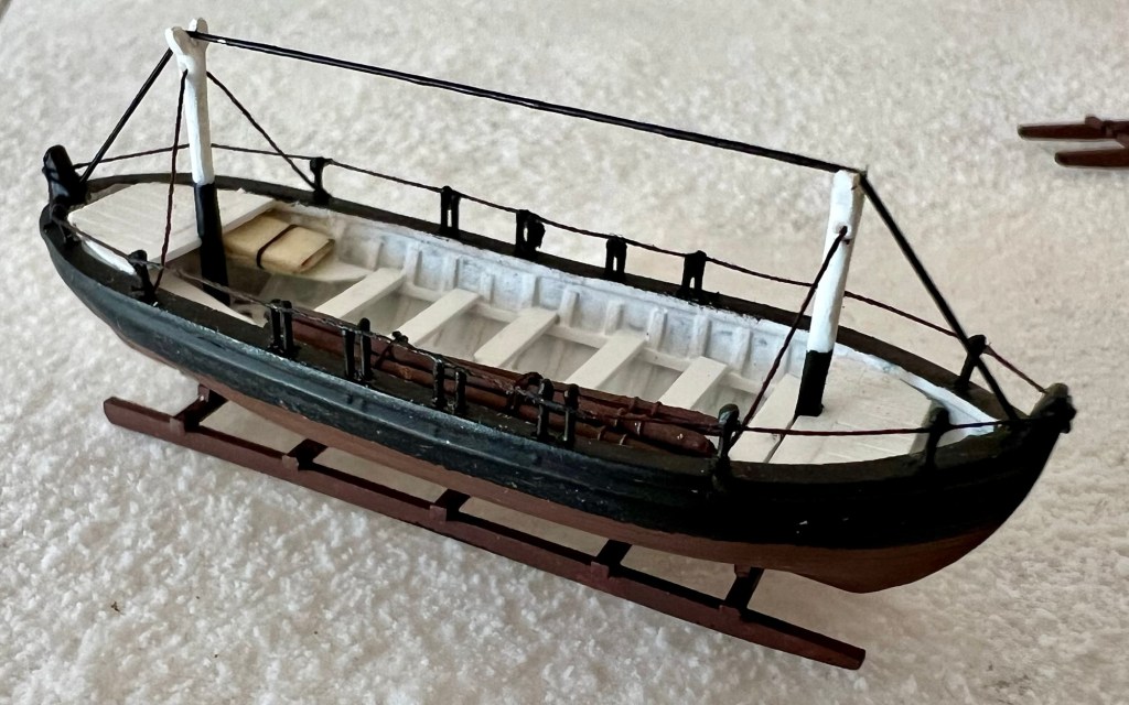
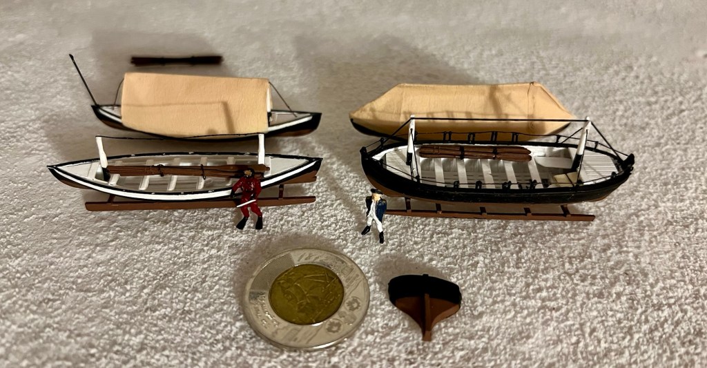
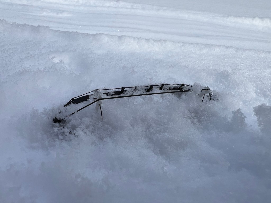
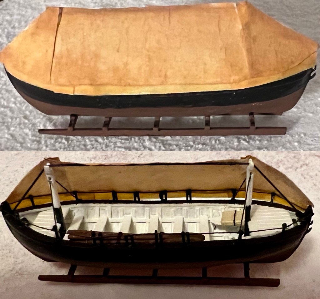
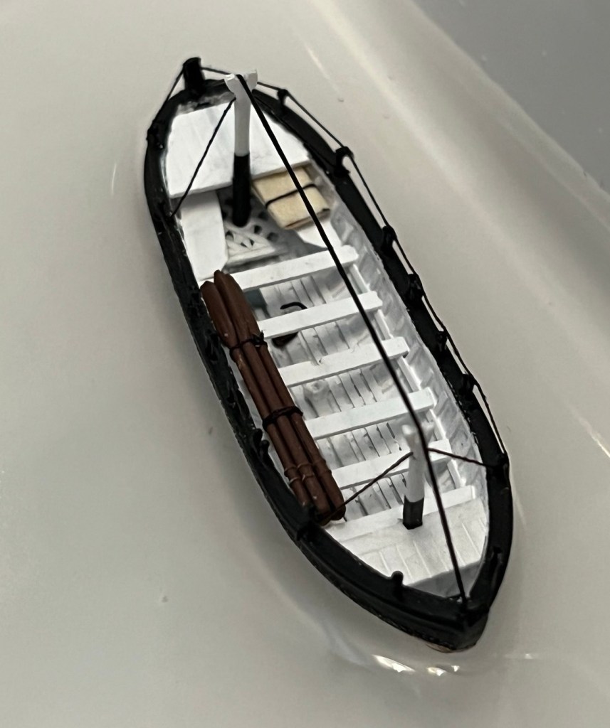
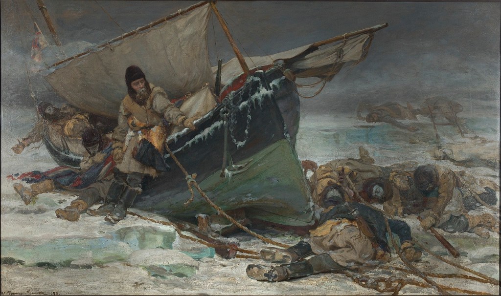
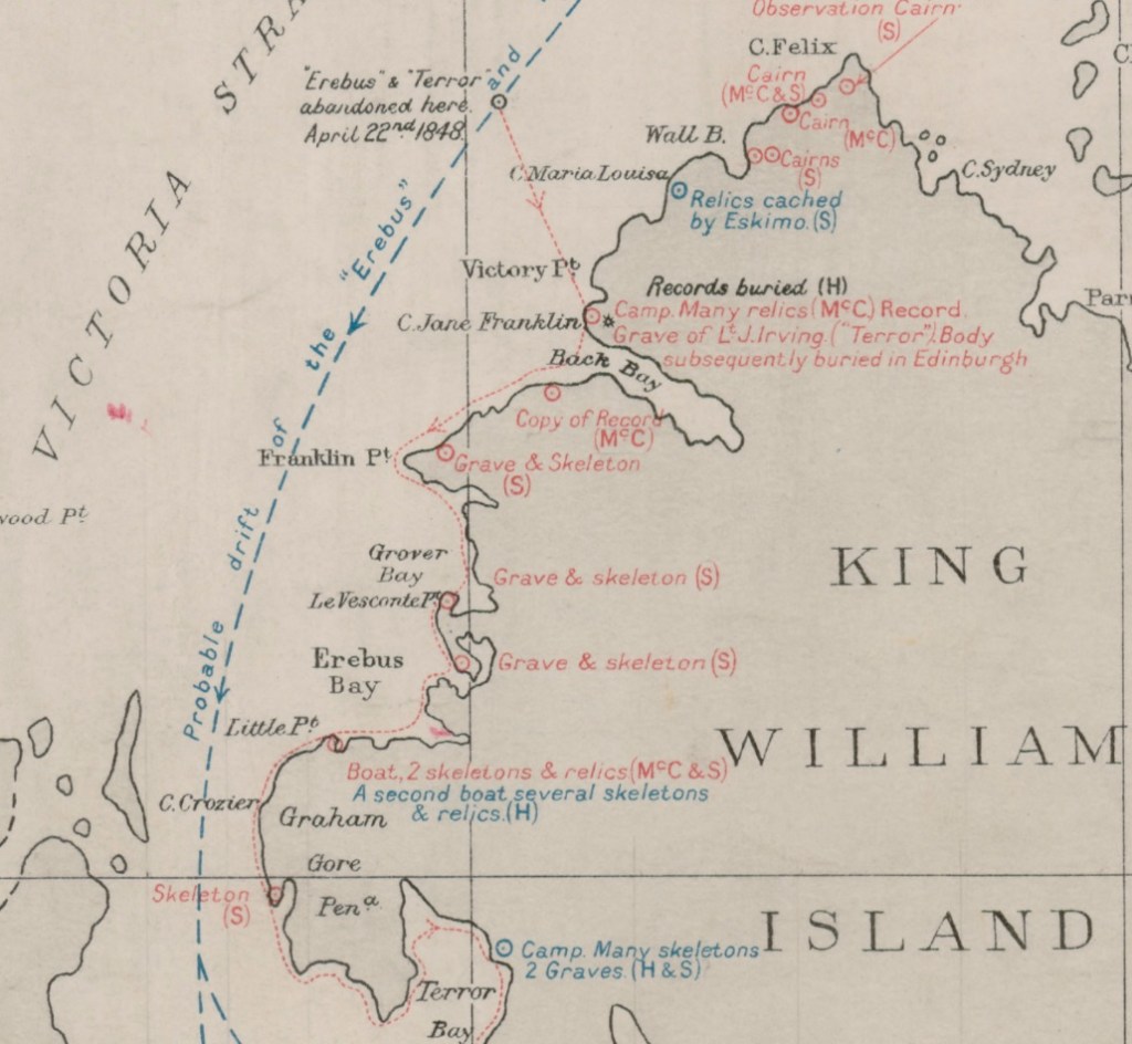
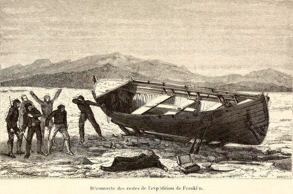
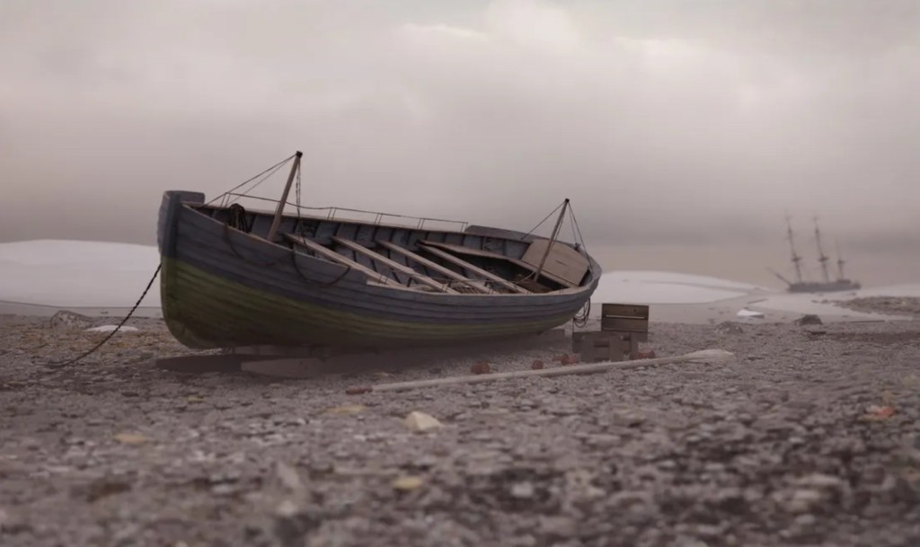
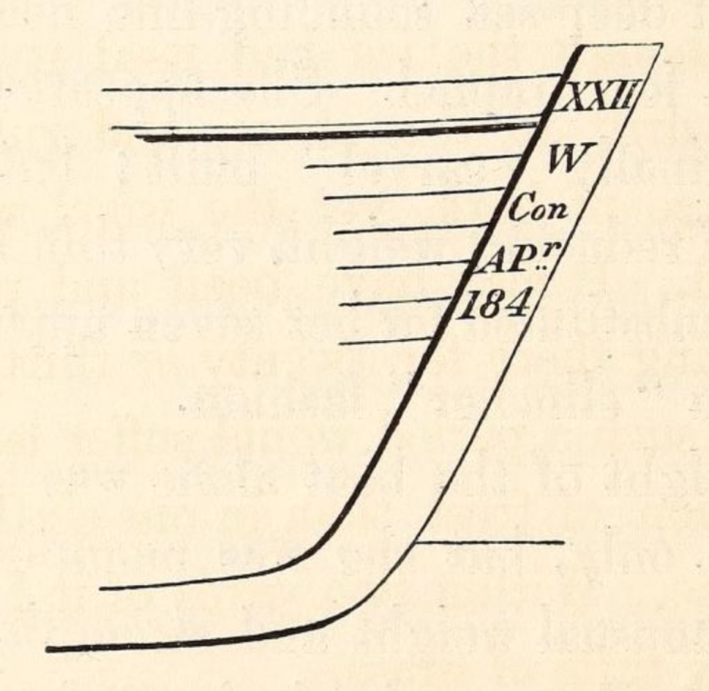
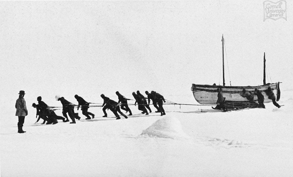
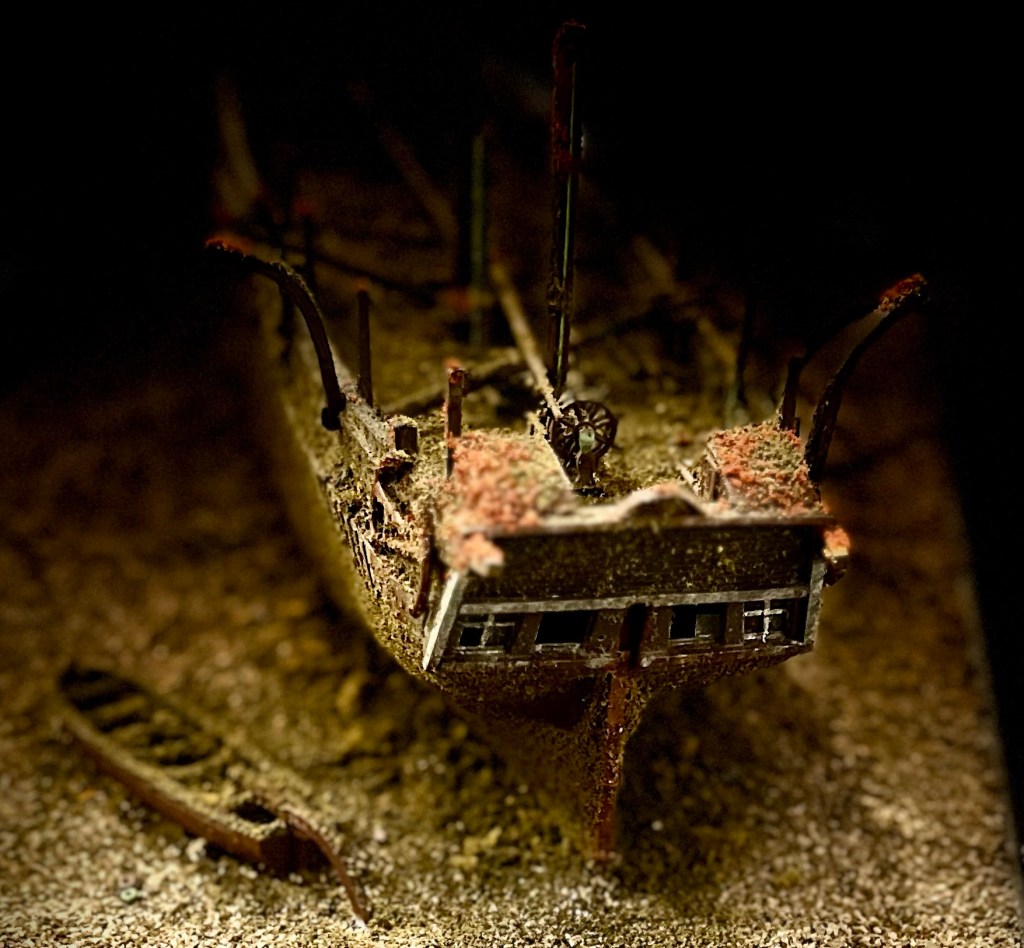
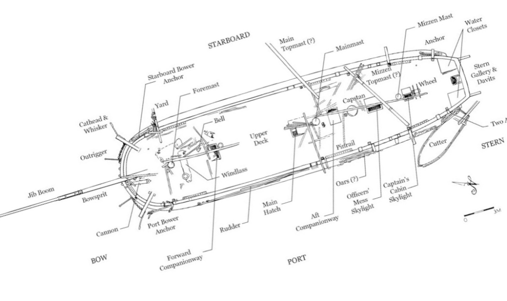
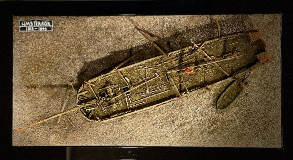
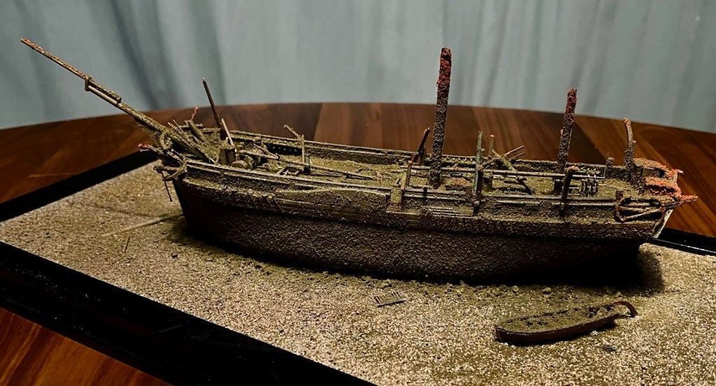

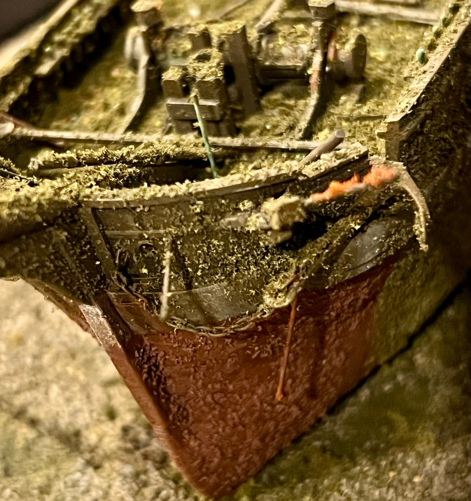
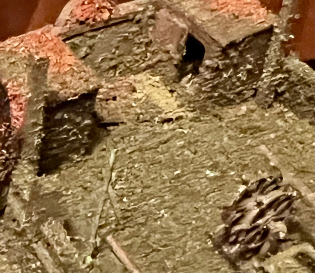

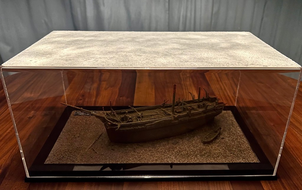
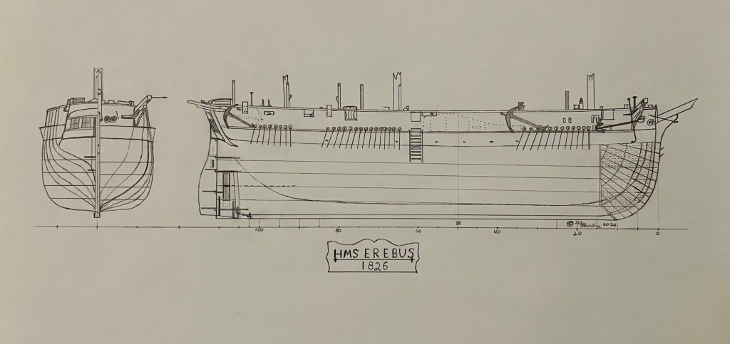
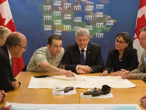
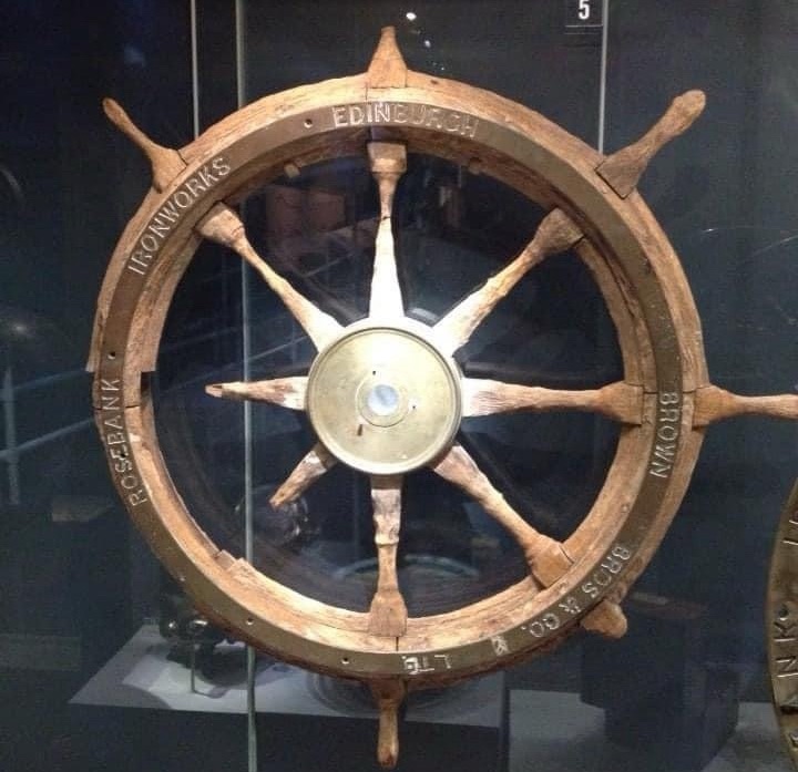
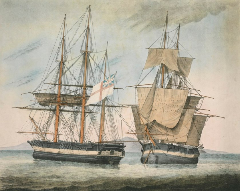
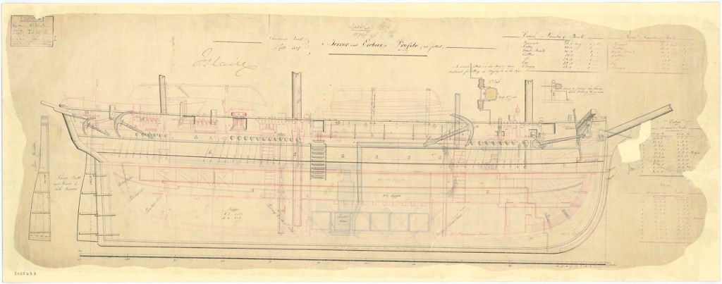
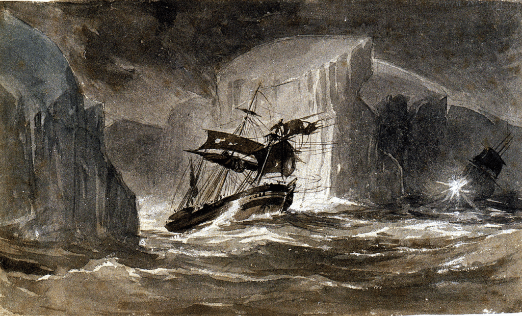
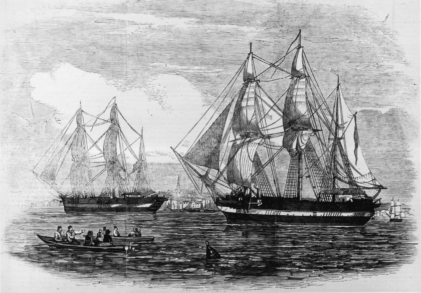
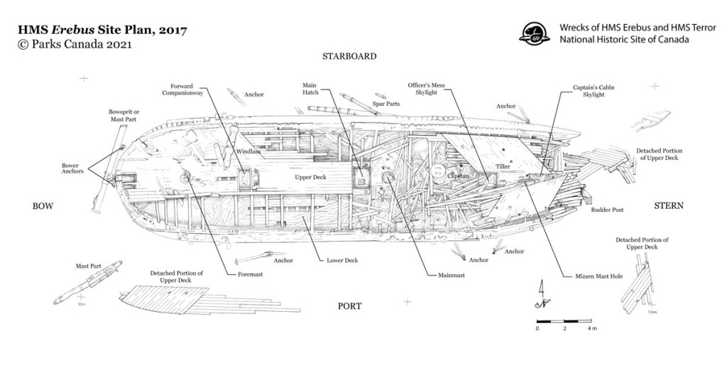
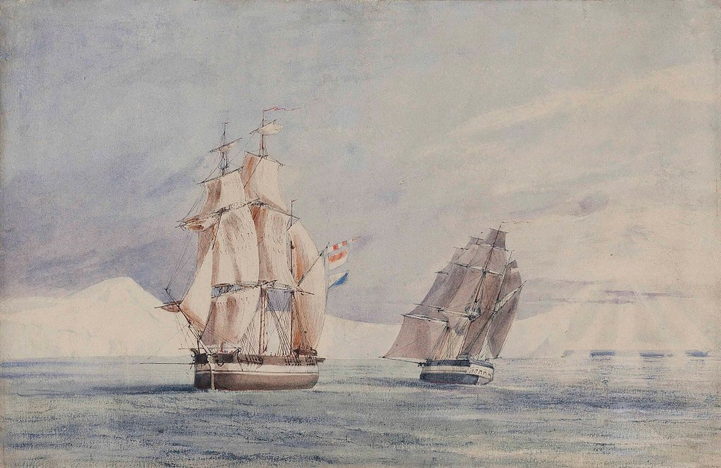
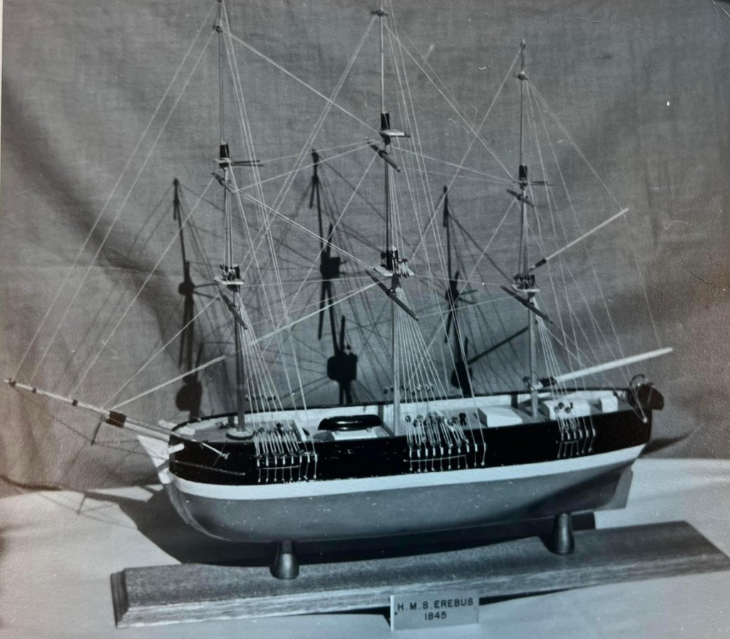
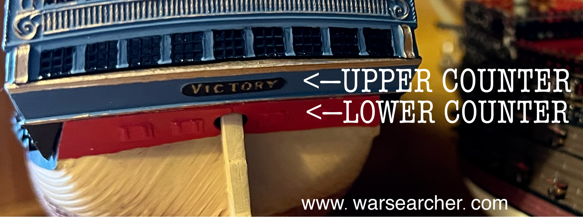 This small feature can be readily seen under the stern windows of Parry’s ships in the illustration of Hecla and Fury at top. Terror and her two Vesuvius class sisters (RMG
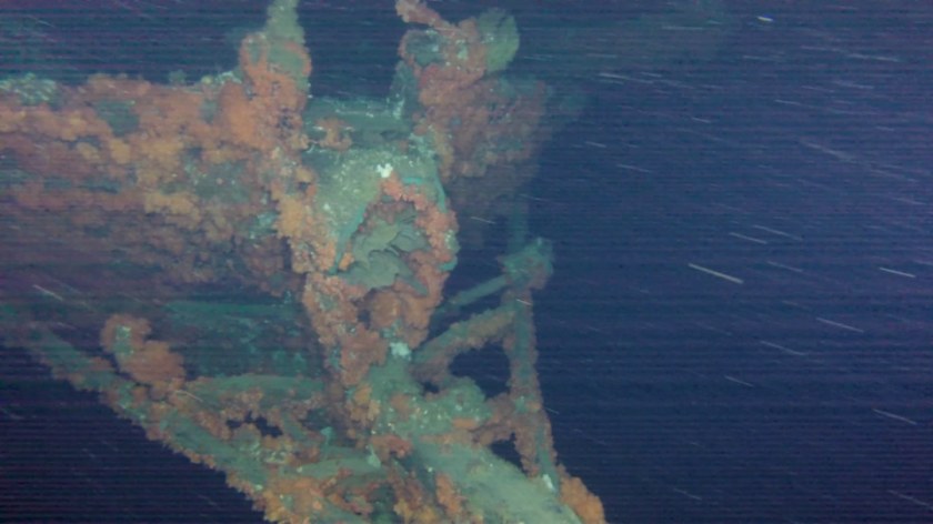
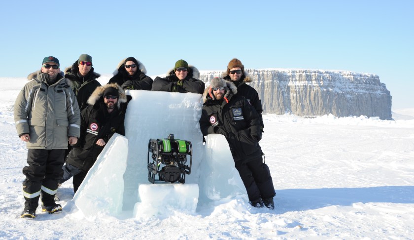
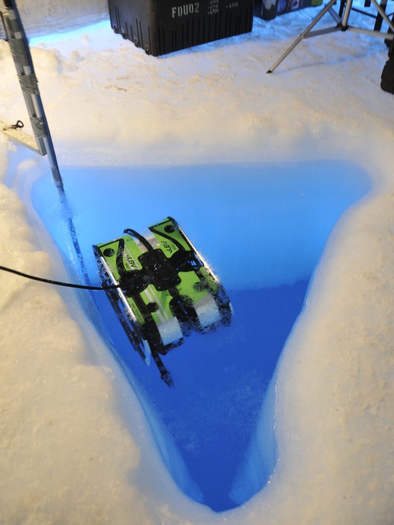
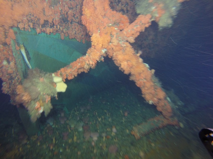
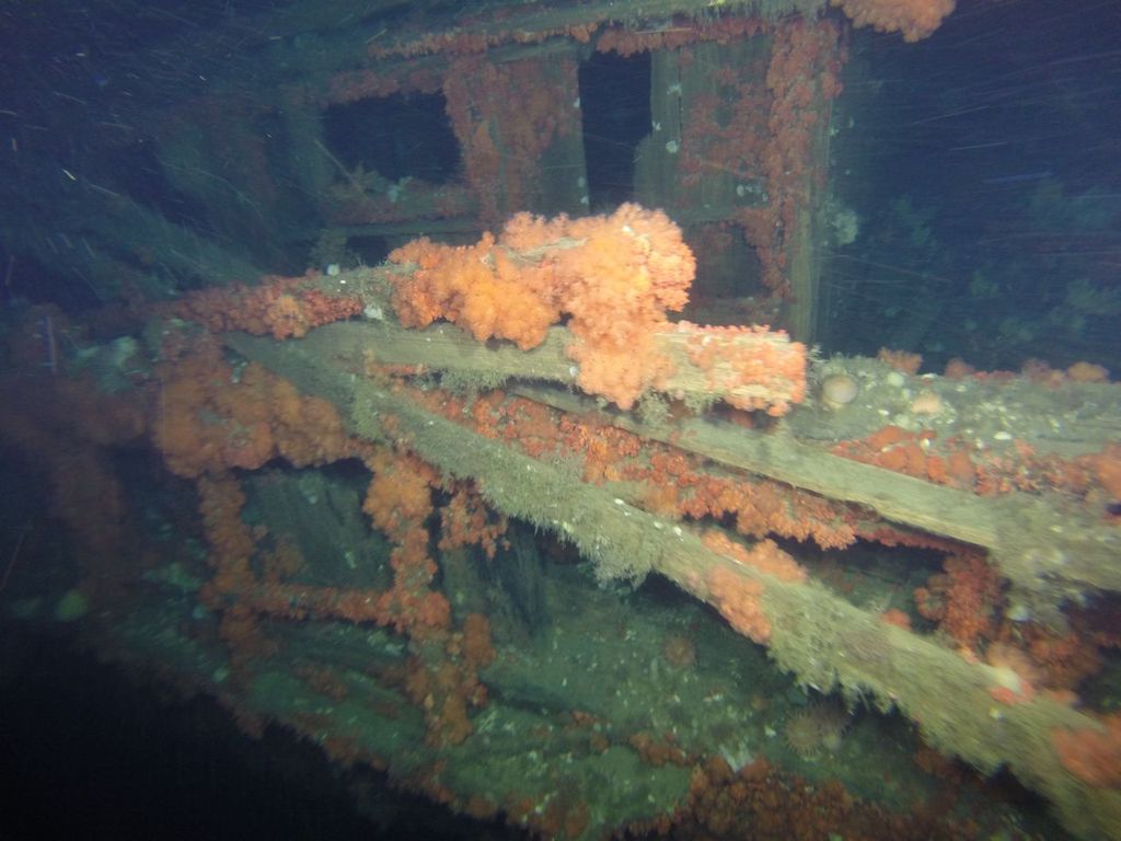
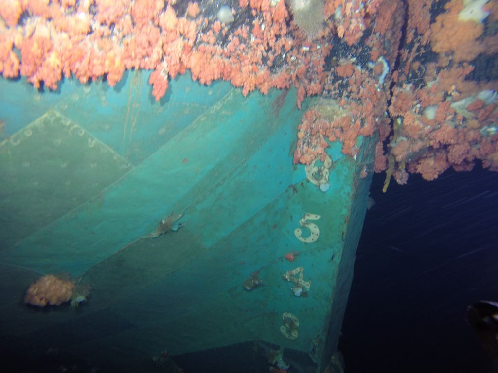
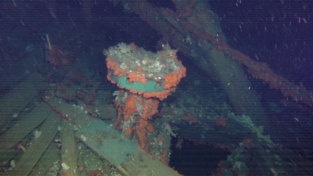
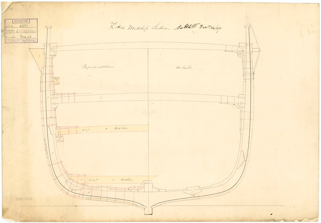
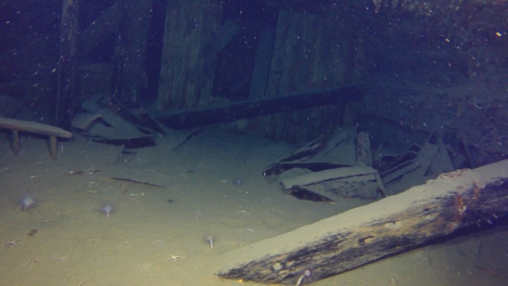
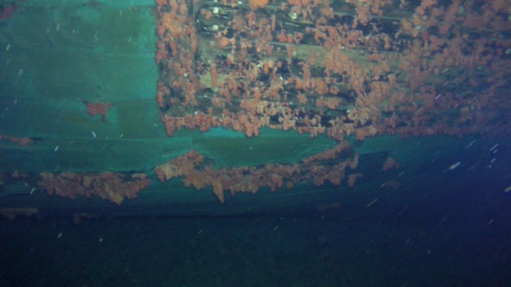
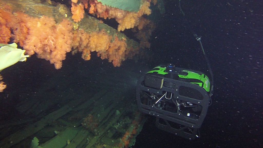
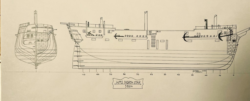
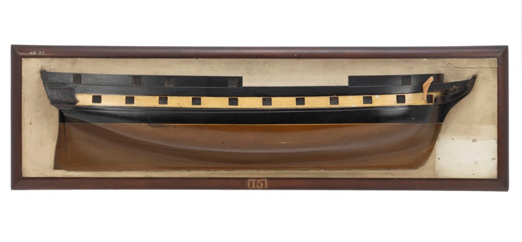
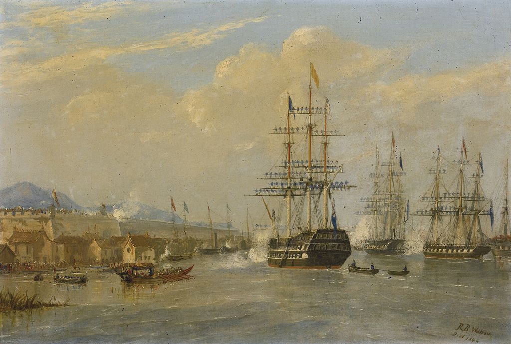

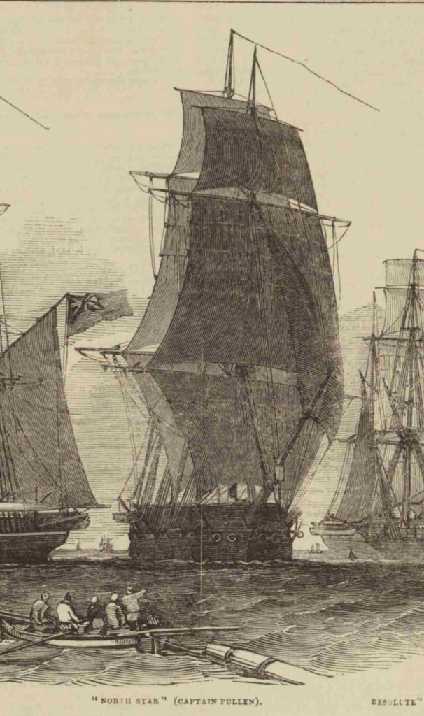
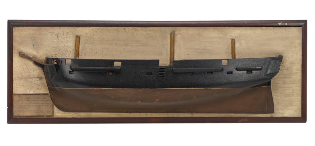
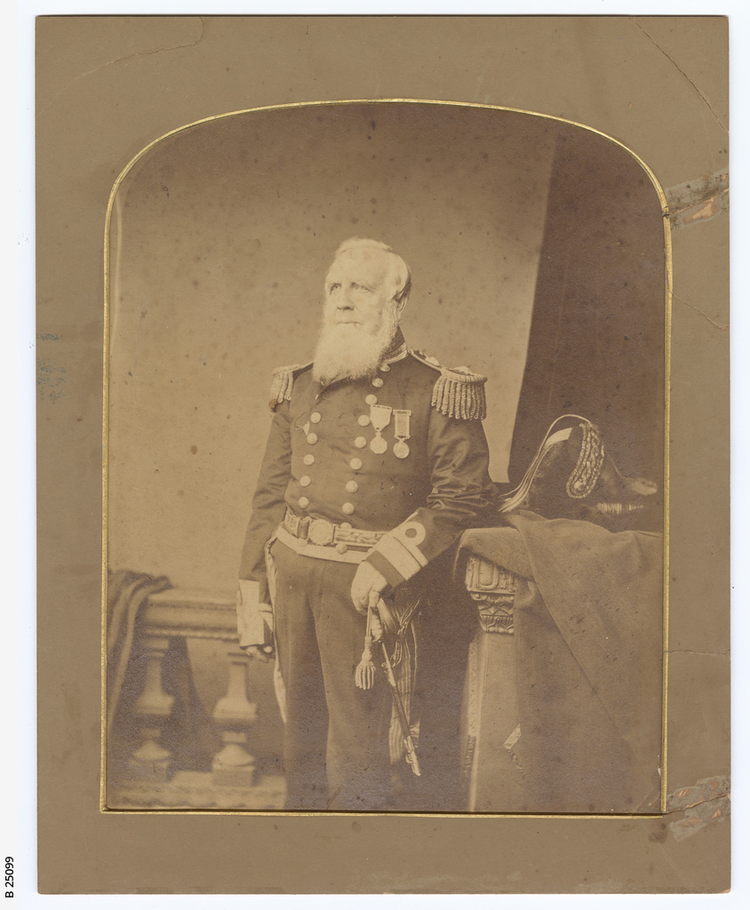


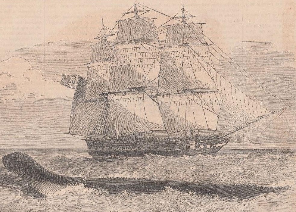
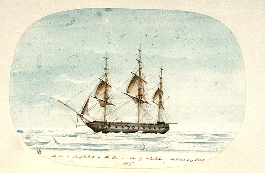
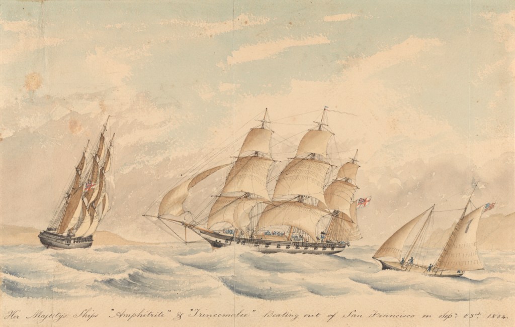
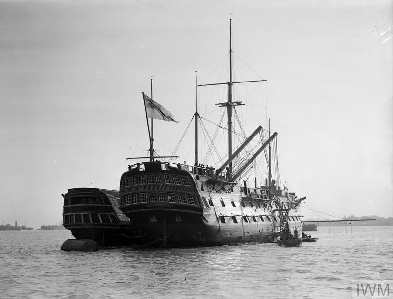
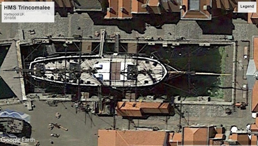
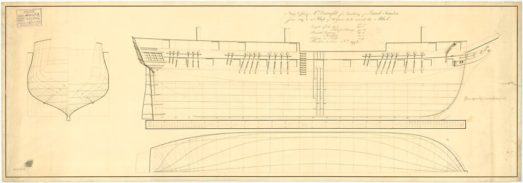
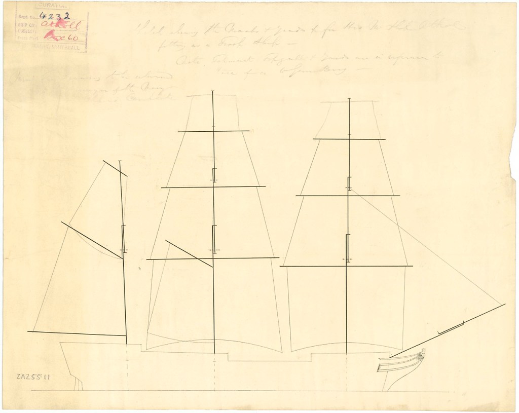
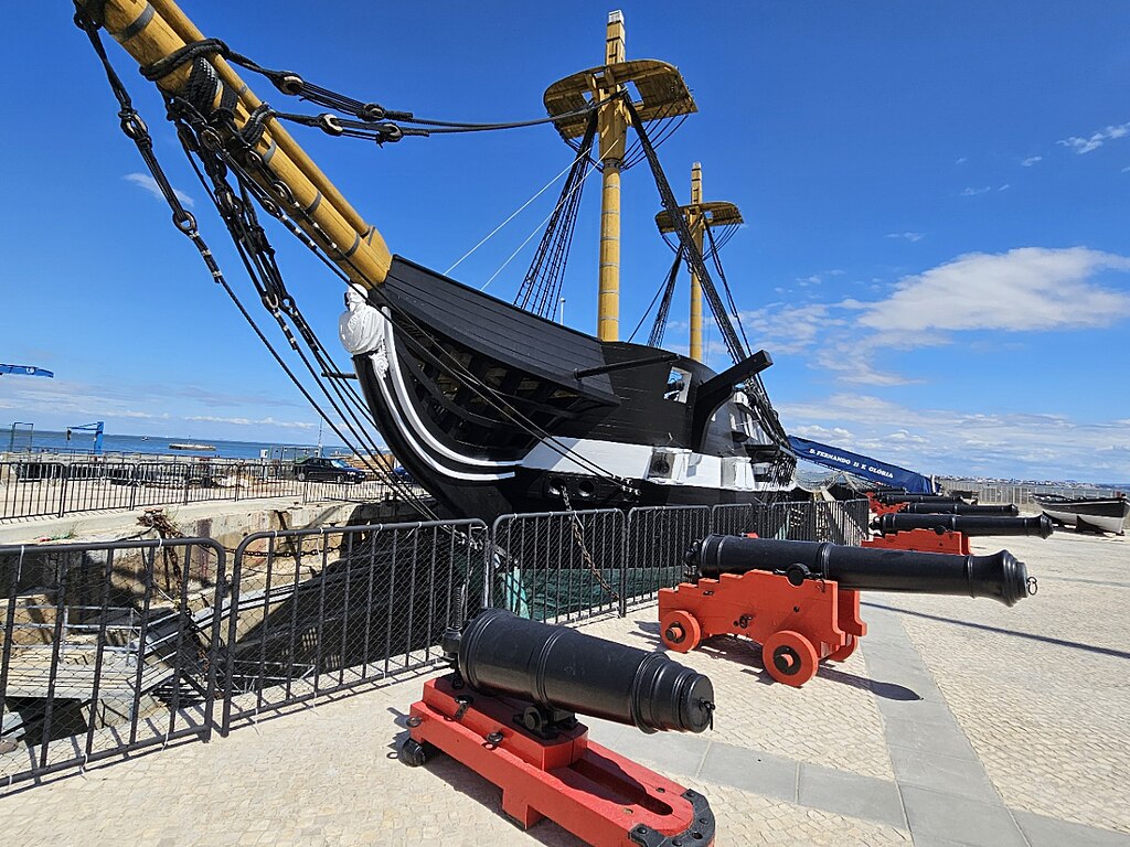

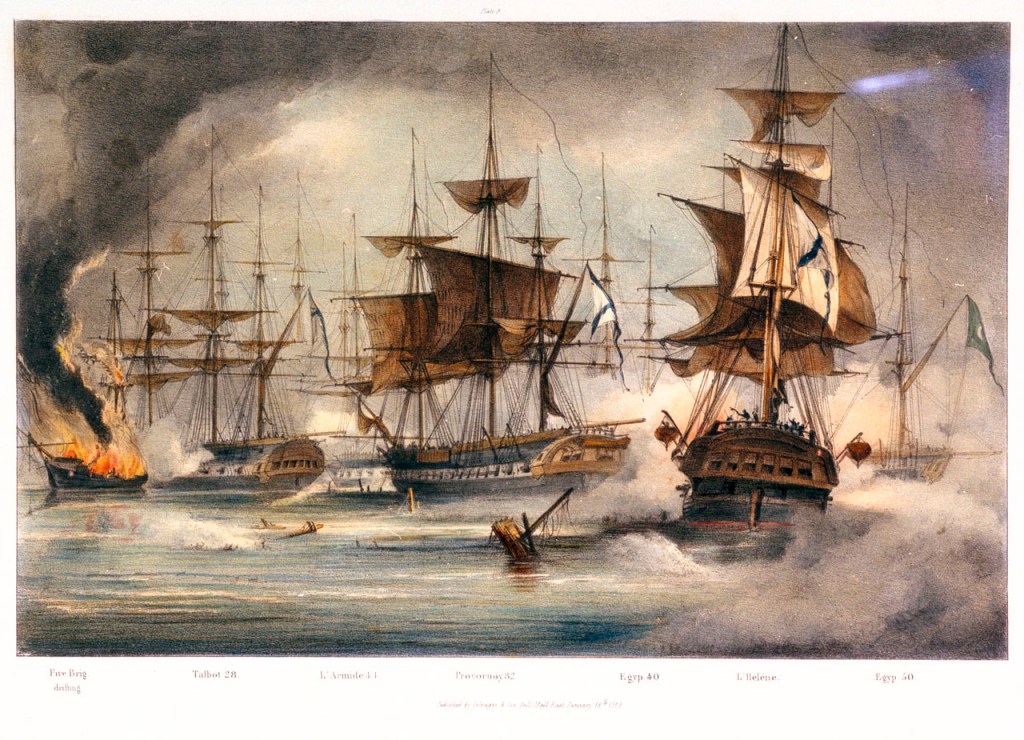

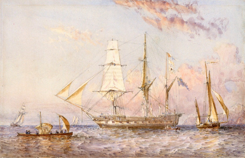
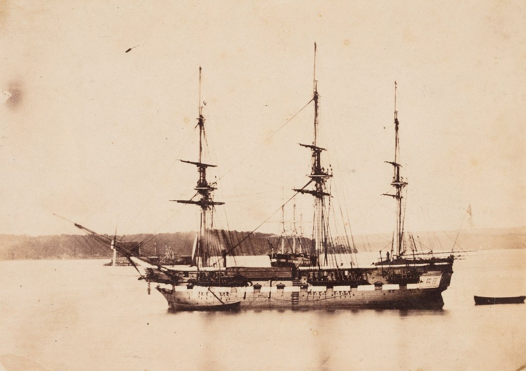
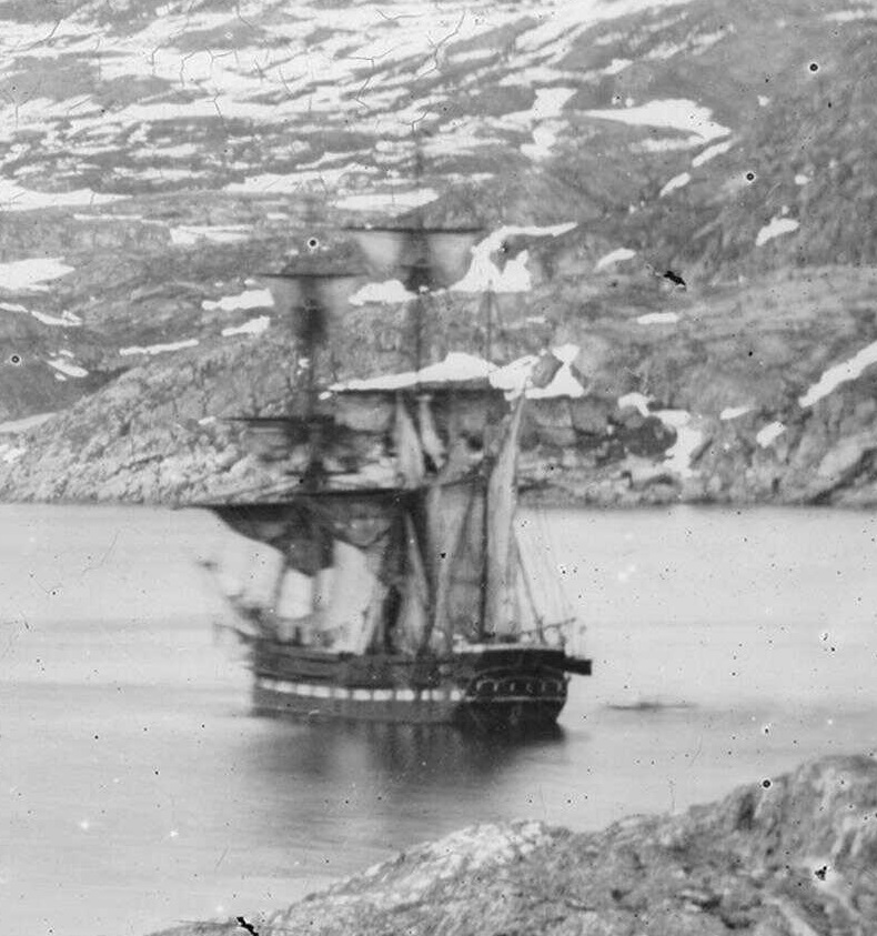
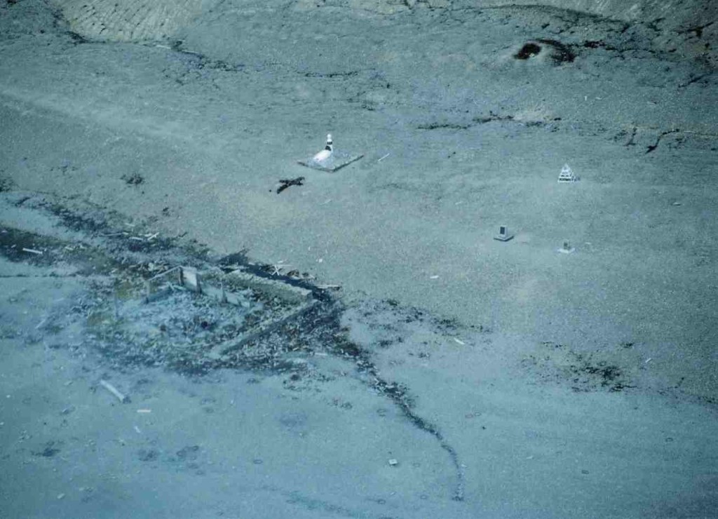

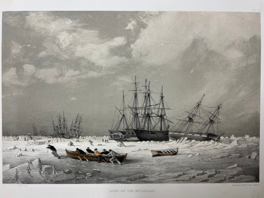
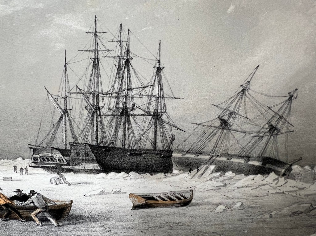
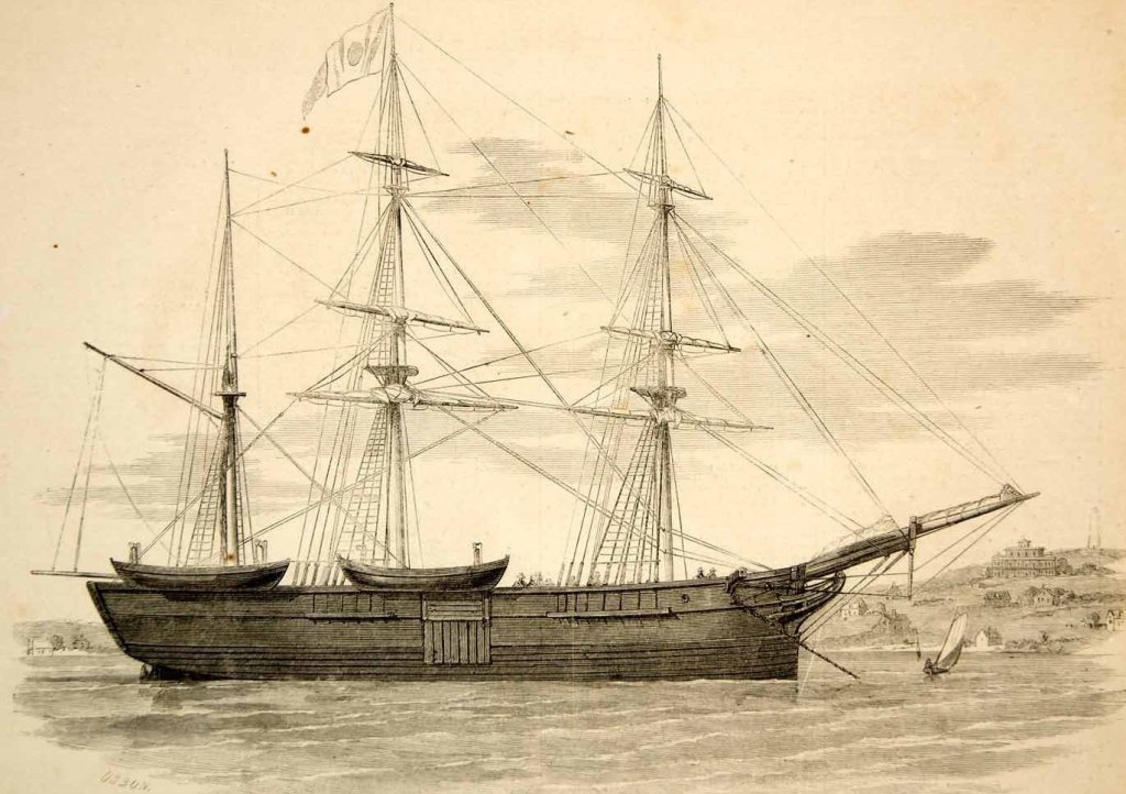
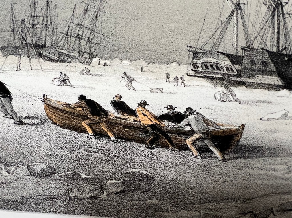
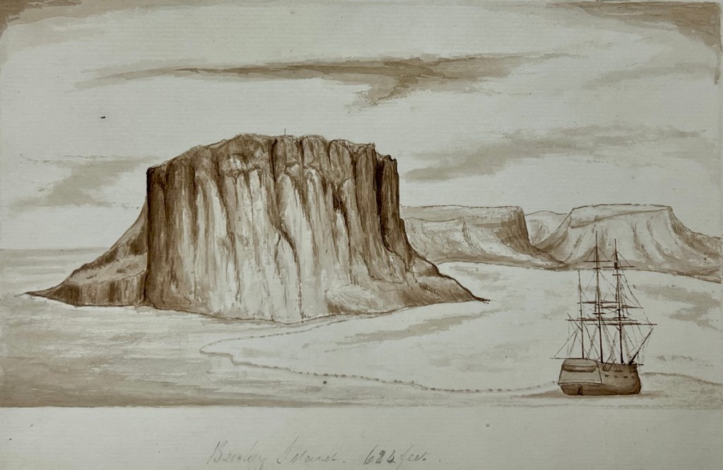
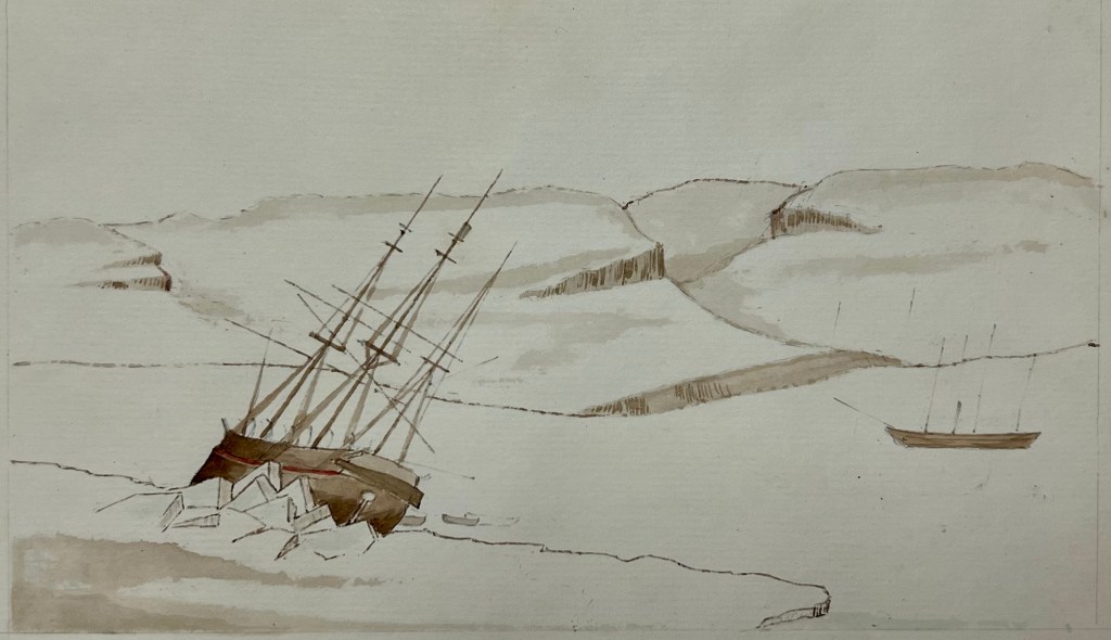
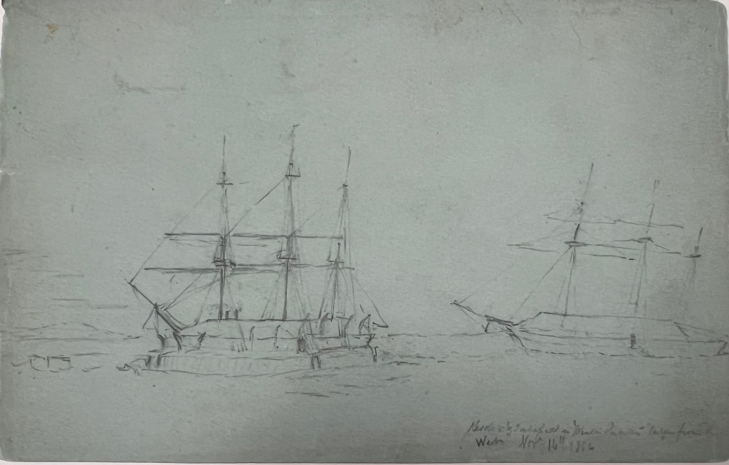
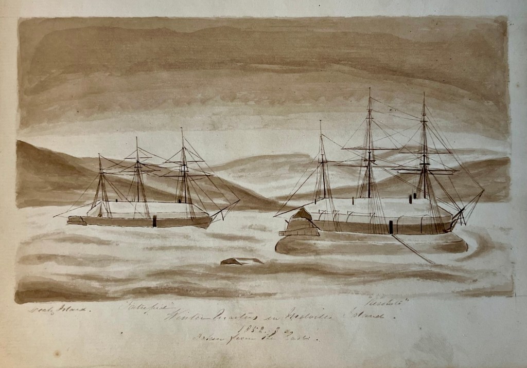
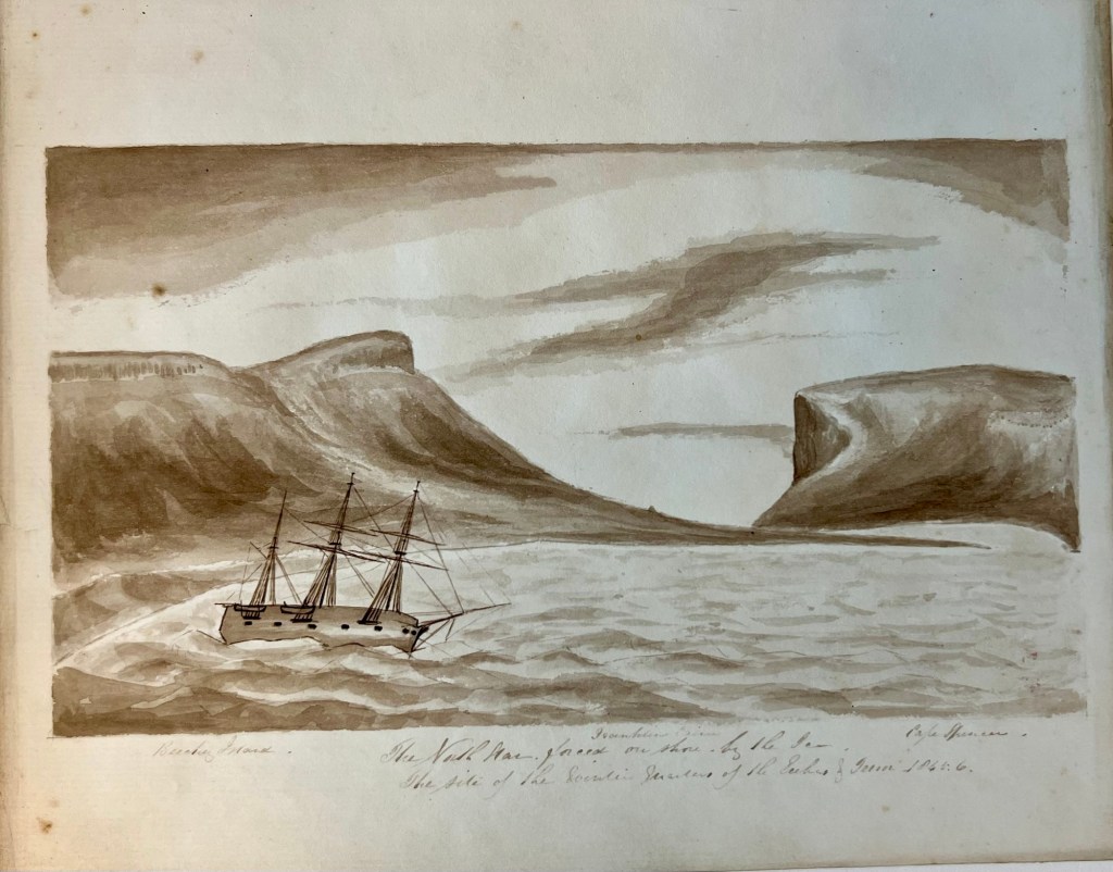
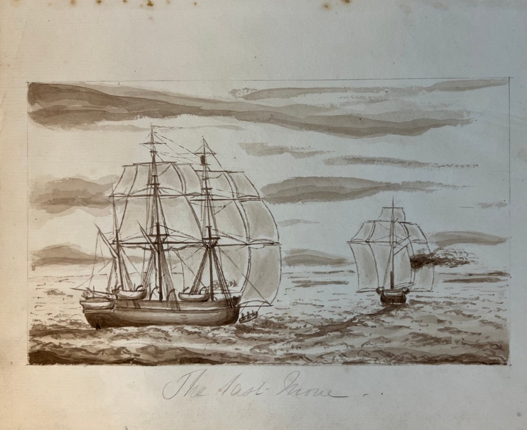
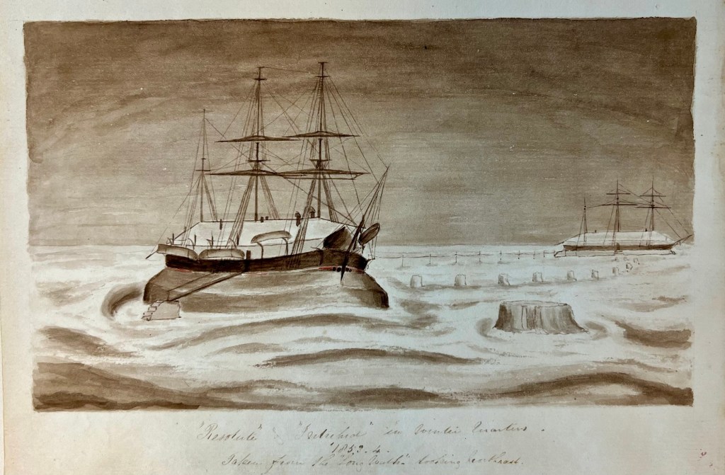
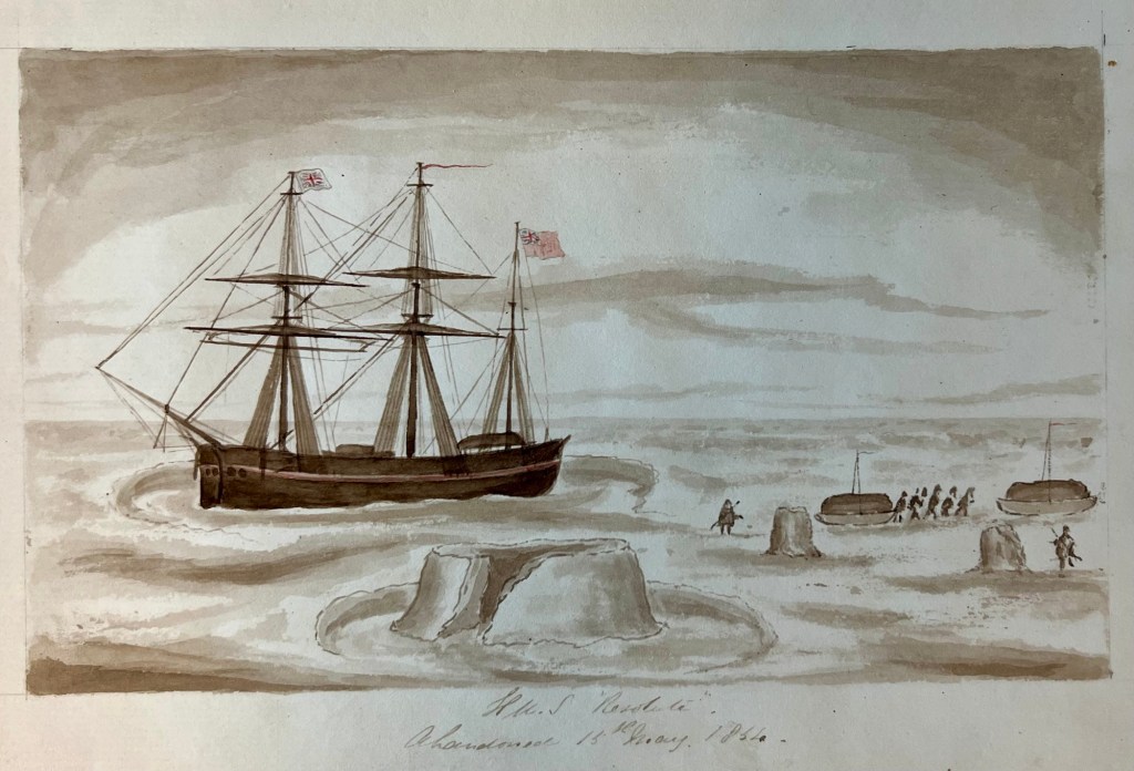
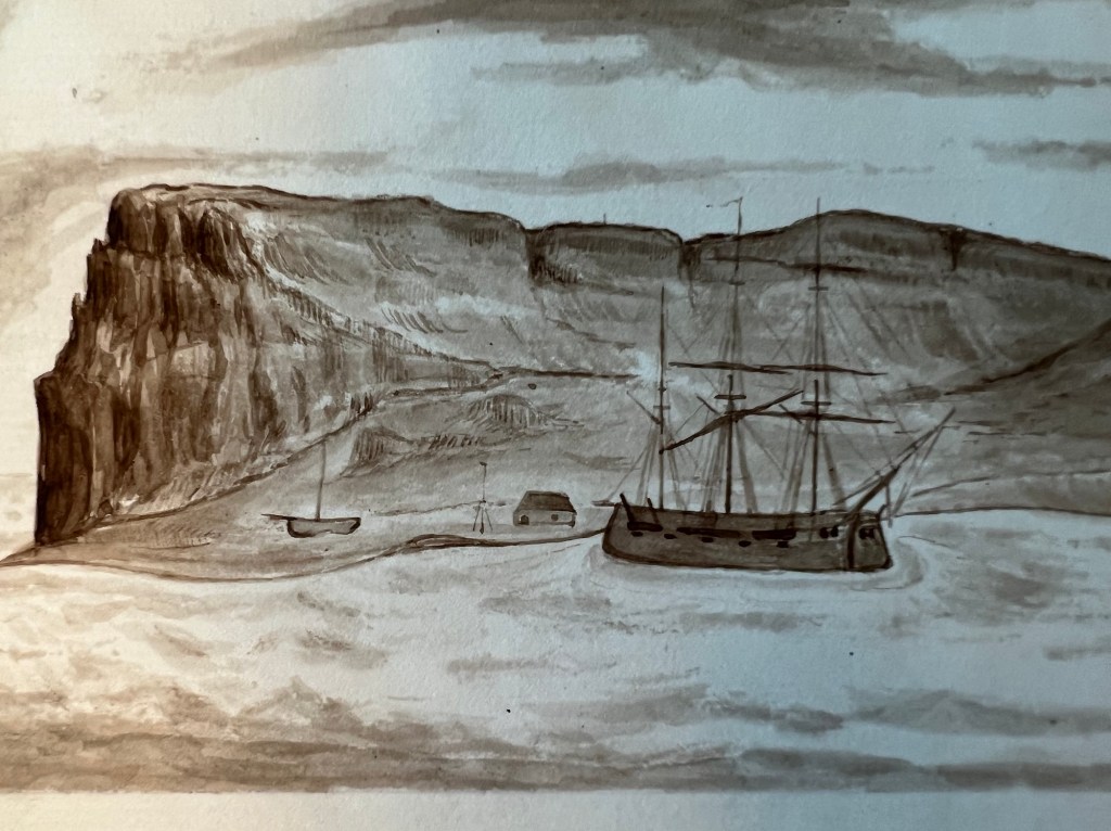
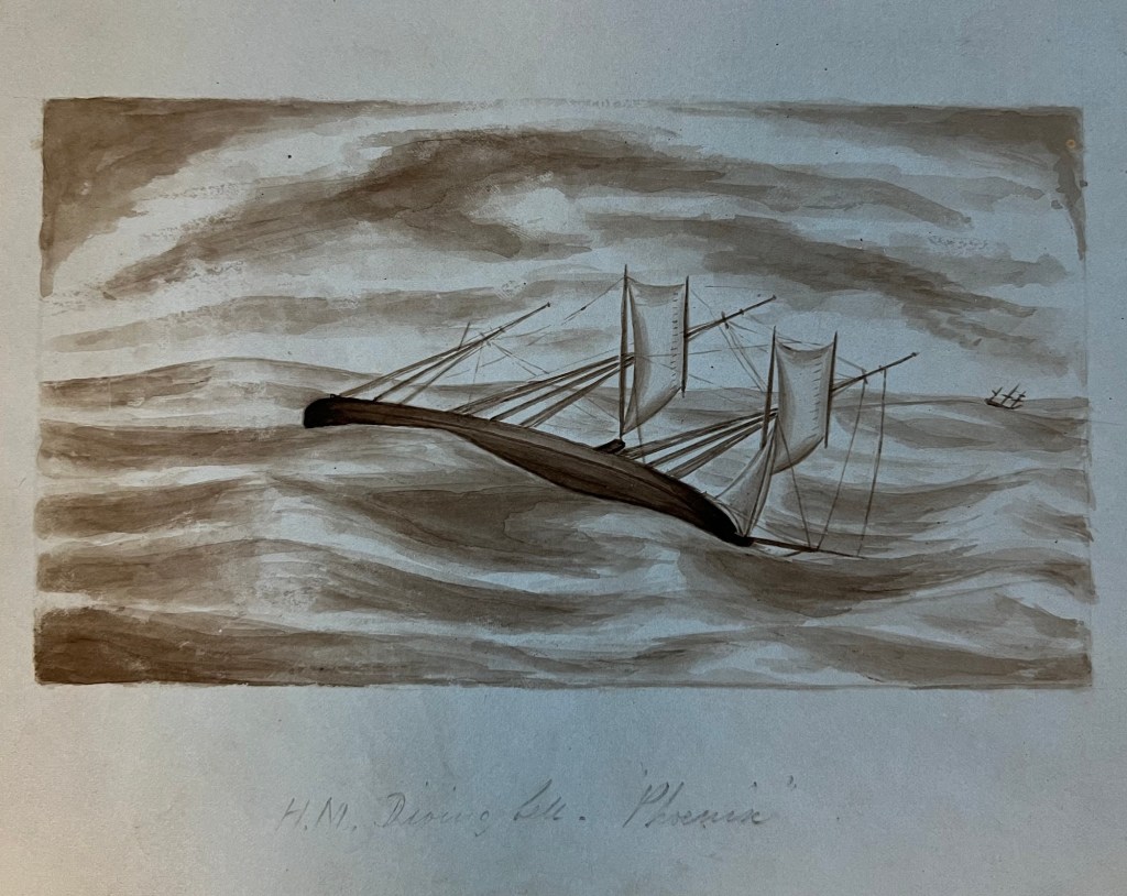
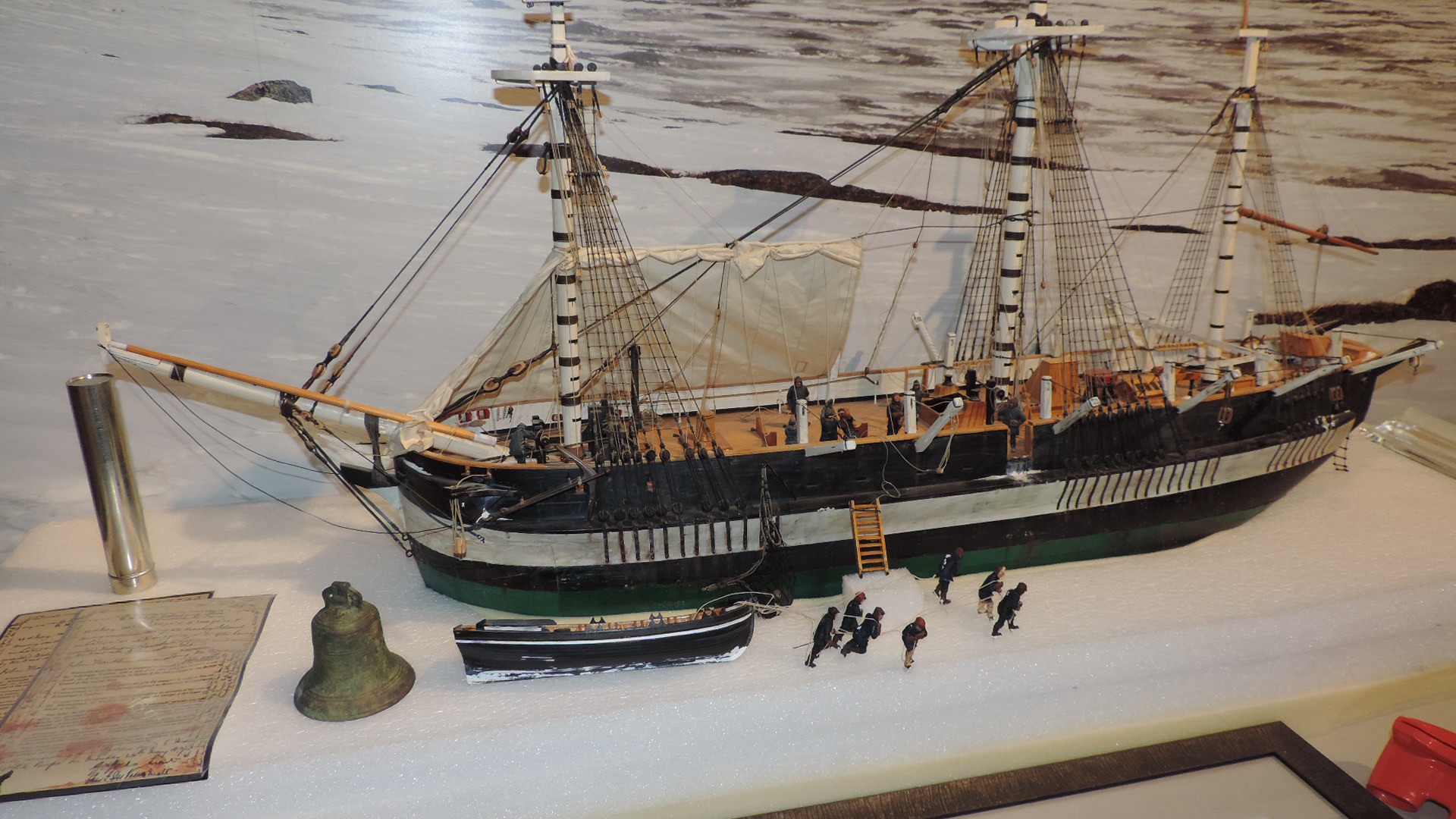
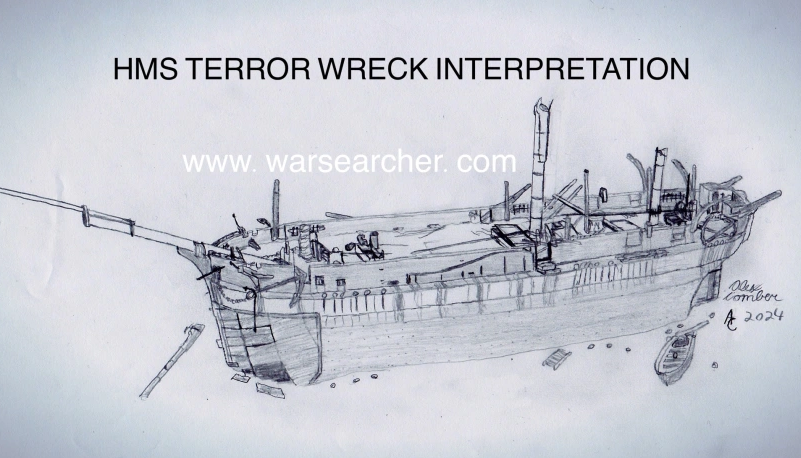
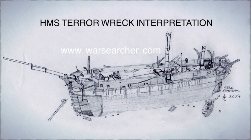

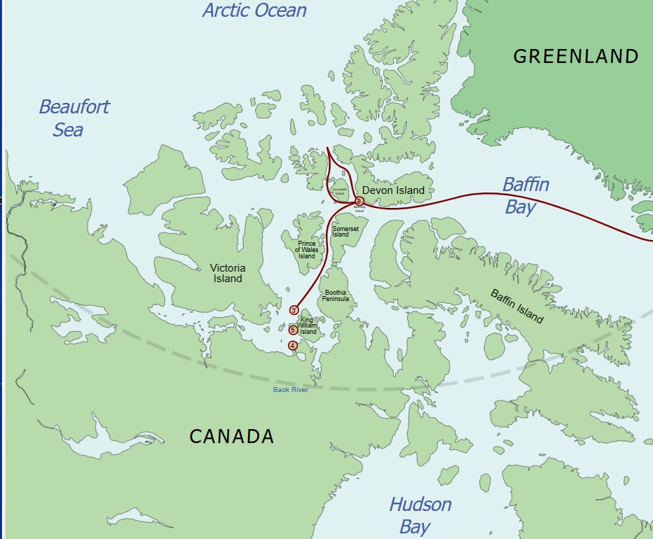
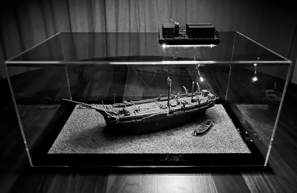
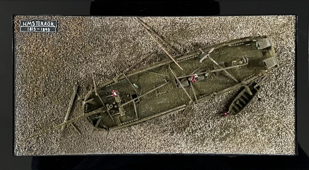
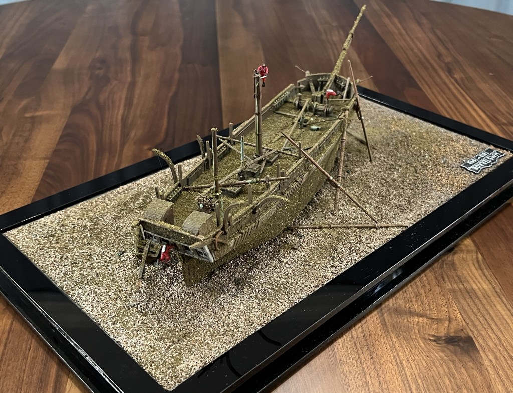
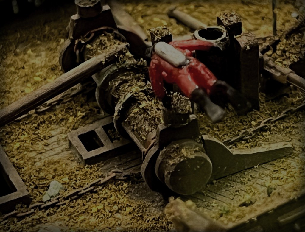
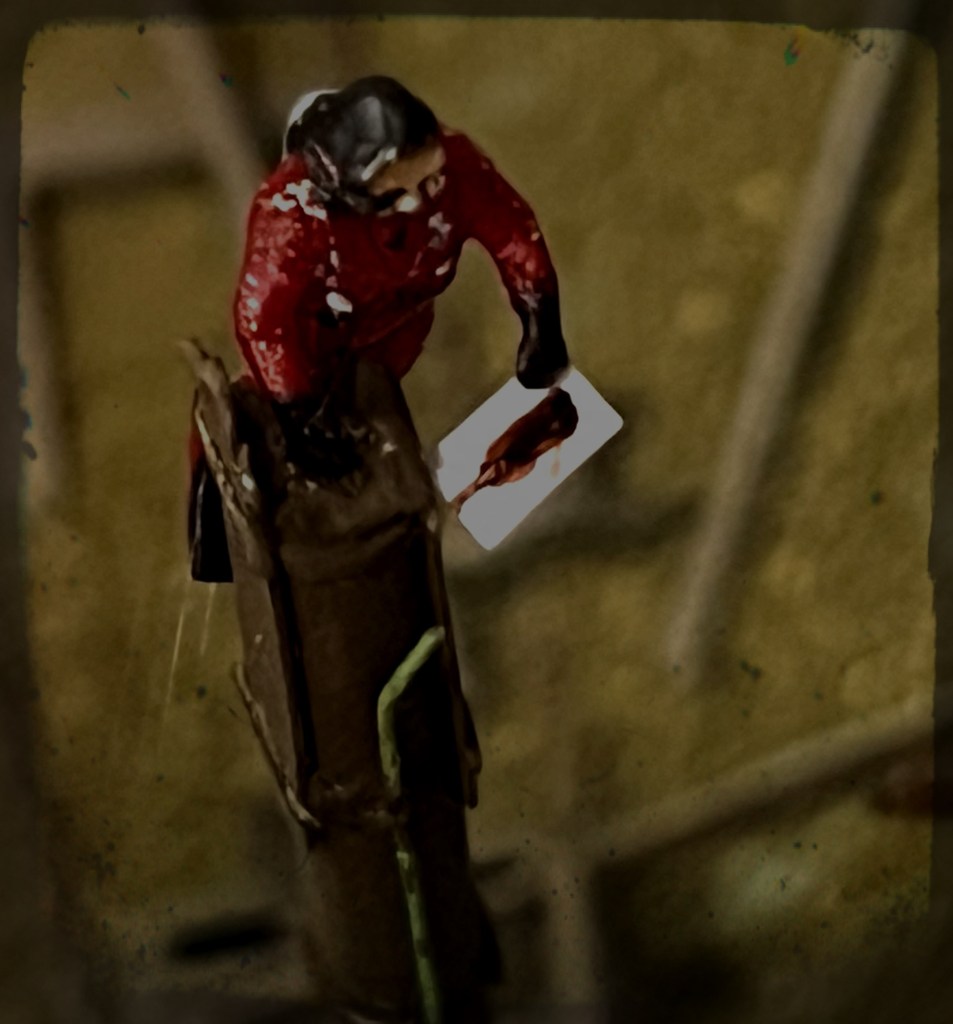
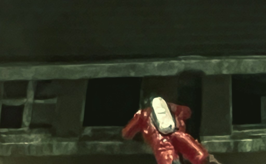
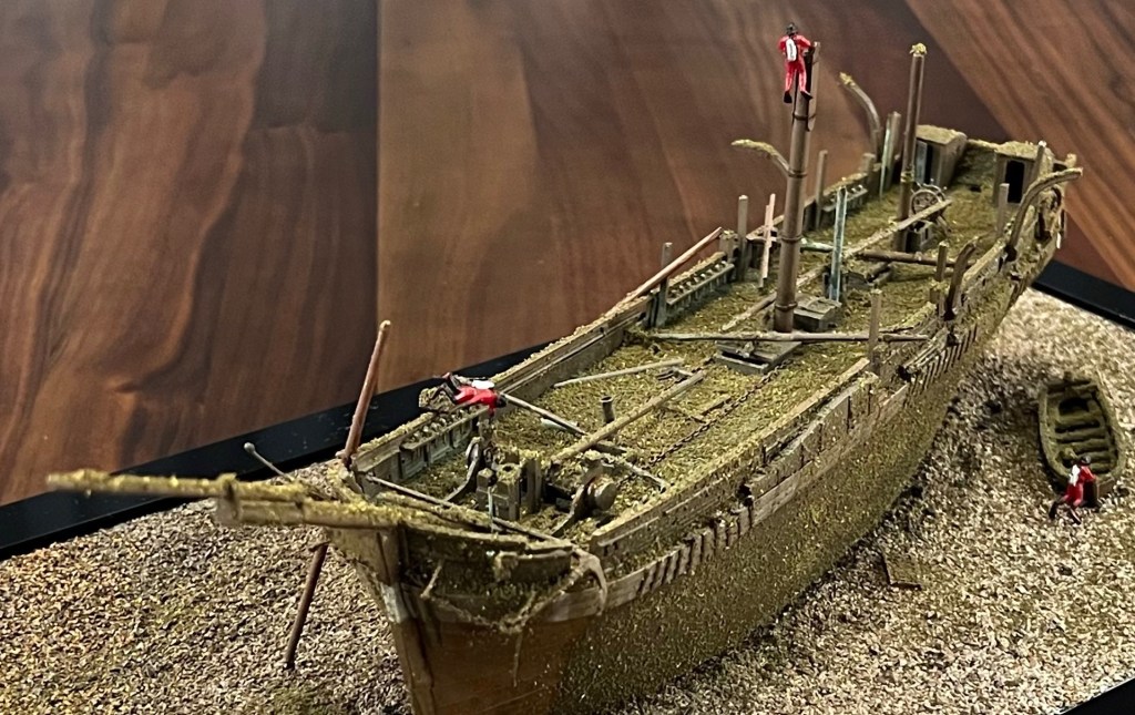

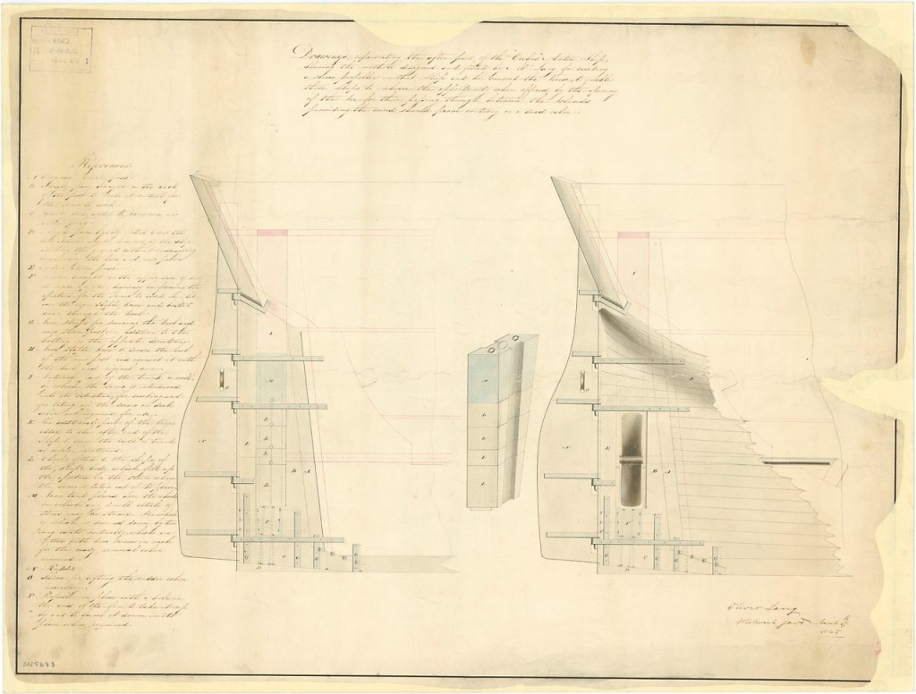
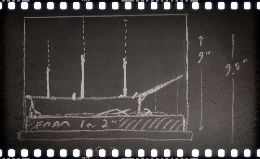

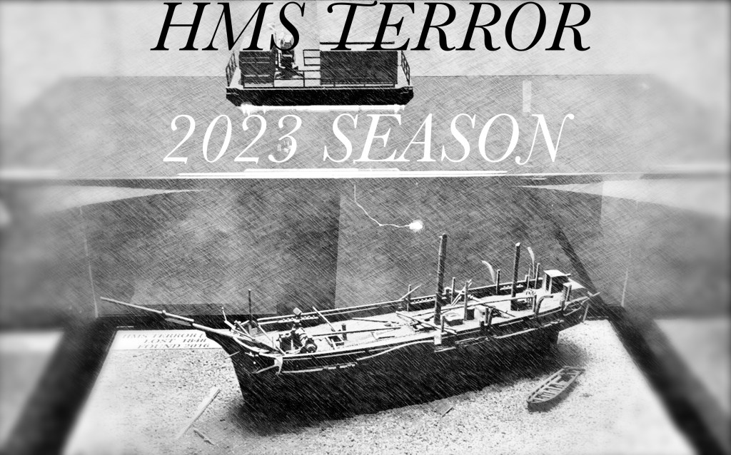
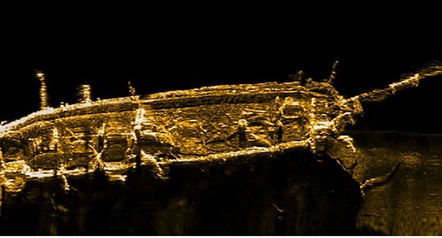
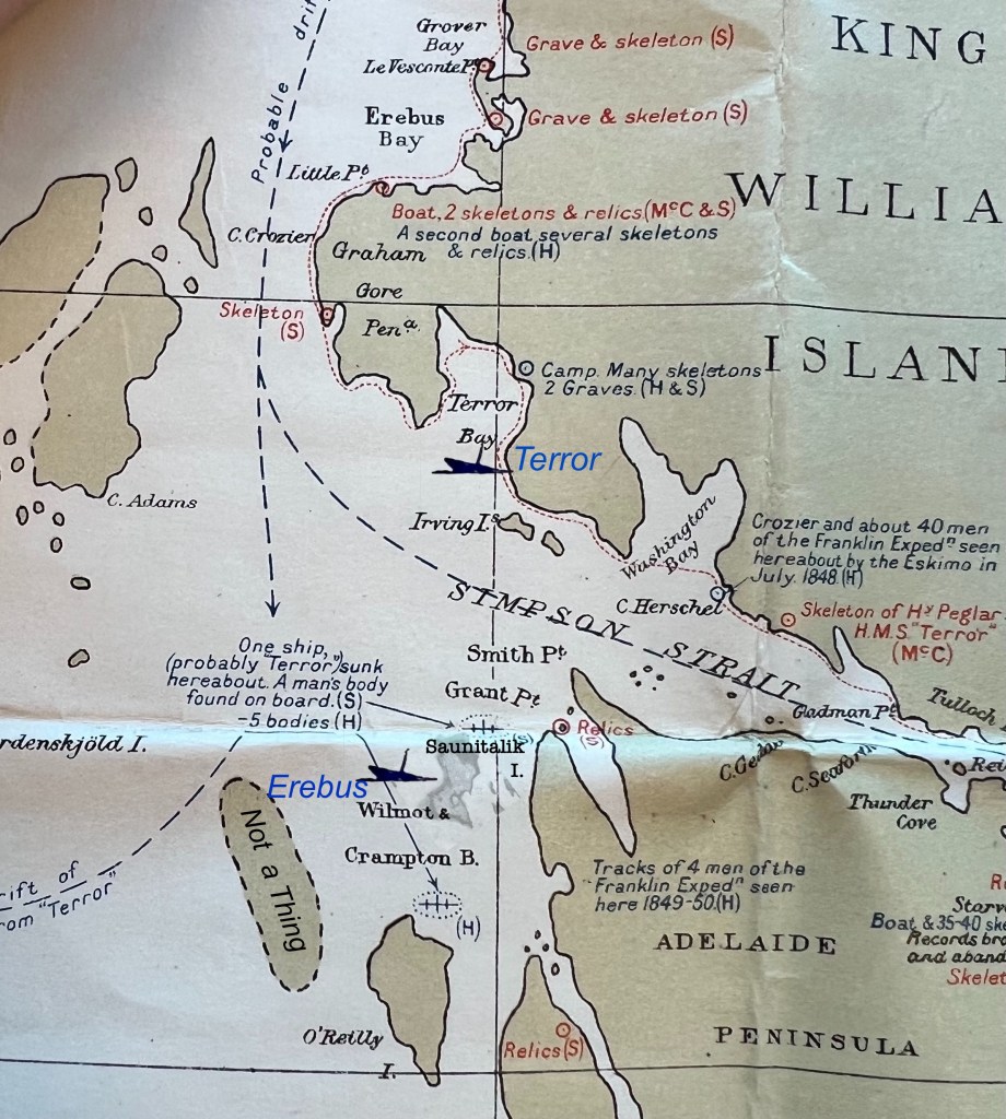
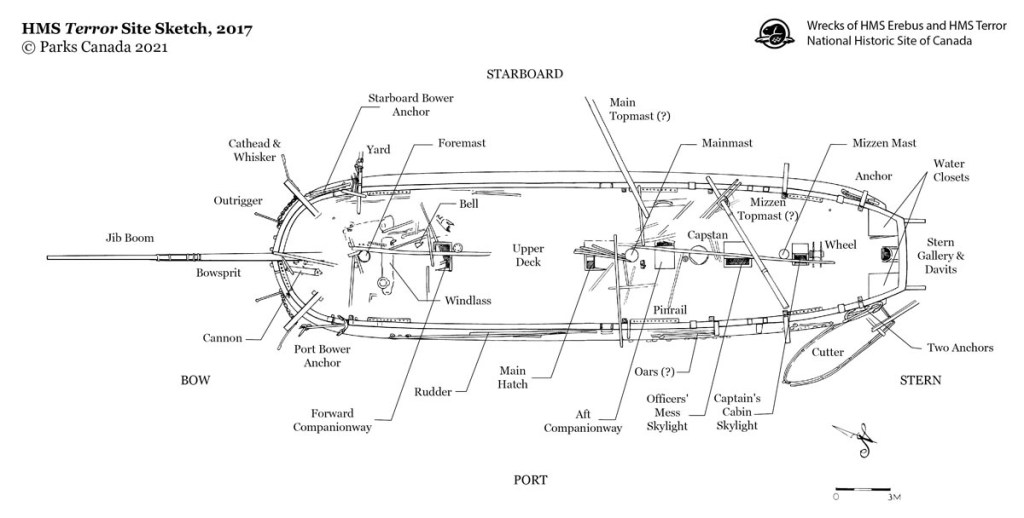
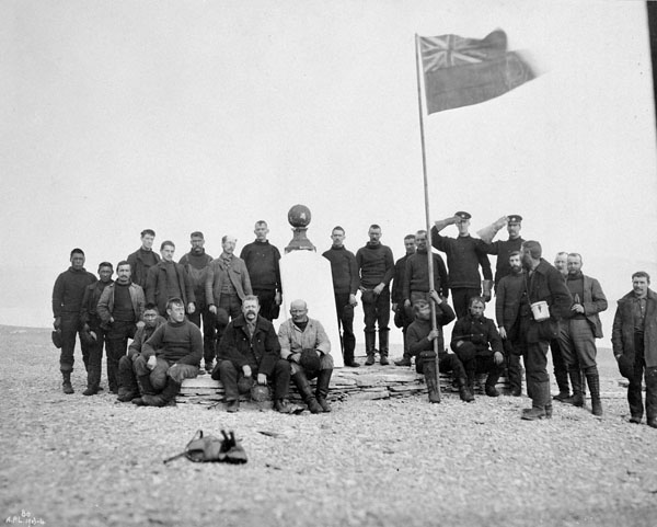

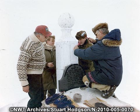
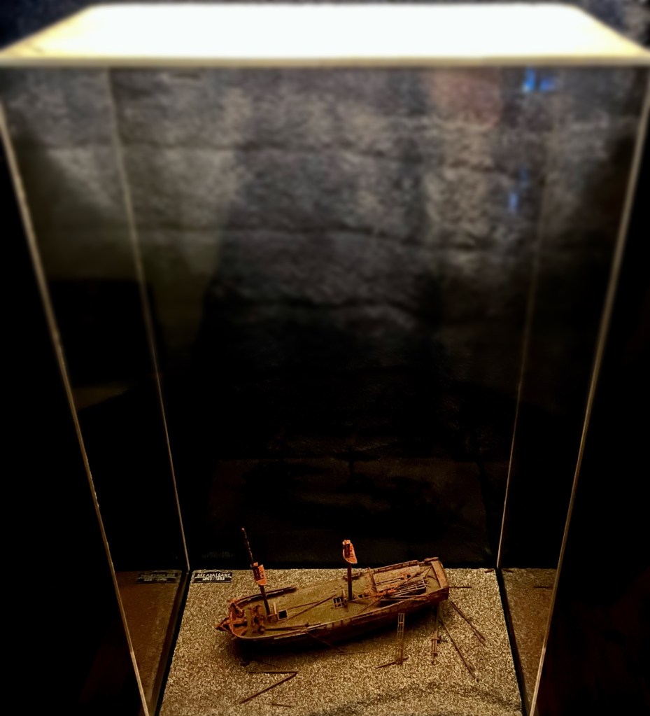
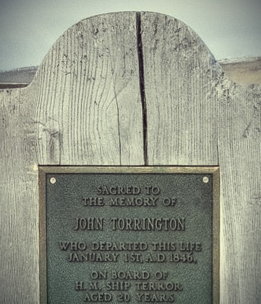
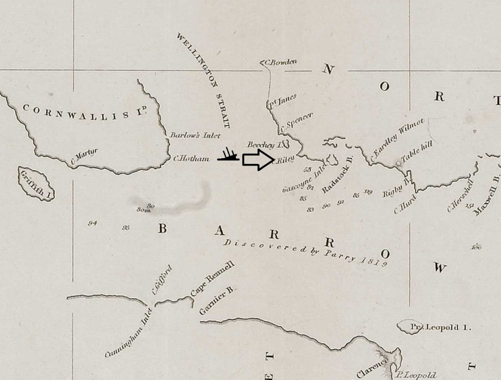


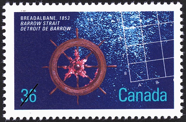
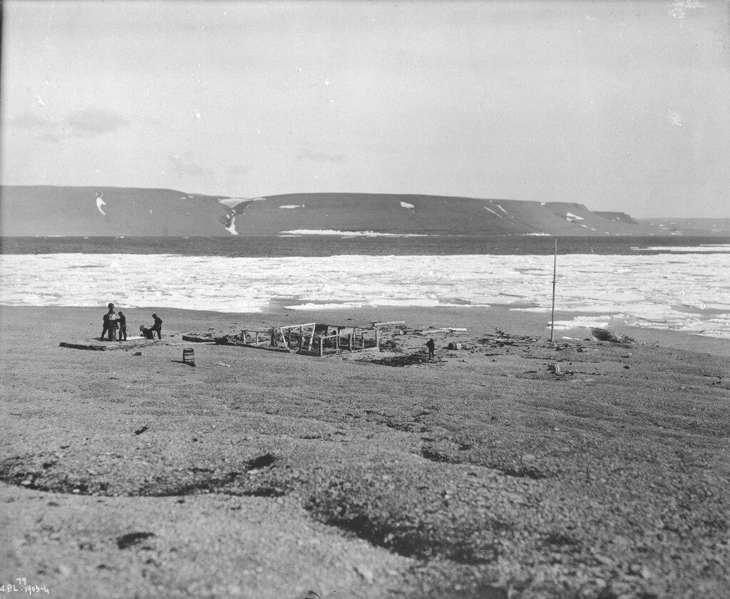


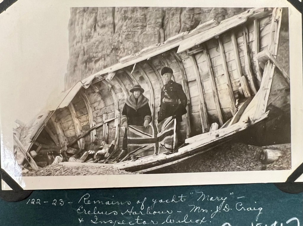

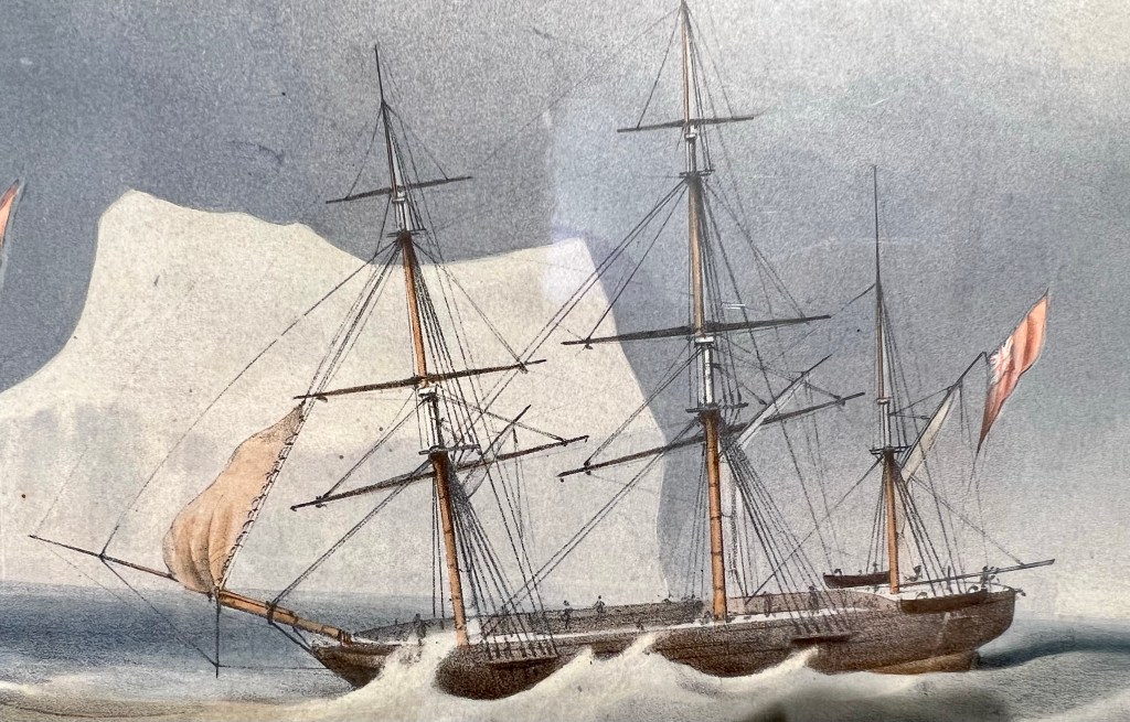
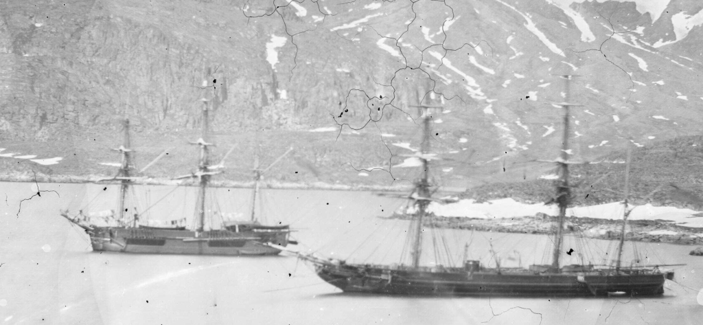
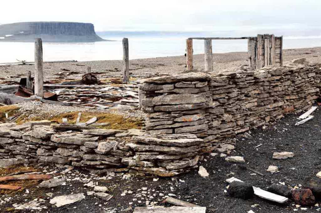
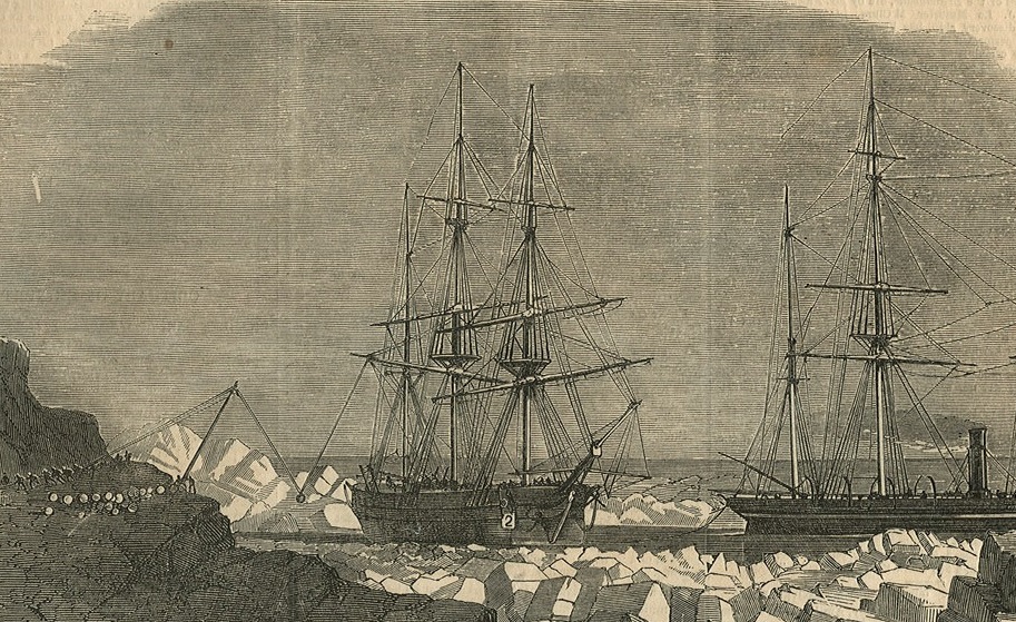
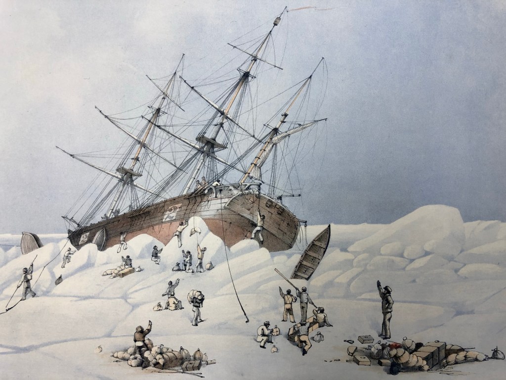
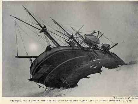
