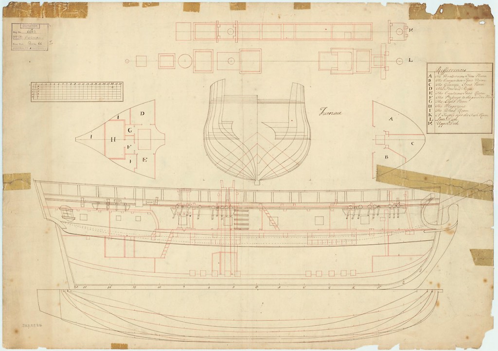
Traditionally, the Royal Navy’s program of Arctic exploration is represented as having commenced with the Constantine Phipps Expedition towards the North Pole in 1773.1 Phipps and his crews pushed north to above 80° latitude near Spitzbergen, before having to turn for home. Though the Phipps Expedition set many precedents for later polar exploration missions, it is Captain Christopher Middleton who deserves wider recognition for his trailblazing 1741-1742 Hudson’s Bay Expedition .2 This was the first Admiralty mission to search for a Northwest Passage.3 I will argue that Middleton also deserves credit for commanding the first Royal Navy expedition to explore an area north of the Arctic Circle.4 He had reached this far north in the first bomb vessel modified for northern exploration (which set the precedent for a century of discovery missions).5 During his time in Hudson’s Bay, he conducted a program of scientific research spanning several disciplines. After he arrived back in England, a dispute with Arthur Dobbs – his armchair-cartographer nemesis -marred his reputation and cast doubt upon his important discoveries.
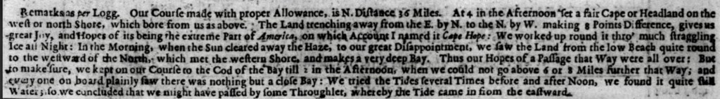
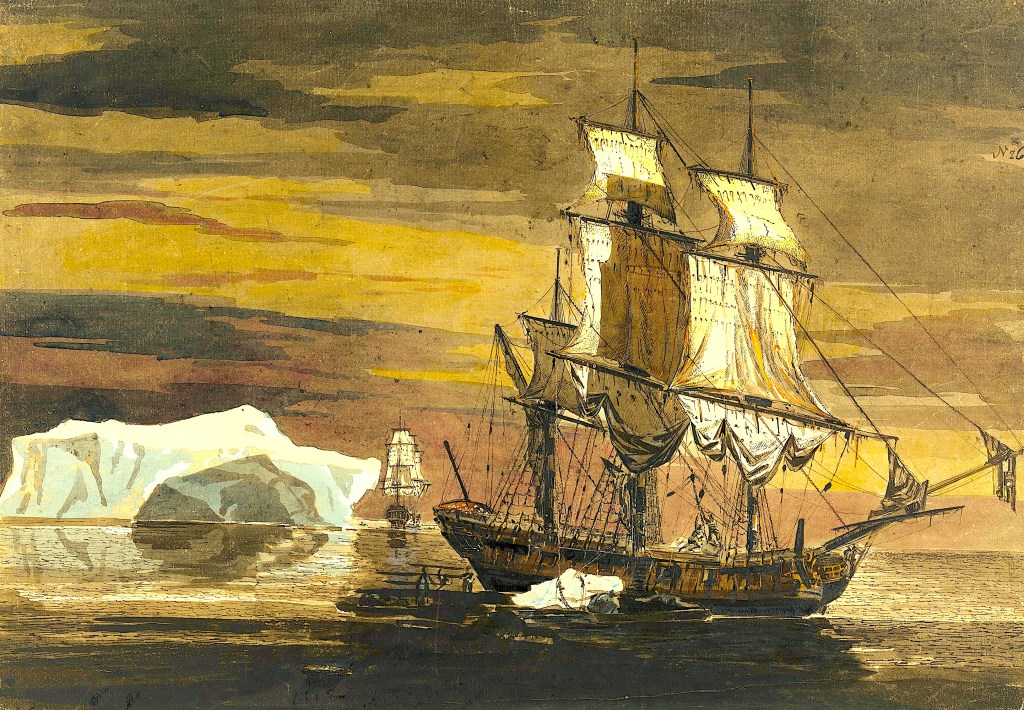
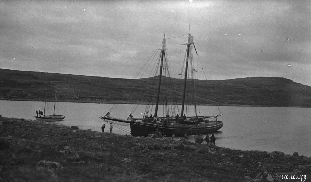
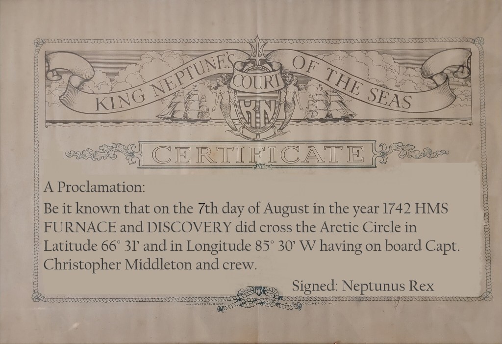
Early on the morning of August 7th, 1742, Captain Christopher Middleton nervously paced the quarterdeck of His Majesty’s Ship Furnace.6 He and his crew believed they were on the threshold of a historic discovery: A northwest passage towards the “South Sea” (the Pacific Ocean). These explorers had diligently clawed their way up Roes Welcome Sound, between the northwestern shores of Hudson’s Bay and Southampton Island. Standing into danger, they had picked their way around “islands of ice” (icebergs) and “ledges” (land floes). When they could find no favourable winds, they had even used cables anchored to the ice to haul the ships north from berg to berg.7
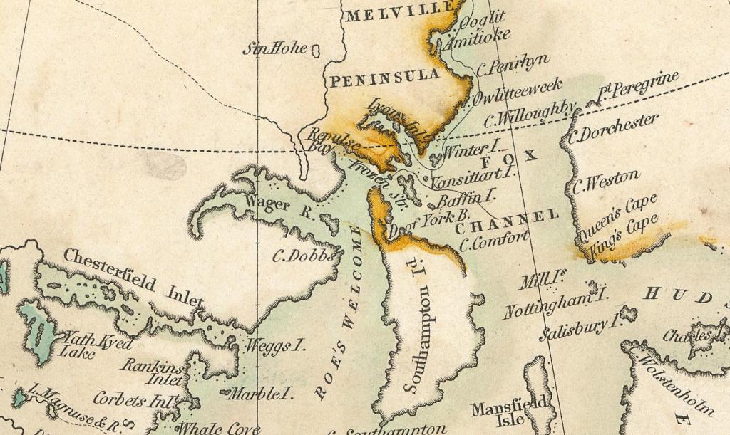
In the hazy morning twilight of those extended northern days, Furnace had been working around a promontory which Middleton had just named “Cape Hope.” He believed this could represent the “extreme part of America,” (or the northern most point of the North American continental landmass) a major milestone along the way of achieving his Admiralty mission to discover the fabled maritime route westwards.9
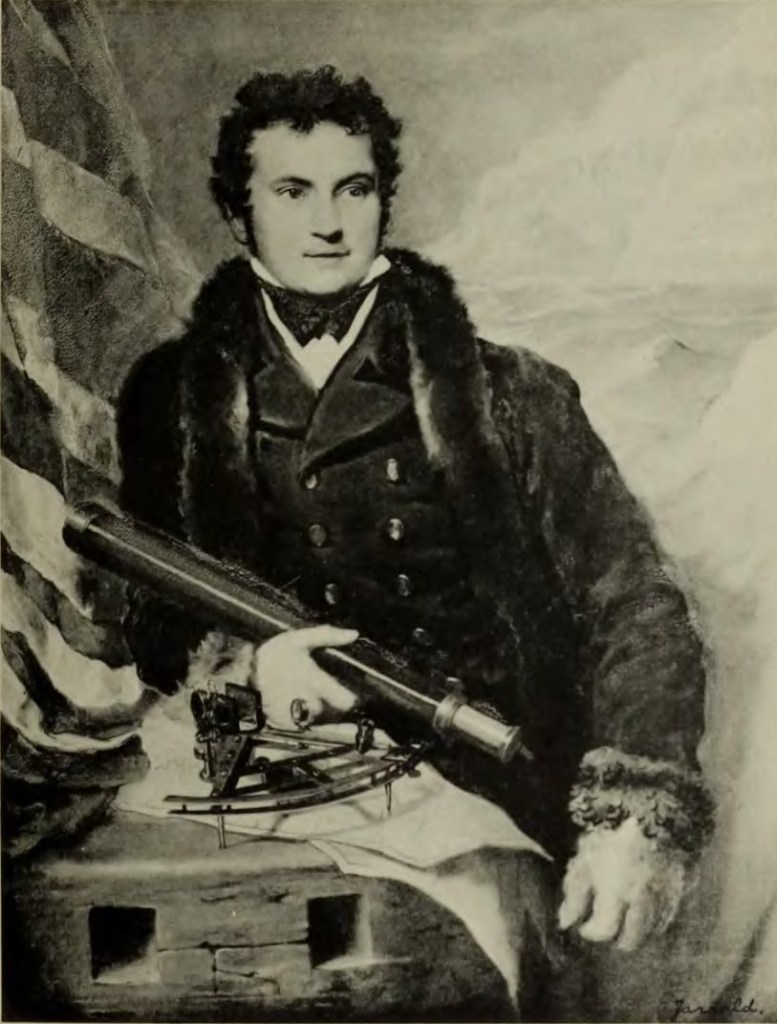
Middleton was a skilled navigator, who had outfitted his ships with the latest navigational devices. He employed these to survey under exceptionally challenging circumstances.10 His career had prepared him for the rigors of commanding a discovery mission in the Bay.11 After early service aboard a privateer in North American waters (during Queen Anne’s War, 1702-1713), he had worked for many seasons as a merchant captain with the Hudson’s Bay Company (HBC), sailing between England and the HBC factories of the Bay on yearly supply missions.12 His experiences commanding HBC sloops had led him to enthusiastically support a popular European belief that the undiscovered shores of the Bay concealed the beginnings of the Northwest Passage.13 In early 1741, with the support of an influential ally and confidant, Arthur Dobbs, he had left HBC service to secure the command of an official Royal Navy exploration mission.14 The crews of his two ships – Furnace and the small tender Discovery – were the first Europeans to navigate these waters (whose adjoining lands were the ancestral territory of the Aivilingmiut Inuit).15 They had endured many hardships since departing England on 8 June, 1741. A dozen of their mates had already perished.16 The dedicated assistance of both the HBC staff and local indigenous communities at and around the post at Churchill, over the winter of 1741-42, had prevented a much greater loss of life.17
As the sun burned off the haze, the watch on deck sighted high land continuing westwards from under the cape – So far, so good. But then a low shoreline materialized across Furnace’s stout bows. The land stretched around to the starboard beam. This day would bring no happy run far to the west – Christopher Middleton had discovered another bay.19 Disappointed at being “embayed” and turned away from his main objective, he named these waters “the Bay of Repulse” (the Inuktitut name for these enclosed waters is Aiviliup Tariunga). The next few days would see the expedition halted from further progress north by an impassable barrier of ice at the top of Southampton Island. The captain went ashore with two healthy crew members and an indigenous guide, climbed to the highest point he could find, and surveyed the distant shores. From this vantage he saw an iced-over passage extending towards the east, and named this the “Frozen Strait.”20 Given what would befall him upon his return home, Middleton may well have lived to regret ever having been up here in 1742. Today we can acknowledge that he started something in this northwest corner of Hudson’s Bay: An organized program of northern discovery that would eventually see the mapping of vast extents of what would become the Canadian Arctic.
At the northern tip of Southampton Island, the navigation season was fast coming to an end, with the expedition far from any safe harbour. Scurvy – the dreaded disease that had already carried off a dozen of their comrades – was affecting an alarmingly high number of the crew.22 Middleton held a council of the expedition’s leaders. Rather than risk being frozen in for the long winter months, they made the wise decision to turn for home. Returning down Roes Welcome Sound, the expedition paused for officers to take a few last observations, and to better search the shores for some other opening west. Lt. John Rankin and William Moor – Middleton’s cousin, longtime mate, and the commander of the Discovery – went off in the boats to complete the first accurate surveys of the mysterious Marble Island. This ghostly white island, formerly known as Brook Cobham, was connected to the disappearance of the HBC’s 1719 James Knight Expedition (which had vanished searching for precious medals and the illusive entrance to the Northwest Passage). Moor and his boat crew might have actually seen remains of the lost expedition.23
The journey home was difficult: the ailing crew had to contend with a stormy Atlantic crossing. The battered ships reached the Thames in early October, tying back up at Gallions Reach. Though exhausted, Middleton immediately threw himself into the task of working up his findings: He had the expeditions’ clerk, John Wigate, copy his journal; he produced charts featuring his updated surveying work; and he drafted a paper on his scientific observations.24 In contrast to several exploration missions before and after this, the leadership had survived to communicate this hard-earned knowledge home.
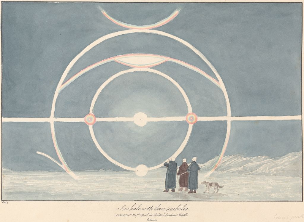
Furnace’s journal and the paper “Account of the Extraordinary Degree and Surprising Effects of Cold in Hudson’s Bay, North America” abound with observations on topics as varied as permafrost, tidal conditions, the depth of freezing of the waters, types of flora and fauna, and the effects of cold on European supplies and provisions.25 Middleton devoted considerable attention to describing ailments endured by crewmembers (such as frostbite and scurvy). His journal entries for the months of overwintering at the Churchill River HBC establishment recount his ongoing efforts to secure quantities of game (mostly birds) and vegetables for his men. He also demonstrated some knowledge of the anti-scorbutic properties of fresh foods. Middleton’s descriptions of sun parahelia (“sun dogs”) and his efforts to measure the submerged depths of massive icebergs make for fascinating reading. When presented at the Royal Society, this paper earned him the prestigious Copley medal and monetary prize.26
Unfortunately, details about his expedition’s route in Hudson’s Bay set him on a collision course with Arthur Dobbs.27 Dobbs had invested too much effort and money to concede that there was no passage west out of the Bay. He also would not abandon his campaign to break the HBC monopoly on trade (which he believed was stifling North American exploration).28 Dobbs concocted a narrative that saw Wager Bay – which Middleton’s crews had surveyed over several weeks in July – as the true corridor to the Far East. In early 1743 he set out to convince Middleton to amend his statements about Wager, to allow for the continued possibility of a path westwards out of the Bay.
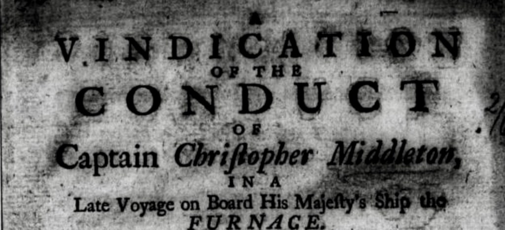
There were hazards ahead, but Middleton held his course: He maintained that there were only impassable rivers and streams leading westwards into the interior of the massive continent. Middleton’s findings contradicted Dobbs’ views and could undermine his whole project, so with brutal efficiency Dobbs denounced his former ally and induced the captains’ shipmates to turn against him. Lt. Rankin, Surgeon Edward Thompson, and John Wigate all deserted Middleton. Most cutting was the defection of his cousin and longtime Ship’s Mate, Moor. Dobbs accused Middleton of taking a bride from his former employer, the HBC, to conceal his true discoveries. He followed this with claims that Middleton had invented the Frozen Strait, and that he had falsified information about the shape and extent of Repulse Bay.29 Dobbs’ speculative geography – he had never and would never journey near Hudson’s Bay – cast doubt on the existence of a real strait, even as he conjured up a great western corridor communicating out of Wager or Repulse Bay. Middleton replied by publishing a 165-page defence of his conduct, which reproduced some of Furnace’s daily log, and relevant correspondences (including between himself and Dobbs).30 Despite the calumnies of his senior staff, fifteen of his crew members came forward to provide statements in his defence.31 Far from settling the matter, Middleton’s Vindication caused a tit-for-tat exchange of publications that further damaged his reputation.32 In several of his publications about the history of British exploration, historian Glyn Williams revisited the events of the Middleton Expedition and explored the escalating controversy. Williams concluded that “Middleton’s story is a sad one, for he was an outstanding scientific navigator and a fine explorer whose career was wrecked by a malicious campaign of denigration.”33
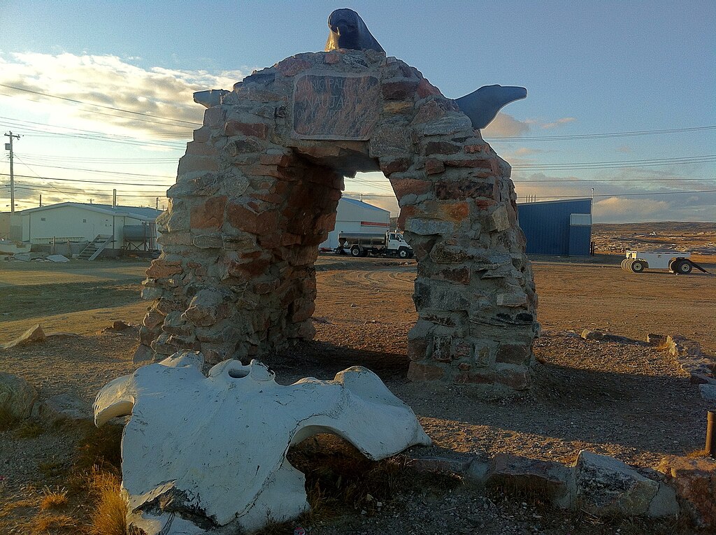
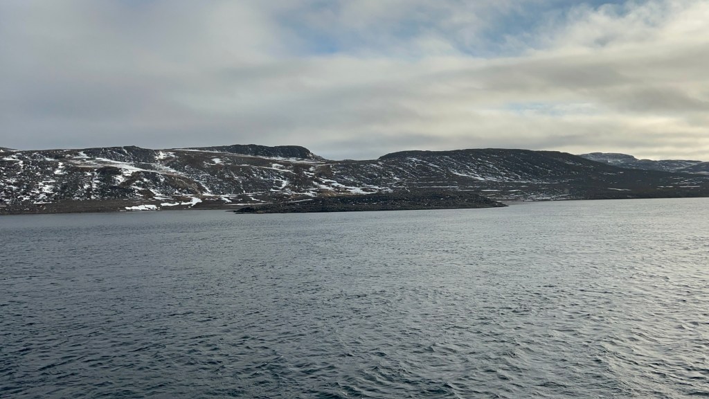
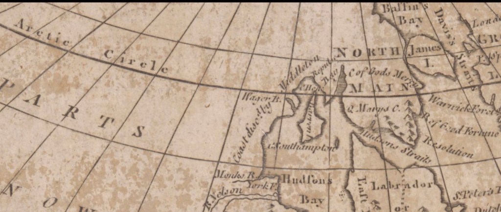
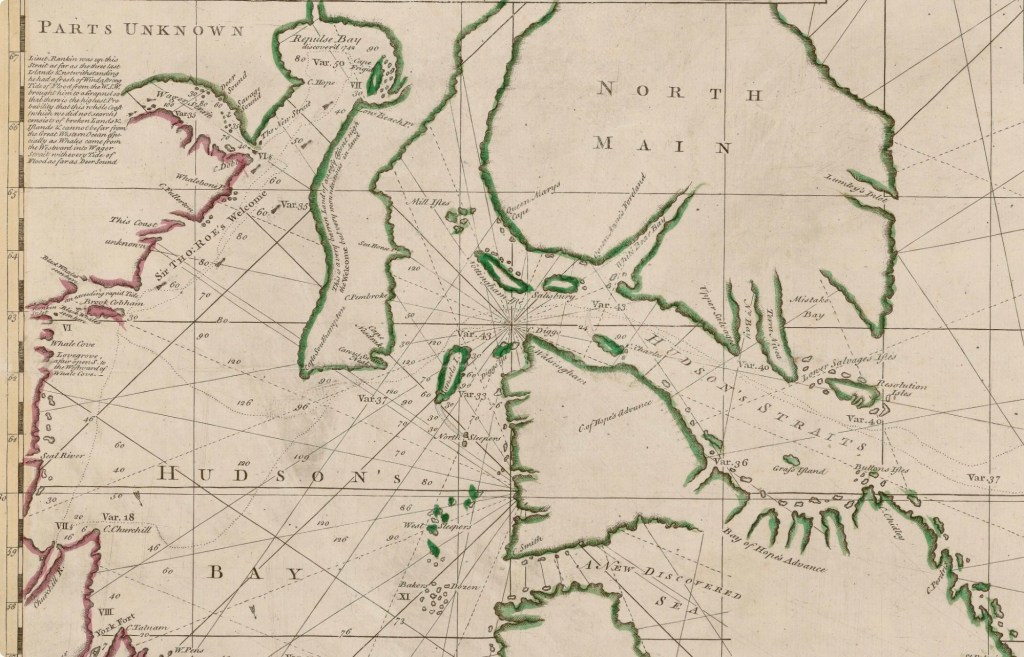
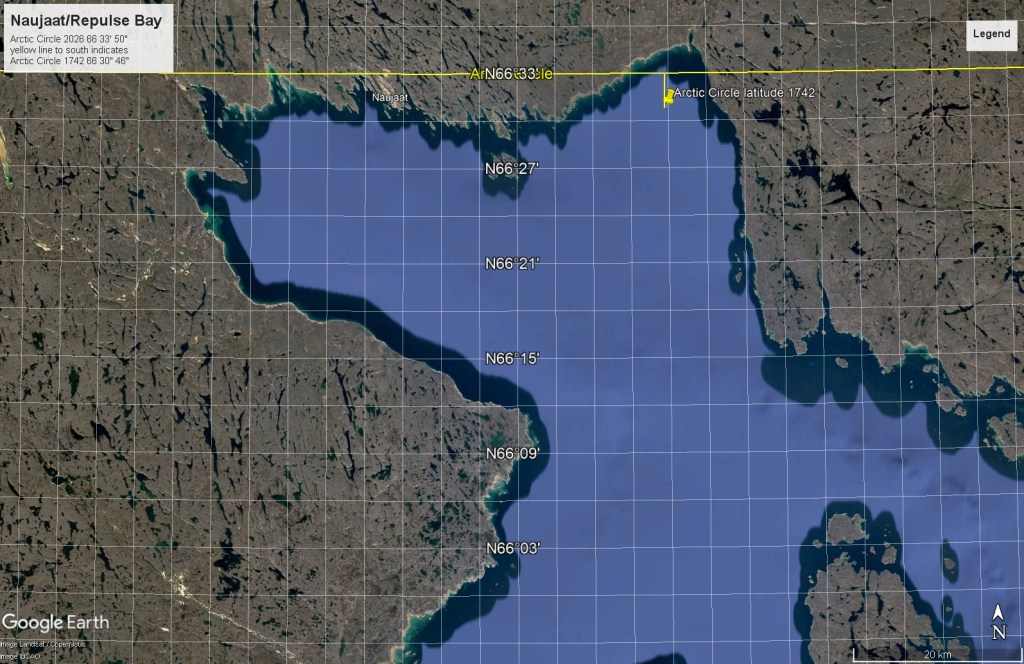
Lost amidst all the rancor was an achievement, which may have had little import then, but should now: Christopher Middleton’s expedition had been exploring the Arctic!34 As noted above, Furnace rounded Cape Hope on the morning of 7 August 1742 with crew believing it could be the last and highest point of land of continental North America. The modern town of Naujaat (formerly named Repulse Bay) is located about a third of the way westwards along the northern shore of Repulse Bay. It is one of the few communities in the world located directly on the Arctic Circle, at latitude 66°33’50″ north.35 This line of latitude passes just inland of the Bay’s northwestern shore, where there is a small inlet or river mouth that continues towards North Pole Lake (a notable overwintering spot in the later expeditions of Dr. John Rae). East of Naujaat, the shoreline indents towards the northeast, forming Haviland Bay.36 It is here that the Circle latitude passes from the rocky shores into the shallow waters near Qaggitalik Point.
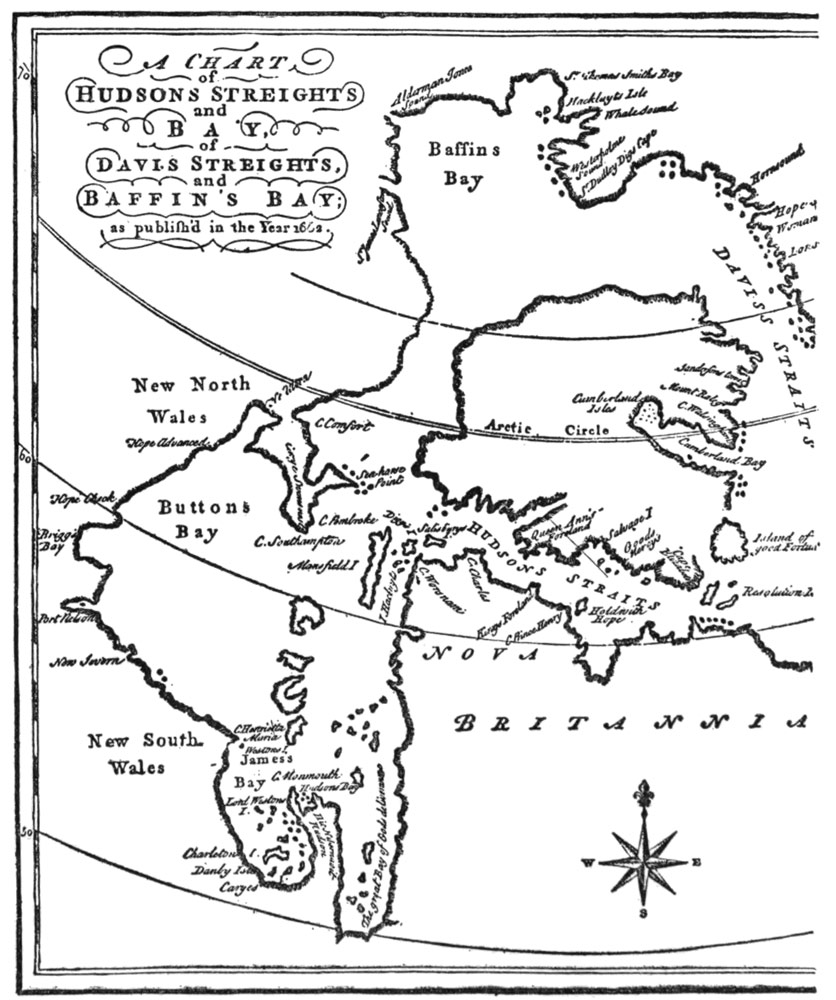
Despite Middleton’s ships having remained only briefly in these sheltered waters, we have several important sources that indicate that he or his officers circumnavigated Repulse Bay in Furnace or the ship’s boats: Middleton’s HMS Furnace ship’s log; published correspondences and accounts; and cartographic records. His crew conducted detailed depth soundings, referenced in the 6-7 August 1742 log entries. These soundings are indicated on his contemporary map and appear as numbers representing the depths (measured in fathoms) of various locations in the Bay.37 In a letter dated 27 November 1742, Middleton described to Dobbs how he had proved Repulse Bay did not actually represent the beginnings of a corridor to the west: “The said Strait [Roes Welcome Sound] ends to the westward of Cape Hope, in a Bay 20 Leagues, and 15 Leagues broad, which lies W.N.W. By true Bearings; and we carefully surrounded it, sailing up to the very Bottom within 2 or 3 Leagues, and found no Appearance of a Passage for either tide or Vessels. All the way I sail’d from Cape Hope, quite down to the bottom of this Bay, I tried the Tide; and all round I found neither Ebb nor Flood, which must have appeared had there been any.”38 As they sounded the depths of Repulse Bay and collected tidal information, Middleton’s boat crews, minding their Admiralty orders, had thoroughly examined the shoreline to search for any outlets.
Let’s press on towards the waters of Haviland Bay, to consider what Middleton’s highest northing actually was in 1742. This author was surprised to discover that the Arctic Circle is not a fixed line of latitude, and neither is it now located where it was in Middleton’s time. Each year the Circle latitude wanders at least 14.5 meters towards the geographic North Pole.39 This movement has, over the last 284 years, taken it more than 4 kilometers north up into shallower water. By this simple calculation, the 1742 Circle latitude would be 66°31’45″ north. A more complex calculation of “precession” or the “Obliquity of the Ecliptic, Nutation and Latitudes of the Arctic and Antarctic Circles,” was developed by French astronomer Jacques Laskar to calculate this gradual deviation. Laskar’s algorithm places the August 1742 Circle latitude even further south at precisely 66°31’33.6″.40 As Furnace or the sounding boats crossed this latitude, Middleton Expedition members surveyed, sounded, and recorded information about the Canadian Arctic. At the very dawning of Admiralty exploration missions, It was important work, which deserves to be recognized.
Five years after Middleton’s expedition, Dobbs organized the financing of a private venture which aimed to prove Middleton wrong: To find the so-called “Wager Straits” and also return to Repulse Bay.41 This next attempt to find the Passage in Hudson’s Bay would be led by William Moor, who commanded in a smaller ship, Dobbs Galley.42 This expedition did end up definitively proving Wager was not some continental corridor to the “South Sea.”43 Moor turned back well before he reached the higher latitudes of Roes Welcome to investigate Repulse Bay.
The results of the Moor Expedition also failed to convince Dobbs that he had misjudged the geography of the Canadian north. Meanwhile, Middleton’s career languished. This experience captain and gifted navigator saw no further opportunities to lead discovery efforts. Dobbs’ accusations succeeded at throwing suspicion on him. An inevitable Admiralty enquiry into the accusations did not support Dobbs’ claims against Middleton, but it also stopped short of clearing his name or commending his efforts. After a period in command of HMS Shark, he found no further naval employment after the Peace of Aix-la-Chappelle concluded the War of the Austrian Succession. The HBC also demurred from reinstating him to Company service. He retired to Yorkshire, where he died in early 1770, still on half-pay.44
Dobbs’ campaign would cast a long shadow, as geographers continued to imagine the Bay as a possible beginning to the Passage. The inland explorations of the HBC’s Samuel Hearne – who departed from Churchill and reached the shores of the Arctic Sea in 1772 – should have been enough to disprove the hypothesis of an inland corridor west. However, it took the exploration missions of James Cook, George Vancouver, Alexander Mackenzie, and others to the “far shore” – the Pacific and Alaskan coasts – to establish that there was no continental connection below the Bering Strait.45
In the early nineteenth century – after the conclusion of the French Revolutionary and Napoleonic Wars – the Admiralty turned again to northern discovery missions. John Barrow (Senior), Second Secretary at the Admiralty, carefully laid out his case for resuming the quest for a Northwest passage in his 1818 Chronological History. An oft-cited quote links the quest for a passage, imperial rivalries, mercantile interest, and British national pride:
“From the numerous attempts that have been made from the earliest periods of British navigation to the end of the eighteenth century, it is sufficiently evident that the discovery of a north-west passage to India and China has always been considered as an object peculiarly British. It engaged the attention and procured the encouragement of the first literary characters of the age, and the most respectable of the mercantile class. It has received the patronage of sovereigns, and the promise of rewards from different parliaments. It never failed to excite a most lively interest among all conditions of men. The principal maritime nations of Europe have at different times been engaged in the same enterprize…”46
He briefly summarized the events of the Middleton Expedition. He gave particular attention to Dobbs’ charges. Barrow mentioned that the Admiralty was suspicious of Middleton’s motives, and repeated the accusation that he may have accepted an HBC bribe to omit some discoveries from his accounts. He also seemed to doubt that a Frozen Strait could be located to the east of Middleton’s Cape Hope.47
Seventy-nine years after the 1742 Expedition, William Edward Parry, on his second Arctic expedition, finally vindicated Middleton’s claim to have discovered the Frozen Strait. Parry’s 1821-1823 Expedition marked the first (known) European return to these waters. Parry commanded two reinforced exploration bomb-vessels, Fury and Hecla. Onboard his ships, he had a contingent of young officers and warrant officers who would become famous for further naval explorations of the polar regions.
Parry had just returned from his phenomenally successful expedition of 1819-1820, where he had proved more than capable of resolving outstanding disputes about geographic features: His expedition had established that Lancaster Sound was a passage, and not, as John Ross had recently maintained, a closed inlet. He had fully exploited this sound by driving his ships westwards incredibly deep into the Arctic archipelago.48 For this new expedition, he was under orders to resolve the cartographic chaos the Dobbs-Middleton feud had introduced into North American geography. His junior officers – including James Clark Ross and Francis Crozier – probed the areas along the coast of the Melville Peninsula for a path southwards towards the upper reaches of Roes Welcome Sound. Parry’s good fortune continued: Where Furnace had been halted from further progress east towards the Fox Channel by ice conditions in 1742, Fury led the way west through the Strait and on into Repulse Bay in 1821.49
In 1741 – in the midst of an escalating war of imperial European powers – Christopher Middleton sailed to Hudson’s Bay to locate a Northwest Passage. It was an era when Europeans had not yet laid eyes on vast extents of the North American continent. When explorers bothered to consult indigenous peoples, their knowledge about their own ancestral lands was co-opted to support speculative geography: Fantastical landscapes, vast inland seas, expansive straits, and rivers shimmering with copper and gold. Spain held a virtual monopoly of trade in the Pacific, despite the northern coasts of the Pacific coastline being unknown. French explorers and fur traders were pushing west from New France along lakes and river systems. In Britain, there was great enthusiasm for the idea of a commercially viable maritime trade corridor stretching to the South Sea. The Admiralty prioritized the search for the Passage over the adjacent quest for the North Pole, the search for a massive and temperate southern continent, or the exploration of the far side of the World. Christopher Middleton did not find a passage out of the Bay in mid-1742, and he paid a terrible price for it. His expedition deserves to be credited for what it did accomplish: On the first Admiralty discovery mission of its kind, along a section of the Hudson’s Bay coast that had destroyed or turned back other expeditions, Middleton diligently surveyed, he sighted the Frozen Strait, and, in the very corner of a bay that had repulsed his hardy crew from their main objective, he reached the Canadian Arctic.
CLICK NEXT PAGE FOR ENDNOTES:
