A hundred-and-seventy-one-years ago, crew members of the supply ship Breadalbane gazed forwards from the bow rails, looking towards the forbidding cliffs and unknown shores of Beechey Island, in the High Arctic. Today, the spot where they once stood is preserved 310 feet/ 95m underwater, near those same cliffs. Breadalbane’s shipwreck endures as a magnificent time capsule of a remarkable era of Arctic exploration.
Breadalbane’s broken bowsprit and head rails. The bowsprit was most likely sheared off as the ship plunged through the ice. Credit: used with written permission of Parks Canada, who retain copyright
This fourth post will focus on the program of archaeological research conducted ten years ago by Parks Canada and the Canadian Armed Forces at Beechey Island, Nunavut. We will also provide a brief description of the wreck, accompanied with remarkable images. The first post summarized the loss of this supply ship in the High Arctic in August 1853, while provisioning search expeditions looking for the Franklin Expedition. The second post described the original 1980s discovery and exploration of the wreck. The third post showcased the construction of an archaeologically-based scale diorama of this National Historic Site of Canada.
Two decades after the last visits to Breadalbane, there was a revived interest in exploring the wreck. The 2012 Canadian Armed Forces (CAF) work involved a preparatory survey by a naval dive team using a remotely operated vehicle (ROV). Parks Canada archaeological participation would correspond with the 2014 iteration of Operation NUNALIVUT, a CAF exercise in the Arctic.
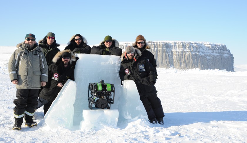
Combined dive team photo Operation NUNALIVUT 2014 with Beechey Island’s cliffs in the background (left to right): Jonathan Moore (Parks Canada Underwater Archaeology Team), Jesse Rodocker (SeaBotix Inc.), Petty Officer Second Class Geoff White, Petty Officer First Class Yves Bernard, Leading Seaman Luke Therrien, Lieutenant Greg Oickle and Leading Seaman Quinn Audette from Fleet Diving Unit (Atlantic). Credit: Crown Copyright Department of National Defence/Canadian Armed Forces RE2014-0013-140 (cropped)
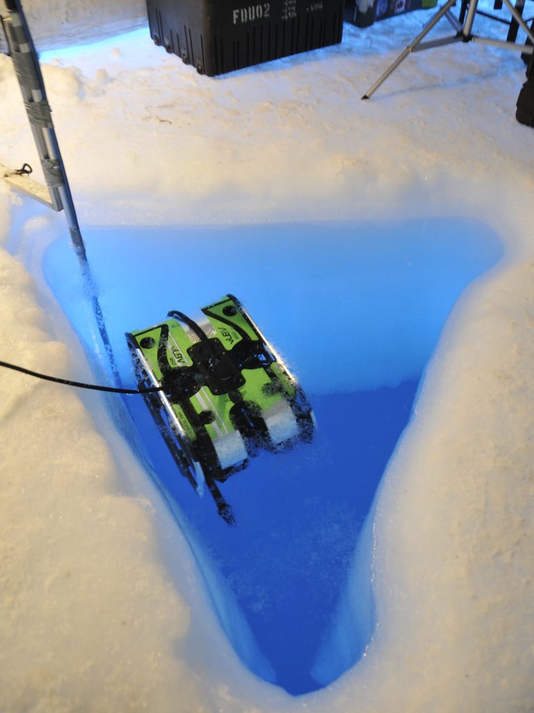
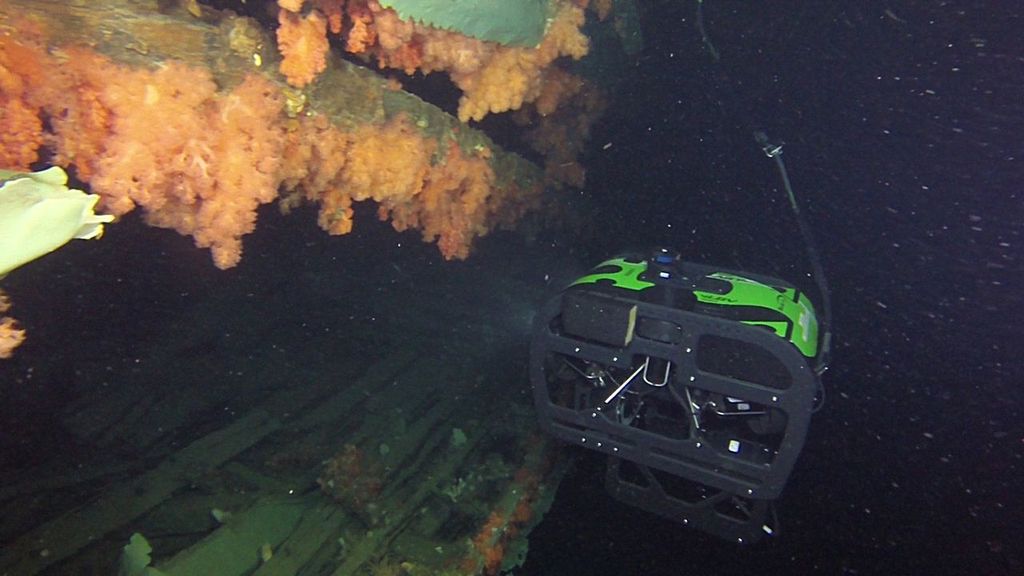
This visit involved surveying and filming efforts employing SeaBotix ROVs, one of which used multibeam sonar to guide the exploration to sites of interest, and to construct a detailed visual survey of the site. Parks Canada Underwater Archaeologist Jonathan Moore was the permit holder for the archaeological program, working from an ice camp 330’/100m above the seafloor.
One of the Seabotix ROVs in the ice hole above Breadalbane Credit: Crown Copyright Department of National Defence/Canadian Armed Forces RE2014-0013-139 [cropped]
We are very excited to share stunning ROV images from this visit. Some photos were generously provided to us by Parks Canada, and others are from the Department of National Defence. These allow us to navigate around and inside this wrecked supply barque to note some of her outstanding features.*
The ship’s port bower anchor, resting on the seabed near the copper-clad stem. Credit: used with written permission of Parks Canada, who retain copyright
The return to Breadalbane was an exciting phase in the archaeological survey of Franklin Expedition-related sites, continuing on from the 2010-2011 Parks Canada-led location and dives on HMS Investigator at Mercy Bay, Northwest Territories, and coming a short time before the discovery of Sir John Franklin’s lost flagship, HMS Erebus, in September 2014. One objective of the underwater survey was to assess changes to the Breadalbane since the 1980s.
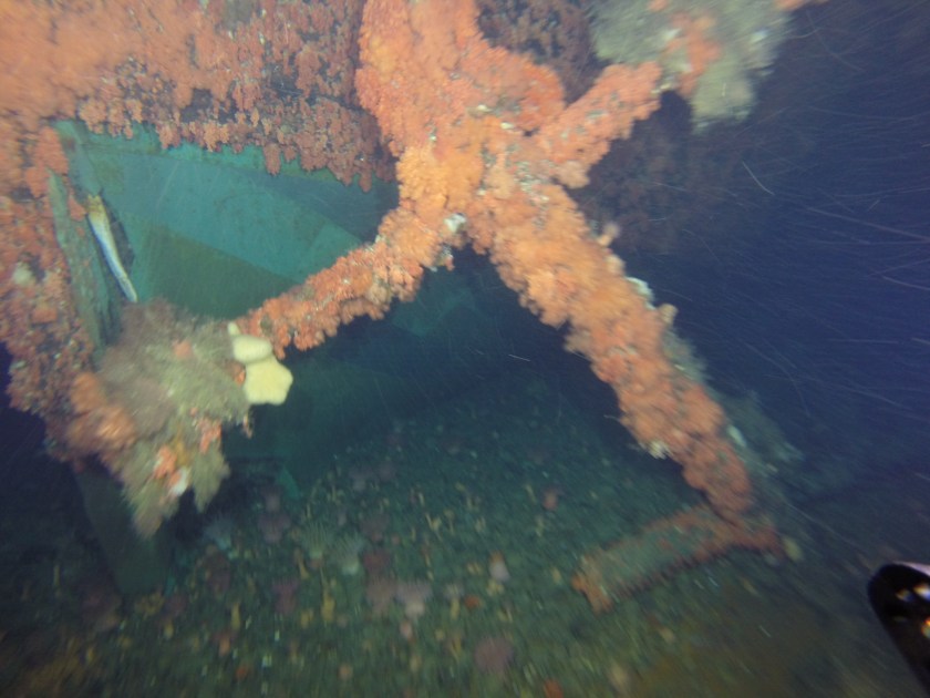
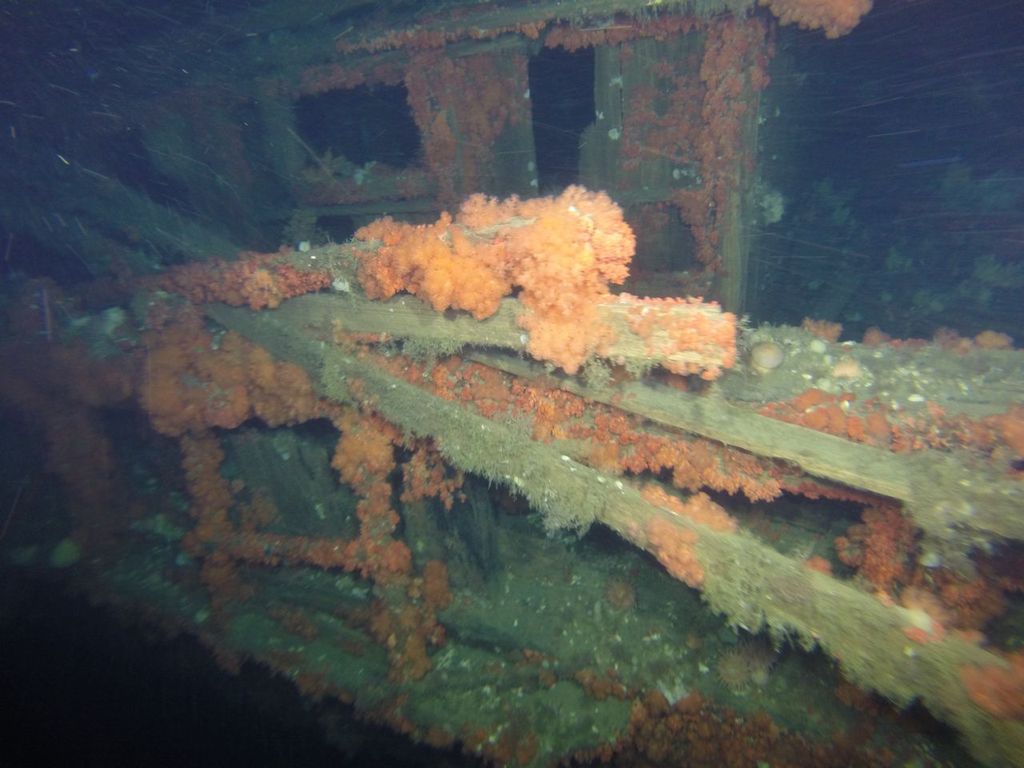
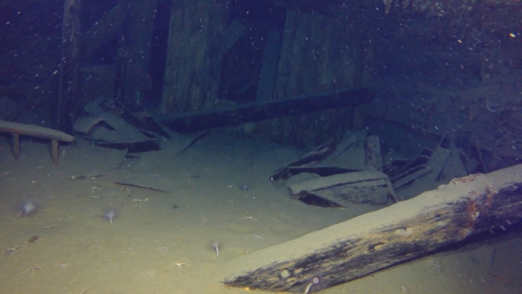
The broken port quarter rail and rear of the unusually large deckhouse, showing fallen roof planking, the tight fit with the ship’s side rails, and the small aft deck. This area is little changed in 30 years. Credit: Crown Copyright Department of National Defence/Canadian Armed Forces RE2014-0013-133
Though Breadalbane is often treated as a footnote in the saga of Arctic exploration, and as “also wrecked” in the high-drama surrounding the lost Franklin Expedition, it is an incredible site – many areas have not witnessed significant deterioration.
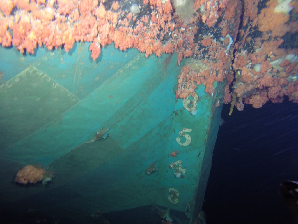
Breadalbane’s well-preserved lower hull, clad in copper sheathing, and stern post (the rudder lies under the wreck on the seabed). This shows the draft marks that climb up the post. Credit: Crown Copyright Department of National Defence/Canadian Armed Forces RE2014-0013-131
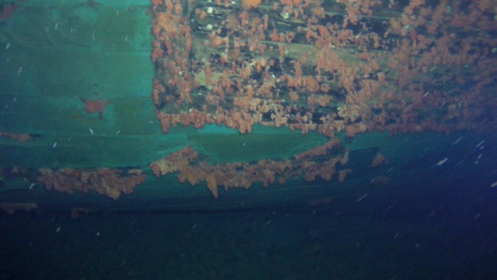
The marine life growing at the wreck site is as stunning as what Dr. Joe MacInnis and his teammates encountered in the early 1980s.
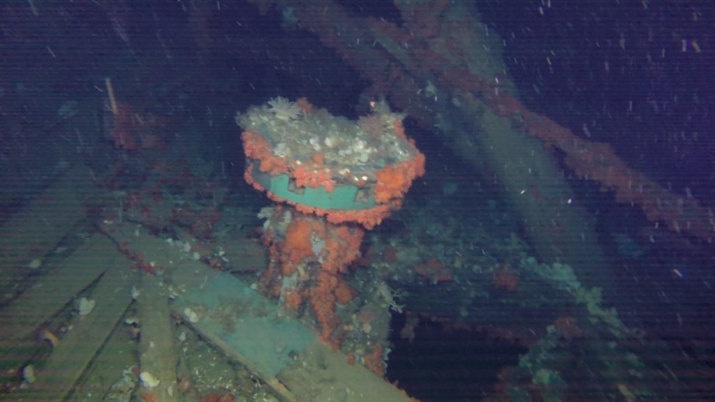
Breadalbane’s capstan between the forward wall of the deckhouse and a companionway. Credit: used with written permission of Parks Canada, who retain copyright
Breadalbane helps us understand the range of options available to the British Admiralty for reinforcing mid-19th Century vessels intended for polar service. This supply vessel was not a “paper ship”, totally unprepared for the rigors of Arctic service, but rather received hybrid modifications which were suitable to her intended role: “Continuation service” outbound for the Lancaster Sound.1
Breadalbane was going north in the high summer. The ship was not intended to be beset by ice – frozen-in over the long, dark months. The commanding officer of HMS Phoenix, Captain Edward Augustus Inglefield, was under specific instructions to unload Breadalbane’s vital cargo at Beechey, and then get her turned around and on her way back south before the season changed and all the navigable waters froze.
Breadalbane’s interior spaces. The Lower deck looking aft from near the companionway, towards closed cabins near the stern. Note the heavy timbers to reinforce the hull. Credit: used with written permission of Parks Canada, who retain copyright
An 1853 Lloyd’s special survey report notes that the outside of the bows was shielded by 4″ thick Canadian elm planks, which extended 7′ / 2.1m below the water, from the stem back to a point even with the foremast. This was a lighter-duty version of the combined sheathing and iron-plates installed at the bows of the Franklin search ships.
Lower area of the starboard bow. This view shows the coppering of the lower hull and the beginning of the elm sheathing that extended 7′ down from the waterline and forwards to the stem. Credit: used with written permission of Parks Canada, who retain copyright
Ultimately, these reinforcements did not save the ship from being crushed. The unexpected movement of the ice south of Beechey Island on 21 August, 1853 was instantly fatal to the fabric of the lower hull. The ice created a large rent that stretches for 70’/ 21m along the starboard side, revealing the ship’s mostly empty cargo hold.
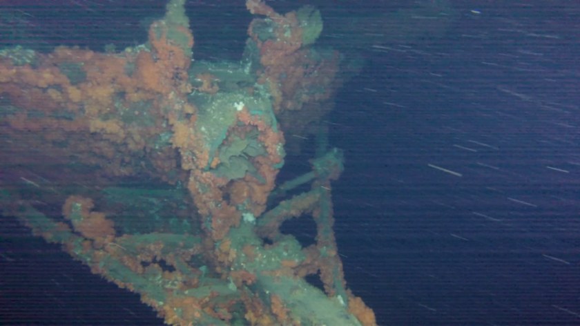
The ROV explores the massive hole in the starboard side, running along the bilge. The ice punched through the copper sheathing, ship’s side, and interior framing, before continuing on to damage supporting knees, bulwarks, and decks. Credit: Crown Copyright Department of National Defence/Canadian Armed Forces RE2014-0013-130
I would like to acknowledge the significant assistance of Parks Canada’s Underwater Archaeology Team, and especially Jonathan Moore, who generously shared Parks’ substantial research and the above images.
This is how the Captain of HMS North Star, William J.S. Pullen, described Breadalbane in a letter to John Barrow, written at Beechey Island soon after the sinking. At this time North Star was frozen-in on the inland side of Beechey. As noted in the first blog, the Lloyd’s survey report of early 1853 is an important source for interpreting the modifications Breadalbane received for her “Continuation Service” (a termed used in their survey) in early 1853. ↩︎
One-hundred-and-seventy years ago, the Breadalbane supply ship was proceeding North to a rendezvous in Greenland. This merchant ship had been built on the Clyde River, Scotland, in 1843. Ten years later, the crew succeeded in an important mission, but Breadalbane would not return from her Arctic service. Her shipwreck was located 130 years later by Dr. Joseph B. MacInnis and his colleagues. Currently, she is the most northerly identified Canadian Arctic wreck, and one of the most northerly in the World.1 She remains one of the most intact ships from the great era of polar exploration. Breadalbane’s wreck is a vibrant oasis of marine life in a brutally harsh environment.
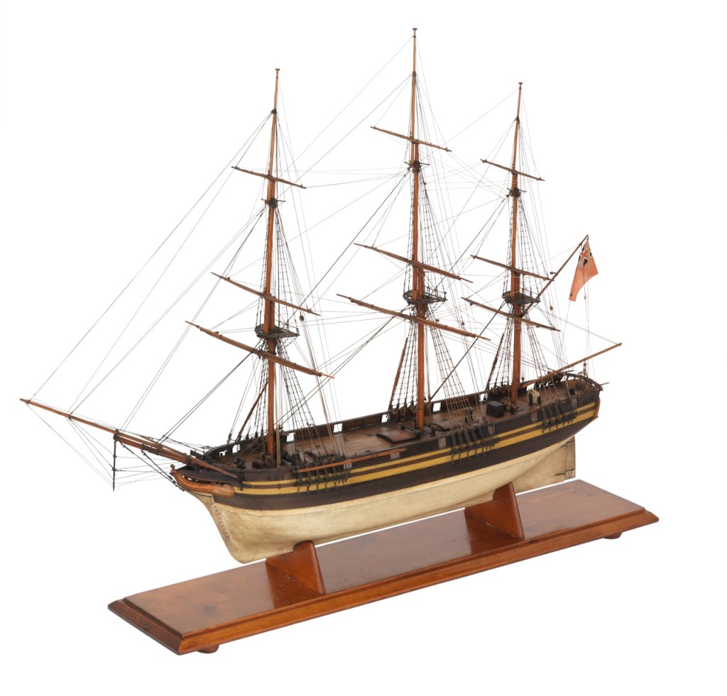
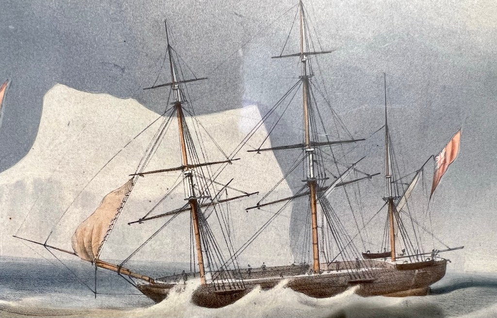
Of all our attempts to locate imagery and plans of Breadalbane, we have settled on this National Maritime Museum model of an 1830s merchant ship as best representing Breadalbane as she appeared before Admiralty modifications for Arctic service. Even the paint scheme appears similar to that found on the wreck. Credit: Royal Museums Greenwich SLR0726
Breadalbane was built by the firm of Hedderwick and Rankin in 1842-1843 near Glasgow, and was typical of hundreds of other merchant ships. She was roughly 125 feet from bow to stern (according to the Lloyd’s of London survey report for 1843, she was 117.8 feet, which could be a stem-to-sternpost dimension), and displaced about 430 tons, her moulded breadth was about 24 ‘, suggesting her overall width was greater. She was sturdily built, of a bewildering variety of woods, from all over the British Empire and beyond: African and American Oak, Quebec Rock Elm, Red and Yellow pine. Well-squared English and Welsh oak predominated. Unlike the later clipper ships, she was designed for economical transportation of goods, not speedy passages. Her bows were bluff, her proportions were generous (to incorporate capacious cargo holds) and her lines were simple. She was rigged as a barque–that is to say square sails on the fore and mainmast and a simpler fore-and-aft rigged mizzen mast near the stern. Compared to a fully-rigged ship, this simplified rig had only a small impact on the ship’s performance before the wind, while requiring less crew members.
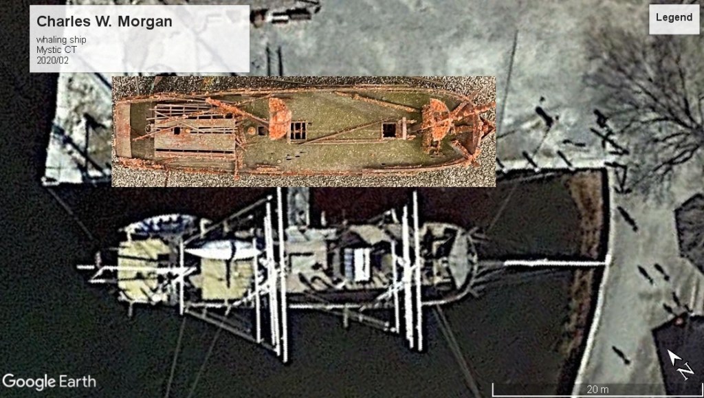
The Charles W. Morgan whaling ship, a museum ship at Mystic CT, barque-rigged and the most similar surviving vessel to Breadalbane. She was built two years earlier, and is slightly smaller, with the specialized features of a whaler-tryworks stoves for melting down blubber and davits for more whale-catching boats. Credit: Ken Mist, CC BY 2.0 https://creativecommons.org/licenses/by/2.0, via Wikimedia Commons
Breadalbane’s career thus far had involved routine voyages to transport goods to and from British India. She had been meticulously maintained. Upon an 1848 return from one such voyage, she had to be set right after a minor accident in Calcutta. She was repaired with teak sections and classed again at the highest level of Lloyd’s of London assessment, A1 for ten years, with the surveyor writing ” The barque is in good condition and eligible for the safe conveyance of dry and perishable cargos to and from all parts of the World.”2
Taken up for Admiralty service in March 1853 and given a refit and modifications for Arctic service (which we will describe in a future post), Breadalbane departed from the Thames Estuary 19 May 1853, fully loaded with provisions for the search expeditions, commanded by Captain Edward Belcher, which were then scouring the Arctic for traces of the Franklin Expedition and HM Ships Erebus and Terror. It was eight years to the day since Franklin’s ships had started off on their own fateful passage. Breadalbane arrived off Disko Island, Greenland, 8 July. After meeting up with her powerful consort, HMS Phoenix, a steamship, she proceeded along the western coast of Greenland and on up the Davis Strait. Breadalbane was not updated with steam engines and screw propellers like Erebus and Terror had been in 1845. Instead, she was towed through adverse winds and dangerous ice by Phoenix.
Breadalbane under tow off Disko, Greenland. This is the only representation we have ever seen that shows both the figurehead and the deckhouse at the base of the mizzen. Detail of E.A. Inglefield’s view of HMS Phoenix towing the ship, with HMS Diligence store ship aft. Credit Library and Archives Canada mikan 2837866.
Phoenix’s Captain, Edward A. Inglefield, commanded the resupply effort. He also kept a visual record, in the form of well-executed sketches of the major events of the 1853 passage. Despite worsening ice conditions, the ships continued to make progress with Phoenix in the lead, employing her steam power and reinforced bows in the novel role of icebreaking, cutting a path for Breadalbane while simultaneously towing her.
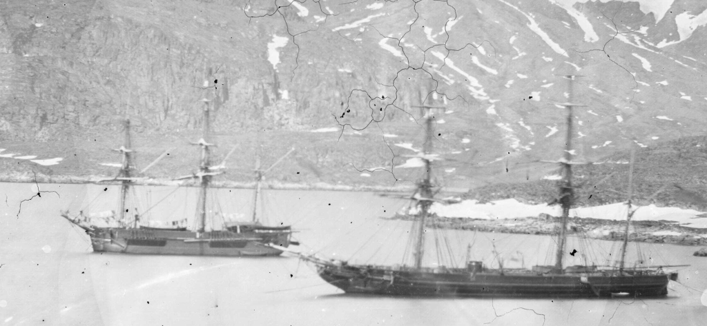
Inglefield took a photographic record of a later resupply mission, in mid-1854, which saw HMS Phoenix (right) again leading a storeship, HMS Diligence, to resupply the Belcher expedition (1852-1854) looking for Franklin. They were photographed at Godhavn, (Qeqertarsuaq) Disko Island, Greenland. Diligence was a similar barque to Breadalbane, but of earlier vintage. It appears that Diligence had been upgraded with partially reinforced ice channels under the fore, main and mizzen chains. Credit: Captain Edward Augustus Inglefield, Public domain, via Wikimedia Commons.
The ships arrived near Beechey Island off the southwest coast of Devon Island, 8 August. Beechey already had a special significance, as the spot where the Franklin crews had spent their first winter of 1845-46, onboard their frozen-in ships. It was now being used as a staging base for the Belcher expedition ships, with HMS North Star depot ship victualling the widely-dispersed search ships. For the isolated Royal Navy crews confined to Beechey for many months, Breadalbane and Phoenix’s arrival was a joyous time. News of home, new faces, and new supplies boosted spirits. Breadalbane’s goods were sustaining the largest of the Franklin searches.
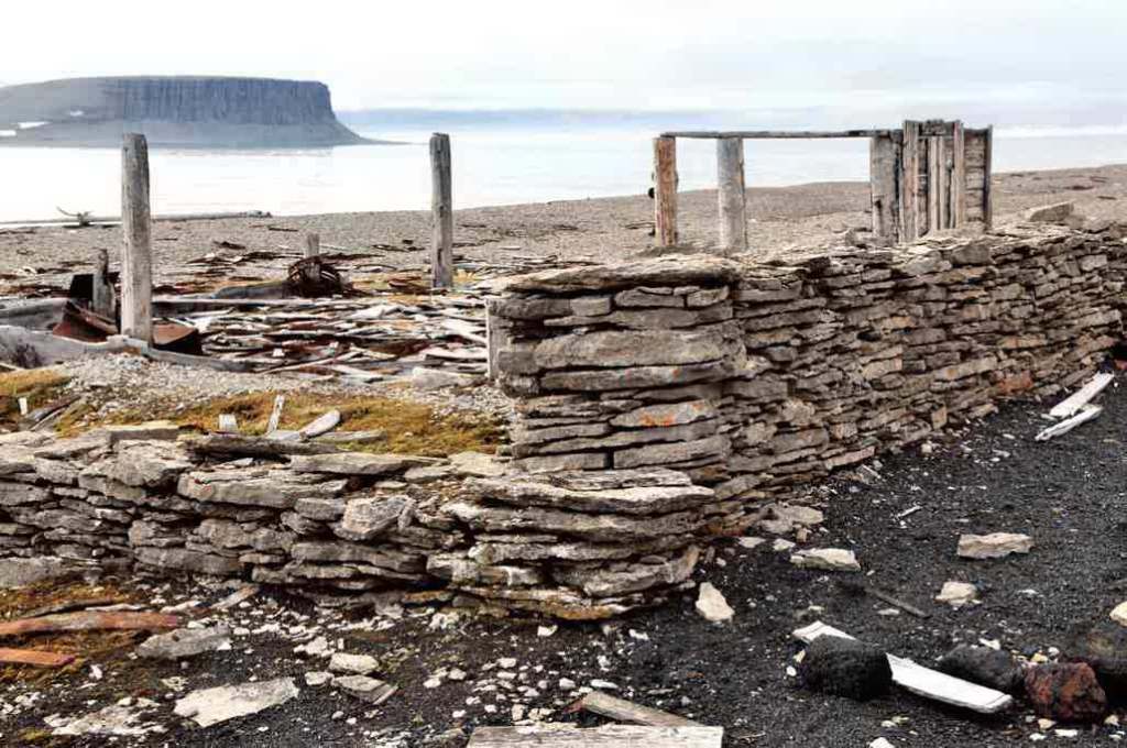
Beechey is an island of lost explorers, graves, monuments, shipwrecks, and house wrecks made from shipwrecks. These are the ruins of Northumberland House, constructed in 1852-53 under the direction of HMS North Star‘s Captain, Cmdr. W.J.S. Pullen. It was provisioned with supplies in case Franklin’s crews or others returned. The mast of a whaling ship (still standing in the 1980s), whose timbers also wound up incorporated into the house, can just be seen on the beach, with a view out to Cape Riley, Devon Island, across Erebus and Terror Bay. Credit: Ansgar Walk, CC BY-SA 3.0 , via Wikimedia Commons
Navigating the ice-chocked waters off Beechey proved to be challenging, so the next day the ship manoeuvred across Erebus and Terror Bay and in close to the bluffs at Cape Riley on Devon Island. Crew members begun shifting coal ashore. Ice remained a hazard, but the transport worked back inshore to discharge more cargo on 16 August.
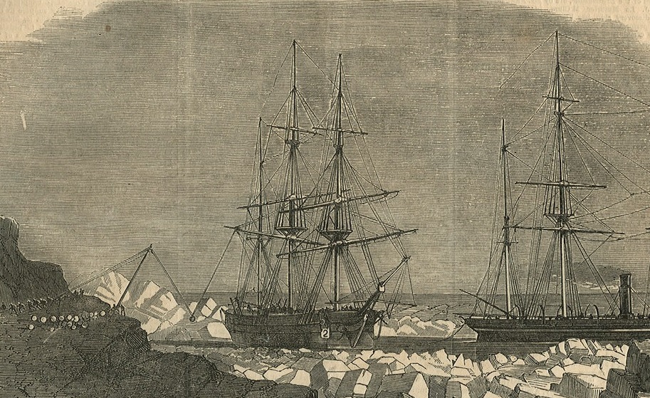
Breadalbane’s crew shifting supplies ashore at Cape Riley, Devon Island, in company with HMS Phoenix (at right). (Detail of) Illustrated London News 22 Oct. 1853. Credit: Frederick James Smyth, Public domain, via Wikimedia Commons
Unlike the events leading to final abandonment of Erebus and Terror, the details of Breadalbane’s loss, on 21 August 1853, are well-established. Descriptions by both Inglefield, and Breadalbane’s Second Master, William Fawckner, help chronicle the ship’s end. When most supplies had been unloaded, drifting ice began to descend on the area. The decision was taken to again evacuate the inshore area on the 20th. Sledging trips continued to remove more supplies to North Star. By midnight, Phoenix had worked her way to a position about a half-mile South of Beechey Island. Both ships were moored to a large flow. The ice crowded in, and the crew worked to save boats and to help Phoenix, which was thought to be in more imminent peril.
Edward Inglefield (1820-1894), HMS Breadalbane and HMS Phoenix caught in ice off Beechey Island, 1853. Breadalbane was a supply ship to an expedition that had the aim of recovering Sir John Franklin’s ill fated voyage in the Arctic. For sale in marine show in Oct. #history#navalpic.twitter.com/CDjzfSc6za
This remarkable work came up for auction a few years ago. It seems unlikely it was actually sketched by Inglefield, as it contrasts quite strikingly with his other depiction of the sinking. Here Breadalbane is shown heaved up on the ice, with HMS Phoenix nearby. This depiction has some unique features: A more ornate stern with three lights and false galleries (not depicted anywhere else), and lines which seem to indicate the bow sheathing.
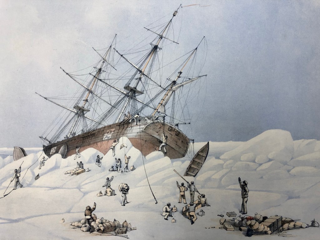
The worst of the ice passed aft of Phoenix, smashed the boats, and brutalized Breadalbane, which would have been sitting high in the water, in ballast trim. The ice first pinched the ship, sending tremors throughout, before crashing straight through the lower hull. This opened an enormous gash along the starboard side at the same time as it ground a smaller rent in the port bows. Interior spaces, particularly around the ship’s bows, were devastated, with decks and partitions snapping like matchsticks.
The moment when Breadalbane was crushed by ice, 21 Aug. 1853, by EA Inglefield, who witnessed the events from his command, Phoenix, ahead of Breadalbane. Close visual inspection of the transom seems to indicate that there is indeed a third sealed scuttle or light across the stern, matching a detail of the auction house sketch. Evidence does suggest that Breadalbane had two enormous “2”s painted on each side, to mark her role as a supply ship. Nothing of these markings has been located on the wreck. Credit: Edward Augustus Inglefield, Library and Archives Canada [detail of] mikan 2837463
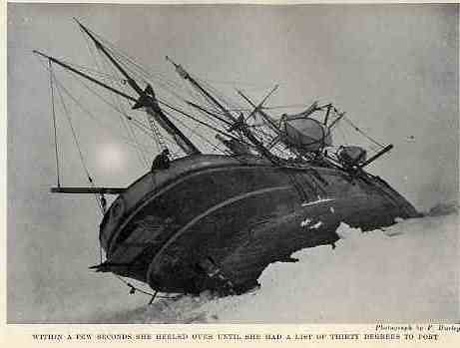
Inglefield arrived on scene and ordered Fawckner to assess the damage, as the ship settled lower by the bows. A cursory glance down the hatches into the main hold showed him that the ship was doomed. The 21-member crew worked to save a few possessions as the ice momentarily let up. Moments after all crew members had escaped over the ice, the ship plunged straight down with a rapidity that shocked all who witnessed the sorry end of Breadalbane.3 The process may have looked a bit like a sped-up version of Frank Hurley’s 1915 footage of Shackleton’s Endurance sinking in the Weddell Sea, Antarctica.
A World away, the most Southerly shipwreck, Sir Ernest Shackleton’s barquentine RRS Endurance, being gradually crushed by ice during the 1915 Imperial Trans-Antarctic Expedition. Endurance was located deep under the Weddell Sea in 2022. Credit: Frank Hurley via wikimedia commons.
The shipwrecked crew joined some of the crew of HMS Investigator (one of the search ships that had been beset and had been abandoned at Mercy Bay in April) and were soon on their way back to England on Phoenix. Breadalbane had served the Admiralty’s purpose. The ships of Britain’s far flung merchant marine were routinely lost in seas all over the World, and Breadalbane’s story seemed set to fade into obscurity, amidst the greater drama of the continued disappearance of the Franklin expedition, and the loss of many of the search ships.
A teaser for a future post. Here the model of Breadalbane’s wreck, which we will extensively interpret, is compared to satellite imagery of the Charles W. Morgan…BECAUSE WE CAN!
I would like to acknowledge the assistance and expertise of Jonathan Moore, Underwater Archaeology Team, Parks Canada, and Dr. Joe MacInnis, original team lead of the late 1970s and early 80s efforts to locate and explore Breadalbane.
Jonathan Dore (Facebook group Remembering the Franklin Expedition) and David Mearns (FB group Sir E.H. Shackleton Appreciation Society) have supplied information about the remains of Benjamin Leigh Smith’s exploration ship Eira, in Franz Joseph Land, 6 degrees of latitude higher North. Eira was lost 18 years to the day after Breadalbane, 21 Aug. 1881. Breadalbane was the World’s most northerly located wreck from her discovery by Dr. Joe MacInnis in 1980 until 2018, when substantial evidence was recovered from the Eira wrecksite. Eira’s archaeological assessment is ongoing. ↩︎
The Lloyd’s of London survey reports for Breadalbane from 1843,1844,1849,1853 are a valuable resource for describing her construction, repairs, and substantial modification in early 1853 for Northern service. ↩︎
A detailed description of the sinking is provided by Fawckner, extensively excerpted in Joe MacInnis’s 1983 book: The Search for the Breadalbane. Many of the details of Breadalbane’s journey are taken from this source. I would like to thank Fabiënne Tetteroo for providing me with a copy of the Illustrated London News of 22 Oct. 1853 that excerpted Fawckner’s report. ↩︎